The Volcanoes of
Lewis and Clark
Lewis and Clark
|
October 29, 1805 The Columbia River Gorge - The Dalles to Little White Salmon |
|
Home
The Volcanoes of Lewis and Clark Map of the Journey Volcanoes, Basalt Plateaus, Major Rivers, etc. The Volcanoes Mount Adams, Mount Hood, Mount Jefferson, Mount Rainier, and Mount St. Helens CALENDAR of the Journey October 1805 to June 1806 Along the Journey Pacific Northwest Maps - Columbia River, Volcanoes, Flood Basalts, Missoula Floods, Geology, etc. The Corps of Discovery The Journey of Lewis and Clark About the Reference Materials The Journals, Biddle/Allen, DeVoto, Gass, Moulton, Topo Maps, and others USGS Lewis and Clark Links Links to USGS Websites highlighting the Lewis and Clark Journey Resources Publications Referenced and Websites Visited |
PREVIOUS
October 26-28 The Dalles, "Long Narrows" |
October 29
Entering the Columbia River Gorge, The Dalles to the Little White Salmon Rowena Gap Basalts, Klickitat River and Lyle (Washington), Columbia River Gorge National Scenic Area, Memaloose Island, Bingen Gap Basalts, Hood River and Hood River Valley, Mount Hood, White Salmon River, Columbia River west of White Salmon, Mount Adams, Underwood Mountain, Little White Salmon River |
CONTINUE
October 30 "Lower Falls of the Columbia", Dog Mountain to Cascade Locks |
|
To the Pacific - October 1805
The Columbia River Gorge - The Dalles to Little White Salmon |
| Lewis and Clark's camp of October 28, 1805, was on the Oregon side of the Columbia River, near Crate's Point and Rocky Island. On October 29, 1805, the men begin their journey down the Columbia River Gorge. |
| Tuesday, October 29, 1805 |
| The morning was still cloudy, and the wind from the west, but as it had abated its violence, we set out at daylight. At the distance of four miles we passed a creek on the right [??? --- Note: this Biddle/Allen publication has the creek on the right. Thwaites and Moulton versions have the creek on the left, see quoted passage below.], one mile below which is a village of seven houses on the same side. This is the residence of the principal chief of the Chilluckittequaw nation, whom we now found to be the same between whom and our two chiefs we had made a peace at the Echeloot village. ...... |
| "... A cloudy morning wind from the West but not hard, we Set out at day light, and proceeded on about 'five' miles Came too on the Stard. Side at a village of 7 houses ... we call this the friendly village. ..." [Clark, October 29, 1805] |
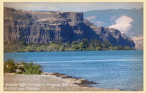
| The hills as we passed are high with steep and rocky sides, [basalts of Rowena Gap area] and some pine and white oak, and an undergrowth of shrubs scattered over them. |
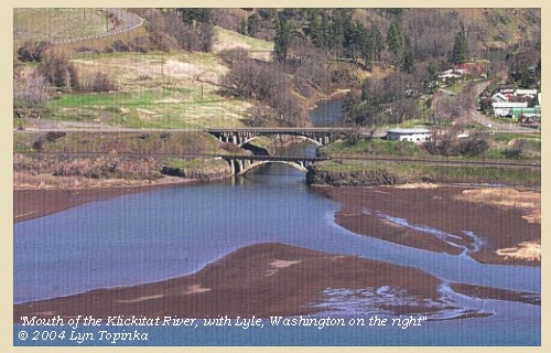
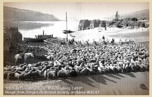
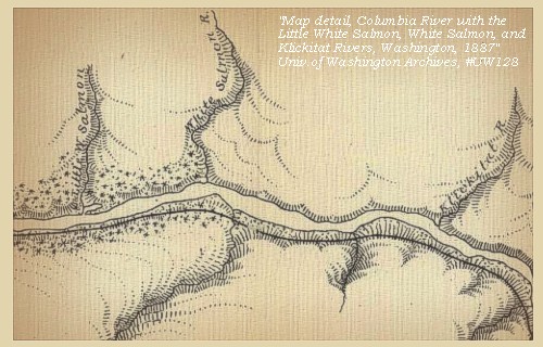
| Four miles below this village is a small river on the right side [Klickitat River]; immediately below is a village of Chilluckittequaws, consisting of eleven houses. [today Lyle, Washingon, is located on the upstream bank of the Klickitat where it merges with the Columbia] Here we landed and smoked a pipe with the inhabitants, who were very cheerful and friendly. They as well as the people of the last village inform us, that this river [Klickitat River] comes a considerable distance from the N.N.E. that it has a great number of falls, which prevent the salmon from passing up, and that there are ten nations residing on it who subsist on berries, or such game as they can procure with their bows and arrows. At its mouth the river is sixty yards wide, and has a deep and very rapid channel. From the number of falls of which the Indians spoke, we gave it the name of Cataract river [Klickitat River]. We purchased four dogs, and then proceeded. |
| "... after brackfast we proceeded on, the mountains are high on each Side, containing Scattering pine white oake & under groth, hill Sides Steep and rockey; at 4 miles lower we observed a Small river falling in with great rapidity on the Stard. Side below which is a village of 11 houses, here we landed to Smoke a pipe with the nativs and examine the mouth of the river, which I found to be 60 yards wide rapid and deep, The inhabitants of the village are friendly and Chearfull; those people inform us also those at last village that this little river is long and full of falls, no Salmon pass up it, it runs from N. N. E. that 'ten' nations live on this river and its waters ... we purchased 4 dogs and Set out -- ..." [Clark, October 29, 1805] |
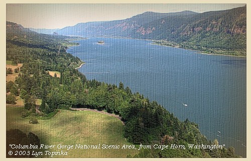
| The country as we advance is more rocky and broken, and the pine and low whiteoak on the hills increase in great quantity. [Lewis and Clark are now in the Columbia River Gorge National Scenic Area] |
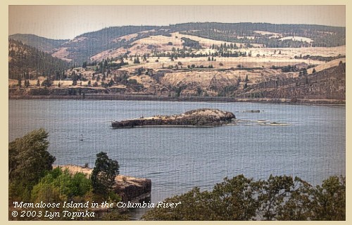
| Three miles below Cataract river [Klickitat River] we passed three large rocks in the river; that in the middle is large and longer than the rest, and from the circumstance of its having several square vaults on it, obtained the name of Sepulchre island [Memaloose Island]. |
| A short distance below are two huts of Indians on the right: the river now widens, and in three miles we came to two more houses on the right; one mile beyond which is a rocky island [possibly Eighteenmile Island] in a bend of the river towards the left. Within the next six miles we passed fourteen huts of Indians, scattered on the right bank, [passing thru the basalts of the Bingen Gap] |
|
|
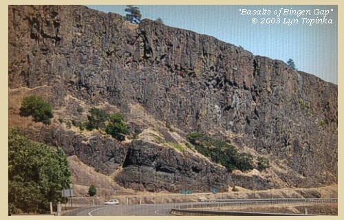
Bingen Gap basalts: 
|
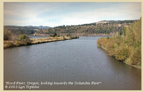
| and then reached the entrance of a river on the left, which we called Labieshe's river [Hood River], after Labieshe one of our party. |
| Just above this river [Hood River] is a low ground more thickly timbered than usual, and in front are four huts of Indians on the bank, which are the first we have seen on that side of the Columbia. The exception may be occasioned by this spot's being more than usually protected from the approach of their enemies, by the creek, and the thick wood behind. |
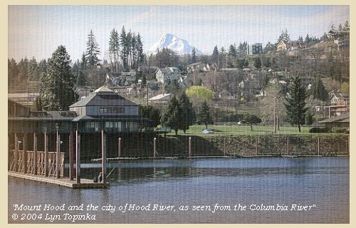
| The Biddle/Allen version did not mention Mount Hood to the south. The original journals however refer to it as the "falls mountain". |
| "... 4 Houses in a point of a timbered bottom on the Lard. Side at a large creek or River 40 yr. passed a bottom on the Stard Side the distance in which there is 14 Indian houses -- The falls mountain covered with Snow is South. S.70o W. 6 miles to a high Clift of rocks Std bend passed a large creek at 1 mile on the Stard. Side in which the Indians catch fish, a large Sand bar from the Lard. Side for 4 miles, at which place a small stream of water falls over a rock of 100 feet on the Lard Side passed 4 Indian Houses at 5 miles in a bottom on the Lard Side ..." [Clark, October 29, 1805, first draft] |
| "... passed 2 Lodges of Indians a Short distance below the Sepulchar Island on the Stard. Side river wide, at 4 mile passed 2 houses on the Stard. Side, Six miles lower passed 4 houses above the mouth of a Small river 40 yards wide on the Lard. Side a thick timbered bottom above & back of those houses; those are the first houses which we have Seen on the South Side of the Columbia River, ... from the mouth of this little river which we shall Call Labeasche River, the 'falls mountain' is South and the top is covered with Snow , one mile below pass the mouth of a large rapid Stream on the Stard. Side, opposit ot a large Sand bar, in this creek the Indians above take their fish, here we Saw Several canoes, which induced us to call this Canoe Creek it is 28 yards wide, about 4 miles lower and below the Sand bar is a butifull cascade falling over a rock of about 100 feet ..." [Clark, October 29, 1805] |
| "... In the evening we discovered a hight mountain to the south, not more than five miles off, covered with snow. We have here still water; and the breadth of the river is from three quarters to a mile. ..." [Gass, October 29, 1805] |
| "... Saw Snow on a mountain on the Lard Side. ..." [Ordway, October 29, 1805] |
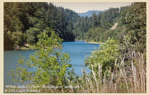
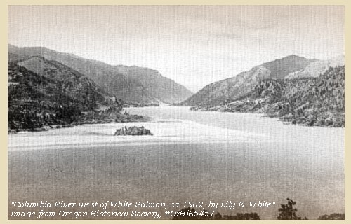
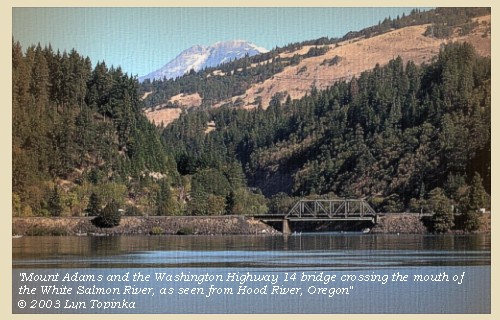
| We again embarked, and at the distance of a mile passed the mouth of a rapid creek on the right [White Salmon River] eighteen yards wide: in this creek the Indians whom we left take their fish, and from the number of canoes which were in it, we called it Canoe creek [White Salmon River]. |
| While Lewis and Clark did not make mentioned of it, Mount Adams is occasionally visible along this section of the Columbia River. |
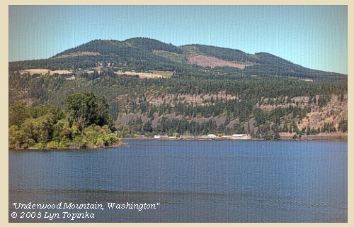
| Just downstream of the White Salmon River is the Pleistocene volcano, Underwood Mountain. |
| Opposite to this creek [White Salmon River] is a large sandbar, which continues for four miles along the left side of the river. Just below this a beautiful cascade falls in on the left over a precipice of rock one hundred feet in height [???, near Mitchell Point]. One mile further are four Indian huts in the low ground on the left: and two miles beyond this a point of land on the right, where the mountains become high on both sides, and possess more timber and greater varieties of it than hitherto, and those on the left are covered with snow. One mile from this point we halted for the night at three Indian huts on the right [near the mouth of the Little White Salmon River] having made thirty-two miles. ...... |
| "... Here the mountains are high on each Side, those to the Lard. Side has Some Snow on them at this time, more timber than above and of greater variety. ..." [Clark, October 29, 1805] |
|
|
|
The Camp - October 29, 1805:
Lewis and Clark camped on the Washington side of the Columbia, upstream of the Little White Salmon River, at a village near a "Pond". Today the Washington town of Cook is located at the mouth of the Little White Salmon River, and the "Pond" is today's Drano Lake. |
| Home | Previous | Continue |
If you have questions or comments please contact: GS-CVO-WEB@usgs.gov
June/July 2004, Lyn Topinka
The Volcanoes of Lewis and Clark Home Page | CVO Home Page


