| Columbia Plateau - Columbia River Basin - Columbia River Flood Basalts - Summary |
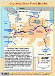
Columbia River Basin: The Columbia River pours more water into the Pacific Ocean than any other river in North or South America. In its 1,270 mile course to the Pacific Ocean, the Columbia flows through four mountain ranges -- the Rockies, Selkirks, Cascades, and coastal mountains -- and drains 258,000 square miles. The mainstem of the Columbia rises in Columbia Lake on the west slope of the Rocky Mountain Range in Canada. Its largest tributary, the Snake, travels 1,038 miles from its source in Yellowstone National Park in Wyoming before joining the Columbia. When Lewis and Clark explored the region in the early 19th century, huge numbers of fish (salmon) returned to spawn every year. "The multitudes of this fish are almost inconceivable," Clark wrote in the autumn of 1805. At that time, the Columbia and its tributaries provided 12,935 miles of pristine river habitat. Columbia River Flood Basalts: During late Miocene and early Pliocene times (between 17 and 6 million years ago), one of the largest basaltic lava floods ever to appear on the earths surface engulfed about 63,000 square miles of the Pacific Northwest. Over a period of perhaps 10 to 15 million years lava flow after lava flow poured out, eventually accumulating to a thickness of more than 6,000 feet. Over 300 high-volume individual lava flows have been identified, along with countless smaller flows. Numerous linear vents, some over 90 miles long, show where lava erupted near the eastern edge of the Columbia River Basalts. Older vents were probably buried by younger flows. As the molten rock came to the surface, the earths crust gradually sank into the space left by the rising lava. The subsidence of the crust produced a large, slightly depressed lava plain now known as the Columbia Basin (Plateau). The ancient Columbia River was forced into its present course by the northwesterly advancing lava. Columbia River Gorge National Scenic Area: The Columbia River Gorge is a spectacular river canyon cutting the only sea-level route through the Cascade Mountain Range. The Gorge is 80 miles long and up to 4,000 feet deep, with the north canyon walls in Washington State and the south canyon walls in Oregon State. The Columbia River Gorge National Scenic Area is located east of Portland along both sides of the Columbia River. Missoula Floods: With the beginning of the Pleistocene time, about one million years ago, cooling temperatures provided conditions favorable for the creation of great sheets of moving ice. Thus began the Ice Age. At the end of the last Ice Age, a finger of the Cordilleran ice sheet crept southward into the Idaho panhandle, forming a large ice dam that blocked the mouth of the Clark Fork River, creating a massive lake 2,000 feet deep and containing more than 500 cubic miles of water. Glacial Lake Missoula stretched eastward for some 200 miles and contained more water than Lake Erie and Lake Ontario combined. When the highest of these ice dams failed, lake water burst through, shooting out at a rate 10 times the combined flow of all the rivers of the world. This towering mass of water and ice literally shook the ground as it thundered toward the Pacific Ocean, stripping away hundreds of feet of soil and cutting deep canyons -- "coulees" -- into the underlying bedrock. With flood speeds approaching 65 miles per hour, the lake would have drained in as little as 48 hours. Over time the Cordilleran ice sheet continued moving south and blocked the Clark Fork River again and again, recreating Glacial Lake Missoula. Over approximately 2,500 years, the lake, ice dam and flooding sequence was repeated dozens of times, leaving a lasting mark on the landscape. Wallula Gap: Glacial-outburst waters that crossed the Channeled Scablands during the Spokane floods (Missoula Floods) were channeled through Wallula Gap. For several weeks, as much as 200 cubic miles of water per day were delivered to a gap that could discharge less than 40 cubic miles per day. Ponded water filled the Pasco Basin and the Yakima and Touchet valleys to form temporary Lake Lewis. -- Excerpts from: U.S. Army Corps of Engineers Website, 2002, USGS/NPS Geology in the Parks Website, 2002, U.S. National Park Service, Lake Roosevelt National Recreation Area Website, 2002, U.S. National Park Service, Ice Age Floods Website, 2002, U.S. National Park Service, National Natural Landmarks Program Website, 2002, and U.S. Forest Service, Columbia Gorge National Scenic Area Website, 2002 |
|
The Volcanoes of Lewis and Clark |
If you have questions or comments please contact: GS-CVO-WEB@usgs.gov
June/July 2004, Lyn Topinka
The Volcanoes of Lewis and Clark Home Page | CVO Home Page