The Volcanoes of
Lewis and Clark
October 26 - 28, 1805
The Dalles - "Long Narrows"
 
Home
The Volcanoes of Lewis and Clark

Map of the Journey
Volcanoes, Basalt Plateaus, Major Rivers, etc.

The Volcanoes
Mount Adams, Mount Hood, Mount Jefferson, Mount Rainier, and Mount St. Helens

CALENDAR of the Journey
October 1805 to June 1806

Along the Journey
Pacific Northwest Maps - Columbia River, Volcanoes, Flood Basalts, Missoula Floods, Geology, etc.

The Corps of Discovery
The Journey of Lewis and Clark

About the Reference Materials
The Journals, Biddle/Allen, DeVoto, Gass, Moulton, Topo Maps, and others

USGS Lewis and Clark Links
Links to USGS Websites highlighting the Lewis and Clark Journey

Resources
Publications Referenced and Websites Visited


PREVIOUS

October 25
The Dalles, "Long Narrows"
October 26-28

The Dalles,
"Long Narrows"

Rock Fort, Mount Hood, Rocky Island and Crates Point
CONTINUE

October 29
Entering the Columbia River Gorge, The Dalles to the Little White Salmon
 

On October 7, 1805, Lewis and Clark and the "Corps of Discovery" began their journey down the Clearwater River and into the volcanics of the Pacific Northwest. The Corps travelled from the Clearwater to the Snake and down the "Great Columbia", finally reaching the Pacific Ocean on November 15, 1805. Along the journey they encountered the lava flows of the Columbia Plateau, river channels carved by the great "Missoula Floods", and the awesome beauty of five Cascade Range volcanoes.

Map, Lewis and Clark in the Pacific Northwest, click for brief
                         summary
[Click map for brief summary about the area]


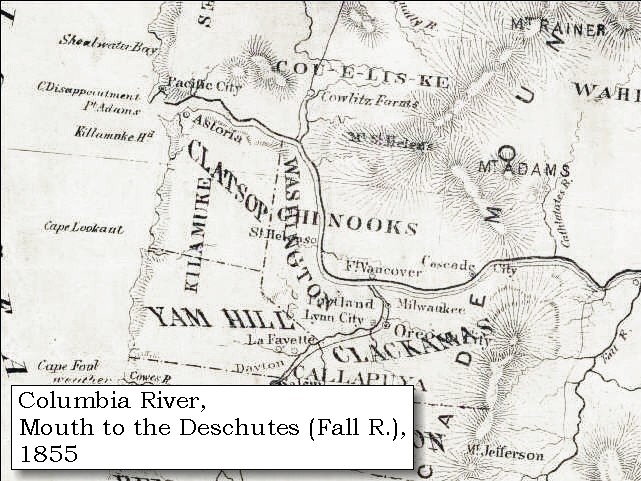
To the Pacific - October 1805
The Dalles - "Long Narrows"
 

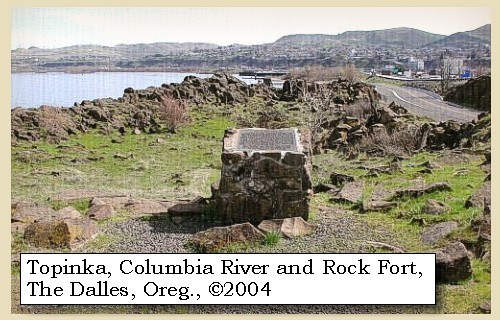
Lewis and Clark's camp of October 25, 1805, was the first of three nights on their journey downstream spent at "Rock Fort", just downstream from Mill Creek, The Dalles, Oregon.

Saturday, October 26, 1805
The morning was fine: we sent six men to hunt and to collect rosin to pitch the canoes, which, by being frequently hauled over rocks, have become very leaky. ...... We were occupied with the observations necessary to determine our longitude ......


Along the Journey - October 26, 1805
Rock Fort, 2004

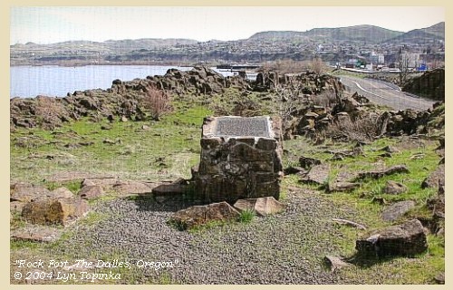
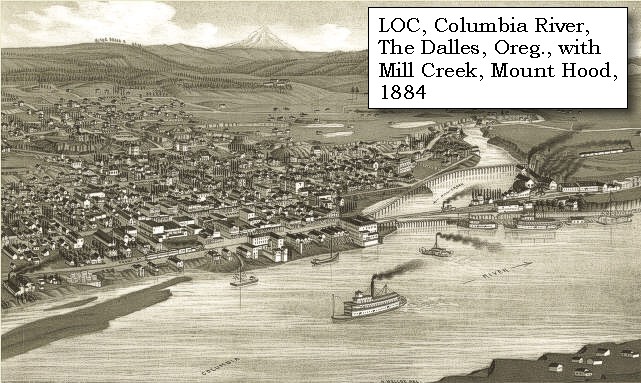
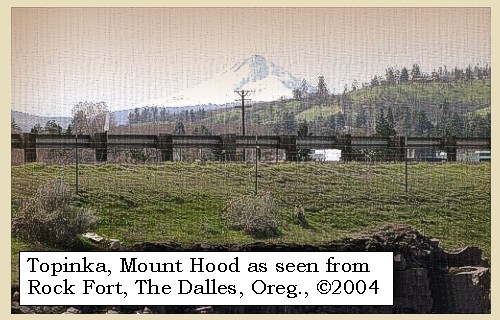
Rock Fort:
The fort-like basalt outcropping lies just downstream from the mouth of Mill Creek at present-day The Dalles, Oregon, on a wedge-shaped parcel bordered by the Columbia River, Bargeway Road, and Bridge and Garrison Streets. A riverfront trail leads to Rock Fort where interpretive signage marks the campsite. -- U.S. National Park Service Website, Lewis and Clark Expedition, 2003


Map, 1858 Military recon map, The Dalles and Mill Creek, click to enlarge Map, 1985, Mill Creek, The Dalles, click to enlarge Image, 2004, Rock Fort
  1. 1858 Military Recon Map (section of original), Columbia River and The Dalles Vicinity. (Click to enlarge). Map of military reconnaissance from Fort Dalles, Oregon, via Fort Wallah-Wallah, to Fort Taylor, Washington Territory, 1858. Shows approximate location of military road constructed 1859 to 1862. From the report and maps of Captain John Mullan, United States Army, G.P.O., 1863. University of Washington Archives #UW85. -- University of Washington Library Archives Website, 2004
  2. 1985 Map, Mill Creek and The Dalles. (Click to enlarge). Office of Coast Surveys, Historical Maps and Charts, Columbia River, Bonneville to The Dalles, 1985, Chart#18531, 1:40,000. -- NOAA Office of Coast Survey Website, 2004
  3. 2004, Rock Fort, The Dalles, Oregon. (Click to enlarge). Copyright © 2004 Lyn Topinka, private archives, used with permission.


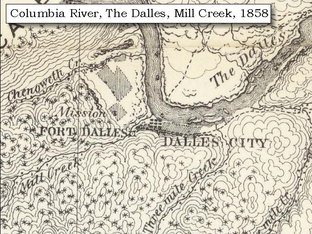
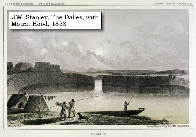
"... the Country to the Lard is broken Country thinly timbered with pine and white oake, a mountain which I must call 'Timm' or 'falls' Mountain rises verry high and bears to the S W the Course it has bore Sinc we first Saw it ..." [Clark, October 26, 1805]


Along the Journey - October 26, 1805
Mount Hood and The Dalles, Oregon, from Dallesport, Washington, 2004

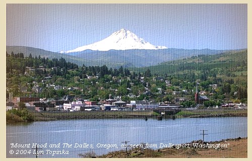
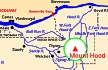
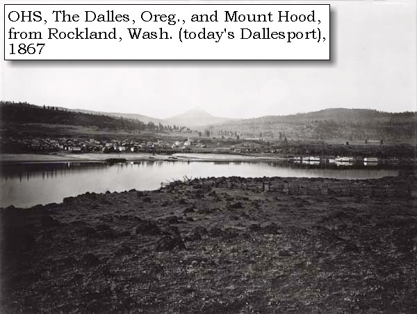
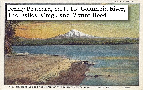
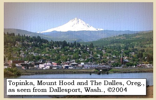
Mount Hood and The Dalles, Oregon:
Mount Hood, at 11,245 feet high, is the fourth highest peak in the Cascade Range and the highest in the state of Oregon. The peak dominates the skyline from the Portland, Oregon, metropolitan area to the wheat fields of Wasco and Sherman Counties of eastern Oregon.


Map, the Volcanoes of Lewis and Clark, click to enlarge Map, 1993, Mount Hood and Vicinity, click to enlarge Map, 1814, Lewis and Clark on the Columbia, click to enlarge Map, 1853, Washington and Oregon and the Columbia River, click to enlarge Map, 1855, Columbia River, Vancouver to the Pacific, click to enlarge Map, 1860, Columbia River, Washington, Oregon, click to enlarge Engraving, 1853, The Dalles, Oregon, with Mount Hood, click to enlarge Image, 1867, The Dalles, Oregon, and Mount Hood, from Rockland, Washington, click to enlarge Engraving detail, 1884, The Dalles and Mount Hood, with Mill Creek, click to enlarge Penny Postcard, ca.1915, Mount Hood from The Dalles, click to enlarge Image, 2004, Mount Hood from Rock Fort Image, 2004, Mount Hood and The Dalles, Oregon
  1. Map, "Lewis and Clark Volcano Sitings"
  2. 1993 Map, Mount Hood and Vicinity, showing river drainages which flow into the Columbia river. (Click to enlarge). Includes Hood River and the Sandy River. Map modified from: Brantley and Scott, 1993.
  3. 1814 Map, Lewis and Clark (section of original). (Click to enlarge.) Shows Mount Hood. From the "Nicholas Biddle/Paul Allen" 1814 publication. Original Map: "A Map of Lewis and Clark's Track, Across the Western Portion of North America, From the Mississippi to the Pacific Ocean". From: History of the expedition under the command of Captains Lewis and Clark : to the sources of the Missouri, thence across the Rocky Mountains and down the river Columbia to the Pacific Ocean : performed during the years 1804-5-6 : by order of the government of the United States / prepared for the press by Paul Allen. Philadelphia : Bradford and Insskeep, 1814. Harold B. Lee Library, Brigham Young University #upbover maps37. -- Brigham Young University, Harold B. Lee Library Website, 2004.
  4. 1853 Map, Washington and Oregon and the Columbia River, from the Clearwater River to the Snake River and down the Columbia River to the Pacific Ocean (section of original). (Click to enlarge). Includes: Clearwater River (Kooskooski), Lapwai Creek (Lapwai R.), Snake River (Saptin or Lewis R.), Columbia River (Columbia R.), Yakima River (Yakima R.), Walla Walla River (Wallawalla R.), Umatilla River (Umatilla R.), Willow Creek (Quesnells R.), John Day River (John day's R.), Deschutes River (Fall R.), Willamette River (Willammette R.), and Cowlitz River (Cowlitz R.). Original Map: "Map of California, Oregon, Washington, Utah, and New Mexico (1853)", by Thomas Cowperthwait & Co. Washington State University Archives #WSU22. -- Washington State University Library Collections Website, 2003
  5. 1855 Map, Columbia River from Vancouver to the Pacific, including Mount St. Helens (section of original). (Click to enlarge). Original Map: "Map of Oregon and Washington Territories: showing the proposed Northern Railroad route to the Pacific Ocean, by John Disturnell, 1855. University of Washington Archives #UW155. -- University of Washington Library Collections Website, 2002
  6. 1860 Map, Columbia River, Washington State, and Oregon (section of original). (Click to enlarge). Original Map: Map of Oregon, Washington, and British Columbia, (1860). This map dates between March 2nd, 1861 (when the Dakota Territory was formed) and March 4th, 1863 (when the Idaho Territory was formed from eastern Washington and western Dakota) Nearing retirement from a thirty year long and rather successful career, S. Augustus Mitchell printed this map showcasing Oregon, the Territory of Washington, and British Columbia. Washington became a territory in 1853, arguing that distances to Willamette Valley kept them from obtaining a voice in the Oregon territorial government. As this map shows, when it split from Oregon proper the Washington territory included parts of Wyoming and Montana and all of Idaho. Territorial government for Idaho would not be approved until 1863. When Mitchell retired he left the business for his son to manage. Washington State University Archives #WSU7. -- Washington State University Archives, 2004
  7. 1853 Engraving, Columbia River area indian camp at The Dalles, Oregon, with Mount Hood in the background. (Click to enlarge). Engraving by John M. Stanley, 1853. From the U.S. War Department's Reports of explorations and surveys to ascertain the most practicable and econmical route for a railroad from the Mississippi River to the Pacific Ocean, 1860, v.12, pt.1, pl.43. University of Washington Libraries Collection, #NA4170. -- University of Washington Libraries Website, 2002
  8. 1867, The Dalles, Oregon, and Mount Hood. (Click to enlarge). View from Rockland, Washington (today's Dallesport). Photographer: Carleton Watkins. Oregon Historical Society #21577, #1100-A, Columbia Gorge Discovery Center Catalogue #2001.06.003. -- Columbia Gorge Discovery Center Website, 2004
  9. 1884, Closer-in detail from engraving of The Dalles, Oregon, and Mount Hood. (Click to enlarge). Created by H. Wellge. Published 1884, J.J. Stoner, Madison, Wisconsin. Panoramic view of the city of The Dalles, Oregon, county seat of Wasco County, 1884. Original lithograph shows The Dalles, Mount Hood, the Columbia River, and the mouth of Mill Creek. Reference #LC Panoramic Maps #727. -- Library of Congress American Memories Website, 2002
  10. ca.1915, Penny Postcard, Mount Hood from near The Dalles. (Click to enlarge). "Mount Hood as seen from bank of the Columbia River near The Dalles, Ore.", A.M. Prentiss Photo. #447, Lipschuetz of Katz, Portland, Oregon. -- L.Topinka private collection, 2003, used with permission.
  11. 2004, Mount Hood, Oregon, as seen from Rock Fort, The Dalles, Oregon. (Click to enlarge). Copyright © 2004 Lyn Topinka, private archives, used with permission.
  12. 2004, Mount Hood and The Dalles, Oregon, as seen from Dallesport, Washington. (Click to enlarge). Copyright © 2004 Lyn Topinka, private archives, used with permission.


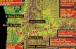
The fleas, with whom we had contracted an intimacy at the falls, are so unwilling to leave us, that the men are obliged to throw off all their clothes, in order to relieve themselves from their persecution.


Along the Journey - October 25, 1805
The Camp - October 25 through October 27, 1805:
Lewis and Clark set up camp at "Rock Fort" during both their journey to the Pacific (October 25 through October 27, 1805) and their journey home (April 15 through April 17, 1806).


Sunday, October 27, 1805

The wind was high from the westward during the night and this morning, but the weather begin fair we continued our celestial observations. ......
"... The Creek at which we are Encamped is Called by the natives - 'Que-nett' - ... The pinical of Falls mountain bears S 43o W. about 35 miles [Mount Hood] ..." [Clark, October 27, 1805]


Along the Journey - October 25, 1805
The Camp - October 25 through October 27, 1805:
Lewis and Clark set up camp at "Rock Fort" during both their journey to the Pacific (October 25 through October 27, 1805) and their journey home (April 15 through April 17, 1806).


Monday, October 28, 1805

The morning was again cool and windy. Having dried our goods, we were about setting out, when three canoes came from above to visit us, and at the same time two others from below arrived for the same purpose. ...... This interview detained us till nine o'clock, when we proceeded down the river, which is now bordered with cliffs of loose dark coloured rocks about ninety feet high with a thin covering of pine and other small trees. At the distance of four miles we reached a small village of eight houses under some high rocks on the right, with a small creek [Chenoweth Creek ???] on the opposite side of the river. We landed and found the houses similar to those we had seen at the great narrows ...... The wind however rose so high, that we were obliged after going one mile to land on the left side opposite to a rocky island [vicinity of today's Rocky Island], and pass the day there. We formed our camp in a niche above a point of high rocks [upstream of Crates Point], and as it was the only safe harbour we could find, submitted to the inconvenience of lying on the sand, exposed to the wind and rain during all the evening. ......


Along the Journey - October 28, 1805
Crates Point, 2003

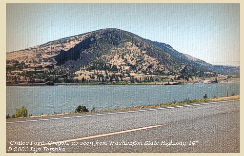
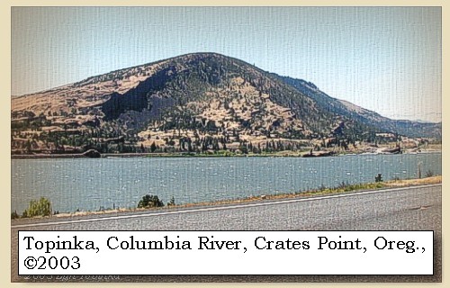
Rocky Island and Crates Point:


Map, 1934 USGS topo map of Crate's Point area, click to enlarge Image, 2003, Crates Point, Oregon
  1. 1934 Map (section of original), from The Dalles 1:125,000 topographic quadrangle. (Click to enlarge). Map section showing Rowena, Crates Point, and Crates. Rocky Island is not named and not depicted as an Island on this map. It is depicted as a spit of land half way between Crates Point and Crates. Original map surveyed in 1929-30, contour interval of 50 feet. The Washington side of the river is not depicted on the map. -- University of Washington Library Collections Website, 2002
  2. 2003, Crates Point, Oregon, as seen from Washington State Highway 14. (Click to enlarge). Copyright © 2003 Lyn Topinka, private archives, used with permission.


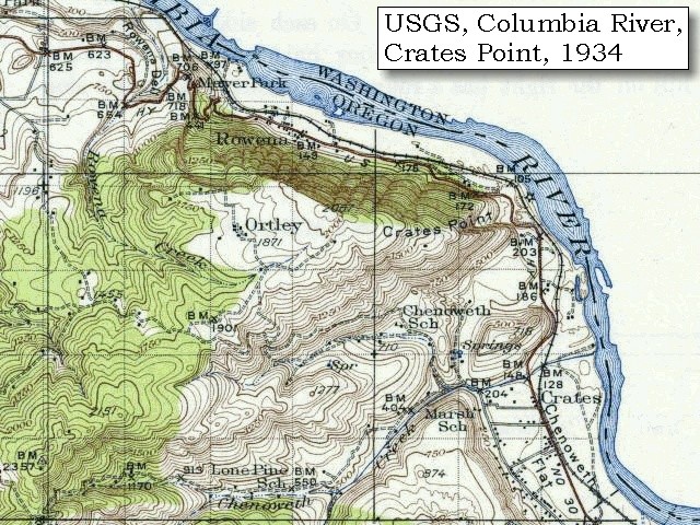
"... the wind rose and we were obliged to lie by about 1 mile below on the Lard. Side North 1 mile to a rock Island on the Stard. Side. ... rained all the evenig & blew hard from the West encamped on the Lard Side opsd. an Rock in a verry Bad place ..." [Clark, October 28, 1805]


Along the Journey - October 28, 1805
The Camp - October 28, 1805:
Oregon side of the Columbia River, near Rocky Island, Oregon, upstream of Crate's Point.


Home Previous Continue


If you have questions or comments please contact: GS-CVO-WEB@usgs.gov
June/July 2004, Lyn Topinka
The Volcanoes of Lewis and Clark Home Page | CVO Home Page