The Volcanoes of
Lewis and Clark
Lewis and Clark
|
October 18, 1805 Down the "Great" Columbia River - to Spring Gulch |
|
Home
The Volcanoes of Lewis and Clark Map of the Journey Volcanoes, Basalt Plateaus, Major Rivers, etc. The Volcanoes Mount Adams, Mount Hood, Mount Jefferson, Mount Rainier, and Mount St. Helens CALENDAR of the Journey October 1805 to June 1806 Along the Journey Pacific Northwest Maps - Columbia River, Volcanoes, Flood Basalts, Missoula Floods, Geology, etc. The Corps of Discovery The Journey of Lewis and Clark About the Reference Materials The Journals, Biddle/Allen, DeVoto, Gass, Moulton, Topo Maps, and others USGS Lewis and Clark Links Links to USGS Websites highlighting the Lewis and Clark Journey Resources Publications Referenced and Websites Visited |
PREVIOUS
October 17 Side-Trip Up the Columbia, Tri-Cities and the Yakima River |
October 18
Down the "Great Columbia", Columbia/Snake Confluence to Spring Gulch Junction of the Snake River with the Columbia River, Columbia River, Snake River, Islands at the Mouth, McNary NWR, Walla Walla River, Wallula Gap, Twin Sisters, first view of Mount Hood, Port Kelley and Spring Gulch |
CONTINUE
October 19 Down the "Great Columbia", Spring Gulch to Umatilla |
|
To the Pacific - October 1805
Down the "Great" Columbia River - to Spring Gulch |
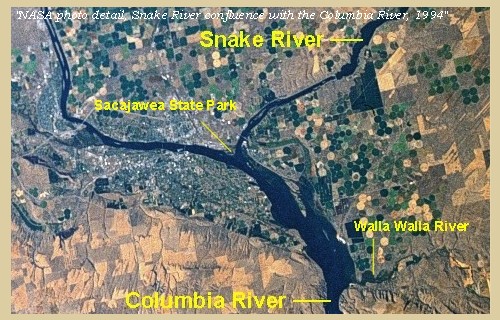
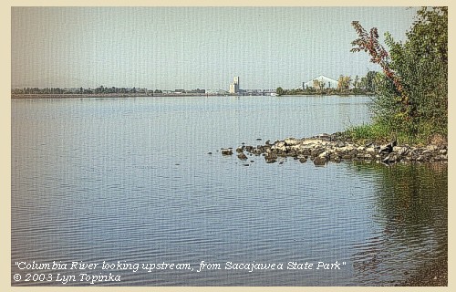
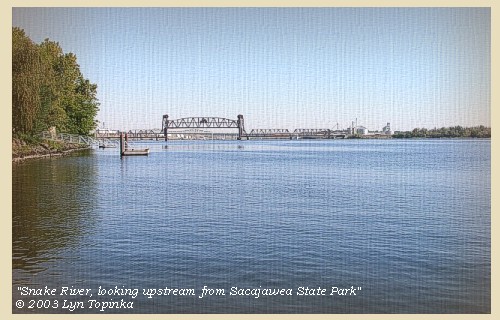
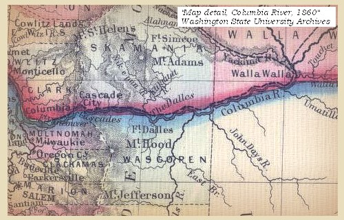
| Lewis and Clark's camp of October 16 and 17, 1805, was at the confluence of the Snake and Columbia Rivers, just east of Pasco, Washington. Today Sacajawea State Park is located at this junction. The original campsite is now under the waters of Lake Wallula, behind McNary Dam. |
| Friday, October 18, 1805 |
|
We were visited this morning by several canoes of
Indians, who joined those who were already with us, and
soon opened a numerous council.
......
We now procured from the principal chief and
one of the Cuimnapum nation a
sketch of the
Columbia
[Columbia River],
and the tribes of his nation living along its
banks and those of the
Tapteet
[Yakima River].
They drew it with a
piece of coal on a robe, and as
we afterwards transferred to paper,
it exhibited a valuable specimen of Indian
delineation.
Having completed the purposes of our stay, we now began to lay in our stores ...... The morning was cool and fair, and the wind from the southeast. |
| "... at 4 oClock we set out down the Great Columbia accompanied by our two old Chiefs, one young man wished to accompany us, but we had no room for more, & he could be of no service to us ..." [Clark, October 18, 1805] |
| "... Capt. Lewis had an observation at noon, which gave 46o 15 13.9 north latitude. At one we proceeded on down the Great Columbia, which is a very beautiful river. The course is something to the east of south for about 12 miles and then winds round to almost a west course ..." [Gass, October 18, 1805] |
| "... a clear pleasant morning. we delayed here until after 12 oClock to day Capt. Clark measured Columbia River and the Ki mo e nem Rivers and found the Columbia River to be 860 yards wide, and the ki moo enem R. to be 475 yards wide at the forks. Capt. Lewis Compleated his observations and found the Latitude to produce ... North ... about 2 oClock P.M. we Set out. two chiefs continued on with us ..." [Ordway, October 18, 1805] |
| Soon after proceeding, We passed the island in the mouth of Lewis river [Snake River], and at eight miles reached a larger island, which extends three miles in length. On going down by this island there is another on the right, which commences about the middle of it, and continues for three and a half miles. While they continue parallel to each other, they occasion a rapid near the lower extremity of the first island, opposite to which on the second island are nine lodges built of mats, and intended for the accommodation of the fishermen, of whom we saw great numbers, and vast quantities of dried fish on their scaffolds. [These Islands are most likely Rabbit Island and Goat Island, now under the waters of Lake Wallula.] |
| On reaching the lower point of the island, we landed to examine a bad rapid, and then undertook the passage which is very difficult, as the channel lies between two small islands, with two others still smaller near the left side of the river. Here are two Indian houses, the inhabitants of the river. Here are two Indian houses, the inhabitants of which were as usual drying fish. We passed the rapid without injury, and fourteen and a half miles from the mouth of Lewis's river [Snake River], came to an island near the right shore, on which were two other houses of Indians pursuing the customary occupation. |
| "... we proceeded on down the great Calumbia River which is now verry wide about 3/4 of a mile in General the country in general Smooth plains for about 10 miles down then the barron hills make close to the River on each Side. passed Several Smooth Islands on which was large fishing Camps. large quantity of Sammon on their Scaffels. ..." [Ordway, October 18, 1805] |
| The entire east bank of the Columbia, from downstream the Snake River to the Walla River, is now a part of the McNary National Wildlife Refuge. |
|
|
|
McNary National Wildlife Refuge:
The McNary National Wildlife Refuge spans the east bank of the Columbia from the Snake River to the Wallula Gap. The Refuge now has 7 Units: Strawberry Island, Burbank Slough (original McNary NWR), Peninsula, Two Rivers, Wallula, Stateline, and Juniper Canyon. Originally established at 3,600 acres, the Refuge now encompasses over 15,000 acres of backwater sloughs, seasonal wetlands, shrub-steppe uplands, irrigated farmlands, river islands, delta mudflats, and riparian areas. The Refuge also includes riverine wetlands and shoreline bays that serve as an important nursery for developing fall chinook salmon. The Refuge has trails, wildlife viewing, and an education center. and is located southeast of Pasco off U.S. Highway 12 just south of the Snake River. Refuge Visitor facilities are a quarter mile east of Highway 12 on Maple Street. -- Lewis and Clark Bicentennial in Oregon Website, 2002, and U.S. Fish & Wildlife Service Website, 2002 |
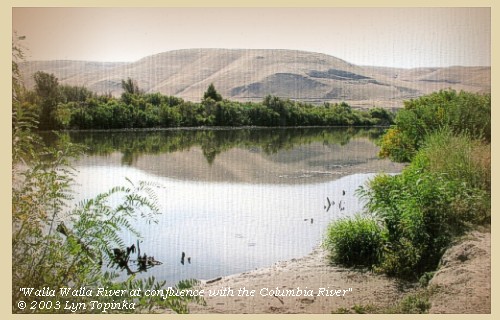
| One mile and a half beyond this place, is a mouth of a small brook [Walla Walla River]. under a high hill on the left. It seems to run during its whole course through the high country, which at this place begins, |
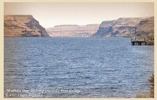
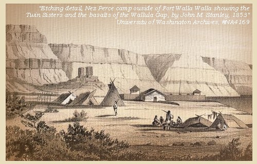
| and rising to the height of two hundred feet form cliffs of rugged black rocks which project a considerable distance into the river [Wallula Gap]. |
| "... at 16 miles from the point the river passes into the range of high Countrey at which place the rocks project into the river from the high clifts which is on the Lard. Side about 2/3 of the way across and those of the Stard. Side about the Same distance, the Countrey rises here about 200 feet above The water and is bordered with black rugid rocks, at the Commencement of this high Countrey on Lard Side a Small riverlet falls in which appears to passed under the high Country in its whole cose ..." [Clark, October 18, 1805] |
| On the left bank of the Columbia River, within the Wallula Gap, lies a basalt feature known as the "Twin Sisters". |
| At this place too we observed a mountain to the S. W. the form of which is conical, and its top covered with snow [Mount Hood]. |
| "... Saw a mountain bearing S. W. Conocal form Covered with Snow. ..." [Clark, October 18, 1805] |
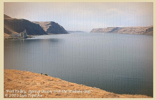
| We followed the river as it entered these highlands, and at the distance of two miles reached three islands, one on each side of the river, and a third in the middle, on which were two houses, where the Indians were drying fish opposite a small rapid. Near these a fourth island begins, close to the right shore, where were nine lodges of Indians, all employed with their fish. As we passed they called to us to land, but as night was coming on, and there was no appearance of wood in the neighbourhood, we went on about a mile further, till observing a log that had drifted down the river, we landed near it on the left side, and formed our camp under a high hill [near Port Kelley and Spring Gulch Creek], after having made twenty miles today. |
|
|
|
The Camp:
Lewis and Clark's campsite of October 18, 1805 was located about 1 mile downstream from Port Kelley, Washington, near Spring Gulch Creek. Today the location of the campsite is under the waters of Lake Wallula, behind McNary Dam. |
| Home | Previous | Continue |
If you have questions or comments please contact: GS-CVO-WEB@usgs.gov
June/July 2004, Lyn Topinka
The Volcanoes of Lewis and Clark Home Page | CVO Home Page


