The Columbia River:
The Columbia River and its tributaries form the dominant water system in the Pacific Northwest. The mainstem of the Columbia rises in Columbia Lake in British Columbia, Canada. After flowing a path for 1,270 miles, the Columbia joins the Pacific Ocean near Astoria, Oregon. The major tributaries of the Columbia are the Kootenai, Flathead/Pend Oreille/Clark's Fork, Snake, and Willamette. The largest of these tributaries, the Snake, travels 1,038 miles from its source in Yellowstone National Park in Wyoming. The Snake River enters the Columbia at Columbia River Mile 325, near Pasco, Washington.
Early History:
The earliest archaeological evidence of human habitation in the Columbia River Basin dates to 10,000 B.P. [Before Present Time] The earliest groups lived by fishing, hunting large mammals, and gathering plant foods. Cultures in the proto-historic and historic periods varied greatly along the river. On the lower Columbia groups lived in large multi-family long houses, while on the middle and upper river sections, people moved seasonally and lived in smaller groups. Native fishers took salmon at Willamette Falls on the Willamette River and at Kettle Falls on the upper Columbia. Celilo Falls on the middle river was the most important native fishery. Thousands gathered there during the spring and summer fish runs to harvest chinook salmon and trade. In the early 19th century, Pacific Fur Company trader Alexander Ross called Celilo "the great emporium or mart of the Columbia."
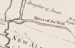
"River of the West":
The Columbia River first appeared on European maps in the early 17th century as "River of the West," when a Spanish maritime explorer Martin de Auguilar located a major river near the 42nd parallel. Cartographers often labeled the "River of the West" as an estuary to the mythical Straits of Anian, or the Northwest Passage and located it anywhere from the 42nd to the 50th parallel. In 1765, British Major Robert Rogers called the river "Ouragon" -- later spelled "Oregon" by Jonathan Carver in 1778 -- as a derivative name referring to the "ouisconsink" river in present-day Wisconsin. The first confirmation of its location came in 1775 when Bruno de Hezeta described a river estuary at the Columbia's correct latitude.
Exploring the Columbia:
On May 12, 1792, the American Captain Robert Gray, became the first explorer to enter the Columbia River by crossing over the sandbar that blocked its mouth. Gray sailed about 20 miles up the estuary of the river, traded with the Indians for a few days, and then left after drawing a chart of the mouth of the river. He named the river the Columbia after his ship, and claimed it for the United States.
British Captain George Vancouver obtained a copy of Gray's chart from the Spanish governor at Nootka Sound and sailed to the mouth of the Columbia River in October 1792. He was unable to get his flagship Discovery over the sandbar, but Lt. William Robert Broughton succeeded with his smaller ship, the Chatham. Broughton advanced nearly 100 miles to a site opposite present-day Portland, Oregon, which he named Point Vancouver. To the east he saw a majestic mountain peak which he named
Mount Hood.
Meriwether Lewis and William Clark explored the river in 1805-1806 for the United States, and Northwest Company fur trader David Thompson made the first map of the full river in 1811-1812.

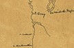
- 1766 Map, North American Coastline around the Columbia River (section of original). (Click to enlarge).
Original Map:
"L'hydrographie fran?oise : recueil des cartes g?n?rales et particuli?res qui ont ?te faites pour le service des vaisseaux du roy, par ordre des Ministres de la marine, depuis 1737, jusqu'en 1765", by Jacques Nicolas Bellin, Created/Published: Paris, 1766.
Library of Congress American Memory Archives #G1059 B43 1772.
-- U.S. Library of Congress Archives, 2004, "American Memory"
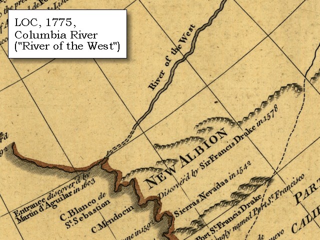
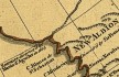
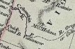
- 1775 Map, North American Coastline around the Columbia River (section of original). (Click to enlarge).
Original Map:
The Russian discoveries from the map published by the Imperial Academy of St. Petersburg.
Notes: "Printed for Robt. Sayer, Map and Printseller..."
Library of Congress American Memory Archives #G7321.S12 1775 .R8 TIL Vault.
-- U.S. Library of Congress Archives, 2004, "American Memory"
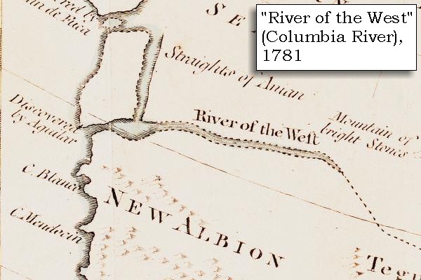
- 1781 Map, "River of the West", Columbia River (section of original). (Click to enlarge).
Original map: Jonathan Carver's ?A New Map of North America From the Latest Discoveries.? In Travels Through the Interior Parts of North America in the Years 1766, 1767, and 1768. London, 1781.
University of Virginia Special Collection "Lewis & Clark, The Maps of Exploration 1507-1814".
-- University of Virginia Library Archives Website, 2004
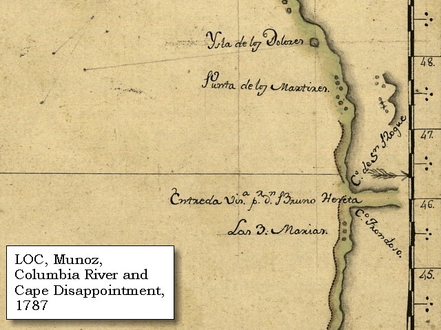
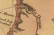
- 1787 Map, North American Coastline around the Columbia River (section of original). (Click to enlarge).
Includes Cape Disappointment as "C. de San Roque".
Original Map:
"Carta que contiene parte de la costa de la California", by
Bernabe Munoz, 1787. Scale ca.1:5,000,000.
Library of Congress American Memory Archives #G4362.C6 1787 .M8 TIL Vault.
-- U.S. Library of Congress Archives, 2004, "American Memory"
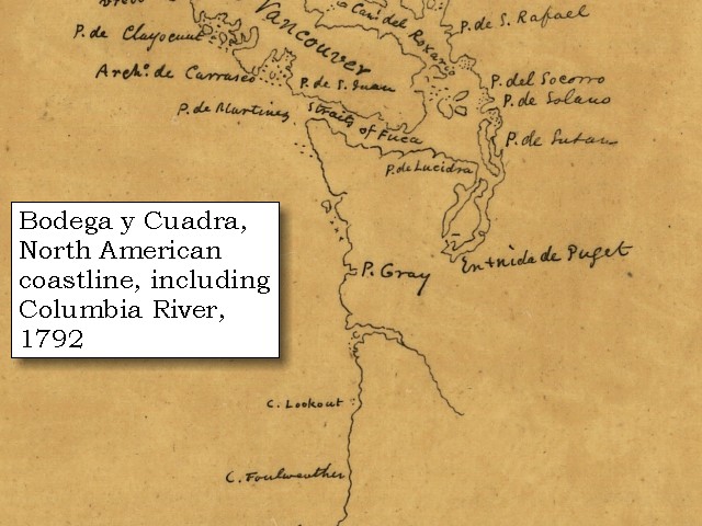
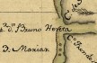
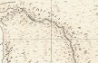
- 1792 Map, North American Coastline around the Columbia River (section of original). (Click to enlarge).
Original Map:
Carta de los descrubrimientos hechos en la costa N.O. de la America Septentrional, by
Juan de la Bodega y Cuadra, 1792.
Notes: Pen-and-ink.
Library of Congress American Memory Archives #G3350 1792 .B6 TIL Vault.
-- U.S. Library of Congress Archives, 2004, "American Memory"
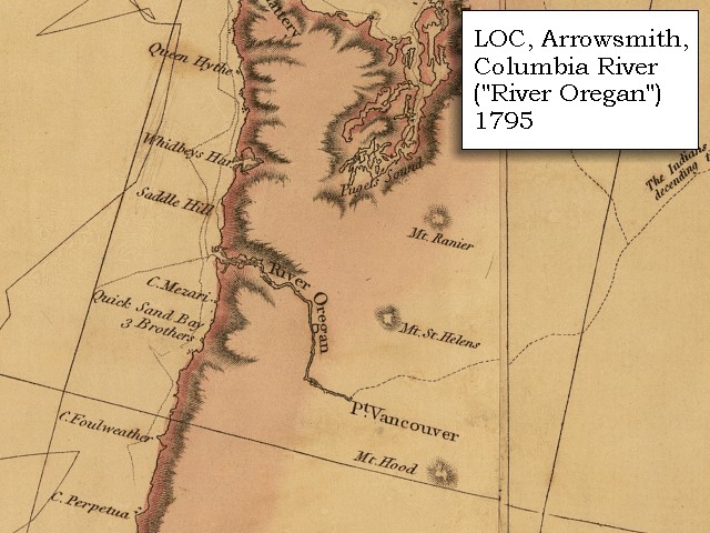
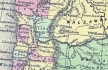
- 1795 Map, Pacific Northwest and the Columbia River (section of original). (Click to enlarge).
Includes the Columbia River ("River Oregan"), Mount Rainier, Mount St. Helens, and Mount Hood, and Point Vancouver.
Original Map: A map exhibiting all the new discoveries in the interior parts of North America / inscribed by permission to the honorable
governor and company of adventurers of England trading into Hudsons Bay in testimony of their liberal communications to
their most obedient and very humble servant A. Arrowsmith, January 1st 1795.
Published: London, 1802. Notes: Relief shown by hachures. Shows "Rivers added east of the Rocky Mountains, 900 L. 450 Lat.," from Tooley's Printed maps of America. In lower margin: London: Published Jan. 1, 1795 by A. Arrowsmith, No. 24 Rathbone Place. Includes notes.
Reference: Tooley. Printed maps of America 137. Scale [ca. 1:3,800,000] (W 1600--W 400/N 700--N 250).
Library of Congress American Memory Archives #G3300 1802 A7 Vault Casetop.
-- U.S. Library of Congress Archives, 2004, "American Memory"
- 1798 Map, Columbia River of George Vancouver (section of original). (Click to enlarge).
Includes Columbia River, Cape Disappointment, Point Adams, Point Vancouver, and Mount St. Helens.
Original Map: George Vancouver's "A Chart Shewing Part of the
Coast of N.W. America." In A Voyage of discovery to the North Pacific ocean, and Round the World. London, 1798.
University of Virginia Special Collection "Lewis & Clark, The Maps of Exploration 1507-1814".
-- University of Virginia Library Archives Website, 2004
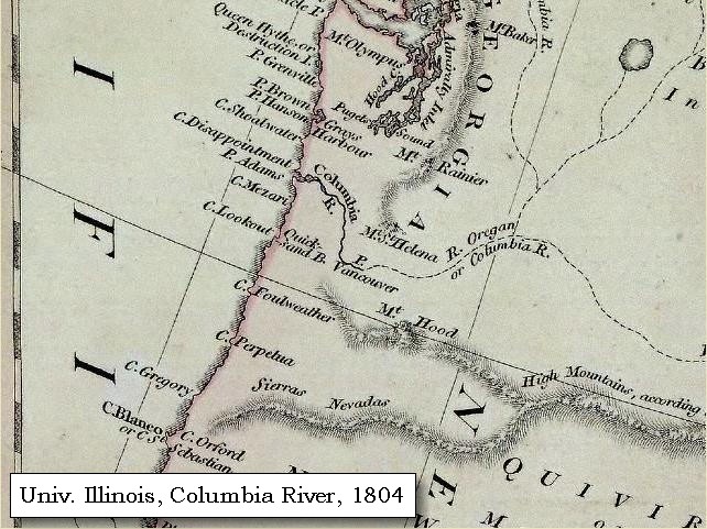
- 1804 Map, Pacific Northwest and the Columbia River (section of original). (Click to enlarge).
Includes the Columbia River, Mount Baker, Mount Rainier, Mount St. Helens, and Mount Hood.
Original Map: "North America".
Year: 1804.
Author: Robert Wilkinson and E. Bourne.
Notes:
Scale, ca. 1:9,000,000; London, R. Wilkinson, 12th of Aug. 1804; 1 map, hand col.; 51 x 61 cm.; Relief shown by hachures; Prime meridians: Greenwich, Ferro. -- Henry Stevens and Roland Tree, Comparative cartography, exemplified in an analytical & bibliographical description of nearly one hundred maps and charts of the American continent published in Great Britain during the years 1600 to 1850, no. 62a. In the Collection of Map & Geography Library, University of Illinois at Urbana-Champaign, Champaign, Illinois,
Call Number: G3300 1804 .W5.
-- Univerisity of Illinois at Urbana-Champaign Website, 2004.
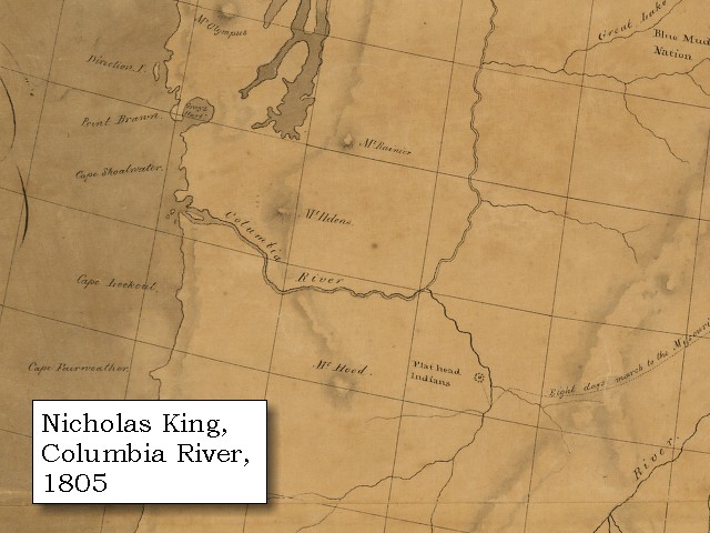
- 1805 Map, Pacific Northwest and the Columbia River (section of original). (Click to enlarge).
Includes the Columbia River, Mount Rainier, Mount St. Helens, and Mount Hood.
Original Map:
A map of part of the continent of North America : between the 35th and 51st degrees of north latitude,
and extending from 89o degrees of west longitude to the Pacific Ocean / compiled from the authorities
of the best informed travellers by M. Lewis ; copied by Nicholas King, 1805.
Notes: Map covers western North America, from Lake Michigan and Lake Superior to the Pacific Ocean, including southern Canada and northern
Mexico. Pen-and-ink and watercolor.
Note from map folder: Map was copied from a sketch by William Clark, not one by Meriwether Lewis as indicated in the title. Copy sectioned and mounted on cloth.
Library of Congress American Memory Archives #G3300 1805 .C5 Vault Oversize.
-- U.S. Library of Congress Archives, 2004, "American Memory"
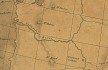
- 1814 Map, Lewis and Clark's map of the Columbia River (section of original). (Click to enlarge.)
Includes three of the five volcanoes Lewis and Clark saw and commented on. While the journals mention the expedition seeing Mount Adams, it does not appear on their map. Mount Jefferson is to the south (bottom) and off the map.
From the "Nicholas Biddle/Paul Allen" 1814 publication.
Original Map: "A Map of Lewis and Clark's Track, Across the Western Portion of North America, From the Mississippi to the Pacific Ocean".
From: History of the expedition under the command of Captains Lewis and Clark : to the sources of the Missouri, thence across the Rocky Mountains and down the river Columbia to the Pacific Ocean : performed during the years 1804-5-6 : by order of the government of the United States / prepared for the press by Paul Allen. Philadelphia : Bradford and Insskeep, 1814.
Harold B. Lee Library, Brigham Young University #upbover maps37.
-- Brigham Young University, Harold B. Lee Library Website, 2004.
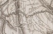
- 1814 Map, Lewis and Clark's map of the Columbia River (section of original). (Click to enlarge.)
Map includes three of the five volcanoes Lewis and Clark saw and commented on. While the journals mention the expedition seeing Mount Adams, it does not appear on their map. Mount Jefferson is just visible to the south (bottom) and Mount Rainier is to the north but off the map.
From the "Nicholas Biddle/Paul Allen" 1814 publication.
Original Map: "A Map of Lewis and Clark's Track, Across the Western Portion of North America, From the Mississippi to the Pacific Ocean".
From: History of the expedition under the command of Captains Lewis and Clark : to the sources of the Missouri, thence across the Rocky Mountains and down the river Columbia to the Pacific Ocean : performed during the years 1804-5-6 : by order of the government of the United States / prepared for the press by Paul Allen. Philadelphia : Bradford and Insskeep, 1814.
Harold B. Lee Library, Brigham Young University #upbover maps37.
-- Brigham Young University, Harold B. Lee Library Website, 2004.
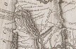
- 1833 Map (section of original), Columbia River. (Click to enlarge).
Includes Mount Hood and Mount Jefferson. Note: Mount Baker is depicted (upper middle) but Mounts Adams, Rainier and St. Helens are missing. The Columbia River is shown as "Oregon River" at its mouth and "Columbia or Oregon R." further inland. "Wappatoo Valley" is labeled. Also shows Fort Clatsop ("F. Clatsop or F. George"), the Willamette River ("Multnomah R."), Sandy River ("Quicksand R."), John Day River ("R.La Page"), Walla Walla River ("Wallwullah R."), Snake River ("Lewis R."), and the Yakima River ("Tapete R.").
Original Map: Oregon Territory, 1833.
Creator: Illman & Pilbrow, published by Illman & Pilbrow, New York.
Comments: Illman & Pilbrow is the engraving firm which copyrighted and published this map, the actual artist is unknown.
Washington State University Digital Maps Collection #WSU323.
University of Washington Digital Maps Collection #UW104.
-- Washington State University Early Washington Maps Digital Collection Website, 2004
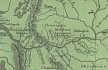
- 1853 Map, Washington and Oregon and the Columbia River,
from the Clearwater River to the Snake River and down the Columbia River to the Pacific Ocean (section of original). (Click to enlarge).
Includes: Clearwater River (Kooskooski), Lapwai Creek (Lapwai R.), Snake River (Saptin or Lewis R.), Columbia River (Columbia R.), Yakima River (Yakima R.), Walla Walla River (Wallawalla R.), Umatilla River (Umatilla R.), Willow Creek (Quesnells R.), John Day River (John day's R.), Deschutes River (Fall R.), Willamette River (Willammette R.), and Cowlitz River (Cowlitz R.).
Original Map: "Map of California, Oregon, Washington, Utah, and New Mexico (1853)",
by Thomas Cowperthwait & Co.
Washington State University Archives #WSU22.
-- Washington State University Library Collections Website, 2003
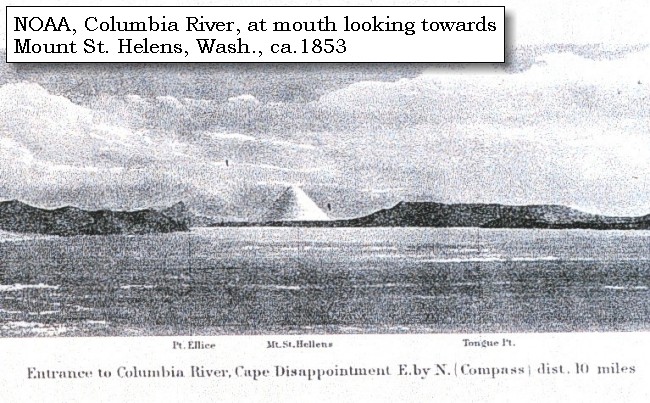
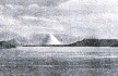
- ca.1853, Engraving. Mouth of the Columbia River (section of original).
(Click to enlarge). Engraving depicts the Mouth of the Columbia River, Point Ellice,
Mount St. Helens,
and Tongue Point. Original also depicts Cape Disappointment and Point Adams.
From: NOAA Photo Archives, America's Coastline Collection #line2075.
-- NOAA Photo Archives Website, 2002
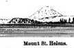
- 1889, Engraving/Sketch. Mouth of the Columbia River (section of original).
(Click to enlarge). Engraving depicts the Mouth of the Columbia River, Point Ellice,
Mount St. Helens, and Tongue Point. Original also depicts Scarborough Hill.
From: NOAA Library, Pacific Coast Coast Pilot of California, Oregon, and Washington, 1889
-- NOAA Photo Archives Website, 2004
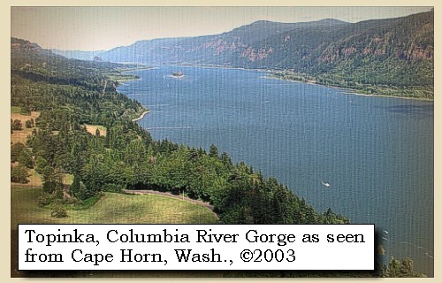
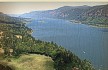
- 2003, Looking upstream at the Columbia River Gorge
(Click to enlarge).
Image taken from Washington State Highway 14, at the Cape Horn Overlook.
Copyright © 2003 Lyn Topinka, private archives, used with permission.
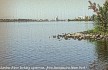
- 2003, Columbia River, from the junction of the Snake River with the Columbia River, looking upstream from Sacajawea State Park, Washington. (Click to enlarge).
Lewis and Clark arrived at this junction on October 16, 1805.
Copyright © 2003 Lyn Topinka, private archives, used with permission.
-- Excerpts from:
Center for Columbia River History Website, 2004,
U.S. Army Corps of Engineers, 2002, and the
University of Virginia Library Special Collections, 2002.
|