The Volcanoes of
Lewis and Clark
Lewis and Clark
|
October 19, 1805 Down the "Great" Columbia River - Spring Gulch to Umatilla |
|
Home
The Volcanoes of Lewis and Clark Map of the Journey Volcanoes, Basalt Plateaus, Major Rivers, etc. The Volcanoes Mount Adams, Mount Hood, Mount Jefferson, Mount Rainier, and Mount St. Helens CALENDAR of the Journey October 1805 to June 1806 Along the Journey Pacific Northwest Maps - Columbia River, Volcanoes, Flood Basalts, Missoula Floods, Geology, etc. The Corps of Discovery The Journey of Lewis and Clark About the Reference Materials The Journals, Biddle/Allen, DeVoto, Gass, Moulton, Topo Maps, and others USGS Lewis and Clark Links Links to USGS Websites highlighting the Lewis and Clark Journey Resources Publications Referenced and Websites Visited |
PREVIOUS
October 18 Down the "Great Columbia", Snake/Columbia Confluence to Spring Gulch |
October 19
Down the "Great Columbia", Spring Gulch to Umatilla NWR Wallula Gap, Oregon State Geology, Hat Rock and Hat Rock State Park, Umatilla Rapids, McNary Dam, and Lake Wallula, Umatilla Rapids vs. Devils Bend Rapids, Mount Adams and Mount Hood, Sillusi Butte, Umatilla River and the Umatilla NWR, Blalock Islands |
CONTINUE
October 20 Islands and Ridges, Umatilla NWR to Roosevelt and Arlington |
|
To the Pacific - October 1805
Down the "Great" Columbia River - Spring Gulch to Umatilla |
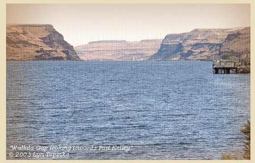
| Lewis and Clark's campsite of October 18, 1805 was located within the Wallula Gap, about 1 mile downstream from Port Kelley, Washington. The campsite was near Spring Gulch Creek. Today the location of the campsite is under the waters of Lake Wallula, behind McNary Dam. |
| Saturday, October 19, 1805 |
| The great chief with two of his inferior chiefs, and a third belonging to a band on the river below, made us a visit at a very early hour. The first of these is called Yelleppit, a handsome well proportioned man, ...... This conference detained us till nine o'clock, by which time great numbers of the Indians had come down to visit us. On leaving them, we went on for eight miles, [through the Wallula Gap] |
| "... passed high clifts of rocks on each Side of the River ..." [Ordway, October 19, 1805] |
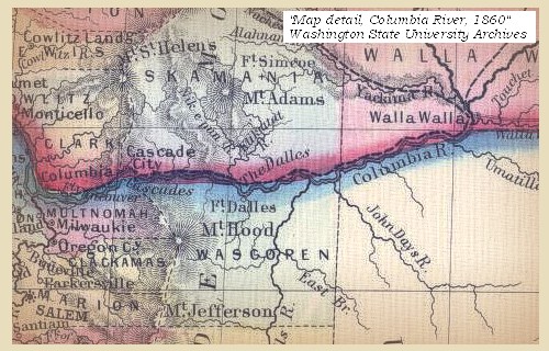
| Lewis and Clark are approximately 309 miles from the mouth of the Columbia River, a spot where the right bank of the Columbia is Washington State and the left bank is the State of Oregon. |
|
|
|
Oregon State Geology:
Oregon's geology tells fantastic stories of awesome volcanic eruptions, cataclysmic floods and titanic continental collisions. -- Oregon State Department of Geology and Mineral Industries Website, 2004 |
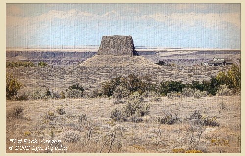
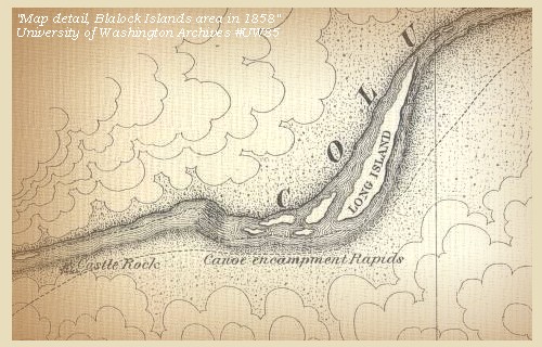
| when we came to an island near the left shore which continued six miles in length. At the lower extremity of it is a small island on which are five houses, at present vacant, though the scaffolds of fish are as usual abundant. A short distance below, are two more islands, one of them near the middle of the river. [today these islands are under the waters of Lake Wallula] On this there were seven houses; but as soon as the Indians, who were drying fish, saw us, they fled to their houses, and not one of them appeared till we had passed, when they came out in greater numbers than is usual for houses of that size, which induced us to think that the inhabitants of the five lodges had been alarmed at our approach and taken refuge with them. We were very desirous of landing in order to relieve their apprehensions, but as there was a bad rapid along the island, all our care was necessary to prevent injury to the canoes. At the foot of this rapid is a rock, on the left shore, which is fourteen miles from our camp of last night, and resembles a hat in its shape [Hat Rock]. |
| "... "S.W. 14 miles to a rock in a Lard. resembling a hat just below a rapid at the lower Point of an Island in the Midl: of the river ..." [Clark, October 19, 1805, first draft] |
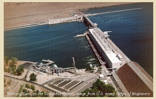
| Four miles beyond this island we came to a rapid, [Umatilla Rapids] from the appearance of which it was judged prudent to examine it. After landing for that purpose on the left side, we began to enter the channel which is close under the opposite shore. It is a very dangerous rapid, strewed with high rocks and rocky islands, and in many places obstructed by shoals, over which the canoes were to be hauled, so that we were more than two hours in passing through the rapids, which extend for the same number of miles. The rapid has several small islands, and banks of muscleshells are spread along the river in several places. In order to lighten the boats, captain Clarke, with the two chiefs, the interpreter, and his wife, had walked across the low grounds on the left to the foot of the rapids [Umatilla Rapids]. |
| The Umatilla Rapids are now under the waters of Lake Wallula, the reservoir behind the McNary Dam, which was constructed at the site of the rapids. Lake Wallula extends approximately 67 miles up the Columbia River. |
| On the way, captain Clarke ascended a cliff about two hundred feet above the water, from which he saw that the country on both sides of the river immediately from its cliffs, was low, and spreads itself into a level plain, extending for a great distance on all sides. To the west, at the distance of about one hundred and fifty miles, is a very high mountain covered with snow, and from its direction and appearance, he supposed to be the mount St. Helens, [in error, Captain Clark actually saw Mount Adams] laid down by Vancouver, as visible from the mouth of the Columbia: |
| "... I assended a high clift about 200 feet above the water; from this place I descovered a high mountain of emence hight covered with Snow, this must be one of the mountains laid down by Vancouver, as seen from the mouth of the Columbia River, from the course which it bears which is 'West' I take it to be Mt. St. Helens, [actually Mount Adams] destant about 120 miles a range of mountains in the Derection crossing a conical mountain S. W. toped with snow ..." [Clark, October 19, 1805] |
| "... we discovred a verry high round mountain a long distance down the River which appears to have Snow on the top of it ..." [Ordway, October 19, 1805] |
| "... the Country around level plains except Some hills & clifts along the Shores. we discovred a high hill or mountn a long distance down the River which appears to have Snow on it ..." [Whitehouse, October 19, 1805] |
| there is also another mountain of a conical form, whose top is covered with snow, in a southwest direction [Mount Hood]. ...... |
| As captain Clarke arrived at the lower end [site of today's McNary Dam] of the rapid [Umatilla Rapids] before any, except one of the small canoes, he sat down on a rock to wait for them, and seeing a crane fly across the river, shot it, and it fell near him. Several Indians had been before this passing on the opposite side towards the rapids, and some few who had been nearly in front of him, being either alarmed at his appearance or the report of the gun, fled to their houses. ...... We remained here to dine, and then proceeded. |
| "... I observed a great number of Lodges on the opposit bank passing up to where Capt. Lewis was with the Canoes, others I saw on a knob nearly opposit to me ..." [Clark, October 19, 1805] |
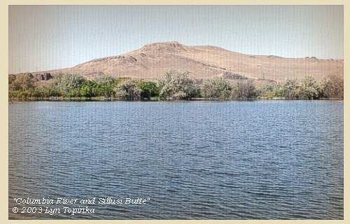
| Clark's journal for October 19, 1805, mentions a "knob", today known as Sillusi Butte. |
| At half a mile the hilly country on the right side of the river ceased: at eleven miles we found a small rapid, and a mile further came to a small island on the left, where there were some willows. ...... On leaving the island we passed three miles further along a country which is low on both sides of the river, [today the Umatilla National Wildlife Refuge] |
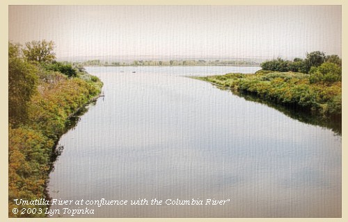
| Downstream of McNary Dam is the Oregon town of Umatilla and the Umatilla River, and the upstream edge of the Umatilla National Wildlife Refuge. Lewis and Clark make no mention of the Umatilla River on their downstream journey, but heading upstream on April 27, 1806, they refer to a "small river, called Youmalolam". |
| and encamped under some willow trees on the left, having made thirty-six miles to-day [near Irrigon, Oregon]. Immediately opposite to us is an island close to the left shore, and another in the middle of the river [upstream of Blalock Island area], on which are twenty-four houses of Indians, all engaged in drying fish. ...... |
|
|
|
The Camp - October 19, 1805:
Lewis and Clark's camp of October 19, 1805 was near Irrigon, Oregon, in what is today the Umatilla National Wildlife Refuge. |
| Home | Previous | Continue |
If you have questions or comments please contact: GS-CVO-WEB@usgs.gov
June/July 2004, Lyn Topinka
The Volcanoes of Lewis and Clark Home Page | CVO Home Page


