The Volcanoes of
Lewis and Clark
October 16, 1805
Reaching the "Great" Columbia River
 
Home
The Volcanoes of Lewis and Clark

Map of the Journey
Volcanoes, Basalt Plateaus, Major Rivers, etc.

The Volcanoes
Mount Adams, Mount Hood, Mount Jefferson, Mount Rainier, and Mount St. Helens

CALENDAR of the Journey
October 1805 to June 1806

Along the Journey
Pacific Northwest Maps - Columbia River, Volcanoes, Flood Basalts, Missoula Floods, Geology, etc.

The Corps of Discovery
The Journey of Lewis and Clark

About the Reference Materials
The Journals, Biddle/Allen, DeVoto, Gass, Moulton, Topo Maps, and others

USGS Lewis and Clark Links
Links to USGS Websites highlighting the Lewis and Clark Journey

Resources
Publications Referenced and Websites Visited


PREVIOUS

October 14-15
On the Snake, Ayers Junction to Fish Hook Rapids
October 16

Reaching the "Great Columbia",
Snake/Columbia Confluence

Rattlesnake Flats and Fish Hook Rapids, Fishhook Park, Five-Mile Rapids, Ice Harbor Dam and Lake Sacajawea, Charbonneau Park, Horse Heaven Hills, Blue Mountains, Junction of the Snake River with the Columbia River, Columbia River, Snake River, Sacajawea State Park
CONTINUE

October 17
Side-Trip Up the Columbia, Tri-Cities and the Yakima River
 

On October 7, 1805, Lewis and Clark and the "Corps of Discovery" began their journey down the Clearwater River and into the volcanics 
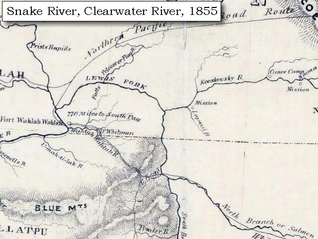
of the Pacific Northwest. The Corps travelled from the Clearwater to the Snake and down the "Great Columbia", finally reaching the Pacific Ocean on November 15, 1805. Along the journey they encountered the lava flows of the Columbia Plateau, river channels carved by the great "Missoula Floods", and the awesome beauty of five Cascade Range volcanoes.

Map, Lewis and Clark in the Pacific Northwest, click for brief
                         summary
[Click map for brief summary about the area]


To the Pacific - October 1805
Reaching the "Great" Columbia River
 

Lewis and Clark's camp of October 15, 1805, was at Rattlesnake Flats, on the right bank of the Snake River at the head of Fish Hook Rapids. Fish Hook Rapids today is under the waters of Lake Sacajawea. The camp was located directly across the Snake River from today's Fishhook Park.

Wednesday, October 16, 1805
"... A cool morning, deturmined to run the rapids ... [Clark, October 16, 1805]
Having examined the rapids [Fishhook Rapids], which we found more difficult than the report of the Indians had induced us to believe, we set out early, and putting our Indian guide in front, our smallest canoe next, and the rest in succession, began the descent: the passage proved to be very disagreeable; as there is a continuation of shoals extending from bank to bank for the distance of three miles, during which the channel is narrow and crooked, and obstructed by large rocks in every direction, so as to require great dexterity to avoid being dashed on them. We got through the rapids with no injury to any of the boats except the hindmost, which ran on a rock; but by the assistance of the other boats, and of the Indians who were very alert, she escaped, though the baggage she contained was wet.


Along the Journey - October 16, 1805
Map, Fish Hook Rapids, 1893

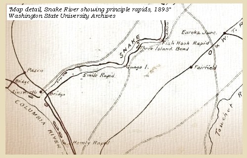
Rattlesnake Flats and Fish Hook Rapids:
Rattlesnake Flats is located on the right bank of the Snake River at the head of Fish Hook Rapids, across from today's Fishhook Park. Fish Hook Rapids today is under the waters of Lake Sacajawea. In 1959, two prehistoric pit-house village archaeological sites were found here. -- Washington State Chapter Lewis & Clark Heritage Foundation Website, 2004, March 1999 Newsletter, and Tourism Walla Walla Website, 2004.


Map, 1893, Snake River showing Fishhook Rapids, click to enlarge NASA Image, 1994, Columbia River, with Snake River from Ice Harbor to Lower Monumental, click to enlarge
  1. 1893 Map, part of the Snake River showing location of principal rapids (section of original). Includes Fishhook Rapids. (Click to enlarge). Original Map: "Part of the Snake River from its mouth to the Grande Ronde, showing location of principal rapids". U.S. Engineers Office, 1893. Washington State University Historical Maps Collection #WSU586. -- Washington State University Library Archives Website, 2002
  2. 1994, NASA Image, Columbia River and the Snake River from Ice Harbor Dam to Lower Monumental Dam (section of original) (Click to enlarge). View from space - Columbia River, Snake River, Ice Harbor Dam, and Lower Monumental Dam, north-looking, low-oblique photograph, September 1994. NASA Earth from Space #STS064-112-093. -- NASA Earth from Space Website, 2002


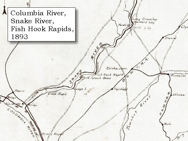
Fishhook Park:
Fishhook Park is a U.S. Corps of Engineers Park located on the south bank of Lake Sacajawea at Snake River Mile 18. The park is located 18 miles east of Burbank, Washington, on Highway 124, and 4 miles north on Fishhook Park Road. -- U.S. Army Corps of Engineers Website, 2003


Within three miles after leaving the rapid [Fish Hook Rapids] we passed three small islands, on one of which were the parts of a house put on scaffolds as usual, and soon after came to a rapid [???] at the lower extremity of three small islands; and a second [???] at the distance of a mile and a half below them; reaching six miles below the great rapid a point of rocks at a rapid opposite to the upper point of a small island on the left. Three miles further is another rapid [???] ; and two miles beyond this a very bad rapid [Five-Mile Rapids], or rather a fall of the river: this, on examination, proved so difficult to pass, that we thought it imprudent to attempt, and therefore unloaded the canoes and made a portage of three quarters of a mile.


Along the Journey - October 16, 1805
Five-Mile Rapids:


Map, 1858 Military recon map, Snake River entering the Columbia River, click to enlarge Map, 1893, Snake River showing Five-Mile Rapids, click to enlarge
  1. 1858 Military Recon Map (section of original), Snake River entering the Columbia River. (Click to enlarge). Map of military reconnaissance from Fort Dalles, Oregon, via Fort Wallah-Wallah, to Fort Taylor, Washington Territory, 1858. Shows approximate location of military road constructed 1859 to 1862. From the report and maps of Captain John Mullan, United States Army, G.P.O., 1863. University of Washington Archives #UW85. -- University of Washington Library Archives Website, 2002
  2. 1893 Map, part of the Snake River showing location of principal rapids (section of original). Includes Fishhook Rapids. (Click to enlarge). Original Map: "Part of the Snake River from its mouth to the Grande Ronde, showing location of principal rapids". U.S. Engineers Office, 1893. Washington State University Historical Maps Collection #WSU586. -- Washington State University Library Archives Website, 2002


The rapid, [Five-Mile Rapids] which is of about the same extent, is much broken by rocks and shoals, and has a small island in it on the right side. After crossing by land we halted for dinner ......

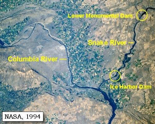
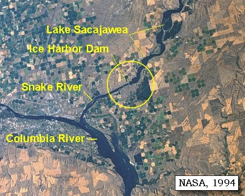
Ice Harbor Dam is now located along this stretch of the Snake River. Lake Sacajawea is the reservoir behind the dam, and it extends for nearly 32 miles up the Snake River.


Along the Journey - October 16, 1805
Ice Harbor Dam

Ice Harbor Dam and Lake Sacajawea:
Ice Harbor Lock and Dam is the last of four dams and navigation locks along the Lower Snake River. The uppermost dam is Lower Granite, followed downstream by Little Goose, Lower Monumental, and Ice Harbor. The Ice Harbor Dam is 2,822 feet long, and 100 feet high. It is of the concrete gravity type, with an earth-fill embankment section at the north abutment. It has a ten-bay spillway and ten 50-foot tainter gates. The lock is a single-lift type with clear plan. There are two fish ladders for passing migratory fish. Lake Sacajawea, the reservoir behind the dam, extends northeast 32 miles upstream to Lower Monumental Dam, and has a surface area of 9,200 acres and an elevation of 440 feet. -- U.S. Army Corps of Engineers Website, 2002


Map, 1893, Snake River showing Five-Mile Rapids, click to enlarge NASA Image, 1994, Columbia River, with Snake River from Ice Harbor to Lower Monumental, click to enlarge NASA Image, 1994, Snake River, Ice Harbor Dam, and Lake Sacajawea, click to enlarge Aerial view, Ice Harbor Dam, click to enlarge
  1. 1893 Map, part of the Snake River showing location of principal rapids (section of original). Includes Fish Hook Rapids. (Click to enlarge). Original Map: "Part of the Snake River from its mouth to the Grande Ronde, showing location of principal rapids". U.S. Engineers Office, 1893. Washington State University Historical Maps Collection #WSU586. -- Washington State University Library Archives Website, 2002
  2. 1994, NASA Image, Columbia River and the Snake River from Ice Harbor Dam to Lower Monumental Dam (section of original) (Click to enlarge). View from space - Columbia River, Snake River, Ice Harbor Dam, and Lower Monumental Dam, north-looking, low-oblique photograph, September 1994. NASA Earth from Space #STS064-112-093. -- NASA Earth from Space Website, 2002
  3. 1994, NASA Image, Snake River, Ice Harbor Dam, and Lake Sacajawea (section of original) (Click to enlarge). View from space - Columbia River, Snake River, Ice Harbor Dam, and Lake Sacajawea, north-looking, low-oblique photograph, September 1994. NASA Earth from Space #STS064-112-093. -- NASA Earth from Space Website, 2002
  4. Aerial view, Ice Harbor Dam on the lower Snake River. (Click to enlarge). From: U.S. Army Corps of Engineers Photo Library. -- U.S. Army Corps of Engineers Website, 2002


Prominent Lava Flows in the Vicinity:
The Saddle Mountains Basalt formation is the youngest in the Columbia River Basalt Group. It is about 13.5 to 6 million years old and contains flows erupted sporadically during a period of waning volcanism, deformation, canyon cutting, and development of thick but local sedimentary deposits between flows. The Saddle Mountains Basalt has a volume of only about 700 cubic miles, less than one percent of the total volume of basalt, yet contains by far the greatest chemical and isotopic diversity of any formation in the group. The Ice Harbor Member of the Saddle Mountains Basalt formation is dated as about 8.5 million years old and was erupted from the central part of the Columbia Plateau, where dikes and remnants of vent areas have been recognized. Most flows are confined to the area of venting, but at least one flow spread westward to the Richland, Washington, area and southwestward to Wallula Gap. The Ice Harbor vent system is about 55 miles long. -- Swanson and Wright, 1981


Charbonneau Park:
Charbonneau Park is located along the Snake River near Ice Harbor Dam. Amentities include: camping, hookups, showers, picnic area, swimming, boat launch, handicapped facilities, group picnic shelter, marina, and dump stations. The park was named after Lewis and Clark's interpreter, Toussaint Charbonneau. -- Tri-Cities Visitors and Convention Bureau Website, 2002


After dinner we reloaded the canoes and proceeded: we soon passed a rapid opposite to the upper point of a sandy island on the left, which has a smaller island near it. At three miles is a gravelly bar in the river: four miles beyond this the Kimooenim [Snake] empties itself into the Columbia, and at its mouth has an island just below a small rapid. We halted above the point of junction on the Kimooenim [Snake River] to confer with the Indians, who had collected in great numbers to receive us.
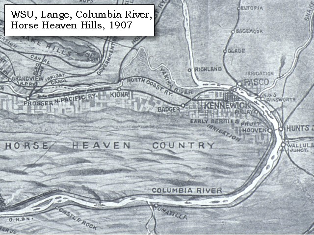
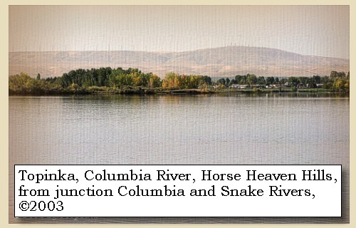
"... In every direction from the junction of those rivers the Countrey is one Continued plain low and rises from the water gradually, except a range of high Countrey which runs from S. W & N E and is on the opposit Side about 2 miles distant from the Collumbia and keeping its derection S W untill it joins a S W. range of mountains. ..." [Clark, October 16, 1805]

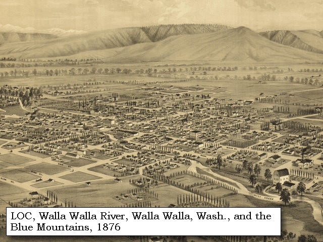
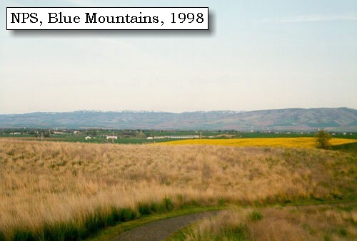
The "range of high Countrey" is the Horse Heaven Hills, and the "range of mountains" is the Blue Mountains.


Along the Journey - October 16, 1805
Horse Heaven Hills, 2003

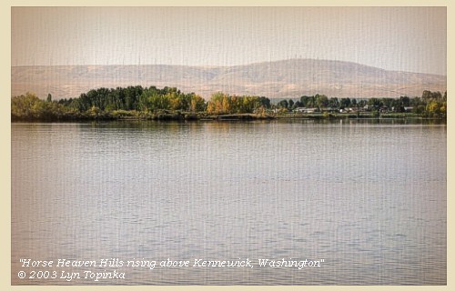
Horse Heaven Hills:
Like all the ridges that surround the Tri-Cities and lower Columbia Basin (Richland, Pasco, and Kennewick), the geology of the Horse Heaven Hills is a story of lava eruptions followed by buckling of the lava flows as they were squeezed from the north and south. The Columbia Plateau province is dominated by lavas of the Columbia River Basalt Group (CRBG), which include the Grande Ronde, Wanapum, and Saddle Mountains Basalts. The basalt occurs as multiple flows, each ranging in thickness from 10 to over 100 feet. After the lavas hardened into rock, earth forces, which still operate today, compressed the region from the north and south. The rock responded by buckling into a series of ridges that trend mainly east-west. Rattlesnake Mountain, Badger Mountain, Red Mountain and the Horse Heaven Hills are some of the more familiar names of these ridges. Rattlesnake Mountain and the Horse Heaven Hills are higher than most of the ridges around here but when you take a close look at any of these ridges, the higher elevations typically are on the north side. The north side is highest because its the point where the rocks change from a north facing slope to a south facing slope. -- Morace, et.al., 1998, Steve Reidel, Pacific Northwest National Laboratory, and Swanson and Wright, 1981


Map, 1814, Lewis and Clark and the Horse Heaven Hills, click to enlarge Map, 1854, Columbia River, Willow Creek to Walla Walla, click to enlarge Map, 1907, Columbia River and the Horse Heaven Hills, click to enlarge Image, 2003, Horse Heaven Hills
  1. 1814 Map, Lewis and Clark (section of original). (Click to enlarge.) The Horse Heaven Hills are depicted but not named (vertical-running ridge, right half). From the "Nicholas Biddle/Paul Allen" 1814 publication. Original Map: "A Map of Lewis and Clark's Track, Across the Western Portion of North America, From the Mississippi to the Pacific Ocean". From: History of the expedition under the command of Captains Lewis and Clark : to the sources of the Missouri, thence across the Rocky Mountains and down the river Columbia to the Pacific Ocean : performed during the years 1804-5-6 : by order of the government of the United States / prepared for the press by Paul Allen. Philadelphia : Bradford and Insskeep, 1814. Harold B. Lee Library, Brigham Young University #upbover maps37. -- Brigham Young University, Harold B. Lee Library Website, 2004.
  2. 1853-54 Map, Columbia River, including the Horse Heaven Hills area (section of original). (Click to enlarge). Includes Horse Heaven Hills ("lands destitute of timber"), Willow Creek, Umatilla River, Walla Walla River, Touchet River, Twin Sisters ("Chimney Rock"), Yakima River, and the junction of the Snake River (only the "S" shows) with the Columbia. Original Map: "Rocky Mountains to Puget Sound : from explorations and surveys / made under the direction of the Hon. Jefferson Davis, Secretary of War by Isaac I. Stevens Governor of Washington Territory, 1853-4." Inset: (Supplementary sketch) Reconnaissance of the railroad route from Wallawalla to Seattle via Yak-e-mah River & Snoqualmie Pass. By A. W. Tinkham in January 1854. Drawn by J. R. P. Mechlin. 20 x 28 cm. Topographer, John Lambert, Published in Washington D.C., 1859, 1:1,200,000, Notes: From the U.S. War Department, Explorations and Surveys for a Railroad Route from the Mississippi River to the Pacific Ocean, Topographical Maps, to Illustrate the Various Reports, U.S. Library of Congress American Memories Reference "LC Railroad Maps #156". -- U.S. Library of Congress, American Memories Website, 2004
  3. 1907 Map, Columbia River, Horse Heaven Hills (section of original). (Click to enlarge). Original Map: "Birdseye view map of Yakima Valley and Central Washington", 1907, by Edward Lange, Published by Legh Freeman. Washington State University Libraries Special Collections #wsu321. -- Washington State University Archives, 2003
  4. 2003, Horse Heaven Hills from across the Columbia River. (Click to enlarge). Image taken from Sacajawea State Park. Copyright © 2003 Lyn Topinka, private archives, used with permission.


Blue Mountains, 1998

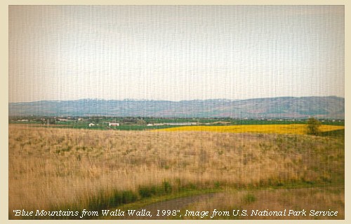
Blue Mountains:
The topography of the Blue Mountains consists of flat-topped ridges and steep stair-stepped valley walls formed by thousands of feet of Miocene basalt flows that engulfed the folded, faulted, and uplifted granitic core of the mountains. As mountains were uplifted, streams and glaciers carved canyons through the basalt layers. -- Columbia Basin Fish and Wildlife Authority Website, 2004


Map, 1814, Lewis and Clark on the Snake River, click to enlarge Map, 1855, Clearwater and Snake from Canoe Camp to the Columbia, click to enlarge Map, 1881, Snake, Clearwater, Grande Ronde, Salmon, click to enlarge Engraving, 1876, 'Birds eye view' of Walla Walla and the Blue Mountains, click to enlarge Image, 1998, Blue Mountains, click to enlarge
  1. 1814 Map, Lewis and Clark (section of original). (Click to enlarge.) The Blue Mountains are depicted but not named (horizontally-running ridge, lower half, left). From the "Nicholas Biddle/Paul Allen" 1814 publication. Original Map: "A Map of Lewis and Clark's Track, Across the Western Portion of North America, From the Mississippi to the Pacific Ocean". From: History of the expedition under the command of Captains Lewis and Clark : to the sources of the Missouri, thence across the Rocky Mountains and down the river Columbia to the Pacific Ocean : performed during the years 1804-5-6 : by order of the government of the United States / prepared for the press by Paul Allen. Philadelphia : Bradford and Insskeep, 1814. Harold B. Lee Library, Brigham Young University #upbover maps37. -- Brigham Young University, Harold B. Lee Library Website, 2004.
  2. 1855 Map, Clearwater and Snake Rivers, including the Blue Mountains (section of original). (Click to enlarge). Original Map: "Map of Oregon and Washington Territories: showing the proposed Northern Railroad route to the Pacific Ocean, by John Disturnell, 1855. University of Washington Archives #UW155. -- University of Washington Library Collections Website, 2002
  3. 1881 Map, Snake, Clearwater, Grande Ronde, and Salmon Rivers (section of original). (Click to enlarge). Original Map: "Map of the Grande Ronde Wallowa and Imnaha Country, 1881". Map section shows the Snake River (name doesn't show), "Clear Water" River (central right, tributary to the Snake), Grande Ronde River (lower left, only "de River" shows, tributary to the Snake), Salmon River (lower right, tributary to the Snake) Lewiston, Central Ferry, Alpowai, Dayton, Pataha, and the Blue Mountains. By H. Chandler, Eng., Buffalo, 1881., Washington State University Historical Maps Collection #WSU468. -- Washington State University Library Archives Website, 2002
  4. 1876 Engraving, "Birds eye view" of Walla Walla, Washington Territory, with the Blue Mountains 9 miles distant. (Click to enlarge). Drawn by E.S. Glover. A.L. Bancroft & Co., lithographers. Perspective map not drawn to scale. "From the west, looking east." Includes index to points of interest and text. -- U.S. Library of Congress, American Memories Website, 2002
  5. 1998, Blue Mountains from the Whitman Mission (Click to enlarge). National Park Service, Whitman Mission National Historic Site Negative #cmb-1998-12. -- U.S. National Park Service Website, 2002, Whitman Mission National Historic Site


"... Having gone 21 miles we arrived at the great Columbia river, which comes in from the northwest. We found here a number of natives, of whose nations we have not yet found out the names. We encamped on the point between the two rivers. The country all round is level, rich and beautiful, but without timber ..." [Gass, October 16, 1805]


Along the Journey - October 16, 1805
NASA photo, Snake River confluence with the Columbia River, 1994

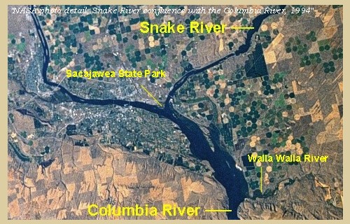
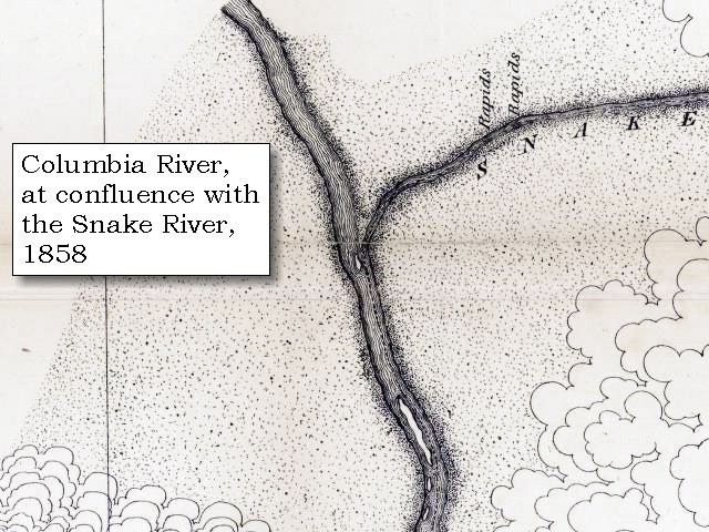
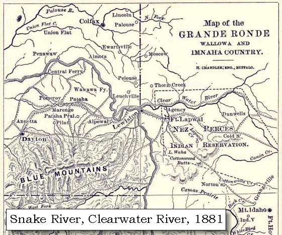
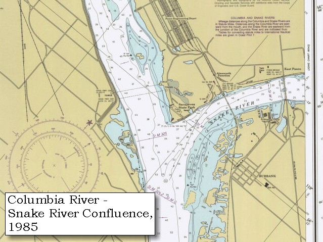
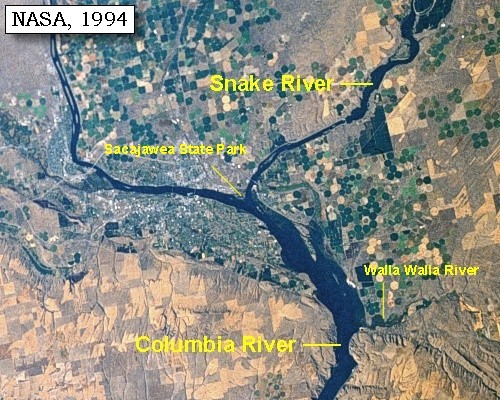
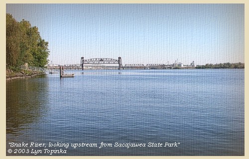
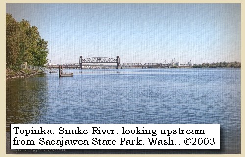
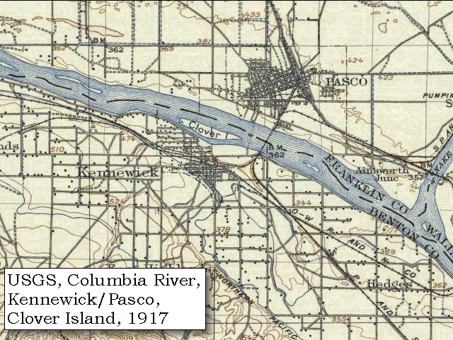
Junction of the Snake River with the Columbia River:
The Snake River joins the Columbia River at River Mile 325, near Pasco, Washington. Lewis and Clark spent two nights camped at the junction, a spot known today as Sacajawea State Park.


Map, the Volcanoes of Lewis and Clark, click to enlarge Map, 1814, Lewis and Clark, click to enlarge Map, 1853, Washington and Oregon and the Columbia River, click to enlarge Map, 1854, Columbia River, Willow Creek to Walla Walla, click to enlarge Map, 1855, Clearwater and Snake from Canoe Camp to the Columbia, click to enlarge Map, 1858 Military recon map, Snake River entering the Columbia River, click to enlarge Map, 1882, Snake River at Confluence with the Columbia, click to enlarge Map, 1893, Snake River showing Fish Hook Rapids, click to enlarge Map, 1987, Snake River confluence with the Columbia River, click to enlarge NASA Image, 1994, Columbia River from Crow Butte to the Snake River, click to enlarge NASA Image, 1994, Columbia River and the confluence of the Snake River, click to enlarge
  1. Map, Junction Snake River with the Columbia River (#9), October 16, 1805
  2. 1814 Map, Lewis and Clark (section of original). (Click to enlarge.) Shows the junction of the Snake River ("Lewis's River", just visible on the right) with the Columbia River (running through the middle of the map). From the "Nicholas Biddle/Paul Allen" 1814 publication. Original Map: "A Map of Lewis and Clark's Track, Across the Western Portion of North America, From the Mississippi to the Pacific Ocean". From: History of the expedition under the command of Captains Lewis and Clark : to the sources of the Missouri, thence across the Rocky Mountains and down the river Columbia to the Pacific Ocean : performed during the years 1804-5-6 : by order of the government of the United States / prepared for the press by Paul Allen. Philadelphia : Bradford and Insskeep, 1814. Harold B. Lee Library, Brigham Young University #upbover maps37. -- Brigham Young University, Harold B. Lee Library Website, 2004.
  3. 1853 Map, Washington and Oregon and the Columbia River, from the Clearwater River to the Snake River and down the Columbia River to the Pacific Ocean (section of original). (Click to enlarge). Includes: Clearwater River (Kooskooski), Lapwai Creek (Lapwai R.), Snake River (Saptin or Lewis R.), Columbia River (Columbia R.), Yakima River (Yakima R.), Walla Walla River (Wallawalla R.), Umatilla River (Umatilla R.), Willow Creek (Quesnells R.), John Day River (John day's R.), Deschutes River (Fall R.), Willamette River (Willammette R.), and Cowlitz River (Cowlitz R.). Original Map: "Map of California, Oregon, Washington, Utah, and New Mexico (1853)", by Thomas Cowperthwait & Co. Washington State University Archives #WSU22. -- Washington State University Library Collections Website, 2003
  4. 1853-54 Map, Columbia River, including the Horse Heaven Hills area (section of original). (Click to enlarge). Includes Horse Heaven Hills ("lands destitute of timber"), Willow Creek, Umatilla River, Walla Walla River, Touchet River, Twin Sisters ("Chimney Rock"), Yakima River, and the junction of the Snake River (only the "S" shows) with the Columbia. Original Map: "Rocky Mountains to Puget Sound : from explorations and surveys / made under the direction of the Hon. Jefferson Davis, Secretary of War by Isaac I. Stevens Governor of Washington Territory, 1853-4." Inset: (Supplementary sketch) Reconnaissance of the railroad route from Wallawalla to Seattle via Yak-e-mah River & Snoqualmie Pass. By A. W. Tinkham in January 1854. Drawn by J. R. P. Mechlin. 20 x 28 cm. Topographer, John Lambert, Published in Washington D.C., 1859, 1:1,200,000, Notes: From the U.S. War Department, Explorations and Surveys for a Railroad Route from the Mississippi River to the Pacific Ocean, Topographical Maps, to Illustrate the Various Reports, U.S. Library of Congress American Memories Reference "LC Railroad Maps #156". -- U.S. Library of Congress, American Memories Website, 2004
  5. 1855 Map, Clearwater and Snake Rivers, including the Confluence of the Snake River (Lewis Fork) and Columbia River (not named) (section of original). (Click to enlarge). Original Map: "Map of Oregon and Washington Territories: showing the proposed Northern Railroad route to the Pacific Ocean, by John Disturnell, 1855. University of Washington Archives #UW155. -- University of Washington Library Collections Website, 2002
  6. 1858 Military Recon Map (section of original), Snake River entering the Columbia River. (Click to enlarge). Map of military reconnaissance from Fort Dalles, Oregon, via Fort Wallah-Wallah, to Fort Taylor, Washington Territory, 1858. Shows approximate location of military road constructed 1859 to 1862. From the report and maps of Captain John Mullan, United States Army, G.P.O., 1863. University of Washington Archives #UW85. -- University of Washington Library Archives Website, 2002
  7. 1882 Map, Snake River Confluence with the Columbia River (section of original). (Click to enlarge). Original Map: "Map of the Upper Columbia River from the international boundary line to Snake River, on a scale of one inch to two miles, 1882, Sheet 25." U. S. Army Corps of Engineers, 1882. Washington State University Historical Maps Collection #WSU505. -- Washington State University Library Archives Website, 2002
  8. 1893 Map, part of the Snake River showing location of principal rapids (section of original). Includes Fish Hook Rapids. (Click to enlarge). Original Map: "Part of the Snake River from its mouth to the Grande Ronde, showing location of principal rapids". U.S. Engineers Office, 1893. Washington State University Historical Maps Collection #WSU586. -- Washington State University Library Archives Website, 2002
  9. 1987 Map, Snake River confluence with the Columbia River (section of original). (Click to enlarge). Includes Sacajawea State Park. Office of Coast Surveys, Historical Maps and Charts, Columbia River, Juniper to Pasco, 1987, Chart#18542, 1:20,000. -- NOAA Office of Coast Survey Website, 2004
  10. 1994, NASA Image, Columbia River from Crow Butte to the Snake River (section of original) (Click to enlarge). View from space - Columbia River, Snake River, Yakima River, Walla Walla River, Umatilla River, Crow Butte and Wallula Gap, north-looking, low-oblique photograph, September 1994. NASA Earth from Space #STS064-112-093. -- NASA Earth from Space Website, 2002
  11. 1994, NASA Image, Columbia River and the junction of the Snake River (section of original) (Click to enlarge). View from space - Columbia River and the Snake River, north-looking, low-oblique photograph, September 1994. NASA Earth from Space #STS064-112-093. -- NASA Earth from Space Website, 2002


Columbia River, looking upstream, from Sacajawea State Park, 2003

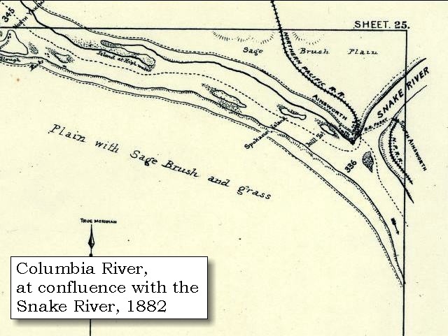
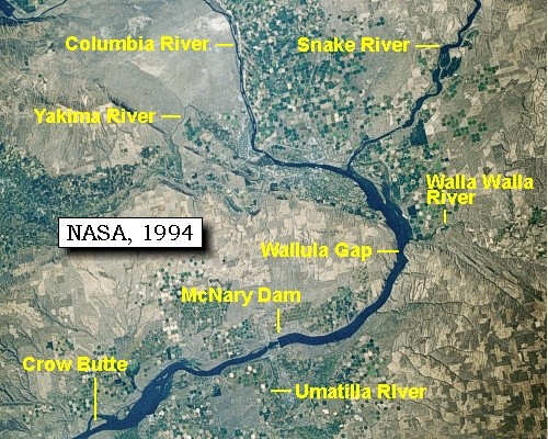
Columbia River:
The Columbia River and its tributaries form the dominant water system in the Pacific Northwest. The mainstem of the Columbia rises in Columbia Lake in British Columbia, Canada. After flowing a path for 1,270 miles, the Columbia joins the Pacific Ocean near Astoria, Oregon. The major tributaries of the Columbia are the Kootenai, Flathead/Pend Oreille/Clark's Fork, Snake, and Willamette. The largest of these tributaries, the Snake, travels 1,038 miles from its source in Yellowstone National Park in Wyoming. The Snake River enters the Columbia at Columbia River Mile 325, near Pasco, Washington. On May 12, 1792, the American Captain Robert Gray, became the first explorer to enter the Columbia River by crossing over the sandbar that blocked its mouth. Gray sailed about 20 miles up the estuary of the river, traded with the Indians for a few days, and then left after drawing a chart of the mouth of the river. He named the river the Columbia after his ship, and claimed it for the United States. British Captain George Vancouver obtained a copy of Gray's chart from the Spanish governor at Nootka Sound and sailed to the mouth of the Columbia River in October 1792. He was unable to get his flagship Discovery over the sandbar, but Lt. William Robert Broughton succeeded with his smaller ship, the Chatham. Broughton advanced nearly 100 miles to a site opposite present-day Portland, Oregon, which he named Point Vancouver. To the east he saw a majestic mountain peak which he named Mount Hood. -- U.S. Army Corps of Engineers, 2002, and University of Virginia Library Special Collections Website, 2002


Map, 1798, Columbia River of George Vancouver, click to enlarge Map, 1814, Lewis and Clark on the Columbia, click to enlarge Map, 1853, Washington and Oregon and the Columbia River, click to enlarge Map, 1854, Columbia River, Willow Creek to Walla Walla, click to enlarge Image, 2003, Horse Heaven Hills Image, 2003, Sacajawea State Park
  1. 1798 Map, Columbia River of George Vancouver (section of original). (Click to enlarge). Includes Columbia River, Cape Disappointment, Point Adams, Point Vancouver, and Mount St. Helens. Original Map: George Vancouver's "A Chart Shewing Part of the Coast of N.W. America." In A Voyage of discovery to the North Pacific ocean, and Round the World. London, 1798. University of Virginia Special Collection "Lewis & Clark, The Maps of Exploration 1507-1814". -- University of Virginia Library Archives Website, 2004
  2. 1814 Map, Lewis and Clark (section of original). (Click to enlarge.) Shows the Columbia River from Deer Island (left) to the junction with the Snake River ("Lewis's River", right). From the "Nicholas Biddle/Paul Allen" 1814 publication. Original Map: "A Map of Lewis and Clark's Track, Across the Western Portion of North America, From the Mississippi to the Pacific Ocean". From: History of the expedition under the command of Captains Lewis and Clark : to the sources of the Missouri, thence across the Rocky Mountains and down the river Columbia to the Pacific Ocean : performed during the years 1804-5-6 : by order of the government of the United States / prepared for the press by Paul Allen. Philadelphia : Bradford and Insskeep, 1814. Harold B. Lee Library, Brigham Young University #upbover maps37. -- Brigham Young University, Harold B. Lee Library Website, 2004.
  3. 1853 Map, Washington and Oregon and the Columbia River, from the Clearwater River to the Snake River and down the Columbia River to the Pacific Ocean (section of original). (Click to enlarge). Includes: Clearwater River (Kooskooski), Lapwai Creek (Lapwai R.), Snake River (Saptin or Lewis R.), Columbia River (Columbia R.), Yakima River (Yakima R.), Walla Walla River (Wallawalla R.), Umatilla River (Umatilla R.), Willow Creek (Quesnells R.), John Day River (John day's R.), Deschutes River (Fall R.), Willamette River (Willammette R.), and Cowlitz River (Cowlitz R.). Original Map: "Map of California, Oregon, Washington, Utah, and New Mexico (1853)", by Thomas Cowperthwait & Co. Washington State University Archives #WSU22. -- Washington State University Library Collections Website, 2003
  4. 1853-54 Map, Columbia River, including the Horse Heaven Hills area (section of original). (Click to enlarge). Includes Horse Heaven Hills ("lands destitute of timber"), Willow Creek, Umatilla River, Walla Walla River, Touchet River, Twin Sisters ("Chimney Rock"), Yakima River, and the junction of the Snake River (only the "S" shows) with the Columbia. Original Map: "Rocky Mountains to Puget Sound : from explorations and surveys / made under the direction of the Hon. Jefferson Davis, Secretary of War by Isaac I. Stevens Governor of Washington Territory, 1853-4." Inset: (Supplementary sketch) Reconnaissance of the railroad route from Wallawalla to Seattle via Yak-e-mah River & Snoqualmie Pass. By A. W. Tinkham in January 1854. Drawn by J. R. P. Mechlin. 20 x 28 cm. Topographer, John Lambert, Published in Washington D.C., 1859, 1:1,200,000, Notes: From the U.S. War Department, Explorations and Surveys for a Railroad Route from the Mississippi River to the Pacific Ocean, Topographical Maps, to Illustrate the Various Reports, U.S. Library of Congress American Memories Reference "LC Railroad Maps #156". -- U.S. Library of Congress, American Memories Website, 2004
  5. 2003, Looking across the Columbia River towards Horse Heaven Hills. (Click to enlarge). Image taken from Sacajawea State Park. Copyright © 2003 Lyn Topinka, private archives, used with permission.
  6. 2003, Columbia River, looking upstream from Sacajawea State Park, Washington. (Click to enlarge). Copyright © 2003 Lyn Topinka, private archives, used with permission.


Snake River, looking upstream from Sacajawea State Park, 2003

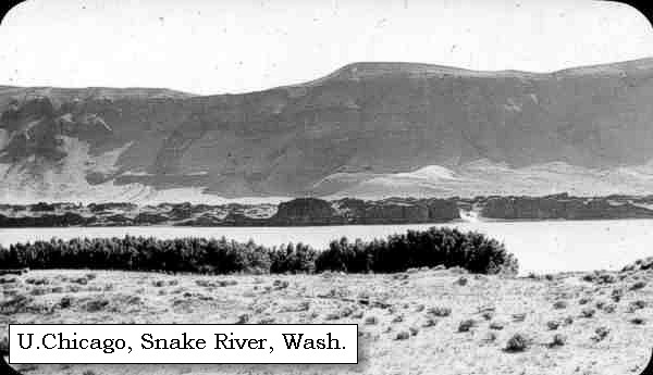
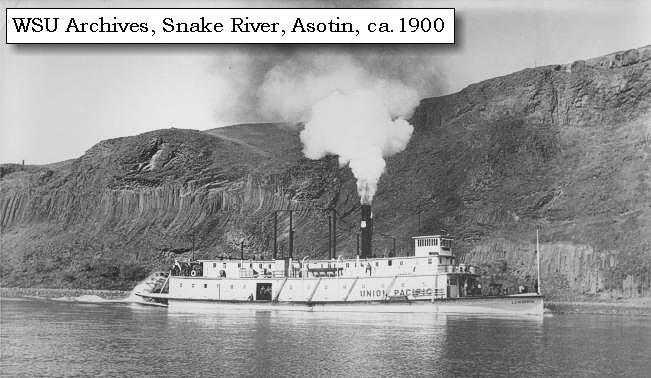
Snake River:
The Snake River originates in Yellowstone National Park at 9,500 feet and winds through southern Idaho before turning north to form the boundary between Idaho and Oregon. It finally joins the Columbia River at Mile 325 near Pasco, Washington, 1,036 miles from its source. Elevation at the confluence is 340 feet. How did it get its name? To identify themselves, Indians living along the river in southern Idaho used a hand sign that resembled the movement of a snake. Although it didn't mean "Snake", that name was given to this group of people, now known as Shoshone. The river flowing through the Snake Indian lands was given the tribal name. -- U.S. National Park Service, Wild and Scenic Rivers Website, 2002, and Idaho State Parks and Recreation Website, 2002


Map, 1814, Lewis and Clark on the Snake, click to enlarge Map, 1853, Washington and Oregon and the Columbia River, click to enlarge Map, 1854, Columbia River, Willow Creek to Walla Walla, click to enlarge Image, Snake River, Washington, click to enlarge Image, ca.1900, Steamer on the Snake River, near Asotin, Washington, click to enlarge Image, 2003, Snake River from Sacajawea State Park
  1. 1814 Map, Lewis and Clark (section of original). (Click to enlarge.) Shows the Snake River ("Lewis's River") from Canoe Camp (right) to its junction with the Columbia River (left). From the "Nicholas Biddle/Paul Allen" 1814 publication. Original Map: "A Map of Lewis and Clark's Track, Across the Western Portion of North America, From the Mississippi to the Pacific Ocean". From: History of the expedition under the command of Captains Lewis and Clark : to the sources of the Missouri, thence across the Rocky Mountains and down the river Columbia to the Pacific Ocean : performed during the years 1804-5-6 : by order of the government of the United States / prepared for the press by Paul Allen. Philadelphia : Bradford and Insskeep, 1814. Harold B. Lee Library, Brigham Young University #upbover maps37. -- Brigham Young University, Harold B. Lee Library Website, 2004.
  2. 1853 Map, Washington and Oregon and the Columbia River, from the Clearwater River to the Snake River and down the Columbia River to the Pacific Ocean (section of original). (Click to enlarge). Includes: Clearwater River (Kooskooski), Lapwai Creek (Lapwai R.), Snake River (Saptin or Lewis R.), Columbia River (Columbia R.), Yakima River (Yakima R.), Walla Walla River (Wallawalla R.), Umatilla River (Umatilla R.), Willow Creek (Quesnells R.), John Day River (John day's R.), Deschutes River (Fall R.), Willamette River (Willammette R.), and Cowlitz River (Cowlitz R.). Original Map: "Map of California, Oregon, Washington, Utah, and New Mexico (1853)", by Thomas Cowperthwait & Co. Washington State University Archives #WSU22. -- Washington State University Library Collections Website, 2003
  3. 1853-54 Map, Columbia River, including the Horse Heaven Hills area (section of original). (Click to enlarge). Includes Horse Heaven Hills ("lands destitute of timber"), Willow Creek, Umatilla River, Walla Walla River, Touchet River, Twin Sisters ("Chimney Rock"), Yakima River, and the junction of the Snake River (only the "S" shows) with the Columbia. Original Map: "Rocky Mountains to Puget Sound : from explorations and surveys / made under the direction of the Hon. Jefferson Davis, Secretary of War by Isaac I. Stevens Governor of Washington Territory, 1853-4." Inset: (Supplementary sketch) Reconnaissance of the railroad route from Wallawalla to Seattle via Yak-e-mah River & Snoqualmie Pass. By A. W. Tinkham in January 1854. Drawn by J. R. P. Mechlin. 20 x 28 cm. Topographer, John Lambert, Published in Washington D.C., 1859, 1:1,200,000, Notes: From the U.S. War Department, Explorations and Surveys for a Railroad Route from the Mississippi River to the Pacific Ocean, Topographical Maps, to Illustrate the Various Reports, U.S. Library of Congress American Memories Reference "LC Railroad Maps #156". -- U.S. Library of Congress, American Memories Website, 2004
  4. An arid region along the Snake River, Washington. (Click to enlarge). Photograph Date: between 1891 and 1936. Photographer: unknown. American Environmental Photographs Collection #AEP-WAS141, Department of Special Collections, University of Chicago Library. -- U.S. Library of Congress, American Memories Website, 2002
  5. ca.1900, Steamer on the Snake River, near Asotin, Washington. (Click to enlarge). Steam rises from atop the 'Lewiston' steamboat as it passes Asotin, Washington, approximately 8 miles downstream of the confluence of the Clearwater River and the Snake River. Photographer: Wilkin Photo Service, Lewiston, Idaho. Photograph date: ca. 1900. Washington State University Libraries Archives, #11108 -- Washington State University Library Archives Website, 2002
  6. 2003, Snake River, looking upstream from Sacajawea State Park, Washington. (Click to enlarge). Copyright © 2003 Lyn Topinka, private archives, used with permission.


On landing we were met by our two chiefs, to whose good offices we were indebted for this reception, and also the two Indians who had passed us a few days since on horseback; one of whom appeared to be a man of influence, and harangued the Indians on our arrival. After smoking with the Indians, we formed a camp at the point where the two rivers unite [today's Pasco and Kennewick, Washington, at today's Sacajawea State Park], near to which we found some driftwood, and were supplied by our two old chiefs with the stalks of willows and some small bushes for fuel. ......


Along the Journey - October 16, 1805
Sacajawea State Park, 2003

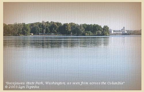
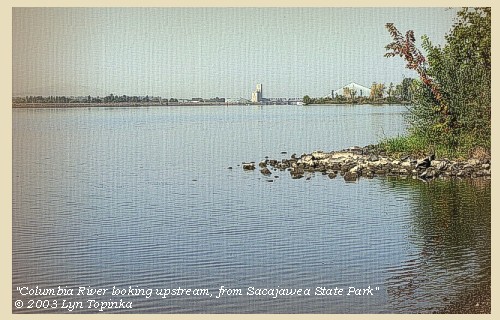
Sacajawea State Park:
Sacajawea State Park is a 284-acre marine, day-use park at the confluence of the Snake and Columbia rivers. It features 9,100 feet of freshwater shoreline. The area is spread out with a big sky and excellent views of the two rivers as they flow together. The park's lands are sand dunes interspersed with wetland ponds. The park is on the plain of the great Lake Missoula floods, which swept through the area 12,000 years ago. The property was deeded to Washington State Parks in 1931. The park is named for Sacajawea, a Shoshoni Indian woman who traveled with the Lewis and Clark expedition. The park is located on one of the expedition's campsites, used by Lewis and Clark from October 16 to 18, 1805. -- Washington State Parks and Recreation Website, 2002


Map, 1814, Lewis and Clark, click to enlarge Map, 1858 Military recon map, Snake River entering the Columbia River, click to enlarge Map, 1917 USGS topo map of Columbia River near Kennewick and Pasco, click to enlarge Map, 1987, Snake River confluence with the Columbia River, click to enlarge NASA Image, 1994, Columbia River and the confluence of the Snake River, click to enlarge Image, 2003, Sacajawea State Park
  1. 1814 Map, Lewis and Clark (section of original). (Click to enlarge.) Shows the junction of the Snake River ("Lewis's River") with the Columbia River (left). From the "Nicholas Biddle/Paul Allen" 1814 publication. Original Map: "A Map of Lewis and Clark's Track, Across the Western Portion of North America, From the Mississippi to the Pacific Ocean". From: History of the expedition under the command of Captains Lewis and Clark : to the sources of the Missouri, thence across the Rocky Mountains and down the river Columbia to the Pacific Ocean : performed during the years 1804-5-6 : by order of the government of the United States / prepared for the press by Paul Allen. Philadelphia : Bradford and Insskeep, 1814. Harold B. Lee Library, Brigham Young University #upbover maps37. -- Brigham Young University, Harold B. Lee Library Website, 2004.
  2. 1858 Military Recon Map (section of original), Snake River entering the Columbia River. (Click to enlarge). Map of military reconnaissance from Fort Dalles, Oregon, via Fort Wallah-Wallah, to Fort Taylor, Washington Territory, 1858. Shows approximate location of military road constructed 1859 to 1862. From the report and maps of Captain John Mullan, United States Army, G.P.O., 1863. University of Washington Archives #UW85. -- University of Washington Library Archives Website, 2002
  3. 1917 Map (section of original), from Pasco 1:125,000 topographic quadrangle. (Click to enlarge). Sacajawea State Park, while not named on the map, is located at the junction of the Snake River with the Columbia River (triangle tip, below "Ainsworth Junc." words). Original map surveyed in 1904 and 1914, contour interval of 50 feet. -- University of Washington Library Collections Website, 2002
  4. 1987 Map, Snake River confluence with the Columbia River (section of original). (Click to enlarge). Includes Sacajawea State Park. Office of Coast Surveys, Historical Maps and Charts, Columbia River, Juniper to Pasco, 1987, Chart#18542, 1:20,000. -- NOAA Office of Coast Survey Website, 2004
  5. 1994, NASA Image, Columbia River and the junction of the Snake River (section of original), Sacajawea State Park is on the "point" (Click to enlarge). View from space - Columbia River and the Snake River, north-looking, low-oblique photograph, September 1994. NASA Earth from Space #STS064-112-093. -- NASA Earth from Space Website, 2002
  6. 2003, Sacajawea State Park from across the Columbia River. (Click to enlarge). Copyright © 2003 Lyn Topinka, private archives, used with permission.


Along the Journey - October 16, 1805
The Camp - October 16 and 17, 1805:
Lewis and Clark's camp of October 16 and 17, 1805, was at the confluence of the Snake and Columbia Rivers, just east of Pasco, Washington. Today on the northeast point of the confluence is Sacajawea State Park. The original campsite is now under the waters of Lake Wallula, behind McNary Dam.


Home Previous Continue


If you have questions or comments please contact: GS-CVO-WEB@usgs.gov
June/July 2004, Lyn Topinka
The Volcanoes of Lewis and Clark Home Page | CVO Home Page