The Volcanoes of
Lewis and Clark
October 13, 1805
On the Snake River - Texas Rapids to Ayers Junction
 
Home
The Volcanoes of Lewis and Clark

Map of the Journey
Volcanoes, Basalt Plateaus, Major Rivers, etc.

The Volcanoes
Mount Adams, Mount Hood, Mount Jefferson, Mount Rainier, and Mount St. Helens

CALENDAR of the Journey
October 1805 to June 1806

Along the Journey
Pacific Northwest Maps - Columbia River, Volcanoes, Flood Basalts, Missoula Floods, Geology, etc.

The Corps of Discovery
The Journey of Lewis and Clark

About the Reference Materials
The Journals, Biddle/Allen, DeVoto, Gass, Moulton, Topo Maps, and others

USGS Lewis and Clark Links
Links to USGS Websites highlighting the Lewis and Clark Journey

Resources
Publications Referenced and Websites Visited


PREVIOUS

October 12
On the Snake, Almota Creek to Texas Rapids
October 13

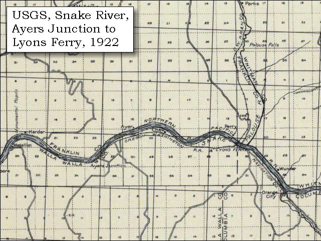
On the Snake,
Texas Rapids to Ayers Junction

Tucannon River, Palouse River and Palouse Rapids, Lyon's Ferry State Park, Palouse Falls and Palouse Falls State Park, False Palouse Rapids, Ayers Junction (Washington)
CONTINUE

October 14-15
On the Snake, Ayers Junction to Fish Hook Rapids
 

On October 7, 1805, Lewis and Clark and the "Corps of Discovery" began their journey down the Clearwater River and into the volcanics of the Pacific Northwest. The Corps travelled from the Clearwater to the Snake and down the "Great Columbia", finally reaching the Pacific Ocean on November 15, 1805. Along the journey they encountered the lava flows of the Columbia Plateau, river channels carved by the great "Missoula Floods", and the awesome beauty of five Cascade Range volcanoes.

Map, Lewis and Clark in the Pacific Northwest, click for brief
                         summary
[Click map for brief summary about the area]


To the Pacific - October 1805
On the Snake - Texas Rapids to Ayers Junction
 

Lewis and Clark's camp of October 12, 1805, was at the mouth of Alkali Flat Creek, near the town of Riparia, Washington, just downstream of Little Goose Dam. The campsite was at the head of Texas Rapids which is now below Lake West, the backwater of Lower Monumental Dam.

Sunday, October 13, 1805
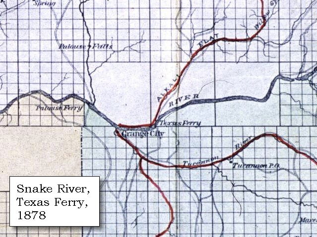
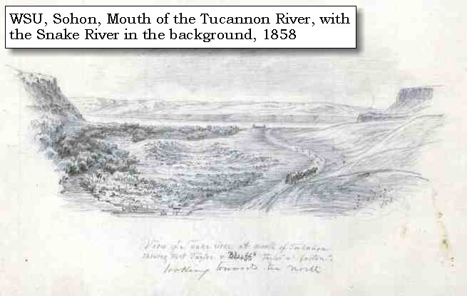
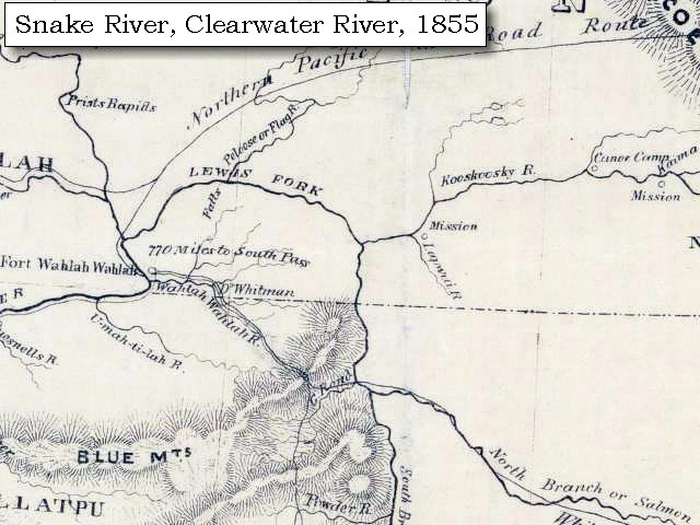
The morning was windy and dark, and the which began before daylight, continued till near twelve o'clock. Having viewed very accurately the whole of this rapid [Texas Rapids] we set out, the Indians going on before us to pilot the canoes. We found it, as had been reported, a very dangerous rapid, about two miles in length, and strewed with rocks in every direction, so as to require great dexterity to avoid running against them. We however passed through the channel, which is towards the left, and about the centre of the rapid, without meeting with any accident. Two miles below it we had another bad rapid [???], a mile beyond which is a large creek in a bend to the left. This we called Kimooenim creek. [Tucannon River. The Tucannon merges with the Snake downstream of Starbuck, Washington. Entry of October 16 uses "Kimooenim" to represent the Snake.]
"... The country continues much the same, all high dray prairie. One handsome creek comes in on the south side ..." [Gass, October 13, 1805]
"... towards evening we passed through a place in the River where it was all confined in a narrow channel of about 15 yards wide for about 2 miles and ran like a mill race ...     passed a creek which came in on the Lard. Side this afternoon     the current Swift. ..." [Ordway, October 13, 1805]


Along the Journey - October 13, 1805
Tucannon River at mouth

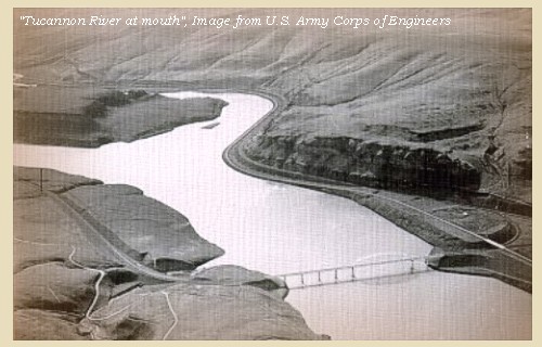
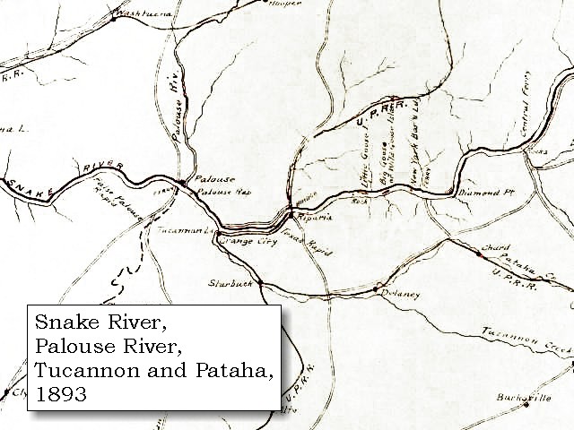
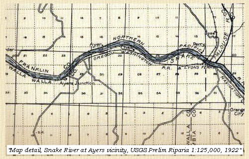
Tucannon River:
The Tucannon River has two major drainages, the mainstem and Pataha Creek. The mainstem drains 318 square miles and flows into the Snake River at River Mile (RM) 62.2, three miles upstream of Lyons Ferry State Park, near the mouth of the Palouse River. Pataha Creek drains 185 square milesand enters the Tucannon River at RM 11.2. The mouth and lower 2 miles of the Tucannon River has become a marshland as a result of the reservoir formed by Lower Monumental Dam, 20 miles downstream on the Snake River. Elevations in the Tucannon basin range from 540 feet at the confluence of the Tucannon and Snake Rivers to 6,400 feet at Oregon Butte in the Wenaha-Tucannon Wilderness located in the Umatilla National Forest. Long slopes intersected by steep canyons characterize topography in the Tucannon basin. The Tucannon River drains the Blue Mountains, a broad anticline arch uplifted during the last 20 million years. The bedrock of the Tucannon watershed consists nearly entirely of lava flows, with an average flow thickness is about 90 to 120 feet. -- Columbia Basin Fish and Wildlife Authority Website, 2002


Map, 1814, Lewis and Clark on the Snake River, click to enlarge Map, 1858 Military recon map, Snake, Palouse, and Tucannon Rivers, click to enlarge Map, 1878, Snake, Palouse, Tucannon Rivers, Alkali Flat, with Texas Ferry, click to enlarge Map, 1878, Snake and Tucannon Rivers, with Central Ferry and Almota Ferry, click to enlarge Map, 1893, Snake, Palouse, Tucannon Rivers, click to enlarge Map, 1893, Closer-in, Snake, Palouse, Tucannon Rivers, click to enlarge Sketch, 1858, Mouth of the Tucannon River, click to enlarge Image, Tucannon River, click to enlarge
  1. 1814 Map, Lewis and Clark (section of original). (Click to enlarge.) Shows the Tucannon River ("Ki moo e nim R."). From the "Nicholas Biddle/Paul Allen" 1814 publication. Original Map: "A Map of Lewis and Clark's Track, Across the Western Portion of North America, From the Mississippi to the Pacific Ocean". From: History of the expedition under the command of Captains Lewis and Clark : to the sources of the Missouri, thence across the Rocky Mountains and down the river Columbia to the Pacific Ocean : performed during the years 1804-5-6 : by order of the government of the United States / prepared for the press by Paul Allen. Philadelphia : Bradford and Insskeep, 1814. Harold B. Lee Library, Brigham Young University #upbover maps37. -- Brigham Young University, Harold B. Lee Library Website, 2004.
  2. 1858 Military Recon Map (section of original), Snake, Palouse, and Tucannon Rivers. (Click to enlarge). Map of military reconnaissance from Fort Dalles, Oregon, via Fort Wallah-Wallah, to Fort Taylor, Washington Territory, 1858. Shows approximate location of military road constructed 1859 to 1862. From the report and maps of Captain John Mullan, United States Army, G.P.O., 1863. University of Washington Archives #UW85. -- University of Washington Library Archives Website, 2002
  3. 1878 Map, part of the Snake River showing Snake, Tucannon, and Palouse Rivers, and Alkali Flat Creek, with Palouse Ferry and Texas Ferry. (Click to enlarge). Original Map: "Map of south eastern Washington Territory compiled from official surveys and published by Eastwick, Morris & Co. ; drawn by John Hanson, 1878" Washington State University Historical Maps Collection #WSU371. -- Washington State University Library Archives Website, 2004
  4. 1878 Map, part of the Snake River showing Snake and Tucannon Rivers, with Central Ferry, Penawawa City, Almota Ferry, Pomeroy, and Pataha City. (Click to enlarge). Original Map: "Map of south eastern Washington Territory compiled from official surveys and published by Eastwick, Morris & Co. ; drawn by John Hanson, 1878" Washington State University Historical Maps Collection #WSU371. -- Washington State University Library Archives Website, 2004
  5. 1893 Map, part of the Snake River showing location of principal rapids (section of original). Includes Snake, Tucannon, and Palouse Rivers. (Click to enlarge). Original Map: "Part of the Snake River from its mouth to the Grande Ronde, showing location of principal rapids". U.S. Engineers Office, 1893. Washington State University Historical Maps Collection #WSU586. -- Washington State University Library Archives Website, 2002
  6. 1893 Map, Closer-in, part of the Snake River showing location of principal rapids (section of original). Includes Snake, Tucannon, and Palouse Rivers. (Click to enlarge). Original Map: "Part of the Snake River from its mouth to the Grande Ronde, showing location of principal rapids". U.S. Engineers Office, 1893. Washington State University Historical Maps Collection #WSU586. -- Washington State University Library Archives Website, 2002
  7. 1858 Sketch, View of the Snake River at mouth of the Tucannon River. (Click to enlarge). "Looking towards the north", showing Fort Taylor and bluffs. Sketch by Gustave Sohon, 1858. Washington State University Archives Collection #WSU515. -- Washington State University Library Archives Website, 2002
  8. Image, Tucannon River, Washington (Click to enlarge). U.S. Army Corps of Engineers photograph, Walla Walla District. -- U.S. Army Corps of Engineers Photo Collection Website, 2002


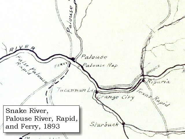
On leaving it the river soon became crowded with rough black rocks, till at the distance of a mile it forms a rapid [Palouse Rapids] which continues for four miles, and during the latter part of it for a mile and a half, the whole river is compressed into a narrow channel, not more than twenty-five yards wide. The water happened to be low as we passed, but during the high waters, the navigation must be very difficult. Immediately at the end of this rapid [Palouse Rapids], is a large stream in a bend to the right, which we called Drewyer's river [Palouse River], after George Drewyer one of the party. ......


Along the Journey - October 13, 1805
Palouse River, 1963

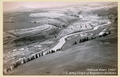
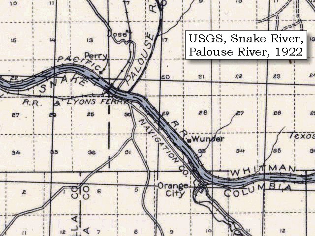
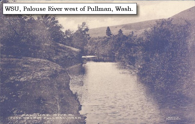
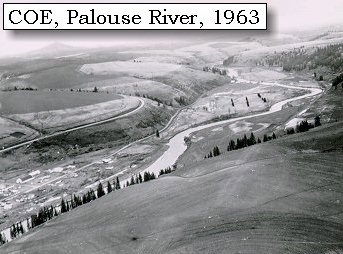
Palouse River and Palouse Rapids:
The Palouse River drains an area encompassing 2,113,970 acres (over 3,000 square miles) in the states of Washington, Oregon, and Idaho. The drainage basin includes 398 miles of stream. It originates in the Palouse Mountain Range within the St. Joe National Forest northeast of Moscow, Idaho, and then flows in a westerly direction into eastern Washington, south of the City of Spokane. The river then winds through the rolling farm ground of Latah and Whitman Counties before it enters the Snake River at the Whitman/Franklin County line. Pine Creek, Rock Creek, and Cow Creek drain large areas within the Whitman County portion of the basin. The part of the basin that lies in Spokane County drains the Turnbull National Wildlife Refuge. The Palouse River once flowed through Washtucna, but was re-routed by the great Lake Missoula floods. Lyons Ferry State Park is located at the junction of the Palouse River with the Snake. The Palouse Falls Natural Area is less than 10 miles north and features a 198-foot-high waterfall cascading into the Palouse River, providing a spectacular view (more information below). -- Columbia Basin Fish and Wildlife Authority Website, 2002, and Washington State Parks and Recreation Website, 2003


Map, 1814, Lewis and Clark on the Snake River, click to enlarge Map, 1853, Washington and Oregon and the Columbia River, click to enlarge Map, 1855, Clearwater and Snake from Canoe Camp to the Columbia, click to enlarge Map, 1858 Military recon map, Snake, Palouse, and Tucannon Rivers, click to enlarge Map, 1878, Snake, Palouse, Tucannon Rivers, Alkali Flat, with Texas Ferry, click to enlarge Map, 1893, Closer-in, Snake, Palouse, Tucannon Rivers, click to enlarge Map, 1893, Snake, Palouse, Tucannon Rivers, click to enlarge Map, 1922, USGS Preliminary Topo Map, Snake River, Ayers, Palouse, click to enlarge Map, 1922 Preliminary USGS topo map of Snake River and Palouse River area, click to enlarge Image, Palouse River west of Pullman, Washington, click to enlarge Image, 1963, Palouse River, Washington, click to enlarge
  1. 1814 Map, Lewis and Clark (section of original). (Click to enlarge.) Shows the Palouse River ("Drewyer's R."). From the "Nicholas Biddle/Paul Allen" 1814 publication. Original Map: "A Map of Lewis and Clark's Track, Across the Western Portion of North America, From the Mississippi to the Pacific Ocean". From: History of the expedition under the command of Captains Lewis and Clark : to the sources of the Missouri, thence across the Rocky Mountains and down the river Columbia to the Pacific Ocean : performed during the years 1804-5-6 : by order of the government of the United States / prepared for the press by Paul Allen. Philadelphia : Bradford and Insskeep, 1814. Harold B. Lee Library, Brigham Young University #upbover maps37. -- Brigham Young University, Harold B. Lee Library Website, 2004.
  2. 1853 Map, Washington and Oregon and the Columbia River, from the Clearwater River to the Snake River and down the Columbia River to the Pacific Ocean (section of original). (Click to enlarge). The Palouse River is shown but not named. Includes: Clearwater River (Kooskooski), Lapwai Creek (Lapwai R.), Snake River (Saptin or Lewis R.), Columbia River (Columbia R.), Yakima River (Yakima R.), Walla Walla River (Wallawalla R.), Umatilla River (Umatilla R.), Willow Creek (Quesnells R.), John Day River (John day's R.), Deschutes River (Fall R.), Willamette River (Willammette R.), and Cowlitz River (Cowlitz R.). Original Map: "Map of California, Oregon, Washington, Utah, and New Mexico (1853)", by Thomas Cowperthwait & Co. Washington State University Archives #WSU22. -- Washington State University Library Collections Website, 2003
  3. 1855 Map, Clearwater and Snake Rivers, including the Palouse River (Falls or Peloose or Flag R.) (section of original). (Click to enlarge). Original Map: "Map of Oregon and Washington Territories: showing the proposed Northern Railroad route to the Pacific Ocean, by John Disturnell, 1855. University of Washington Archives #UW155. -- University of Washington Library Collections Website, 2002
  4. 1858 Military Recon Map (section of original), Snake, Palouse, and Tucannon Rivers. (Click to enlarge). Map of military reconnaissance from Fort Dalles, Oregon, via Fort Wallah-Wallah, to Fort Taylor, Washington Territory, 1858. Shows approximate location of military road constructed 1859 to 1862. From the report and maps of Captain John Mullan, United States Army, G.P.O., 1863. University of Washington Archives #UW85. -- University of Washington Library Archives Website, 2002
  5. 1878 Map, part of the Snake River showing Snake, Tucannon, and Palouse Rivers, and Alkali Flat Creek, with Palouse Ferry and Texas Ferry. (Click to enlarge). Original Map: "Map of south eastern Washington Territory compiled from official surveys and published by Eastwick, Morris & Co. ; drawn by John Hanson, 1878" Washington State University Historical Maps Collection #WSU371. -- Washington State University Library Archives Website, 2004
  6. 1893 Map, part of the Snake River showing location of principal rapids (section of original). Includes Snake, Tucannon, and Palouse Rivers. (Click to enlarge). Original Map: "Part of the Snake River from its mouth to the Grande Ronde, showing location of principal rapids". U.S. Engineers Office, 1893. Washington State University Historical Maps Collection #WSU586. -- Washington State University Library Archives Website, 2002
  7. 1893 Map, wider-view, part of the Snake River showing location of principal rapids (section of original). Includes Snake, Tucannon, and Palouse Rivers. (Click to enlarge). Original Map: "Part of the Snake River from its mouth to the Grande Ronde, showing location of principal rapids". From: U.S. Engineers Office, 1893. Washington State University Historical Maps Collection #WSU586. -- Washington State University Library Archives Website, 2002
  8. 1922 Preliminary Map (section of original), from Riparia 1:125,000 topographic quadrangle. (Click to enlarge). Snake River, Palouse River area. "Advance sheet 80-N-II&IV", Engineer Reproduction Print. U.S. Army Corps of Engineers Map, UW/WSU #Topo46 -- Washington State University Archives Website, 2004
  9. 1922 Preliminary Map (section of original), from Riparia 1:125,000 topographic quadrangle. (Click to enlarge). Snake River, Palouse River area, closer-in view. "Advance sheet 80-N-II&IV", Engineer Reproduction Print. U.S. Army Corps of Engineers Map, UW/WSU #Topo46 -- Washington State University Archives Website, 2004
  10. Palouse River just west of Pullman, Washington. (Click to enlarge). Washington State University Libraries Archives, Neill Public Library Collection, Pullman, Washington, Ivan Shirrod Collection, #SHI455. -- Washington State University Library Archives Website, 2002
  11. 1963, Palouse River, Washington. (Click to enlarge). U.S. Army Corps of Engineers, February 6, 1963. -- U.S. Army Corps of Engineers Archives, 2004


Prominant Lava Flows in the Vicinity:
The prominent bench seen above both the Palouse and Snake Rivers is along the contact of the Grande Ronde and Wanapum Basalts. The Grande Ronde Basalt is the most voluminous and areally extensive formation in the entire Columbia River Basalt Group, and underlies most of the Columbia Plateau. It has an estimated volume of more than 35,000 cubic miles, and its thickness varies widely depending on underlying topography; the thickest preserved section exceeds 3,300 feet in drill holes in the Pasco Basin, and sections 1,650 to 2,300 feet thick occur in the Blue Mountains and other uplifted or deeply incised areas. Grande Ronde flows make up 85 percent of the Columbia River Basalt's total volume, and occured from about 16.5 to 15.5 million years ago. The flows originated in eastern Washington and Oregon. The Wanapum Basalt is the most extensive formation exposed at the surface of the Columbia Plateau, but is much less voluminous than the Grande Ronde, probably having a volume of less than 2,400 cubic miles. The Wanapum is part of the Columbia River Basalt Group, which is is the youngest assemblage of flood basalts known, with an age range from about 17 to 6 million years ago. Most eruptions taking place between about 17 and 14 million years. -- Swanson and Wright, 1981, and U.S. Forest Service, Columbia River Gorge National Scenic Area Website, 2002


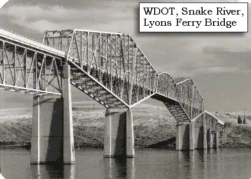
This area today is the location of Lyons Ferry State Park, on the Palouse River at it's confluence with the Snake River.


Along the Journey - October 13, 1805
Lyons Ferry Bridge, ca.1960s

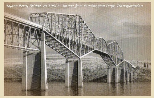
Lyons Ferry State Park:
Lyons Ferry State Park is a 1,282-acre camping park with archeological and geological significance dating back thousands of years. The property was diked and unintentionally flooded when the United States Army Corps of Engineers raised the reservoir behind lower Monumental Dam. Recent history is recalled by the old ferry berthed in Lyons Ferry State Park. Once powered by river current, this ferry and its predecessors crossed the Snake River for 108 years, providing an important link for the Palouse country with the Old Mullan Road. The road was built by Lt. John Mullan to move military troops between Fort Benton and the Missouri River and Fort Walla Walla on the Columbia River. Lyons Ferry was operated for several years by Dan Lyons and Nae and Ruth Turner. -- Washington State Parks and Recreation Website, 2003


Map, 1893, Snake, Palouse, Tucannon Rivers, click to enlarge Map, 1893, Closer-in, Snake, Palouse, Tucannon Rivers, click to enlarge Map, 1922, USGS Preliminary Topo Map, Snake River, Ayers, Palouse, click to enlarge Map, 1996, Recreation sites along Lake West including the Lyons Ferry area, click to enlarge Image, Lyons Ferry Bridge, click to enlarge
  1. 1893 Map, part of the Snake River showing location of principal rapids (section of original). Includes Snake, Tucannon, and Palouse Rivers. (Click to enlarge). Original Map: "Part of the Snake River from its mouth to the Grande Ronde, showing location of principal rapids". U.S. Engineers Office, 1893. Washington State University Historical Maps Collection #WSU586. -- Washington State University Library Archives Website, 2002
  2. 1893 Map, Closer-in, part of the Snake River showing location of principal rapids (section of original). Includes Snake, Tucannon, and Palouse Rivers. (Click to enlarge). Original Map: "Part of the Snake River from its mouth to the Grande Ronde, showing location of principal rapids". U.S. Engineers Office, 1893. Washington State University Historical Maps Collection #WSU586. -- Washington State University Library Archives Website, 2002
  3. 1922 Preliminary Map (section of original), from Riparia 1:125,000 topographic quadrangle. (Click to enlarge). Snake River, Palouse River area, including Lyons Ferry. "Advance sheet 80-N-II&IV", Engineer Reproduction Print. U.S. Army Corps of Engineers Map, UW/WSU #Topo46 -- Washington State University Archives Website, 2004
  4. 1996, Recreation sites along Lake West, including Lyons Ferry. (Click to enlarge). Lake West is the reservoir behind the Lower Monumental Dam on the Snake River. -- U.S. Army Corps of Engineers Website, 2004, Walla Walla District
  5. Lyons Ferry Bridge over the Snake River. (Click to enlarge). The Lyons Ferry Bridge over the Snake River (State Route 261) was built in 1927 at Vantage, Washington, and moved to Lyon's Ferry in 1968. This is the oldest extant steel cantilever bridge in Washington. -- Washington State Department of Transportation Website, 2003


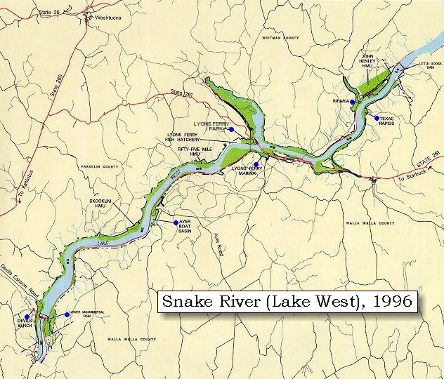
Geology of Lyons Ferry State Park:
The rich geologic history of Lyons Ferry State park is readily evidenced by basaltic formations that outline the paths of both the Snake and the Palouse rivers. Park visitors drive through rolling hills of agricultural land, broken lava, dry grass and sagebrush for opportunities to wander through what geologists call "the strangest landscape this side of Mars." These "Channeled Scablands" are part of hundreds of square miles of raw, peeled ground that stretch from Spokane west to the Cascades and south to the Snake River. -- Washington State Parks and Recreation Website, 2002


Located within Lyons Ferry State Park is spectacular Palouse Falls State Park, with it's 198-foot waterfall cascading over basalt cliffs.


Along the Journey - October 13, 1805
Palouse Falls, 1932

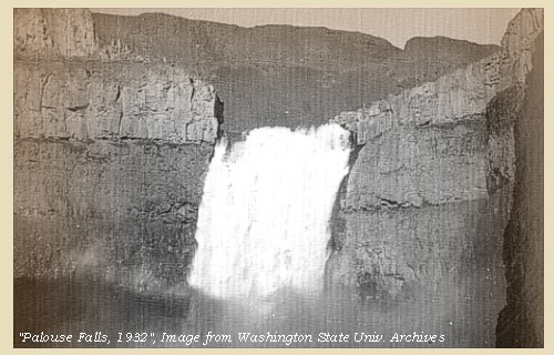
Palouse Falls State Park:
Palouse Falls drops from a height of 200 feet, and was created by the Lake Missoula floods. Palouse Falls is the only major waterfall left along the glacial flood path of 15,000 years ago. Palouse Falls State Park is a camping park included in Lyon's Ferry State Park -- Washington State Parks and Recreation Website, 2002


Map, 1878, Snake, Palouse, Tucannon Rivers, Alkali Flat, with Texas Ferry, click to enlarge Map, 1922, USGS Preliminary Topo Map, Snake River, Ayers, Palouse, click to enlarge Engraving, 1853, Palouse Falls, click to enlarge Image, 1932, Palouse Falls, click to enlarge
  1. 1878 Map, part of the Snake River showing Snake, Tucannon, and Palouse Rivers, and Alkali Flat Creek, with Palouse Ferry and Texas Ferry. (Click to enlarge). Original Map: "Map of south eastern Washington Territory compiled from official surveys and published by Eastwick, Morris & Co. ; drawn by John Hanson, 1878" Washington State University Historical Maps Collection #WSU371. -- Washington State University Library Archives Website, 2004
  2. 1922 Preliminary Map (section of original), from Riparia 1:125,000 topographic quadrangle. (Click to enlarge). Snake River, Palouse River area, including Palouse Falls. "Advance sheet 80-N-II&IV", Engineer Reproduction Print. U.S. Army Corps of Engineers Map, UW/WSU #Topo46 -- Washington State University Archives Website, 2004
  3. 1853 Engraving, Paloos fishing at "Peluse Falls", Washington. Engraving by John M. Stanley. (Click to enlarge). University of Washington Library Collection #NA4168. Original from U.S. War Department's Reports of explorations and surveys to ascertain the most practicable and economical route for a railroad from the Mississippi River to the Pacific Ocean, 1860, v.12, pt.1, pl.41. -- Washington State University Library Archives Website, 2002
  4. 1932, Palouse Falls. (Click to enlarge). Photographer: Ralph Raymond Hutchison. Photograph Date: April 24, 1932. Washington State University Libraries Collection, Hutchison Studio Photographs, #1046i. -- Washington State University Library Archives Website, 2002


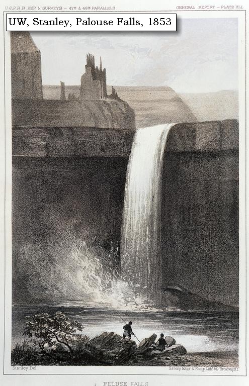
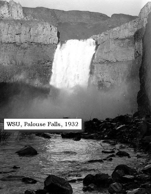
Prominent Lava Flows in the Vicinity:
The lip of Palouse Falls is carved into the oldest flow of the Frenchman Springs formation, a member of the Wanapum Basalt. The Wanapum Basalt is the most extensive formation exposed at the surface of the Columbia Plateau, probably having a volume of less than 2,400 cubic miles. The Wanapum is part of the Columbia River Basalt Group, which is is the youngest assemblage of flood basalts known, with an age range from about 17 to 6 million years ago. (Most eruptions took place between about 17 and 14 million years.) The oldest member of the Wanapum Basalt is the Eckler Mountain Member. The Eckler Mountain Member occurs in the Blue Mountains and adjoining foothills of southeast Washington and northeast Oregon. Next, the Frenchman Springs Member overlies and locally interfingers with the Eckler Mountain Member and crops out widely in the central and western parts of the plateau. Its volume is 700 to 1,200 cubic miles. Generally three to six flows, in places as many as ten, occur in any one section. The Roza Member, with a volume of about 360 cubic miles, is well known. This member erupted from a linear vent system more than 100 miles long in the eastern part of the plateau. The Priest Rapids Member overlies the Roza Member and is the youngest basalt throughout most of the northern part of the Columbia Plateau. The member occurs as far southwest as the Columbia Gorge. The estimated volume of the Priest Rapids is 500 to 700 cubic miles. -- Swanson and Wright, 1981


We saw only two Indians who had visited the narrows, but we were overtaken by two others, who accompanied us on horseback down the river, informing us that they meant to proceed by land down to the great river. [Columbia River] Nine and a half miles below Drewyer's river [Palouse River], we passed another rapid [False Palouse Rapids],


Along the Journey - October 13, 1805
False Palouse Rapids:


Map, 1893, Closer-in, Snake, Palouse, Tucannon Rivers, click to enlarge Map, 1893, Snake, Palouse, Tucannon Rivers, click to enlarge
  1. 1893 Map, part of the Snake River showing location of principal rapids (section of original). Includes Snake, Tucannon, and Palouse Rivers. (Click to enlarge). Original Map: "Part of the Snake River from its mouth to the Grande Ronde, showing location of principal rapids". U.S. Engineers Office, 1893. Washington State University Historical Maps Collection #WSU586. -- Washington State University Library Archives Website, 2002
  2. 1893 Map, wider-view, part of the Snake River showing location of principal rapids (section of original). Includes Snake, Tucannon, and Palouse Rivers. (Click to enlarge). Original Map: "Part of the Snake River from its mouth to the Grande Ronde, showing location of principal rapids". U.S. Engineers Office, 1893. Washington State University Historical Maps Collection #WSU586. -- Washington State University Library Archives Website, 2002


and three and a half miles farther reached some high cliffs in a bend to the left. Here after passing the timbers of a house, which were preserved on forks, we encamped on the right side [across from Ayers Junction], near a collection of graves, such as we had seen above. The country was still an open plain without timber, and our day's journey had no variety, except the fishing houses which are scattered near the situations convenient for fishing, but are now empty. Our two Indian companions spent the night with us.


Along the Journey - October 13, 1805
Topo Map, Snake River near Ayers, 1922

Ayers Junction:


Map, 1922, USGS Preliminary Topo Map, Snake River, Ayers, Palouse, click to enlarge Map, 1996, Recreation sites along Lake West including the Ayers area, click to enlarge
  1. 1922 Preliminary Map (section of original), from Riparia 1:125,000 topographic quadrangle. (Click to enlarge). Snake River, Palouse River area, including Ayers and Ayers Junction. "Advance sheet 80-N-II&IV", Engineer Reproduction Print. UW/WSU #Topo46 -- Washington State University Archives Website, 2004
  2. 1996, Recreation sites along Lake West, including Ayers area. (Click to enlarge). Lake West is the reservoir behind the Lower Monumental Dam on the Snake River. -- U.S. Army Corps of Engineers Website, 2004, Walla Walla District


"... a Lard. bend high Clifts the parts of an Indian house Scaffoled up on the Lard Sd. opposit a Picketed grave yard we Came to on the Stard. Side & Camped. ..." [Clark, October 13, 1805, first draft]
"... at dusk came to on the Std. Side & Encamped. ... The Countery Thro' which we passed to day is Simlar to that of yesterday open plain no timber ..." [Clark, October 13, 1805]
"... the barrons and plains continue as usal ..." [Ordway, October 13, 1805]


Along the Journey - October 13, 1805
The Camp - October 13, 1805:
Lewis and Clark's camp of October 13, 1805, is located approximately 13 miles downstream of the Palouse River, on the north bank of the Snake River, 6 miles downstream of present-day Ayers Junction, Washington.


Home Previous Continue


If you have questions or comments please contact: GS-CVO-WEB@usgs.gov
June/July 2004, Lyn Topinka
The Volcanoes of Lewis and Clark Home Page | CVO Home Page