|
October 11, 1805 On the Snake River - Clearwater Confluence to Almota Creek |
|
Home
The Volcanoes of Lewis and Clark Map of the Journey Volcanoes, Basalt Plateaus, Major Rivers, etc. The Volcanoes Mount Adams, Mount Hood, Mount Jefferson, Mount Rainier, and Mount St. Helens CALENDAR of the Journey October 1805 to June 1806 Along the Journey Pacific Northwest Maps - Columbia River, Volcanoes, Flood Basalts, Missoula Floods, Geology, etc. The Corps of Discovery The Journey of Lewis and Clark About the Reference Materials The Journals, Biddle/Allen, DeVoto, Gass, Moulton, Topo Maps, and others USGS Lewis and Clark Links Links to USGS Websites highlighting the Lewis and Clark Journey Resources Publications Referenced and Websites Visited |
PREVIOUS
October 10 Reaching the Snake, Clearwater Confluence with the Snake River |
October 11
On the Snake River, Clearwater Confluence to Almota Creek Snake River, Washington State Geology, Alpowa Creek, Chief Timothy State Park, Lower Granite Dam and Lower Granite Lake, Almota Creek and Almota (Washington) |
CONTINUE
October 12 On the Snake River, Almota Creek to Texas Rapids |
On October 7, 1805, Lewis and Clark and the
"Corps of Discovery" began their journey
down the Clearwater River and into the volcanics
of the Pacific Northwest. The Corps travelled from the
Clearwater to the Snake and down the
"Great Columbia", finally reaching the
Pacific Ocean on November 15, 1805.
Along the journey they encountered the
lava flows of the Columbia Plateau,
river channels carved by the great "Missoula Floods",
and the awesome beauty of five Cascade Range volcanoes.

[Click map for brief summary about the area] |
|
To the Pacific - October 1805
On the Snake - Clearwater Confluence to Almota Creek |
| Lewis and Clark's camp of October 10, 1805, was on the north bank, at the confluence of the Snake River with the Clearwater River, the site of today's Lewiston, Idaho, and Clarkston, Washington. On October 11, 1805, the men begin their trip down the Snake River. |
| Friday, October 11, 1805 |
| This morning the wind was from the east, and the weather cloudy. We set out early, [The beginning of their journey down the Snake River] and at the distance of a mile and a half reached a point of rocks in a bend of the river towards the left, near to which was an old Indian house, and a meadow on the opposite bank. |
|
|
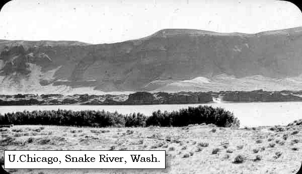
Snake River: The Snake River originates in Yellowstone National Park at 9,500 feet and winds through southern Idaho before turning north to form the boundary between Idaho and Oregon. It finally joins the Columbia River near Pasco, Washington, at 340 feet in elevation, 1,036 miles from its source. How did it get its name? To identify themselves, Indians living along the river in southern Idaho used a hand sign that resembled the movement of a snake. Although it didn't mean "Snake", that name was given to this group of people, now known as Shoshone. The river flowing through the Snake Indian lands was given the tribal name. Lewis and Clark traveled through this area on their journey to find an inland waterway to the Pacific. Many miles upriver from Hells Gate State Park, the Snake River winds through Hells Canyon, one of the deepest gorges in North America. This wild and spectacular area is best visited by boat; there are no roads leading through the canyon. Old homesteads, long-forgotten prospector cabins, and Native American petroglyphs offer a fascinating human story in the midst of the spectacular scenery. -- U.S. National Park Service, Wild and Scenic Rivers Website, 2002, and Idaho State Parks and Recreation Website, 2002 

|
| Lewis and Clark have not only begun their journey down the Snake River, but have also begun their journey in land which, in 1889, would become Washington State. |
|
|
|
Washington State Geology:
Washington State's geology is highly diverse. Rocks of Precambrian age, as well as units from every geologic period, Cambrian to Quaternary, are represented. The state has been subject to continental collisions, metamorphism, intrusion of igneous rocks, volcanism, mountain-building episodes, erosion, glaciation, and massive flooding events. -- Norman and Roloff, 2004, Washington DNR Open-File Report 2004-7 |
| Here the hills came down towards the water, and formed by the rocks, which have fallen from their sides, a rapid over which we dragged the canoes. We passed, a mile and a half further, two Indian lodges in a bend towards the right, and at six miles from our camp of last evening reached the mouth of a brook on the left [Alpowa Creek, today the location of Chief Timothy State Park]. Just above this stream we stopped for breakfast. ...... |
|
|
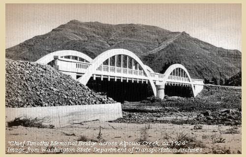
Alpowa Creek: Alpowa Creek, located in southeastern Washington, begins in the Blue Mountains at an elevation of approximately 4,000 feet above sea level and joins the Snake River at Lower Granite Lake about seven miles west of Clarkston, Washington. Alpowa Creek merges with the Snake in the vicinity of the former Alpowa City, later renamed Silcott. The townsite was inundated by Lower Granite Reservoir in 1975. Today this area is the location of Chief Timothy State Park and Alpowai Interpretive Center, located on an island created by the dam's backwater. The entire drainage area of the Alpowa Creek watershed is approximately 130 square miles of mostly very arid landscape with several seasonal canyons which enter the mainstem Alpowa Creek. On October 11, 1805, Lewis and Clark's course and distance log notes, "Passed a large camp of Alpowa Cr. Indians." The creek was not named on the route map or journal entries, either westbound or eastbound. -- Washington State Historical Society Website, 2002, and Columbia Basin Fish and Wildlife Authority Website, 2003
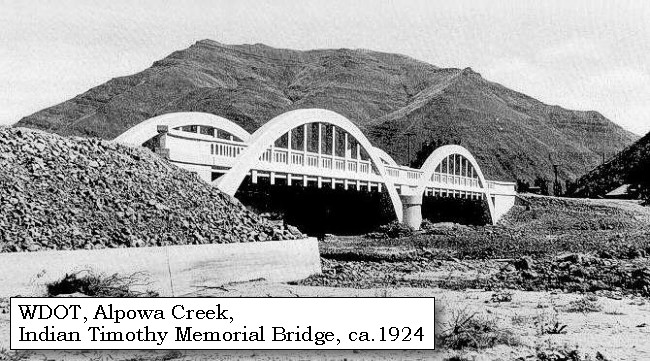
Chief Timothy State Park: Chief Timothy State Park is a 282-acre camping park with 11,500 feet of freshwater shoreline, located on an island in the Snake River, eight miles west of Clarkston, Washington. The park offers water, scenery and excellent camping facilities in a primarily desert environment. The park is on the route of the historic Lewis and Clark trail, proximate to Silcott townsite. The park is named for the chief of the Alpowai encampment of the Nez Perce Indian Tribe. Chief Alpowai was a valued friend of early white settlers in the region. -- Washington State Parks and Recreation Website, 2002 Geology of Chief Timothy State Park: During the Miocene age there were great lava flows that created basaltic columns. The following ice age carved the land, blocking rivers and creating the huge Lake Missoula. As the ice age drew to a close, the ice dams holding back Lake Missoula broke, unleashing a catastrophic flood that shaped the landscape. Chief Timothy is on an island made of glacial tills that were back-washed by the flood when it hit the Wallala gap causing the water to rush backward to the east carrying rocks and debris. -- Washington State Parks and Recreation Website, 2002 |
| On leaving this encampment [Alpowa Creek] we passed two more rapids, and some swift water, and at the distance of four and a half miles reached one which was much more difficult to pass. Three miles beyond this rapid, are three huts of Indians on the right, where we stopped and obtained in exchange for a few trifles some pashequa roots, five dogs and a small quantity of dried fish. We made our dinner of part of each of these articles, and then proceeded on without any obstruction, till after making twelve and a half miles we came to a stony island on the right side of the river, opposite to which is a rapid, and a second at its lower point. |
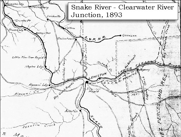
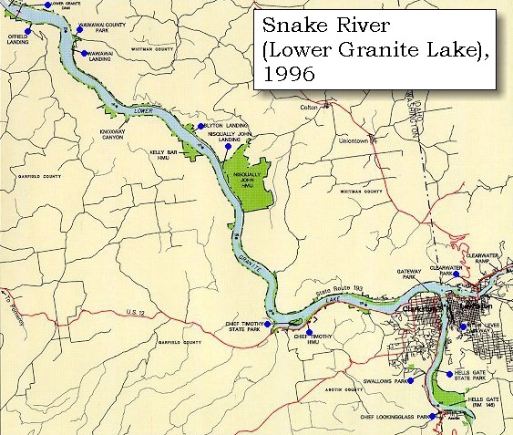
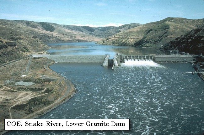
| The Lower Granite Lock and Dam is now located along this section of the Snake River, at River Mile 107.5. Lower Granite Lake is the reservoir extending nearly 40 miles behind the dam. |
|
|
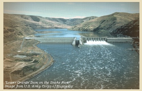
Lower Granite Dam and Lower Granite Lake: The Lower Granite Lock and Dam was the last of four lower Snake River dams constructed by the U.S. Corps of Engineers. It was completed in 1975, and is located at the head of Lake Bryan, the reservoir behind Little Goose Dam. Lower Granite Dam is approximately 3,200 feet long with an effective height of 100 feet. The dam is a concrete gravity type, with an earthfill right abutment embankment. It includes a navigation lock and a 512-foot-long eight-bay spillway with eight radial gates. There is one fish ladder for passing migratory fish. Lower Granite Dam has a visitor center and features fish viewing rooms that allow visitors an up close look at the many species of fish in the Lower Snake River. Lower Granite Lake, the reservoir behind Lower Granite Dam, extends up the Snake River about 39.3 miles to Lewiston, Idaho, the upper terminus of the authorized Lower Snake River slack-water navigation project. -- U.S. Army Corps of Engineers Website, 2002 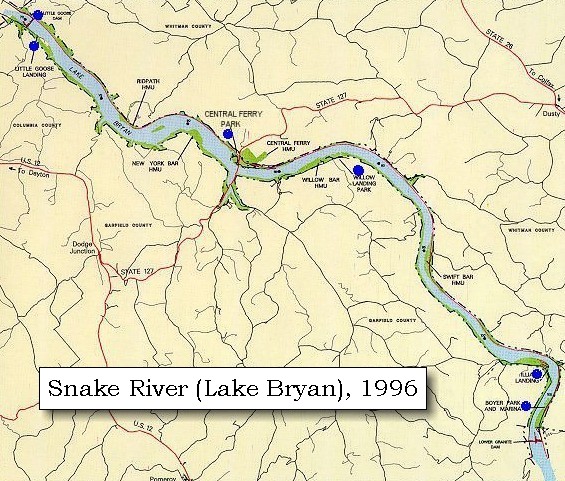

|
| About three and a half miles beyond the island is a small brook which empties itself into a bend on the right [Almota Creek], |
|
|
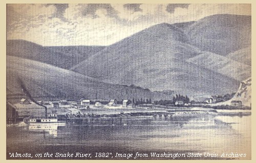
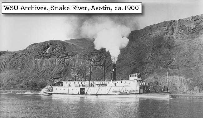
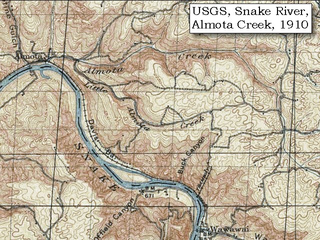
Almota Creek and Almota, Washington: The Washington State town of Almota is located on the north side of the Snake River where Almota Creek merges into the Snake, 40 miles downstream of Clarkston and approximately 4 miles downstream of today's Lower Granite Dam. Almota was used by Nez Perce Indians as a fishing site, and "Allamotin", "Almotine", and even "Alto Motin" have been given as Nez Perce names for the area. It means "torchlight" or "moonlight fishing". Almota, soon became the trading/shipping center for all of Inland Empire, but lost some of its business in 1883 when rail lines arrived in Colfax. The Oregon, Washington and Idaho Railroad and the Snake River Valley Railroad arrived in Almota in 1907. -- Washington State University Library Archives Website, 2002 

|
| where we encamped at two Indian huts, which are now inhabited. [just below Lower Granite Dam] ...... The country on both sides, after mounting a steep ascent of about two hundred feet, becomes an open, level and fertile plain, which is, however, as well as the borders of the river itself, perfectly destitute of any kind of timber; and the chief growth which we observed consisted of a few low blackberries. We killed some geese and ducks. The wind in the after part of the day changed to the southwest and became high. |
| "... The country on both sides is high dry prairie plains without a stick of timber. There is no wood of any kind to be seen except a few small willows along the shore; so that it is with difficulty we can get enough to cook with. The hills on the river are not very high, but rocky; the rocks of a dark colour. The bed and shores of the river are very stony; and the stones of a round smooth kind ..." [Gass, October 11, 1805] |
|
|
|
The Camp - October 11, 1805:
Lewis and Clark's camp of October 11, 1805, was located on the Snake River near the mouth of Almota Creek, approximately 4 miles downstream of the Lower Granite Dam. |
| Home | Previous | Continue |
If you have questions or comments please contact: GS-CVO-WEB@usgs.gov
June/July 2004, Lyn Topinka
The Volcanoes of Lewis and Clark Home Page | CVO Home Page