The Volcanoes of
Lewis and Clark
Lewis and Clark
|
November 25, 1805 Looking for a Place to Winter - Station Camp to Pillar Rock |
|
Home
The Volcanoes of Lewis and Clark Map of the Journey Volcanoes, Basalt Plateaus, Major Rivers, etc. The Volcanoes Mount Adams, Mount Hood, Mount Jefferson, Mount Rainier, and Mount St. Helens CALENDAR of the Journey October 1805 to June 1806 Along the Journey Pacific Northwest Maps - Columbia River, Volcanoes, Flood Basalts, Missoula Floods, Geology, etc. The Corps of Discovery The Journey of Lewis and Clark About the Reference Materials The Journals, Biddle/Allen, DeVoto, Gass, Moulton, Topo Maps, and others USGS Lewis and Clark Links Links to USGS Websites highlighting the Lewis and Clark Journey Resources Publications Referenced and Websites Visited |
PREVIOUS
November 19-24 At the Pacific, Station Camp, Fort Canby, Long Beach |
November 25
Looking for a Place to Winter Station Camp to Pillar Rock Station Camp, Astoria-Megler Bridge, Grays Bay, Pillar Rock, and Mount St. Helens and Mount Adams |
CONTINUE
November 26-December 6 Looking for a Place to Winter, Pillar Rock to Tongue Point |
|
At the Pacific - November 1805
Looking for a Place to Winter - Station Camp to Pillar Rock |
| Lewis and Clark's camp between November 15 through November 24, 1805 - "Station Camp" - was located near today's McGowan, Washington, today the site of Lewis & Clark Campsite State Park. On November 24, 1805m the men voted as to where to winter over. One vote for everyone. The winner was on the south side of the Columbia River, in an area yet unexplored. They prepared to leave in the morning. |
| Monday, November 25, 1805 |
| the wind was too high to suffer us to cross the river, but as it blew generally from the east southeast, the coast on the north was in some degree sheltered by the highlands. We therefore set out, and keeping near the shore, |
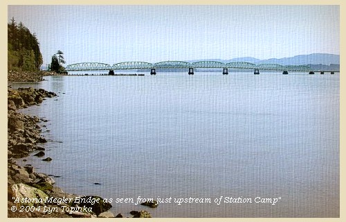
| Lewis and Clark had to back-track all the way to Pillar Rock to find a spot to cross the Columbia. Today, travelers can use the Astoria-Megler Bridge. |
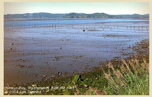
| halted for dinner in the shallow bay [Grays Bay], |
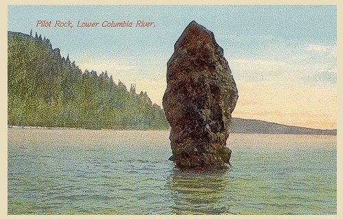
| and after dark, reached a spot near a rock, at some distance in the river, and close to our former camp of the 7th inst. [Near Pillar Rock, Washington] ...... |
| "... The evening cloudy wind of to day Generally from the E S. E, Saw from near of last Campment Mount Ranier [Mount St. Helens] bearing [blank] ..." [Clark, November 25, 1805, first draft] |
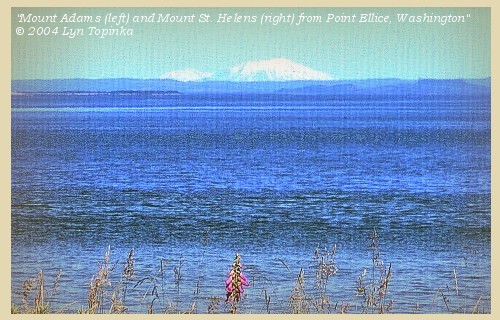
| "... evening Cloudy the Winds of to day is generally E. S. E which was a verry favourable point for us as the highlands kept it from us Mt St. Hilians Can be Seen from the mouth of this river ..." [Clark, November 25, 1805] |
| While Lewis and Clark only mention Mount St. Helens, Mount Adams can both be seen from near the mouth of the Columbia River. |
|
|
|
The Camp - November 25, 1805:
Camped near Pillar Rock, Washington, near their camp of November 7, west of Jim Crow Point. |
| Home | Previous | Continue |
If you have questions or comments please contact: GS-CVO-WEB@usgs.gov
June/July 2004, Lyn Topinka
The Volcanoes of Lewis and Clark Home Page | CVO Home Page


