|
November 12 - 14, 1805 Nearing the Pacific - Hungry Harbor to Megler Cove |
|
Home
The Volcanoes of Lewis and Clark Map of the Journey Volcanoes, Basalt Plateaus, Major Rivers, etc. The Volcanoes Mount Adams, Mount Hood, Mount Jefferson, Mount Rainier, and Mount St. Helens CALENDAR of the Journey October 1805 to June 1806 Along the Journey Pacific Northwest Maps - Columbia River, Volcanoes, Flood Basalts, Missoula Floods, Geology, etc. The Corps of Discovery The Journey of Lewis and Clark About the Reference Materials The Journals, Biddle/Allen, DeVoto, Gass, Moulton, Topo Maps, and others USGS Lewis and Clark Links Links to USGS Websites highlighting the Lewis and Clark Journey Resources Publications Referenced and Websites Visited |
PREVIOUS
November 10-11 Nearing the Pacific, Grays Point to Hungry Harbor |
November 12-14
Nearing the Pacific, Hungry Harbor to Megler Cove Hungry Harbor, Megler Point and Megler Cove, Point Ellice, Saddle Mountain, and Rain |
CONTINUE
November 15 Reaching the Pacific, Megler Cove to the Pacific Ocean |
On October 7, 1805, Lewis and Clark and the
"Corps of Discovery" began their journey
down the Clearwater River and into the volcanics
of the Pacific Northwest. The Corps travelled from the
Clearwater to the Snake and down the
"Great Columbia", finally reaching the
Pacific Ocean on November 15, 1805.
Along the journey they encountered the
lava flows of the Columbia Plateau,
river channels carved by the great "Missoula Floods",
and the awesome beauty of five Cascade Range volcanoes.

[Click map for brief summary about the area] |
|
To the Pacific - November 1805
Nearing the Pacific - Hungry Harbor to Megler Cove |
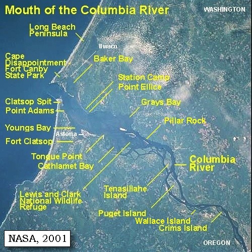
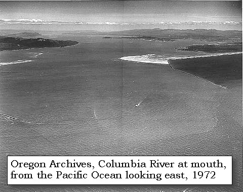
| Lewis and Clark's campsite of November 10 and 11, 1805, was on the Washington State side of the Columbia River, near today's town of Megler, in a small cove called "Hungry Harbor". On November 12, the camp moved about 1/2 mile around Megler Point to Megler Cove. |
| Tuesday, November 12, 1805 |
| About three o'clock a tremendous gale of wind arose, accompanied with lightning, thunder, and hail: at six it became light for a short time, but a violent rain soon began and lasted during the day. During this storm one of our boats, secured by being sunk with great quantities of stone, got loose, but drifting against a rock, was recovered without having received much injury. Our situation became now much more dangerous, for the waves were driven with fury against the rocks and trees, which till now had afforded us refuge: we therefore took advantage of a low tide, and moved about half a mile round a point [Megler Point] to a small brook [Megler Cove], which we had not observed till now on account of the thick bushes and driftwood which concealed its mouth. |
|
|
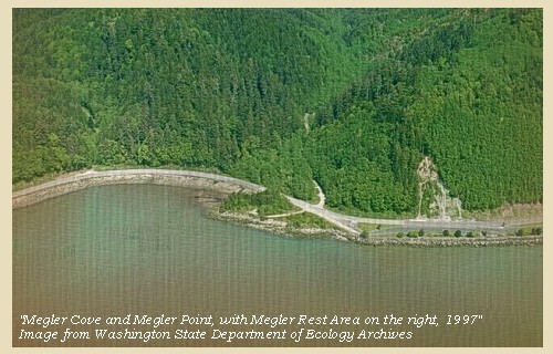
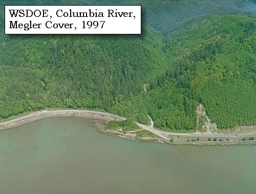
Megler Point and Megler Cove: Megler Cove is just west of the Megler Visitors Information Center. Clark gave the spot the name "Dismal nitch", which no doubt reflected the state of mind of the entire party. -- Pacific County Friends of Lewis & Clark Website, 2002 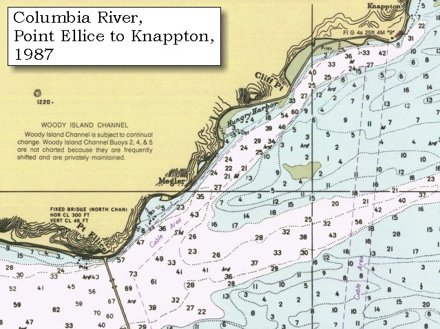

|
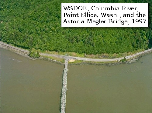
| Here we were more safe; but still cold and wet, our clothes and bedding rotten as well as wet, our baggage at a distance, and the canoes, our only means of escape from this place, at the mercy of the waves: we were, however, fortunate enough to enjoy good health, and even had the luxury of getting some fresh salmon and three salmon trout in the brook. Three of the men attempted to go round a point [Point Ellice] in our small Indian canoe, but the high waves rendered her quite unmanageable; these boats requiring the seamanship of the natives themselves to make them live in so rough a sea. |
|
|
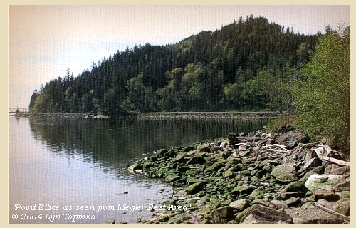
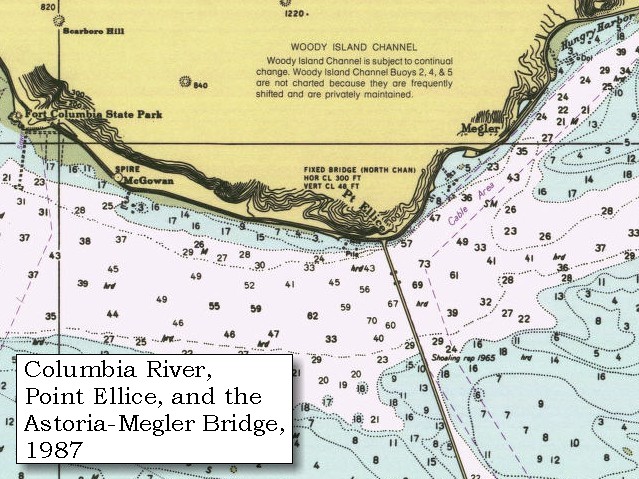
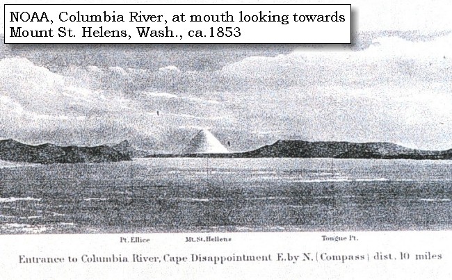
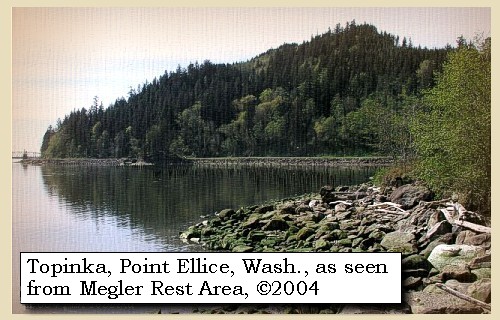
Point Ellice: Point Ellice is located on the Washington side of the Columbia River, 11 miles inside it's entrance, and is a large promontory projecting into the Columbia River. It is the termination of a spur from the mountain ridge back of Scarboro Hill. The point is rounding and rocky, but not high. Two high hillocks lie behind the point. Scarboro Hill is a long, gradually rising ridge, 820 feet high, covered with grass, fern, and some trees. During a seasonal storm that raged inward from the coast, the Lewis and Clark were forced to stay for a week on the east side of Point Ellice. Wind lacerated, waves lashed, and the roaring sea attacked them from every quarter. Gale-force winds threatened to thrust the party into the seething water. "Point Distress," "Stormy Point," and "Blustering Point" were names used to describe the site of the corps' plight during their attempt to reach the mouth of the Columbia. Point Ellice was named by fur traders of the North West Company to honor Edward Ellice, a London agent of the company. -- NOAA Office of Coast Survey Website, 2003, and Washington State Historical Society Website, 2002 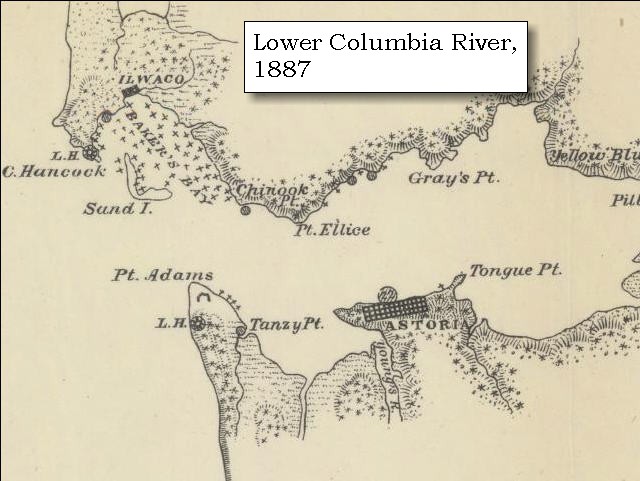

|
| "... a tremendous thunder Storm ... It was clear at 12 for a Short time. I observed the Mountains on the opposit Side was covered with Snow ..." [Clark, November 12, 1805, First Draft] |
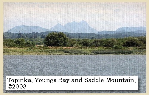
| "... a haard Storm continued all last night, and hard Thunder lightning and hail this morning we Saw a mountain on the opposite Shore covred with Snow [Saddle Mountain] . ..." [Ordway, November 12, 1805] |
| "... We had a hard storm the greater part of last night, & hard thunder, lightning, & hail this morning. We saw a high mountain which lay on the opposite to where we are encamped covered with snow [Saddle Mountain] . ..." [Whitehouse, November 12, 1805] |
|
|
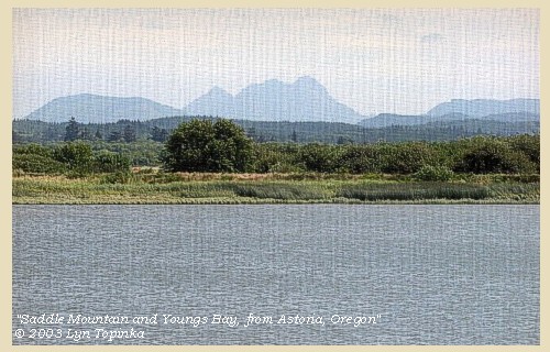
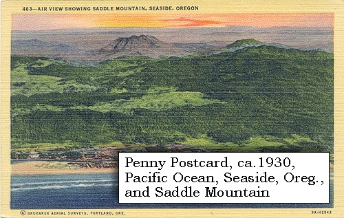
Saddle Mountain: Saddle Mountain, at 3,283 feet elevation, is one of the highest peaks in the Coast Range, and affords a magnificent view of the surrounding mountains and the coast to the west. It is located 10 miles east of Seaside, Oregon, and is reached from the Sunset Highway (U.S. 26) a mile east of Necanicum Junction. A narrow paved road runs eight miles to the north from the highway to a large parking lot at the base of the mountain. A gentle, four-mile trail climbs nearly 1,500 feet from the parking lot to the forest fire lookout on the summit. The Saddle Mountain breccia (a rock consisting of broken angular fragments cemented together in a fine-grained matrix) is volcanic. It was produced about 15 million years ago by thermal shock, when a great lava flow of Columbia River basalt came down an ancestral valley of the Columbia River (south of its present course) and entered the Astoria Sea. The still-hot rock, meeting cold water, caused steam explosions which broke it up into a great pile of basalt fragments. Saddle Mountain appeared as "Mont de la Selle" on explorer John Meares' 1788 map of the Western coast of North America. -- Allen, 1987, and Deja View Antique Maps and Prints Website, 2004. 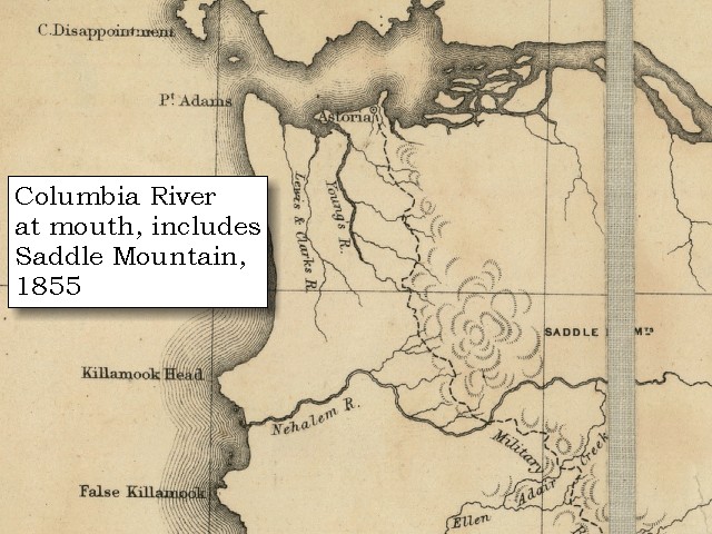

|
|
|
|
The Camp - November 12 - 14, 1805:
Washington side of the Columbia River, at Megler Cove, near today's Megler Rest Area. |
| Wednesday, November 13, 1805 |
| During the night we had short intervals of fair weather, but it began to rain in the morning, and continued through the day. In order to obtain a view of the country below, captain Clarke followed up the course of the brook, and with much fatigue, and after walking three miles, ascended the first spur of the mountains. The whole lower country was covered with almost impenetrable thickets of small pine, with which is mixed a species of plant resembling arrowwood, twelve or fifteen feet high, with a thorny stem, almost interwoven with each other, and scattered among the fern and fallen timber: there is also a red berry, somewhat like the solomon's seal, which is called by the natives, solme, and used as an article of diet. This thick growth rendered travelling almost impossible, and it was rendered more fatiguing by the steepness of the mountain, which was so great as to oblige him to draw himself up by means of the bushes. The timber on the hills is chiefly of a large tall species of pine, many of them eight or ten feet in diameter at the stump, and rising sometimes more than one hundred feet in height. The hail which fell two nights since is still to be seen on the mountains: there was no game, and no traces of any, except some old signs of elk: the cloudy weather prevented his seeing to any distance, and he therefore returned to camp, and sent three men in the Indian canoe to try if they could double the point [Point Ellice] and find some safer harbour for our canoes. At every flood-tide the seas break in great swells against the rocks, and drifts the trees among our establishment, so as to render it very insecure. We were confined as usual to dried fish, which is our last resource. |
|
|
|
The Camp - November 12 - 14, 1805:
Washington side of the Columbia River, at Megler Cove, on the west side of Megler Point. |
| Thursday, November 14, 1805 |
| It rained without intermission during last night and to-day: the wind too is very high, and one of our canoes much injured by being dashed against rocks. |
|
|
|
Rain:
The lower Columbia River area has a marine climate. The summers are cool, with highs around 70, and the winters are mild, with few nights of freezing temperatures. The area gets about 75 inches of rain per year, which accounts for its vivid greenness and crystal clear air. Winter storms can be dramatic with winds reaching 70 to 100 miles per hour on the ocean bluffs. -- Astoria and Warrenton Chamber of Commerce Website, 2002 |
| Five Indians from below came to us in a canoe, and three of them having landed, informed us that they had seen the men sent down yesterday. At this moment one of them arrived, and informed us that these Indians had stolen his gig and basket: we therefore ordered the two women who remained in the canoe, to restore them; but this they refused, till we threatened to shoot, when they gave back the articles, and we then ordered them to leave us. They were of the Wahkiacum nation. The man now informed us that they had gone round the point [Point Ellice] as far as the high sea would suffer them in the canoe, and then landed, and that in the night he had separated from his companions, who had gone further down: that at no great distance from where we are is a beautiful sand beach and a good harbour. Captain Lewis concluded to examine more minutely the lower part of the bay, and taking one of the large canoes was landed at the point, whence he proceeded by land with four men, and the canoe returned nearly filled with water. |
|
|
|
The Camp - November 12 - 14, 1805:
Washington side of the Columbia River, at Megler Cove, on the west side of Megler Point. |
| Home | Previous | Continue |
If you have questions or comments please contact: GS-CVO-WEB@usgs.gov
June/July 2004, Lyn Topinka
The Volcanoes of Lewis and Clark Home Page | CVO Home Page