The Volcanoes of
Lewis and Clark
Lewis and Clark
|
November 10 - 11, 1805 Nearing the Pacific - Grays Point to Hungry Harbor |
|
Home
The Volcanoes of Lewis and Clark Map of the Journey Volcanoes, Basalt Plateaus, Major Rivers, etc. The Volcanoes Mount Adams, Mount Hood, Mount Jefferson, Mount Rainier, and Mount St. Helens CALENDAR of the Journey October 1805 to June 1806 Along the Journey Pacific Northwest Maps - Columbia River, Volcanoes, Flood Basalts, Missoula Floods, Geology, etc. The Corps of Discovery The Journey of Lewis and Clark About the Reference Materials The Journals, Biddle/Allen, DeVoto, Gass, Moulton, Topo Maps, and others USGS Lewis and Clark Links Links to USGS Websites highlighting the Lewis and Clark Journey Resources Publications Referenced and Websites Visited |
PREVIOUS
November 8-9 Nearing the Pacific, Pillar Rock to Grays Point |
November 10-11
Nearing the Pacific, Grays Point to Hungry Harbor Grays Point, Youngs Bay, Hungry Harbor, Landslide |
CONTINUE
November 12-14 Nearing the Pacific, Hungry Harbor to Megler Cove |
|
To the Pacific - November 1805
Nearing the Pacific - Grays Point to Megler Cove |
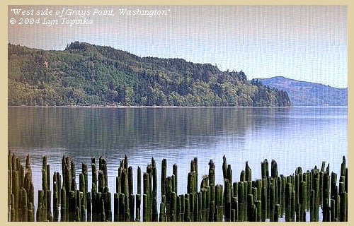
| Lewis and Clark's camp of November 8 and November 9, 1805, was on the Washington side of the Columbia River, west side of Grays Bay, at a place now called "Grays Point". |
| Sunday, November 10, 1805 |
| the wind, however, lulled, and the waves not being so high, we loaded our canoes and proceeded. The mountains on the right are high, covered with timber, chiefly pine, and descend in a bold and rocky shore to the water. We went through a deep niche and several inlets on the right [downstream of Grays Point between Grays Point and Cliff Point], |
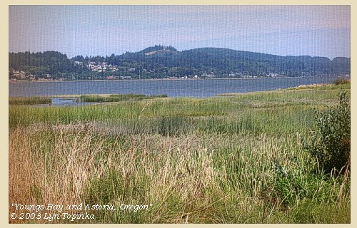
| while on the opposite side is a large bay [Youngs Bay, Oregon side], above which the hills are close on the river. |
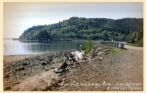
| At the distance of ten miles the wind rose from the northwest and the waves became so high that we were forced to return for two miles to a place where we could with safety unload. Here we landed at the mouth of a small run [Hungry Harbor], and having placed our baggage on a pile of drifted logs waited until low water. |
| The river then appeared more calm: we therefore started, but after going a mile found the waves too high for our canoes and were obliged to put to shore. We unloaded the canoes, and having placed the baggage on a rock above the reach of the tide, encamped on some drift logs which formed the only place where we could lie, the hills rising steep over our heads to the height of five hundred feet [near today's town of Megler, Washington]. All as well as ourselves were thoroughly wet with the rain, which did not cease during the day; it continued violently during the night, in the course of which the tide reached the logs on which we lay, and set them afloat. |
|
|
|
The Camp - November 10 - 11, 1805:
Washington side of the Columbia River, near today's town of Megler. On November 12, the camp moved about 1/2 mile around Megler Point to Megler Cove. |
| Monday, November 11, 1805 |
| The wind was still high from the southwest, and drove the waves against the shore with great fury: the rain too fell in torrents, and not only drenched us to the skin, but loosened the stones on the hill sides, which then came rolling down upon us. |
| "... we are truly unfortunate to be Compelled to lie 4 days nearly in the Same place at a time that our day are precious to us, The Wind Shifted to [blank] the Indians left us and Crossed the river which is about five miles wide through the highest Sees I ever Saw a Small vestle ride, their Canoe is Small, maney times they were out of Sight before the were 2 miles off Certain it is they are the best canoe navigators I ever Saw The tide was 3 hours later to day than yesterday and rose much higher, the trees we camped on was all on flote for about 2 hours from 3 untill 5 oClock P M, the great quantities of rain which has fallen losenes the Stones on the Side of the hill & the Small ones fall on us, our Situation is truly a disagreeable one our Canoes in one place at the mercy of the waves our baggage in another and our Selves & party Scattered on drift trees of emense Sizes, & are on what dry land they can find in the Crevices of the rocks & hill Sides ..." [Clark, November 11, 1805] |
| In this comfortless situation we remained all day wet, cold, with nothing but dried fish to satisfy our hunger; the canoes in one place at the mercy of the waves; the baggage in another, and all the men scattered on floating logs, or sheltering themselves in the crevices of the rocks and hill sides. A hunter was despatched in hopes of finding some fresh meat, but the hills were so steeps and covered with undergrowth and fallen timber, that he could not penetrate them, and he was forced to return. About twelve o'clock we were visited by five Indians in a canoe: they came from above this place on the opposite side of the river, and their language much resembles that of the Wahkiacum: they called themselves Cathlamahs. In person they are small, ill made, and badly clothed; though one of them had on a sailor's round jacket and pantaloons, which, as he explained by signs, he had received from the whites below the point: we purchased from them thirteen red charr, a fish which we found very excellent. After some time they went on board the boat, and crossed the river, which is here five miles wide, through a very heavy sea. |
|
|
|
The Camp - November 10 - 11, 1805:
Washington side of the Columbia River, near today's town of Megler. On November 12, the camp moved about 1/2 mile around a Megler Point to Megler Cove. |
| Home | Previous | Continue |
If you have questions or comments please contact: GS-CVO-WEB@usgs.gov
June/July 2004, Lyn Topinka
The Volcanoes of Lewis and Clark Home Page | CVO Home Page


