The Volcanoes of
Lewis and Clark
Lewis and Clark
|
November 15, 1805 Reaching the Pacific - Station Camp to the Pacific Ocean |
|
Home
The Volcanoes of Lewis and Clark Map of the Journey Volcanoes, Basalt Plateaus, Major Rivers, etc. The Volcanoes Mount Adams, Mount Hood, Mount Jefferson, Mount Rainier, and Mount St. Helens CALENDAR of the Journey October 1805 to June 1806 Along the Journey Pacific Northwest Maps - Columbia River, Volcanoes, Flood Basalts, Missoula Floods, Geology, etc. The Corps of Discovery The Journey of Lewis and Clark About the Reference Materials The Journals, Biddle/Allen, DeVoto, Gass, Moulton, Topo Maps, and others USGS Lewis and Clark Links Links to USGS Websites highlighting the Lewis and Clark Journey Resources Publications Referenced and Websites Visited |
PREVIOUS
November 12-14 Nearing the Pacific, Hungry Harbor to Megler Cove |
November 15
Reaching the Pacific, Station Camp to the Pacific Ocean Megler Point and Megler Cove, Rain, Mount St. Helens and Mount Adams, Point Ellice, Baker Bay, Station Camp, Reaching the Pacific |
CONTINUE
November 16-17 At the Pacific, Station Camp and Cape Disappointment |
|
To the Pacific - November 1805
Reaching the Pacific - Station Camp to the Pacific Ocean |
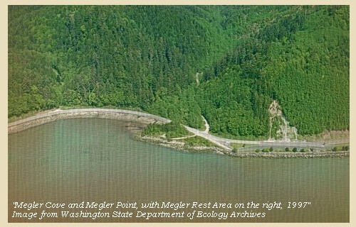
| Lewis and Clark's camp of November 12-14, 1805, was in Megler Cove, just downstream of today's Megler Rest Area. |
| Friday, November 15, 1805 |
| It continued raining all night, but in the morning the weather became calm and fair: we therefore began to prepare for setting out, but before we were ready a high wind sprang up from the southeast, and obliged us to remain [at Megler Cove]. The sun shone until one o'clock, and we were thus enabled to dry our bedding and examine our baggage. |
| The rain, which has continued for the last ten days without an interval of more than two hours, has completely wet all our merchandise, and spoiled some of our fish, destroyed the robes, and rotted nearly one half of our few remaining articles of clothing, particularly the leather dresses. |
| "... The rainey weather continued without a longer intermition than 2 hours at a time, from the 5th in the morng. untill the 16th is eleven days rain, and the most disagreeable time I have experenced confined on a tempiest coast wet, where I can neither git out to hunt, return to a better situation, or proceed on: in this situation have we been for Six days past ..." [Clark, November 15, 1805] |
|
|
|
Rain:
The lower Columbia River area has a marine climate. The summers are cool, with highs around 70, and the winters are mild, with few nights of freezing temperatures. The area gets about 75 inches of rain per year, which accounts for its vivid greenness and crystal clear air. Winter storms can be dramatic with winds reaching 70 to 100 miles per hour on the ocean bluffs. -- Astoria and Warrenton Chamber of Commerce Website, 2002 |
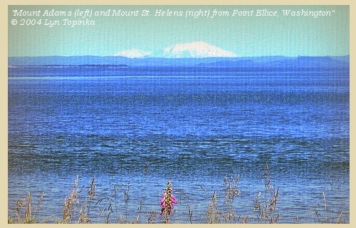
| Had it not been raining, both Mount St. Helens and Mount Adams could have been seen from this stretch of the Columbia, before the men rounded Point Ellice. |
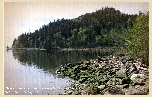
| About three o'clock the wind fell, and we instantly loaded the canoes, and left the miserable spot to which we have been confined the last six days [Hungry Harbor, campsite of November 10 and 11, and Megler Cove, campsite of November 12 through 14]. On turning the point [Point Ellice] we came to the sand beach, through which runs a small stream from the hills [???]; at the mouth of which is an ancient village of thirty-six houses; which has at present no inhabitants except fleas. Here we met Shannon, who had been sent back to meet us by captain Lewis. ...... |
| "... About 3 oClock the wind luled, and the river became calm, I had the canoes loaded in great haste and Set Out, from this dismal nitich where we have been confined for 6 days passed, without the possibility of proceeding on, returning to a better Situation, or get out to hunt, Scerce of Provisions, and torents of rain poreing on us all the time -- proceeded on passed the blustering point below which I found a butifull Sand beech thro which runs a Small below the mouth of this Stream is a 'village' of 36 houses uninhabited by anything except flees ..." [Clark, November 15, 1805] |
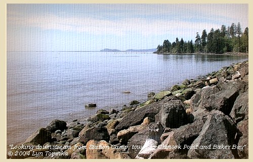
| It was now apparent that the sea was at all times too rough for us to proceed further down the bay [Baker Bay] by water: |
| we therefore landed, and having chosen the best spot we could select, made our camp of boards from the old village. [Station Camp, site of today's McGowan, Washington] |
| "... as the tide was Comeing in and the Seas became verry high imediately from the 'Ocian' (imediately faceing us) I landed and formed a camp on the highest Spot I could find between the hight of the tides, and the Slashers in a Small bottom this I could plainly See would be the extent of our journey by water, as the waves were too high at any Stage for our Canoes to proceed any further down. ..." [Clark, November 15, 1805] |
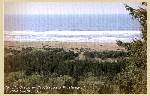
| "... in full view of the 'Ocian' from 'Point Adams' to Cape Diaspointment, I could not See any Island in the mouth of this river as laid down by Vancouver. The Bay which he laies down in the mouth is imediately below me. This Bay we call Haleys bay [Baker Bay] from a favourate Trader with the Indians which they Say comes into this Bay and trades with them Course to Point adams is S.35o W. about 8 miles To Cape Disapointment is S.86o W. about 14 miles ..." [Clark, November 15, 1805] |
|
|
|
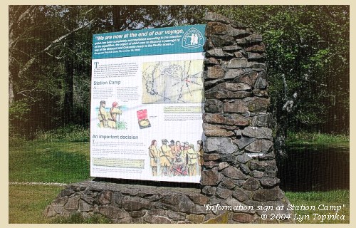
The Camp - November 15 through November 24, 1805:
"Station Camp", near today's McGowan, Washington, site of today's Lewis & Clark Campsite State Park. |
| Home | Previous | Continue |
If you have questions or comments please contact: GS-CVO-WEB@usgs.gov
June/July 2004, Lyn Topinka
The Volcanoes of Lewis and Clark Home Page | CVO Home Page


