The Volcanoes of
Lewis and Clark
May 1 - 3, 1806
The Walla Walla Shortcut - Overland, Touchet to the Snake
 
Home
The Volcanoes of Lewis and Clark

Map of the Journey
Volcanoes, Basalt Plateaus, Major Rivers, etc.

The Volcanoes
Mount Adams, Mount Hood, Mount Jefferson, Mount Rainier, and Mount St. Helens

CALENDAR of the Journey
October 1805 to June 1806

Along the Journey
Pacific Northwest Maps - Columbia River, Volcanoes, Flood Basalts, Missoula Floods, Geology, etc.

The Corps of Discovery
The Journey of Lewis and Clark

About the Reference Materials
The Journals, Biddle/Allen, DeVoto, Gass, Moulton, Topo Maps, and others

USGS Lewis and Clark Links
Links to USGS Websites highlighting the Lewis and Clark Journey

Resources
Publications Referenced and Websites Visited


PREVIOUS

April 30
The Walla Walla Shortcut, Overland, Walla Walla to the Touchet
May 1-3

The Walla Walla Shortcut,
Overland, Touchet to the Snake River

Touchet River, Touchet River at Bolles, Blue Mountains, Waitsburg (Washington), Lewis and Clark Trail State Park, Dayton (Washington), Tucannon River, Pataha City and Pomeroy (Washington)
CONTINUE

May 4 - June
To the Rockies, Snake River to Long Camp
 

On October 7, 1805, Lewis and Clark and the "Corps of Discovery" began their journey down the Clearwater River and into the volcanics of the Pacific Northwest. The Corps travelled from the Clearwater to the Snake and down the "Great Columbia", finally reaching the Pacific Ocean on November 15, 1805. Along the journey they encountered the lava flows of the Columbia Plateau, river channels carved by the great "Missoula Floods", and the awesome beauty of five Cascade Range volcanoes.

Map, Lewis and Clark in the Pacific Northwest, click for brief
                         summary
[Click map for brief summary about the area]


Heading for Home - May 1806
The Walla Walla Shortcut - Overland, Touchet to the Snake
 

Lewis and Clark's camp of April 30, 1806, was on the Touchet River, 12 miles north of today's Touchet, Washington.

Thursday, May 1, 1806
We collected our horses, and after breakfast set out about seven o'clock, and followed the road up the creek [Touchet River]. The low grounds and plains presented the same appearance as that of yesterday, except that the latter were less sandy.
"... we proceeded up the Creek on the N. E. Side through a Countrey of less sand and Some rich bottoms on the Creek which is partially Supplyed with Small Cotton trees, willow, red willow, choke Cherry, white thorn, birch, elder, [blank], rose & honey suckle. ..." [Clark, May 1, 1806]


Along the Journey - May 1, 1806
Touchet River, Washington

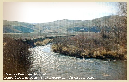
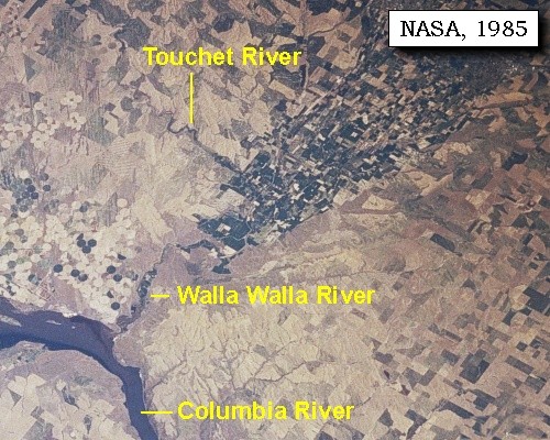
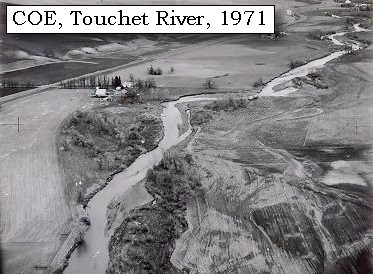
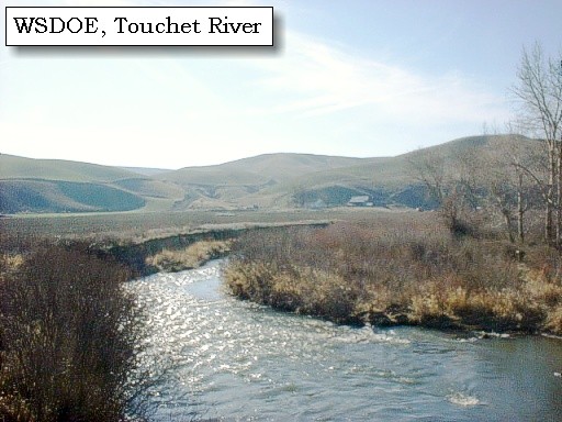
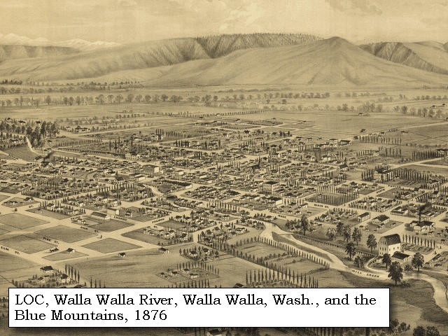
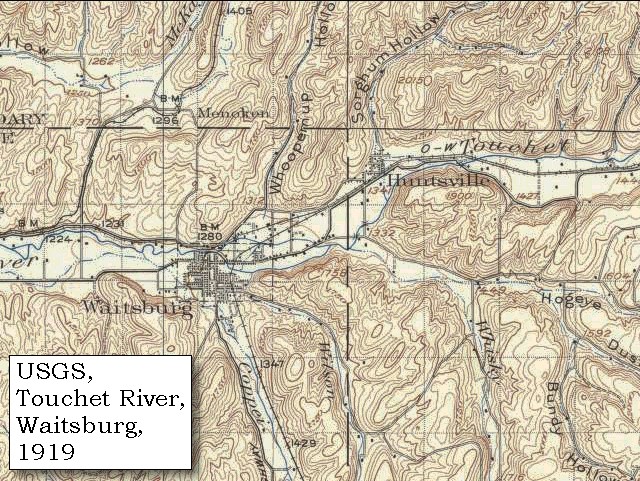
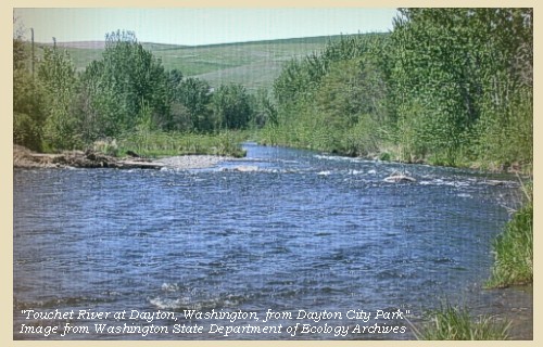
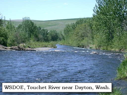
Touchet River:
The Touchet River originates in the Blue Mountains in the southwest corner of Columbia County, and flows west through the cities of Dayton and Waitsburg, merging with the Walla Walla River near the community of Touchet, Washington. The Touchet is the largest tributary of the Walla Walla, and drains an area of approximately 736 square miles. -- Washington State Department of Ecology Website, 2004


Map, 1814, Lewis and Clark on the Snake and Columbia Rivers, click to enlarge Map, 1854, Columbia River, Willow Creek to Walla Walla, click to enlarge Map, 1863, Umatilla, Walla Walla, Touchet Rivers, etc., click to enlarge Map, 1893, Columbia, Snake, and Walla Walla Rivers, click to enlarge Map, 1893, Touchet River and the cities of Waitsburg, Huntsville, and Dayton, click to enlarge NASA Image, 1985, Walla Walla River and the Touchet River, click to enlarge Image, 1971, Touchet River, click to enlarge Image, Touchet River, click to enlarge Image, Touchet River at Bolles, click to enlarge
  1. 1814 Map, Lewis and Clark's map of the Columbia River (section of original). (Click to enlarge.) The Touchet River is depicted but not named. It branches off from the Walla Walla River ("Wollawwollah R."). From the "Nicholas Biddle/Paul Allen" 1814 publication. Original Map: "A Map of Lewis and Clark's Track, Across the Western Portion of North America, From the Mississippi to the Pacific Ocean". From: History of the expedition under the command of Captains Lewis and Clark : to the sources of the Missouri, thence across the Rocky Mountains and down the river Columbia to the Pacific Ocean : performed during the years 1804-5-6 : by order of the government of the United States / prepared for the press by Paul Allen. Philadelphia : Bradford and Insskeep, 1814. Harold B. Lee Library, Brigham Young University #upbover maps37. -- Brigham Young University, Harold B. Lee Library Website, 2004.
  2. 1853-54 Map, Columbia River, including the Wallula Gap area (section of original). (Click to enlarge). Includes Horse Heaven Hills ("lands destitute of timber"), Willow Creek, Umatilla River, Walla Walla River, Touchet River, Twin Sisters ("Chimney Rock"), Yakima River, and the junction of the Snake River (only the "S" shows) with the Columbia. Original Map: "Rocky Mountains to Puget Sound : from explorations and surveys / made under the direction of the Hon. Jefferson Davis, Secretary of War by Isaac I. Stevens Governor of Washington Territory, 1853-4." Inset: (Supplementary sketch) Reconnaissance of the railroad route from Wallawalla to Seattle via Yak-e-mah River & Snoqualmie Pass. By A. W. Tinkham in January 1854. Drawn by J. R. P. Mechlin. 20 x 28 cm. Topographer, John Lambert, Published in Washington D.C., 1859, 1:1,200,000, Notes: From the U.S. War Department, Explorations and Surveys for a Railroad Route from the Mississippi River to the Pacific Ocean, Topographical Maps, to Illustrate the Various Reports, U.S. Library of Congress American Memories Reference "LC Railroad Maps #156". -- U.S. Library of Congress, American Memories Website, 2004
  3. 1863 Map (section of original), Columbia River, Umatilla Rapids, Monumental Rocks, Umatilla River, Walla Walla River, Touchet River, etc. (Click to enlarge). Original map by John Mullan, Julius Bien, and Edward Freyhold, United State Office of Explorations and Surveys. Prepared from field notes from 1858-1863. Scale 1:1,000,000. Original map from: report and maps of Captain John Mullan, United States Army, of his operations while engaged in the construction of a military road from Fort Walla-Walla, on the Columbia River, to Fort Benton, on the Missouri River, 1863. -- University of Washington Library Archives Website, 2002
  4. 1893 Map, part of the Columbia River showing junctions with the Snake and Walla Walla Rivers (section of original). Also shows the Touchet River, a tributary to the Walla Walla. (Click to enlarge). Original Map: "Part of the Snake River from its mouth to the Grande Ronde, showing location of principal rapids". U.S. Engineers Office, 1893. Washington State University Historical Maps Collection #WSU586. -- Washington State University Library Collections Website, 2002
  5. 1893 Map, part of the Columbia River showing junctions with the Touchet River, with Waitsburg, Huntsville, Dayton, and others. (section of original). (Click to enlarge). Original Map: "Part of the Snake River from its mouth to the Grande Ronde, showing location of principal rapids". U.S. Engineers Office, 1893. Washington State University Historical Maps Collection #WSU586. -- Washington State University Library Collections Website, 2002
  6. 1985, NASA Image, Walla Walla River and the Touchet River (section of original). (Click to enlarge). View from space - Columbia River, Walla Walla River, and the Touchet River Hills, northeast-looking, low-oblique photograph, May 1985. NASA Earth from Space #STS51B-038-0096. -- NASA Earth from Space Website, 2002
  7. 1971, Touchet River, Washington (Click to enlarge). U.S. Army Corps of Engineers photograph, Walla Walla District, March 30, 1971. -- U.S. Army Corps of Engineers Photo Collection Website, 2002
  8. Touchet River, Washington, in the Walla Walla River Basin. (click to enlarge). -- Washington State Department of Ecology Website, 2003
  9. Touchet River at Bolles, Washington, in the Walla Walla River Basin. (click to enlarge). -- Washington State Department of Ecology Website, 2004


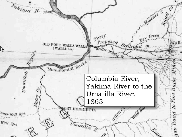
At the distance of nine miles, the Chopunnish Indian, who was in front, pointed out an old unbeaten road to the left, which he informed us was our shortest route. [The Corps is at the juction of today's Greenville Road and State Highway 124.] Before venturing, however, to quit our present road, which was level, and not only led us in the proper direction, but was well supplied with wood and water, we halted to let our horses graze till the arrival of our other guide, who happened to be at some distance behind. On coming up he seemed much displeased with the other Indian, and declared that the road we were pursuing was the proper one [today's Washington State Highway 124]; that if we decided on taking the left road, it would be necessary to remain till to-morrow morning, and then make an entire day's march before we could reach either water or wood. ...... at one o'clock, and pursued our route up the creek [Touchet River], through a country similar to that we had passed in the morning. But at the distance of three miles, the hills on the north side became lower, and the bottoms of the creek widened into a pleasant country, two or three miles in extent. The timber too, is now more abundant, and our guide tells us that we shall not want either wood or game from this place as far as the Kooskooskee [Clearwater River]. We have already seen a number of deer, of which we killed one, and observed great quantities of the curlew, as well as some cranes, ducks, prairie larks, and several species of sparrow, common to the prairies. There is, in fact, very little difference in the general face of the country here from that of the plains on the Missouri, except that the latter are enlivened by vast herds of buffaloe, elk and other animals, which give it an additional interest. Over these wide bottoms we continued on a course north, 75? east, till, at the distance of seventeen miles from where we dined, and twenty-six from our last encampment, we halted for the night [Touchet River, near Bolles, west of Waitsburg]. ......


Along the Journey - May 1, 1806
Touchet River at Bolles, Washington

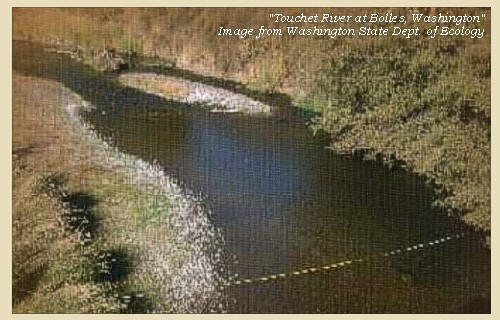
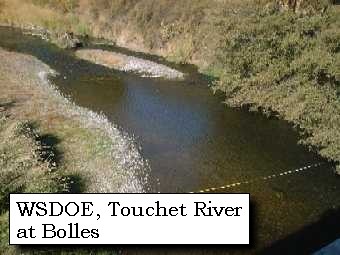
Touchet River at Bolles:
The Touchet River originates in the Blue Mountains in the southwest corner of Columbia County, and flows west through the cities of Dayton and Waitsburg, merging with the Walla Walla River near the community of Touchet, Washington. The Touchet is the largest tributary of the Walla Walla, and drains an area of approximately 736 square miles. -- Washington State department of Ecology Website, 2004


Map, 1893, Touchet River and the cities of Waitsburg, Huntsville, and Dayton, click to enlarge Image, Touchet River at Bolles, click to enlarge
  1. 1893 Map, part of the Columbia River showing junctions with the Touchet River, with Waitsburg, Huntsville, Dayton, and others. (section of original). (Click to enlarge). Original Map: "Part of the Snake River from its mouth to the Grande Ronde, showing location of principal rapids". U.S. Engineers Office, 1893. Washington State University Historical Maps Collection #WSU586. -- Washington State University Library Collections Website, 2002
  2. Touchet River at Bolles, Washington, in the Walla Walla River Basin. (click to enlarge). -- Washington State Department of Ecology Website, 2004


"... we traviled 17 miles this evening makeing a total of 26 mls, and encamped. the first 3 miles of our afternoons march was through a Simaler Country of that of the fore noon; the Creek bottoms then became higher and wider; to the extent of from 2 to 3 miles. ... The Courses & distances of this day are N. 45o E. 9 mls. & N. 75o E. 17 Miles allong the North Side of this Creek to our encampment. ..." [Clark, May 1, 1806]
"... The higher we go up the creek the cotton-wood is more large and plenty; and the plains beautiful. ..." [Gass, May 1, 1806]


Along the Journey - May 1, 1806
The Camp - May 1, 1806:
On the Touchet River, near Bolles, 3 miles west of Waitsburg, Washington.


Friday, May 2, 1806
We despatched two hunters ahead; but the horse we had yesterday purchased from the Chopunnish, although closely hobbled, contrived to break loose in the night, and went back to rejoin his companions. He was however overtaken and brought to us about one o'clock, and we then set forward. For three miles we followed a hilly road on the north side of the creek [Touchet River], opposite to a wide bottom, where a branch falls in [Coppei Creek] from the southwest mountains [Blue Mountains], which, though covered with snow, are about twenty-five miles distant, and do not appear high.


Along the Journey - May 2, 1806
Blue Mountains, 1998

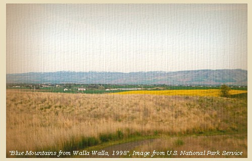
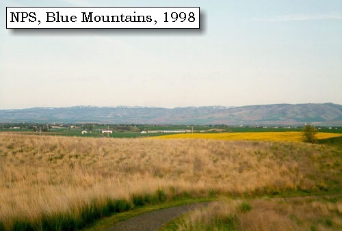
Blue Mountains:
The topography of the Blue Mountains consists of flat-topped ridges and steep stair-stepped valley walls formed by thousands of feet of Miocene basalt flows that engulfed the folded, faulted, and uplifted granitic core of the mountains. As mountains were uplifted, streams and glaciers carved canyons through the basalt layers. -- Columbia Basin Fish and Wildlife Authority Website, 2004


Map, 1814, Lewis and Clark on the Columbia, click to enlarge Map, 1855, Clearwater and Snake from Canoe Camp to the Columbia, click to enlarge Map, 1881, Snake, Clearwater, Grande Ronde, Salmon, click to enlarge Engraving, 1876, 'Birds eye view' of Walla Walla and the Blue Mountains, click to enlarge Image, 1998, Blue Mountains, click to enlarge
  1. 1814 Map, Lewis and Clark's map of the Columbia River (section of original). (Click to enlarge.) Shows the Blue Mountains (right side of map, horizontal chain of mountains). Map also includes three of the five volcanoes Lewis and Clark saw and commented on. While the journals mention the expedition seeing Mount Adams, it does not appear on their map. Mount Jefferson is just visible to the south (bottom) and Mount Rainier is to the north but off the map. From the "Nicholas Biddle/Paul Allen" 1814 publication. Original Map: "A Map of Lewis and Clark's Track, Across the Western Portion of North America, From the Mississippi to the Pacific Ocean". From: History of the expedition under the command of Captains Lewis and Clark : to the sources of the Missouri, thence across the Rocky Mountains and down the river Columbia to the Pacific Ocean : performed during the years 1804-5-6 : by order of the government of the United States / prepared for the press by Paul Allen. Philadelphia : Bradford and Insskeep, 1814. Harold B. Lee Library, Brigham Young University #upbover maps37. -- Brigham Young University, Harold B. Lee Library Website, 2004.
  2. 1855 Map, Clearwater and Snake Rivers, including the Blue Mountains (section of original). (Click to enlarge). Original Map: "Map of Oregon and Washington Territories: showing the proposed Northern Railroad route to the Pacific Ocean, by John Disturnell, 1855. University of Washington Archives #UW155. -- University of Washington Library Collections Website, 2002
  3. 1881 Map, Snake, Clearwater, Grande Ronde, and Salmon Rivers (section of original). (Click to enlarge). Original Map: "Map of the Grande Ronde Wallowa and Imnaha Country, 1881". Map section shows the Snake River (name doesn't show), "Clear Water" River (central right, tributary to the Snake), Grande Ronde River (lower left, only "de River" shows, tributary to the Snake), Salmon River (lower right, tributary to the Snake) Lewiston, Central Ferry, Alpowai, Dayton, Pataha, and the Blue Mountains. By H. Chandler, Eng., Buffalo, 1881., Washington State University Historical Maps Collection #WSU468. -- Washington State University Library Archives Website, 2002
  4. 1876 Engraving, "Birds eye view" of Walla Walla, Washington Territory, with the Blue Mountains 9 miles distant. (Click to enlarge). Drawn by E.S. Glover. A.L. Bancroft & Co., lithographers. Perspective map not drawn to scale. "From the west, looking east." Includes index to points of interest and text. -- U.S. Library of Congress, American Memories Website, 2002
  5. 1998, Blue Mountains from the Whitman Mission (Click to enlarge). National Park Service, Whitman Mission National Historic Site Negative #cmb-1998-12. -- U.S. National Park Service Website, 2002, Whitman Mission National Historic Site


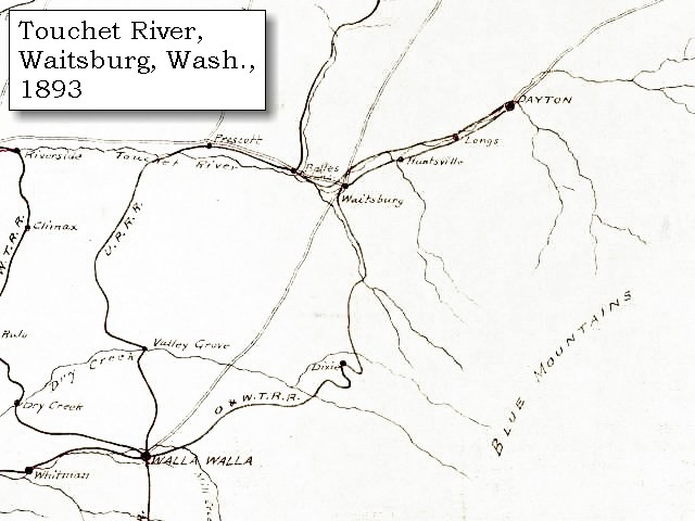
We then entered an extensive level bottom, [passing thru the location of today's Waitsburg, Washington] with about fifty acres of land well covered with pine near the creek, and the long-leafed pine occasionally on the sides of the hills along its banks [vicinity of Lewis and Clark State Park].


Along the Journey - May 2, 1806
Birds-eye view of Waitsburg, Washington, ca. 1893

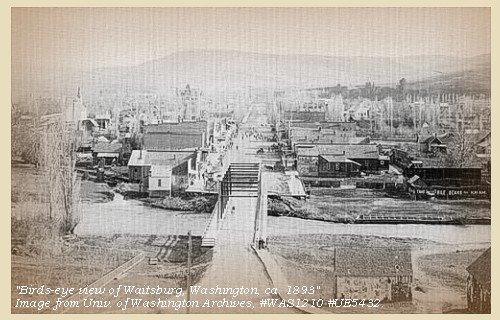
Waitsburg, Washington:
Less that 20 minutes east of Walla Walla, Waitsburg was founded in 1865. Today, the town government is the only one in Washington State still operating under the terms of its original territorial charter. -- Experience Walla Walla Website, 2004


Map, 1893, Touchet River and the cities of Waitsburg, Huntsville, and Dayton, click to enlarge Map, 1919 USGS topo map of the Touchet River, Waitsburg area, click to enlarge Image, ca.1893, Waitsburg, click to enlarge
  1. 1893 Map, part of the Columbia River showing junctions with the Touchet River, with Waitsburg, Huntsville, Dayton, and others. (section of original). (Click to enlarge). Original Map: "Part of the Snake River from its mouth to the Grande Ronde, showing location of principal rapids". U.S. Engineers Office, 1893. Washington State University Historical Maps Collection #WSU586. -- Washington State University Library Collections Website, 2002
  2. 1919 Map (section of original), from Walla Walla 1:125,000 topographic quadrangle. (Click to enlarge). Original map surveyed in 1916 and 1919, contour interval of 50 feet. -- University of Washington Library Collections Website, 2002
  3. ca.1893, Waitsburg, Washington. (Click to enlarge). "Bird's eye view of Waitsburg, Wash.", ca.1893. University of Washington Photo Archives #WAS1210 #UE5432. -- University of Washington Library Collections Website, 2002


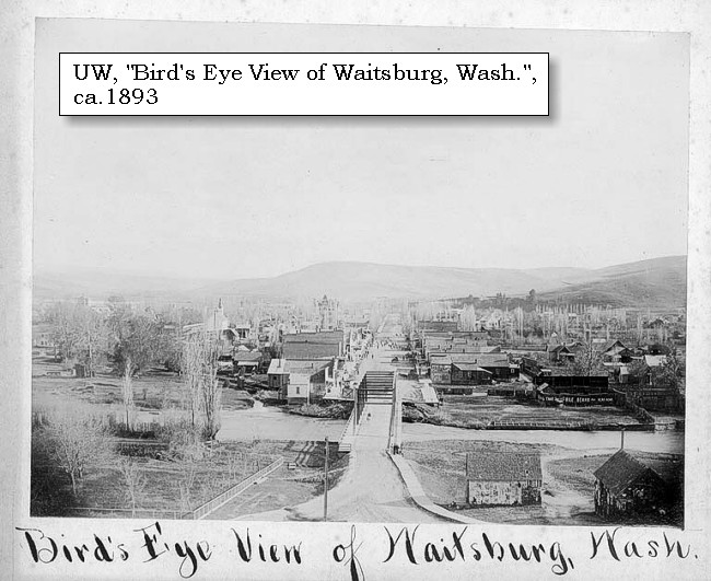
Lewis and Clark Trail State Park:
Lewis and Clark Trail State Park is a 37-acre camping park with 1,333 feet of freshwater shoreline on the Touchet River. Located about halfway between Waitsburg and Dayton (about 1.5 miles east of Huntsville), the park is a rare treasure of old-growth forest and river in the midst of the surrounding arid grassland. "Long-leafed" ponderosa pine still grow here, as Lewis and Clark recorded in their journals. The ponderosa are old-growth trees, as are the cottonwood that abound in the park. The park is located on the historic Nez Perce trail that extends from the Rocky Mountains to the Pacific Ocean. Remnants of the trail can be observed near the park. The explorers Lewis & Clark (for whom the park is named) passed through the property in 1806 and commented on the unusual character of the vegetation. The park was originally homesteaded by the Bateman family in 1864 and was the site for neighboring farmers' post-harvest picnics and games. Homesteading began in the region in 1859. Some of the original homestead sites still remain. Woolly mammoth fossils have been found near the park. The woolly mammoth fossil is the official fossil of Washington state. -- Washington State Parks and Recreation Website, 2002


Map, 1919 USGS topo map of the Touchet River with Lewis Clark Trail State Park, click to enlarge
  1. 1919 Map (section of original), from Walla Walla 1:125,000 topographic quadrangle. (Click to enlarge). Original map surveyed in 1916 and 1919, contour interval of 50 feet. Location of Lewis and Clark Trail State Park added. -- University of Washington Library Collections Website, 2002


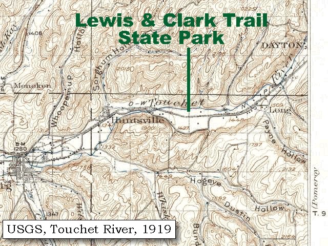
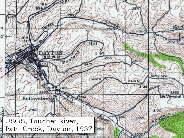
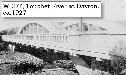
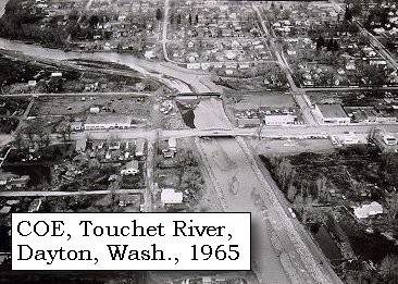
After crossing the creek [Touchet River] at the distance of seven miles from our camp, we repassed it seven miles further, near the junction of one of its branches from the northeast [Patit Creek]. The main stream here [Touchet River] bears to the south, towards the mountains where it rises [Blue Mountains], and its bottoms then become narrow, as the hills are higher. [Today, Dayton (Washington) is located at the junction of Patit Creek with the Touchet River.]


Along the Journey - May 2, 1806
Touchet River at Dayton

Dayton, Washington:
Lewis and Clark walked ground that would later become Dayton's Main Street while following the Nez Perce Indian trail stretching from the Columbia River through Lolo Pass to the Missouri River. They camped east of the future town site on Patit Creek. A Lewis and Clark memorial is located just two miles out of town. -- Dayton Visitor Center Website, 2002


Map, 1893, Touchet River and the cities of Waitsburg, Huntsville, and Dayton, click to enlarge Map, 1881, Snake, Clearwater, Grande Ronde, Salmon, click to enlarge Map, 1937 USGS topo map of the Patit Creek and Dayton, Washington, click to enlarge Engraving detail, 1884, Dayton and the Touchet River, click to enlarge Image, ca.1927, Touchet River Bridge at Dayton, click to enlarge Image, 1965, Dayton and the Touchet River, click to enlarge Image, Touchet River at Dayton, click to enlarge
  1. 1893 Map, part of the Columbia River showing junctions with the Touchet River, with Waitsburg, Huntsville, Dayton, and others. (section of original). (Click to enlarge). Original Map: "Part of the Snake River from its mouth to the Grande Ronde, showing location of principal rapids". U.S. Engineers Office, 1893. Washington State University Historical Maps Collection #WSU586. -- Washington State University Library Collections Website, 2002
  2. 1881 Map, Snake, Clearwater, Grande Ronde, and Salmon Rivers (section of original). (Click to enlarge). Original Map: "Map of the Grande Ronde Wallowa and Imnaha Country, 1881". Map section shows the Snake River (name doesn't show), "Clear Water" River (central right, tributary to the Snake), Grande Ronde River (lower left, only "de River" shows, tributary to the Snake), Salmon River (lower right, tributary to the Snake) Lewiston, Central Ferry, Alpowai, Dayton, Pataha, and the Blue Mountains. By H. Chandler, Eng., Buffalo, 1881., Washington State University Historical Maps Collection #WSU468. -- Washington State University Library Collections Website, 2002
  3. 1937 Map (section of original), from Pomeroy 1:125,000 topographic quadrangle. (Click to enlarge). Original map surveyed in 1936-37, contour interval of 100 feet. -- University of Washington Library Collections Website, 2002
  4. 1884, Detail from engraving, Dayton, Washington Territory, with the Touchet River. (Click to enlarge). Created by H. Wellge. Published 1884, J.J. Stoner, Madison, Wisconsin. Panoramic view of the city of Dayton, Washington Territory, county seat of Columbia County, 1884. Original lithograph shows Dayton with the Touchet River in the middle ground. Reference #LC Panoramic Maps #968. -- Library of Congress American Memories Website, 2002
  5. ca.1927, Touchet River Bridge at Dayton, Washington (Click to enlarge). Washington State Department of Transportation Archives, from 1926-1928 Biennial Report. -- Washington State Department of Transportation Website, 2004
  6. 1965, Touchet River and Dayton, Washington (Click to enlarge). U.S. Army Corps of Engineers photograph, Walla Walla District, February 4, 1965. -- U.S. Army Corps of Engineers Photo Collection Website, 2002
  7. Touchet River at Dayton. (click to enlarge). From the Dayton City Park. -- Washington State Department of Ecology Website, 2003


We followed the course of this northeast branch [Patit Creek] in a direction N. 45? E. for eight and three quarter miles, when having made nineteen miles, we halted in a little bottom on the north side. The creek [Patit Creek] is here about four yards wide, and as far as we can perceive, it comes from the east, but the road here turns from it into the high open plain. The soil of the country seems to improve as we advance, and this afternoon we see, in the bottoms, an abundance of quamash now in bloom. ......
"... saw to our right a range of high hills covered with timber and snow, not more than ten miles distant. ..." [Gass, May 2, 1806]


Along the Journey - May 2, 1806
The Camp - May 2, 1806:
On Patit Creek, 2 1/2 miles east of Dayton, Washington


Saturday, May 3, 1806
We set out at an early hour, and crossed the high plains, which we found more fertile and less sandy than below; yet, though the grass is taller, there are very few aromatic shrubs. After pursuing a course N. 25? E. for twelve miles, we reached the Kinnooenim [Tucannon River]. This creek rises in the southwest mountains [Blue Mountains], and though only twelve yards wide, discharges a considerable body of water into Lewis's river [Snake River], a few miles above the narrows. Its bed is pebbled, its banks low, and the hills near its sides high and rugged; but in its narrow bottoms are found some cottonwood, willow, and the underbrush, which grows equally on the east branch of the Wollawollah [Walla Walla River].


Along the Journey - May 3, 1806
Tucannon River at mouth

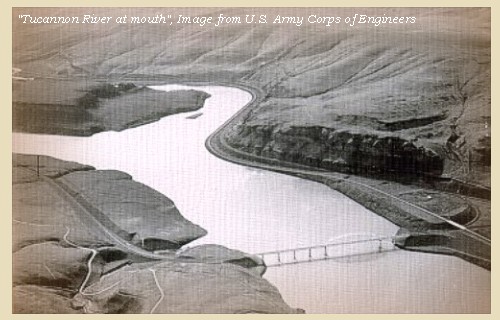
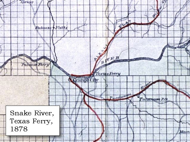
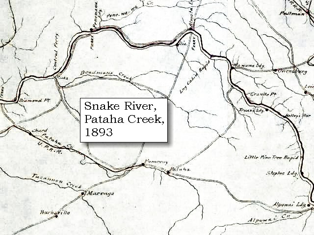
Tucannon River:
The Tucannon River has two major drainages, the mainstem and Pataha Creek. The mainstem drains 318 square miles and flows into the Snake River at River Mile (RM) 62.2, three miles upstream of Lyons Ferry State Park, near the mouth of the Palouse River. Pataha Creek drains 185 square milesand enters the Tucannon River at RM 11.2. The mouth and lower 2 miles of the Tucannon River has become a marshland as a result of the reservoir formed by Lower Monumental Dam, 20 miles downstream on the Snake River. Elevations in the Tucannon basin range from 540 feet at the confluence of the Tucannon and Snake Rivers to 6,400 feet at Oregon Butte in the Wenaha-Tucannon Wilderness located in the Umatilla National Forest. Long slopes intersected by steep canyons characterize topography in the Tucannon basin. The Tucannon River drains the Blue Mountains, a broad anticline arch uplifted during the last 20 million years. The bedrock of the Tucannon watershed consists nearly entirely of lava flows, with an average flow thickness is about 90 to 120 feet. -- Columbia Basin Fish and Wildlife Authority Website, 2002


Map, 1814, Lewis and Clark on the Snake, click to enlarge Map, 1858 Military recon map, Snake, Palouse, and Tucannon Rivers, click to enlarge Map, 1878, Snake, Palouse, Tucannon Rivers, Alkali Flat, with Texas Ferry, click to enlarge Map, 1878, Snake and Tucannon Rivers, with Central Ferry and Almota Ferry, click to enlarge Map, 1893, Snake, Palouse, Tucannon Rivers, click to enlarge Map, 1893, Closer-in, Snake, Palouse, Tucannon Rivers, click to enlarge Sketch, 1858, Mouth of the Tucannon River, click to enlarge Image, Tucannon River, click to enlarge
  1. 1814 Map, Lewis and Clark's map of the Columbia River (section of original). (Click to enlarge.) Shows the Tucannon River ("Ki-moo-e-nam R."). From the "Nicholas Biddle/Paul Allen" 1814 publication. Original Map: "A Map of Lewis and Clark's Track, Across the Western Portion of North America, From the Mississippi to the Pacific Ocean". From: History of the expedition under the command of Captains Lewis and Clark : to the sources of the Missouri, thence across the Rocky Mountains and down the river Columbia to the Pacific Ocean : performed during the years 1804-5-6 : by order of the government of the United States / prepared for the press by Paul Allen. Philadelphia : Bradford and Insskeep, 1814. Harold B. Lee Library, Brigham Young University #upbover maps37. -- Brigham Young University, Harold B. Lee Library Website, 2004.
  2. 1858 Military Recon Map (section of original), Snake, Palouse, and Tucannon Rivers. (Click to enlarge). Map of military reconnaissance from Fort Dalles, Oregon, via Fort Wallah-Wallah, to Fort Taylor, Washington Territory, 1858. Shows approximate location of military road constructed 1859 to 1862. From the report and maps of Captain John Mullan, United States Army, G.P.O., 1863. University of Washington Archives #UW85. -- University of Washington Library Archives Website, 2002
  3. 1878 Map, part of the Snake River showing Snake, Tucannon, and Palouse Rivers, and Alkali Flat Creek, with Palouse Ferry and Texas Ferry. (Click to enlarge). Original Map: "Map of south eastern Washington Territory compiled from official surveys and published by Eastwick, Morris & Co. ; drawn by John Hanson, 1878" Washington State University Historical Maps Collection #WSU371. -- Washington State University Library Archives Website, 2004
  4. 1878 Map, part of the Snake River showing Snake and Tucannon Rivers, with Central Ferry, Penawawa City, Almota Ferry, Pomeroy, and Pataha City. (Click to enlarge). Original Map: "Map of south eastern Washington Territory compiled from official surveys and published by Eastwick, Morris & Co. ; drawn by John Hanson, 1878" Washington State University Historical Maps Collection #WSU371. -- Washington State University Library Archives Website, 2004
  5. 1893 Map, part of the Snake River showing location of principal rapids (section of original). Includes Snake, Tucannon, and Palouse Rivers. (Click to enlarge). Original Map: "Part of the Snake River from its mouth to the Grande Ronde, showing location of principal rapids". U.S. Engineers Office, 1893. Washington State University Historical Maps Collection #WSU586. -- Washington State University Library Archives Website, 2002
  6. 1893 Map, Closer-in, part of the Snake River showing location of principal rapids (section of original). Includes Snake, Tucannon, and Palouse Rivers. (Click to enlarge). Original Map: "Part of the Snake River from its mouth to the Grande Ronde, showing location of principal rapids". U.S. Engineers Office, 1893. Washington State University Historical Maps Collection #WSU586. -- Washington State University Library Archives Website, 2002
  7. 1858 Sketch, View of the Snake River at mouth of the Tucannon River. (Click to enlarge). "Looking towards the north", showing Fort Taylor and bluffs. Sketch by Gustave Sohon, 1858. Washington State University Archives Collection #WSU515. -- Washington State University Library Archives Website, 2002
  8. Image, Tucannon River, Washington (Click to enlarge). U.S. Army Corps of Engineers photograph, Walla Walla District. -- U.S. Army Corps of Engineers Photo Collection Website, 2002


After dining at the Kinnooenim [Tucannon River], we resumed our journey over the high plains, in the direction of N. 45? E. and reached, at the distance of three miles, a small branch of that creek [Pataha Creek] about five yards wide. The lands in its neighbourhood are composed of a dark rich loam; its hill sides, like those of the Kinnooenim [Tucannon River], are high, its bottoms narrow, and possess but little timber. It increased however in quantity as we advanced along the north side of the creek for eleven miles. ...... [Cities located along this route today are Pomeroy and Pataha, Washington.]


Along the Journey - May 3, 1806
Pataha City, 1889

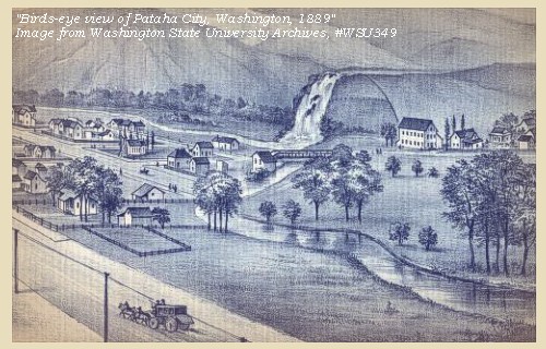
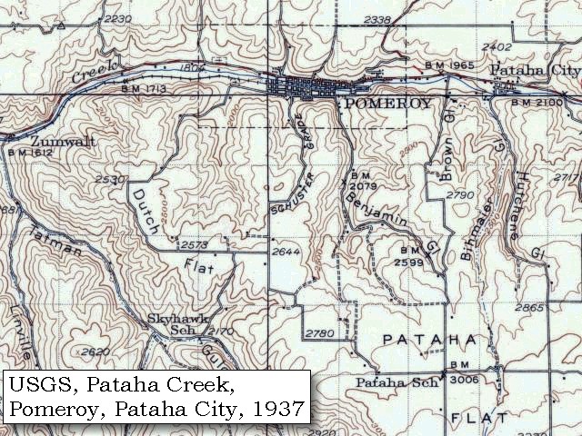
Pataha City and Pomeroy:
The name Pataha is a Nez Perce word that means "bushy creek". The town incorporated in 1875, as more and more people began to settle there. It became a popular spot after the arrival of three economies: the shipping/transportation industry, winter wheat farming, and flour production. The Pataha-Alpowa stage line stopped in the town, and a shipping business running the Snake River was also established some time after. Prior to 1870, Pataha was mostly a cattle raising region, but soon prospered as a farming town with the introduction of a hearty strain of wheat. In 1881, the newly formed Garfield County held its county seat at Pataha City for one year. It transferred the next year three miles away to Pomeroy, Washington. The future looked bright for Pataha until 1886. In that year the Oregon Railway and Navigation Company built a track running up to the town of Pomeroy and greatly improved transportation methods in the area. However, Pomeroy had long been Pataha City's rival, and refused to extend the line into the next town. Pataha City withered away when more and more businesses and farmers switched from shipping transport to the rails. The gristmill business (the Houser Mill or Pataha Flour Mill for example) continued on for a number of years due to a high international demand for its quality product. However, it too closed down by 1940, when the federal government placed costly and rigid regulations on small businesses. -- Washington State University Library Collections Website, 2002


Map, 1878, Snake and Tucannon Rivers, with Central Ferry and Almota Ferry, click to enlarge Map, 1881, Snake, Clearwater, Grande Ronde, Salmon, click to enlarge Map, 1893, Snake River and vicinity, click to enlarge Map, 1937 USGS topo map of the Pataha Creek and Pomeroy, Washington, click to enlarge Engraving, 1889, Pataha City, click to enlarge
  1. 1878 Map, part of the Snake River showing Snake and Tucannon Rivers, with Central Ferry, Penawawa City, Almota Ferry, Pomeroy, and Pataha City. (Click to enlarge). Original Map: "Map of south eastern Washington Territory compiled from official surveys and published by Eastwick, Morris & Co. ; drawn by John Hanson, 1878" Washington State University Historical Maps Collection #WSU371. -- Washington State University Library Archives Website, 2004
  2. 1881 Map, Snake, Clearwater, Grande Ronde, and Salmon Rivers (section of original). (Click to enlarge). Original Map: "Map of the Grande Ronde Wallowa and Imnaha Country, 1881". Map section shows the Snake River (name doesn't show), "Clear Water" River (central right, tributary to the Snake), Grande Ronde River (lower left, only "de River" shows, tributary to the Snake), Salmon River (lower right, tributary to the Snake) Lewiston, Central Ferry, Alpowai, Dayton, Pataha, and the Blue Mountains. By H. Chandler, Eng., Buffalo, 1881., Washington State University Historical Maps Collection #WSU468. -- Washington State University Library Archives Website, 2002
  3. 1893 Map, part of the Snake River showing location of principal rapids (section of original). Includes Central Ferry to Alpowa Creek, and areas south. (Click to enlarge). Original Map: "Part of the Snake River from its mouth to the Grande Ronde, showing location of principal rapids". U.S. Engineers Office, 1893. Washington State University Historical Maps Collection #WSU586. -- Washington State University Library Collections Website, 2002
  4. 1937 Map (section of original), from Pomeroy 1:125,000 topographic quadrangle. (Click to enlarge). Original map surveyed in 1936-37, contour interval of 100 feet. -- University of Washington Library Collections Website, 2002
  5. 1889, "Bird's-eye view" of Pataha City, Washington Territory. (Click to enlarge). Washington State University Libraries Collection, #WSU349 -- Washington State University Library Collections Website, 2002

We continued up the bottoms of the creek for two miles, till the road began to leave the creek, and cross the hill to the plains [following what is today Washington State Highway 12]. We therefore encamped for the night in a grove of cottonwood, after we had made a disagreeable journey of twenty-eight miles. ......


Along the Journey - May 3, 1806
The Camp - May 3, 1806:
On the Pataha Creek, near the city of Pataha, Washington (near Pomeroy, Washington). An interpretive sign is located at the spot today. The camp was across the highway from today's sign, near the foot of the old McKeirnan grade.


Home Previous Continue


If you have questions or comments please contact: GS-CVO-WEB@usgs.gov
June/July 2004, Lyn Topinka
The Volcanoes of Lewis and Clark Home Page | CVO Home Page