|
May 4 - June, 1806 To The Rockies - Snake River to Long Camp |
|
Home
The Volcanoes of Lewis and Clark Map of the Journey Volcanoes, Basalt Plateaus, Major Rivers, etc. The Volcanoes Mount Adams, Mount Hood, Mount Jefferson, Mount Rainier, and Mount St. Helens CALENDAR of the Journey October 1805 to June 1806 Along the Journey Pacific Northwest Maps - Columbia River, Volcanoes, Flood Basalts, Missoula Floods, Geology, etc. The Corps of Discovery The Journey of Lewis and Clark About the Reference Materials The Journals, Biddle/Allen, DeVoto, Gass, Moulton, Topo Maps, and others USGS Lewis and Clark Links Links to USGS Websites highlighting the Lewis and Clark Journey Resources Publications Referenced and Websites Visited |
PREVIOUS
May 1-3 The Walla Walla Shortcut, Overland, Touchet to the Snake |
May 4 - June
To the Rockies Snake River to Long Camp Blue Mountains, Alpowa Creek, Chief Timothy State Park, Snake River, Washington State Highway 12, Clearwater River, Lewiston (Idaho) and Clarkston (Washington), Nez Perce National Historical Park, Clearwater River, Lapwai Valley and Spalding (Idaho), Potlatch River, Great Lake River, Jacks Creek, Big Canyon Creek, Orofino (Idaho), Geology of the Camas Prairie, Kamiah (Idaho), Long Camp |
BEGIN
The Volcanoes of Lewis and Clark Lewis and Clark begin their Journey through the Pacific Northwest |
On October 7, 1805, Lewis and Clark and the
"Corps of Discovery" began their journey
down the Clearwater River and into the volcanics
of the Pacific Northwest. The Corps travelled from the
Clearwater to the Snake and down the
"Great Columbia", finally reaching the
Pacific Ocean on November 15, 1805.
Along the journey they encountered the
lava flows of the Columbia Plateau,
river channels carved by the great "Missoula Floods",
and the awesome beauty of five Cascade Range volcanoes.

[Click map for brief summary about the area] |
|
Heading for Home - May 1806
To the Rockies - Snake River to Long Camp |
| Lewis and Clark's camp of May 3, 1806 was on Pataha Creek, near the cities of Pataha and Pomeroy, Washington, near the foot of the old McKeirnan grade. |
| Sunday, May 4, 1806 |
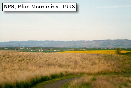
| After a disagreeable night, we collected our horses at an early hour. and proceeded with a continuation of the same weather. We are now nearer to the southwest mountains [Blue Mountains], which appear to become lower as they advance towards the northeast. |
|
|
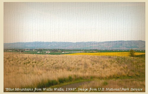
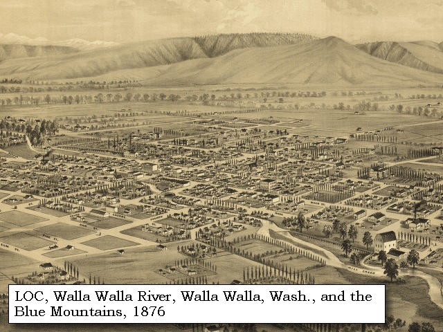
Blue Mountains: The topography of the Blue Mountains consists of flat-topped ridges and steep stair-stepped valley walls formed by thousands of feet of Miocene basalt flows that engulfed the folded, faulted, and uplifted granitic core of the mountains. As mountains were uplifted, streams and glaciers carved canyons through the basalt layers. -- Columbia Basin Fish and Wildlife Authority Website, 2004 
|
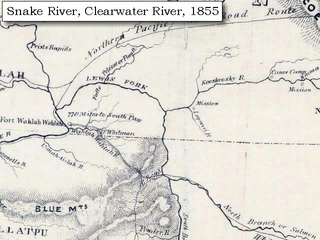
| We followed the road over the plains [Alpowa Ridge], north 60? east, for four miles to a ravine, where was the source of a small creek [Stember Creek, which flows into Alpowa Creek just west of Clayton Gulch], down the hilly and rocky sides of which we proceeded for eight miles [down Alpowa Creek] to its entrance into Lewis's river [Snake River] about seven miles and a half above the mouth of the Kooskooskee [Clearwater River]. ...... |
| "... the hills of the creek which we decended this morning are high and in most parts rocky and abrupt. one of our packhorses sliped from one of those hights and fell into the creek with it's load consisting principally of ammunition but fortunately neith the horse nor load suffered any material injury ..." [Lewis, May 4, 1806] |
|
|
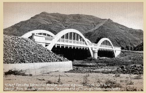
Alpowa Creek: Alpowa Creek in Asotin County enters the Snake River in the vicinity of the former Alpowa City, later renamed Silcott. The townsite was inundated by Lower Granite Reservoir in 1975. Chief Timothy State Park and Alpowai Interpretive Center are now located on an island created by the dam's backwater. On October 11, 1805, Lewis and Clark noted: "Passed a large camp of Alpowa Cr. Indians." The creek was not named on the route map or journal entries, either westbound or eastbound. Clark explained in the journals that in taking Indian vocabularies, "great object was to make every letter sound." "Alpowa" must have been one of the easier native names for Clark, who spelled phonetically and derived some interesting spellings, occasionally using several forms for the same word. -- Washington State Historical Society Website, 2002, "Lasting Legacy"
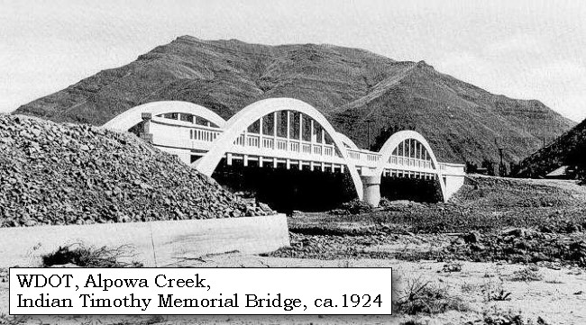
Chief Timothy State Park: Chief Timothy State Park is a 282-acre camping park with 11,500 feet of freshwater shoreline. The park offers water, scenery and excellent camping facilities in a primarily desert environment. The park is on an island in the Snake River on the route of the historic Lewis and Clark trail, proximate to Silcott townsite. The park is named for the chief of the Alpowai encampment of the Nez Perce Indian Tribe. Chief Alpowai was a valued friend of early white settlers in the region. -- Washington State Parks and Recreation Website, 2002 Geology of Chief Timothy State Park: During the Miocene age there were great lava flows that created basaltic columns. The following ice age carved the land, blocking rivers and creating the huge Lake Missoula. As the ice age drew to a close, the ice dams holding back Lake Missoula broke, unleashing a catastrophic flood that shaped the landscape. Chief Timothy is on an island made of glacial tills that were back-washed by the flood when it hit the Wallala gap causing the water to rush backward to the east carrying rocks and debris. -- Washington State Parks and Recreation Website, 2002 |
| The soil of the plain is good, but it has no timber. The range of southwest mountains [Blue Mountains] is about fifteen miles above us, but continues to lower, and is still covered with snow to its base. After giving a passage to Lewis's river [Snake River], near their northeastern extremity, they terminate in a high level plain between that river and the Kooskooskee [Clearwater River]. ...... |
| Back on the Snake |
| Sunday, May 4, 1806 ... Continued |
| After our repast we continued our route along the west side of the river [Snake River's left bank, which today Washington State Highway 12 follows], where as well as on the opposite shore, the high hills approach it closely, till at the distance of three miles we halted opposite to two houses: the inhabitants consisted of five families of Chopunnish, among whom were Tetoh, or Sky, the younger of the two chiefs who accompanied us in the autumn to the great falls of the Columbia, and also our old pilot who had conducted us down the river to the Columbia. |
|
|
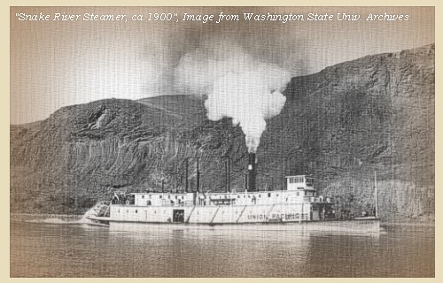
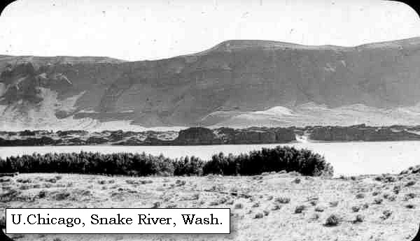
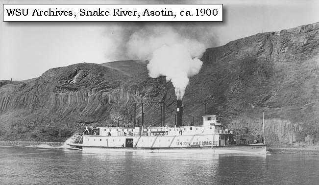
Snake River: The Snake River originates in Yellowstone National Park at 9,500 feet and winds through southern Idaho before turning north to form the boundary between Idaho and Oregon. It finally joins the Columbia River near Pasco, Washington, at 340 feet in elevation, 1,036 miles from its source. How did it get its name? To identify themselves, Indians living along the river in southern Idaho used a hand sign that resembled the movement of a snake. Although it didn't mean "Snake", that name was given to this group of people, now known as Shoshone. The river flowing through the Snake Indian lands was given the tribal name. Lewis and Clark traveled through this area on their journey to find an inland waterway to the Pacific. Many miles upriver from Hells Gate State Park, the Snake River winds through Hells Canyon, one of the deepest gorges in North America. This wild and spectacular area is best visited by boat; there are no roads leading through the canyon. Old homesteads, long-forgotten prospector cabins, and Native American petroglyphs offer a fascinating human story in the midst of the spectacular scenery. -- U.S. National Park Service, Wild and Scenic Rivers Website, 2002, and Idaho State Parks and Recreation Website, 2002 

Washington State Highway 12: Washington State Highway 12 in this area follows Pataha Creek, Megginson Gulch, Stemper Creek, and Alpowa Creek. It continues along Alpowa Creek until it merges with the Snake River near Silcott, Washington, and Chief Timothy State Park. Washington State Highway 12 approximates the path of Lewis and Clark on their return trip. The area is Grande Ronde formation of the Columbia River Basalt Group. The Grande Ronde Basalt is the most voluminous and areally extensive formation in the entire Columbia River Basalt Group, and underlies most of the Columbia Plateau. It has an estimated volume of more than 35,000 cubic miles, and its thickness varies widely depending on underlying topography; the thickest preserved section exceeds 3,300 feet in drill holes in the Pasco Basin, and sections 1,650 to 2,300 feet thick occur in the Blue Mountains and other uplifted or deeply incised areas. Grande Ronde flows make up 85 percent of the Columbia River Basalt's total volume, and occured from about 16.5 to 15.5 million years ago. The flows originated in eastern Washington and Oregon. -- Swanson and Wright, 1981, and U.S. Forest Service, Columbia River Gorge National Scenic Area Website, 2002
|
| They both advised us to cross here [near Chief Timothy State Park, Washington, see above for more information], and ascend the Kooskooskee [Clearwater River] on the northeast side, this being the shortest and best route to the forks of that river, where we should find the Twistedhair, in whose charge we left our horses, and to which place they promised to show us the way. We did not hesitate to accept this offer, and therefore crossed with the assistance of three canoes; but as the night was coming on, we purchased a little wood and some roots of cows, and encamped, though we had made only fifteen miles to-day. ...... |
|
|
|
The Camp - May 4, 1806:
About 3 miles below Clarkston, Washington. |
| Back on the Clearwater |
| Monday, May 5, 1806 |
| We collected our horses, and at seven o'clock set forward alone ...... Our road was across the plains for four and a half miles, to the entrance of the Kooskooskee [Clearwater River]. |
|
|
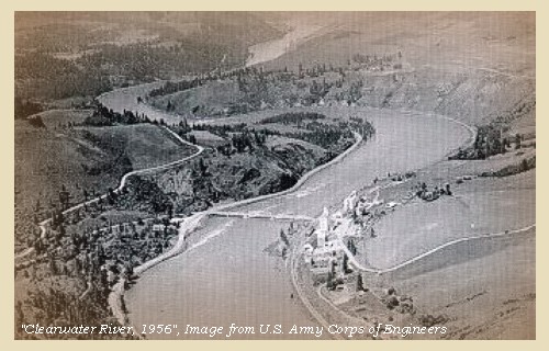
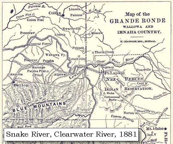
Clearwater River: The Clearwater River drains approximately 9,645 square miles, and extends 100 miles north to south and 120 miles east to west. Four major tributaries drain into the mainstem Clearwater River: the Lochsa, Selway, South Fork Clearwater, and North Fork Clearwater Rivers. The Clearwater River has an international reputation as one of the best steelhead fisheries anywhere. The river, along with U.S. Highway 12, are part of the Lewis and Clark National Historic Trail. Developed recreation sites in the area are primarily for boating and fishing, with camping available in a few locations. The North Fork of the Clearwater and the Lochsa Rivers provide miles of tumbling whitewater interspersed with quiet pools for migratory and resident fish. The Clearwater was used as a passageway by explorers and trappers, and later by miners and loggers because it was much more tame than its counterpart the Salmon River. -- Columbia Basin Fish and Wildlife Authority Website, 2002, Visit Idaho Website, 2002, and Idaho Museum of Natural History Website, 2002, Digital Atlas of Idaho

|
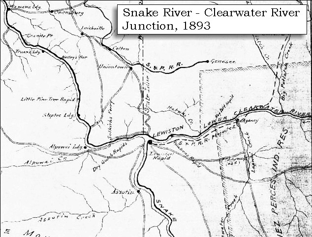
| Today at the junction of the Clearwater River with the Snake River lies Lewiston, Idaho, and Clarkston, Washington, and the entrance to the Nez Perce National Historic Park. |
|
|
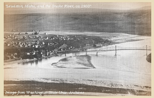
Lewiston, Idaho, and Clarkston, Washington: Lewiston is a seaport that leads to the Columbia River and the Pacific Ocean. Together with its sister-city of Clarkston, Washington, the city was named for the explorers Lewis and Clark. -- Visit Idaho Website, 2002 
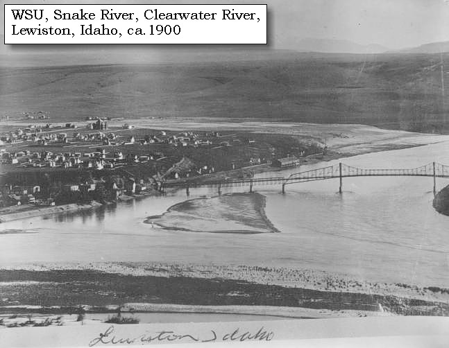
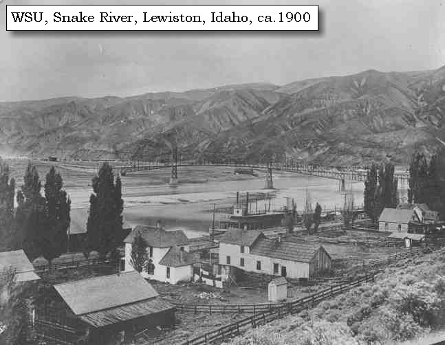
Confluence Overlook, Nez Perce National Historical Park: Confluence Overlook is a highway pullout overlooking the confluence and valleys of the Snake and Clearwater Rivers. The pullout is about 8 miles north of Lewiston, Idaho, on the Lewiston Grade of U.S. Highway 95. The scene is dominated by a rolling grassy foreground that slopes steeply down to the Clearwater River, more than a thousand feet below. A sense of the confluence area and the scale of the surrounding uplands -- part of the Nez Perce homeland -- can be gained from this vantage point. -- U.S. National Park Service Website, Nez Perce National Historical Park, 2002 |
| We then proceeded up that river [Clearwater River], and at five miles reached a large mat house, but could not procure any provisions from the inhabitants, but on reaching another three miles beyond, we were surprised at the liberality of an Indian, who gave captain Clarke a very elegant gray mare, ...... Four miles beyond this house we came to another one, containing ten families, where we halted, and made our dinner ...... |
| "... about noon we came to another small Village opposite the mouth of cottonwood creek [Lapwai Creek and the site of today's Spalding, Idaho] where we bought 2 dogs and dined & proceed on to Colters Creek [Potlatch River] & pah-map village where we camped ..." [Ordway, May 5, 1806] |
|
|
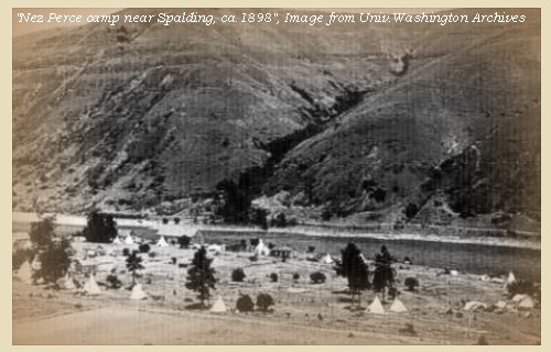
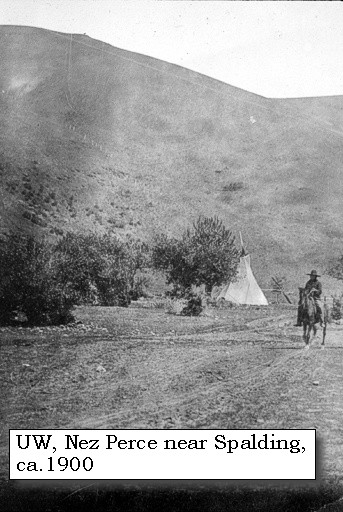
Lapwai Valley and Spalding, Idaho: Spalding, Idaho, is along U.S. Highway 95 approximately 10 miles east of Lewiston, Idaho, at the confluence of the Clearwater River and Lapwai Creek. The present day community and park area of Spalding (officially named in 1897) was originally called Lapwai and served as a traditional homesite for over 11,000 years to the Thlep-thlep-weyma band of Nez Perces. Each summer they moved to higher elevations to hunt, fish, gather roots, berries, and other wild foods, returning each fall in time for the salmon 'run' on the Clearwater River. The location was ideal where Lapwai Creek flowed into the Clearwater River. A large boomground where trees and branches washed downstream by spring floods were deposited provided enough firewood for a village of over 200 people. Winters were usually milder at this 700-foot elevation and the bluffs provided shelter from the winds and storms. In November, 1836, Henry and Eliza Spalding established the first mission to the Nez Perce. The Spaldings built their first home at Thunder Hill, 2 miles up Lapwai Creek but heat and mosquitos forced them to move to the banks of the Clearwater River where morning and evening breezes made for more pleasant living conditions. Rev. Henry Harmon Spalding wrote about his first view of Lapwai Valley in the fall of 1836. "We road on and entered the valley. It proved to be larger than we expected. It is on a little stream emptying into Koos Koos from the south. We found it well-timbered with cotton wood, balm of gilead, birch, and a few pine. Soon found good soil." In 1847, due to the murders of the Whitmans and 12 others at Waiilatpu, the Spaldings were ordered to close their mission. -- U.S. National Park Service Website, 2002, Nez Perce National Historical Park

Geology of Nez Perce County: Almost all of Nez Perce County (includes Spaulding and the Lapwai areas) is underlain by the Miocene basalts of the Columbia River basalts which make up the steep sided plateau south of Lewiston. The Miocene basalts filled in and flowed up an ancestral Clearwater River canyon about 17 million years ago. -- Digital Atlas of Idaho Website, 2003 |
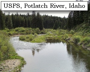
| After dinner we proceeded to the entrance of Colter's creek, [Potlatch River] at the distance of four miles, and having made twenty and a half miles, encamped on the lower side of it. Colter's creek [Potlatch River] rises not far from the Rocky mountains, and passing in the greater part of its course through a country well supplied with pine, discharges a large body of water. It is about twenty-five yards wide, with a pebbled bed and low banks. ...... |
|
|
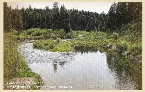
Potlatch River: The Potlatch River is one of the largest tributaries of the lower Clearwater River. The Potlatch has a length of 52 miles, contains 745 miles of tributary streams, and drains a watershed of approximately 335 square miles. It originates in the Beal Butte area of the Clearwater National Forest. The main tributaries of the lower Potlatch are Little Potlatch, Middle Potlatch, Big Bear Creek, Pine Creek, and Cedar Creek, and the main tributaries of the upper Potlatch are the East Fork and West Fork. The geological and hydrological features of the upper and lower reaches of the Potlatch River are quite distinct. The lower Potlatch River basin contains a series of large deep canyons which traverse through the Palouse Plateau. This area is basaltic and much of the stream substrate is large, primarily boulders and large rubble. Stream flow within the lower basin is regulated more by local precipitation than springs and snow pack. High runoff occurs early in the spring and subsides rapidly by early summer, extreme low flows are typical throughout the summer and stream flow increases again with the onset of the fall and winter rainy seasons. The upper basin and headwaters of the Potlatch River flow through timbered hills and high meadow terrain. These streams provide a more stable flow than those in the lower Potlatch; the watershed in the upper basin is not farmed as intensively as the lower basin; therefore, runoff is not as rapid or extreme. -- Bonneville Power Administration Website, 2004
|
| "... the natives have a considerable salmon fishery up Colter's Creek [Potlatch River] . this stream extends itself to the pirs of the rocky mountains and in much the greater part of it's course passes through a well timbered pine country it is 25 yds. wide and discharges a large body of water. the banks low and bed formed of pebbles ... ..." [Lewis, May 6, 1806] |
|
|
|
The Camp - May 5, 1806:
Along the Clearwater River, south side of the Potlatch River. |
| Tuesday, May 6, 1806 |
| We here found three men, of a nation called Skeetsomish, who reside at the falls of a large river, emptying itself into the north side of the Columbia. This river takes its rise from a large lake in the mountains [Lake Coeur d'Alene], at no great distance from the falls where these natives live. We shall designate this river, hereafter, by the name of Clarke's river [???], as we do not know its Indian appellation, and we are the first whites who have ever visited its principal branches; for the Great Lake river mentioned by Mr. Fidler, if at all connected with Clarke's river, must be a very inconsiderable branch. To this river, moreover, which we have hitherto called Clarke's river, which rises in the southwest mountains [Oregon Cascades], we restored the name of Towahnahiooks [Deschutes River], the name by which it is known to the Eneeshurs. ...... |
| "... at this place ... [at their camp of May 5, 1806] ... we met with three men of a nation called the Skeets-so-mish who reside at the falls of a large river disharging itself into the Columbia on it's East side to the North of the entrance of Clark's river. this river they informed us headed in a large lake in the mountains and that the falls below which they resided was at no great distance from the lake. these people are the same in their dress and appearance with the Chopunnish, tho their language is intirely different a circumstance which I did not learn untill we were about to set out and it was then too late to take a vocabulary. The river here called Clark's river is that which we have heretofore called the Flathead river, I have thus named it in honour of my worthy friend and fellow traveller Capt. Clark. for this stream we know no indian name and no white man but ourselves was ever on it's principal branches. the river which Fidler calls the great lake river may possibly be a brance of it but if so it is but a very inconsiderable branch and may as probably empty itself into the Skeetssomish as into that river. the stream which I have heretofore called Clark's river has it's three principal sources in mountains Hood, Jefferson & the Northern side of the S. W. Mountains and is of course a short river. this river I shall in future call the To-wannahiooks river it being the name by which it is called by the Eneshur nation. ..." [Lewis, May 6, 1806] |
|
|
|
Great Lake River:
The "Great lake River" appears on Aaron Arrowsmith's map of 1802, based on information from Peter Fidler. It headed near the Saskatchewan and ran into Mackenzie's "Tacoutche-Tess" River, which was assumed to be the Columbia or a major tributary thereof. No known river really matches the description. The captains were now trying to fit this largely conjectureal stream into their own increasing knowledge of Western geogrphy by making it a tributary of eithr Clark's River or the "Skeetsomish." -- Moulton, v.7 |
| About two o'clock we collected our horses and set out [proceeding up the Clearwater River], accompanied by Weahkoonut, with ten or twelve men, and a man who said he was the brother of the Twistedhair. |
| "... The Kooskooske river may be safely navigated at present all the rocks of the sholes and rapids are perfectly covered; the current is strong, the water clear and cold. this river is rising fast. The timber of this river which consists principally of the long leafed pine which commences about 2 miles below our present encampment on Colters Creek ..." [Clark, May 6, 1806] |
| At four miles we came to a single house of three families, but we could not procure provisions of any kind; and five miles further we halted for the night near another house, built like the rest, of sticks, mats and dried hay, and containing six families. ...... |
|
|
|
The Camp - May 6, 1806:
On the Clearwater River, below Pine Creek. |
| Wednesday, May 7, 1806 |
| We proceeded up the river with the brother of the Twistedhair as a guide. The Kooskooskee [Clearwater River] is now rising fast, the water is clear and cold, and as all the socks and shoals are now covered, the navigation is safe, notwithstanding the rapidity of the current. The timber begins about the neighbourhood of Colter's creek [Potlatch River], and consists chiefly of l ong-leafed pine. After going four miles, we reached a house of six families, below the entrance of a small creek [Bedrock Creek], where our guide advised us to cross the river, as the route was better, and the game more abundant near the mouth of the Chopunnish. [North Fork Clearwater River]. We therefore unloaded, and by means of a single canoe, passed to the south side in about four hours, during which time we dined. An Indian of one of the houses now brought two canisters of powder, which his dog had discovered under ground in a bottom some miles above [at the mouth of Jack's Creek, near Lenore, Idaho] . We immediately knew them to be the same we had buried last autumn ...... We set out at three o'clock, and pursued a difficult and stony road for two miles, when we left the river and ascended the hills on the right, which begin to resemble mountains. But when we reached the heights, we saw before us a beautiful level country ...... |
|
|
|
Jacks Creek:
Jacks Creek is approximately 8 miles in length and courses in a northerly direction through a canyon area, has well developed riparian vegetation, and discharges into the Clearwater River at River Mile 36. Lewis and Clark refer to this creek as "Canister run", so named for the location the men stored canisters of gunpowder in 1805 for their return journey east in 1806. -- Bonneville Power Administration Website, 2004, and Clearwater Historical Society Website, 2002 |
| As we entered the plain Neeshnepahkee, the Cutnose, overtook us, and after accompanying us a few miles, turned to the right to visit some of his people. ...... Having crossed the plain a little to the south of east, we descended a long steep hill, at the distance of five miles, to a creek six yards wide [Big Canyon Creek], which empties itself into the Kooskooskee [Clearwater River]. We ascended this little stream for a mile, and encamped at an Indian establishment of six houses, which seem to have been recently evacuated. Here we were joined by Neeshnepahkee, and the Shoshonee who had interpreted for us on the fifth. |
| "... in short it is a beautifull fertile and picturesque country. ... we called Musquetoe Creek in consequence of being infested with swarms of those insects on our arrival at it. ... here we remained all night ..." [Lewis, May 7, 1806] |
|
|
|
Big Canyon Creek:
Big Canyon Creek is approximately 30 miles in length and flows in a northerly direction before discharging into the Clearwater River at River Mile 42.5. -- Bonneville Power Administration Website, 2004 |
| From the plain we observed that the spurs of the Rocky mountains are still perfectly covered with snow, which the Indians inform us is so deep that we shall not be able to pass before the next full moon, that is, the first of June. ...... |
| "... The spurs of the rocky mountains which were in view from the high plain to day were perfectly covered with snow. The Indians inform us that the snow is yet so deep on the mountains that we shall not be able to pass them untill after the next full moon or about the first of June. others set the time at still a more distant period. this unwelcom intiligence to men confined to a diet of horsebeef and roots, and who are as anxious as we are to return to the fat plains of the Missouri and thence to our native homes ..." [Clark, May 7, 1806] |
| "... Here some of the natives came to our camp, and informed us, that we could not cross the mountains for a moon and an half; as the snow was too deep, and no grass for our horses to subsist on. We have the mountains in view from this place, all covered white with snow ..." [Gass, May 8, 1806] |
|
|
|
The Camp - May 7, 1806:
On Big Canyon Creek near Peck, Idaho. |
| Thursday, May 8, 1806 |
| Most of the hunters set out at daylight. By eleven o'clock they all returned, with four deer, and a duck of an uncommon kind ...... The mother of the Twistedhair, and Neeshnepahkeeook now drew a sketch, which we preserved, of all the waters west of the Rocky mountains. They make the main southern branch of Lewis's river [Snake River], much more extensive than the other, and place a great number of Shoshonee villages on its western side. Between three and four o'clock in the afternoon we set out, in company with Neeshnepahkeeook and other Indians, the brother of the Twistedhair having left us. Our route was up a high steep hill to a level plain, with little wood, through which we passed in a direction parallel to the river, for four miles, when we met the Twistedhair and six of his people. To this chief we had confided our horses and a part of our saddles, last autumn ...... |
| Lewis and Clark are on the plains a few miles west/southwest of Orofino, Idaho. |
|
|
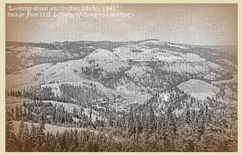
Orofino, Idaho: In the winter of 1859, Captain Elias D. Pierce found gold in the Orofino region. Due to restrictions on what had become part of the Nez Perce Reservation, Captain Pierce could not legally come into the area. He returned quietly in the winter of 1860 with a party of 12, camped on Canal Gulch near what is now the town of Pierce, and made a significant gold discovery. That winter, 1860-61, Pierce City and Oro Fino City were established two miles apart. In 1867 Oro Fino burned down and was not rebuilt. Today's Orofino got its start in 1898, with the inflow of settlers and the construction of the Northern Pacific Railroad up Clearwater River. The name Oro Fino (which means "fine gold") was taken from the old gold rush town of "Oro Fino". When the post office objected to two words, the town joined the two words and became Orofino. -- Orofino, Idaho, Chamber of Commerce Website, 2003, and Clearwater, Idaho, Historical Museum Website, 2003

|
| "... the road led us up a steep and high hill to a high and level plain mostly untimbered, through which we passed parrallel with the river about 4 miles when we met the 'Twisted hair" and a party of six men ... we informed the Cheifs that we should continue our march to the first water and encamp accordingly we moved on and the Indians all followed. about two miles on the road we arrived at a little branch which run to the wright. here we encamped for the evening having traveled 6 miles today ..." [Clark, May 8, 1806] |
|
|
|
The Camp - May 8, 1806:
A few miles west or southwest of Orofino, Idaho, on one of several small creeks flowing south into Little Canyon Creek. |
| Friday, May 9, 1806 |
| In the morning after sending out several hunters, we proceeded through a level rich country, similar to that of yesterday, for six miles [on the plains near Orofino, Idaho], when we reached the house of the Twistedhair, situated near some larch trees, and a few bushes of balsam fir. ...... As soon as we halted at this place, we went with the Twistedhair to the spot where he had buried our saddles, and two other young Indians were despatched after the horses. ...... Late in the afternoon, the Twistedhair returned with about half the saddles we had left in the autumn, and some powder and lead which was buried at the same place. Soon after, the Indians brought us twenty-one of our horses, the greater part of whom were in excellent order, though some had not yet recovered from hard usage, and three had sore backs. We were however very glad to procure them in any condition. ...... Our camp was in an open plain, and soon became very uncomfortable, for the wind was high and cold, and the rain and hail which began about seven o'clock, changed in about two hours to a heavy fall of snow, which continued till after six o'clock the next morning when it ceased, after covering the ground eight inches deep, and leaving the air keen and cold. |
|
|
|
The Camp - May 9, 1806:
Near modern Orofino, Idaho, on the Nez Perce Reservation. The Nez Perce brought 21 of the Corps' horses to them, cared for all winter by the Nez Perce. |
| To The Rockies |
| May 10 - June 9, 1806 |
| Our camp was in an open plain [camp of May 9, 1806, was near today's Orofino, Idaho], and soon became very uncomfortable, for the wind was high and cold, and the rain and hail which began about seven o'clock, changed in about two hours to a heavy fall of snow, which continued till after six o'clock the next morning [May 10, 1806], when it ceased, after covering the ground eight inches deep, and leaving the air keen and cold. We soon collected our horses, and after a scanty breakfast of roots, set out on a course S. 35o E. across the plains [Camas Prairie], the soil of which being covered with snow, we could only judge from observing that near the ravines, where it had melted, the mud was deep, black, and well supplied with quamash. The road was very slippery, and the snow stuck to the horses' feet and made them slip down very frequently. After going about sixteen miles, we came to the hills of Commearp creek [Lawyer Creek], which are six hundred feet in height, but the tops of which only are covered with snow, the lower parts as well as the bottoms of the creek having had nothing but rain while it snowed in the high plains. On descending these hills to the creek, we reached about four o'clock, the house of Tunnachemootoolt, where was displayed the flag which we had given him, raised on a staff: under this we were received with due form, and then conducted a short distance to a good spot for an encampment, on Commearp creek [Lawyer Creek]. ...... |
| "... we are now as near the Mountains as we can git untill Such time as the Snow is nearly gone of the mountains as we are too eairly to cross ..." [Ordway, May 10, 1806] |
|
|
|
Geology of the Camas Prairie:
Lewis County, on the south side of the Clearwater River, contains the steep sided Camas Prairie plateau underlain by Miocene lava flows of the Columbia River basalts. Poking through at several places are Cretaceous and Jurassic island arc rocks of the Accreted terranes. The Suture zone runs just east of the county line along the Clearwater River through Kamiah. These plateaus are unusual, since the flat ground is on top, and the cities are generally in narrow valley bottoms. The Clearwater River cuts through the plateau, following the track of the Cretaceous suture zone. -- Digital Atlas of Idaho Website, 2003 |
| the chief had a large leathern tent spread for us, and desired that we would make that our home whilst we remained at his village. We removed there, and having made a fire, and cooked a supper of horse-beef and roots, collected all the distinguished men present, and spent the evening [May 10, 1806] in explaining who we were, the objects of our journey, and giving answers to their inquiries. ...... |
|
|
|
The Camp - May 10, 1806 to May 12, 1806:
On Lawyer Creek, near Kamiah, Idaho. |
| we collected our horses [Tuesday, May 13, 1806] and proceeded for two miles in a southeastern direction [down Lawyer Creek], crossing a branch from the right [Sevenmile Creek], at the distance of a mile. We then turned nearly north, and crossing an extensive open bottom [just south of the present city of Kamiah]; about a mile and a half wide, reached the bank of the Kooskooskee [Clearwater River]. |
|
|

Kamiah, Idaho: Kamiah, Idaho, was the winter home of the Nez Perce Indians. It was here they came to fish for steelhead, a staple in their diet, and to manufacture "Kamia" ropes, hence the name Kamiah, meaning the place of "many rope litters". Lewis and Clark camped for several weeks during the early spring of 1806 in the Kamiah Valley waiting for the snow to melt before they could continue their journey east. The valley is rich in the heritage and legends of the Nez Perce and it was here, among the ancestors of the present day Nez Perce, that the Appaloosa horse was first bred, primarily for use as a war animal. -- Kamiah Chamber of Commerce Website, 2003 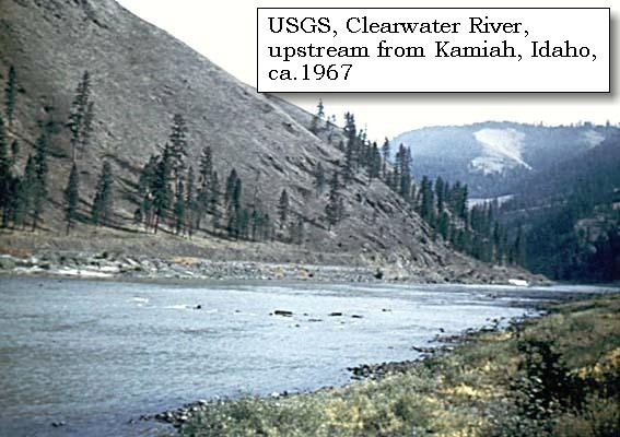

|
| Here we expected the canoe which they had promised; but although a man had been despatched with it at the appointed time, he did not arrive before sunset. We therefore encamped [on the banks of the Clearwater near the present town of Kamiah], with a number of Indians who had followed us from the village, |
|
|
|
The Camp - May 13, 1806:
On the banks of the Clearwater River, near the present town of Kamiah. |
| and in the morning [Wednesday, May 14, 1806], after sending out some hunters, transported the baggage by means of the canoe, and then drove our horses into the river, over which they swam without accident, although it is one hundred and fifty yards wide, and the current very rapid [Clearwater River]. We then descended the river about half a mile, and formed our camp on the spot which the Indians had recommended [today this camp is known as "Camp Chopunnish" or "Long Camp"]. It was about forty paces from the river, and formerly an Indian habitation; but nothing remained at present but a circle thirty yards in diameter, sunk in the ground about four feet, with a wall round it of nearly three and a half feet in height. In this place we deposited our baggage, and round its edges formed our tents of sticks and grass. This situation is in many respects advantageous. It is an extensive level bottom, thinly covered with long-leafed pine, with a rich soil, affording excellent pasture, and supplied, as well as the high and broken hills on the east and northeast, with the best game in the neighbourhood; while its vicinity to the river [Clearwater River] makes it convenient for the salmon, which are now expected daily. ...... |
|
|
|
"Long Camp":
The Lewis and Clark Expedition spent from May 14, 1806 to June 9, 1806 at a spot near Kamiah, Idaho, while waiting for winter to end in order to cross the Bitterroots and continue the eastward trek home. The camp at "Camp Chopunnish," was located near Kamiah, Idaho, on the Nez Perce Reservation, and was the longest camp of any, other than the three winter encampments of the Corps. The Corps had to wait until the snow melted in the mountains so that they could pass over the Continental Divide and return to the east. Today there is an interpretive sign at a pullout on U.S. Highway 12 (mile 68), approximately 1 mile east of Kamiah, Idaho. The actual camp site is approximately 2 miles downstream along the Clearwater River on private property. |
| The country along the Rocky mountains for several hundred miles in length and about fifty wide, is a high level plain; in all its parts extremely fertile, and in many places covered with a growth of tall long-leafed pine. This plain is chiefly interrupted near the streams of water, where the hills are steep and lofty; but the soil is good, being unincumbered by much stone, and possess more timber than the level country. Under shelter of these hills, the bottom lands skirt the margin of the rivers, and though narrow and confined, are still fertile and rarely inundated. Nearly the whole of this wide spread tract is covered with a profusion of grass and plants, which are at this time as high as the knee. |
| "... "The Country along the rocky mountains for Several hundred Miles in length and about 50 in width is leavel extremely fertile and in many parts Covered with a tall and opult. growth of the long leafed pine. near the Watercourses the hills are lofty tho' are covered with good Soil and not remarkably Stoney and possess more timber than the leavel country. the bottom lands on the Water courses are reather narrow and confined tho' fertile and Seldom inundated. this Country would form an extensive Settlement ..." [Clark, May 28, 1806] |
| Home | Previous |
If you have questions or comments please contact: GS-CVO-WEB@usgs.gov
June/July 2004, Lyn Topinka
The Volcanoes of Lewis and Clark Home Page | CVO Home Page