The Volcanoes of
Lewis and Clark
Lewis and Clark
|
March 30, 1806 Vancouver, Washington - Ridgefield to Ryan Point |
|
Home
The Volcanoes of Lewis and Clark Map of the Journey Volcanoes, Basalt Plateaus, Major Rivers, etc. The Volcanoes Mount Adams, Mount Hood, Mount Jefferson, Mount Rainier, and Mount St. Helens CALENDAR of the Journey October 1805 to June 1806 Along the Journey Pacific Northwest Maps - Columbia River, Volcanoes, Flood Basalts, Missoula Floods, Geology, etc. The Corps of Discovery The Journey of Lewis and Clark About the Reference Materials The Journals, Biddle/Allen, DeVoto, Gass, Moulton, Topo Maps, and others USGS Lewis and Clark Links Links to USGS Websites highlighting the Lewis and Clark Journey Resources Publications Referenced and Websites Visited |
PREVIOUS
March 29 Heading Home, Deer Island to Ridgefield NWR |
March 30
Vancouver, Washington Ridgefield NWR to Ryan Point Sauvie Island, Ridgefield NWR, Vancouver Lake and Vancouver Lake County Park, FIVE VOLCANOES, Fort Plain, Fort Vancouver and Vancouver (Washington), Fort Vancouver National Historical Site, Hayden Island, Interstate-5 Bridge, Columbia Shores area near Ryan Point, Mount Jefferson, Mount St. Helens, and Mount Hood |
CONTINUE
March 31 On the Banks of the Columbia, Ryan Point to Cottonwood Beach Camp |
|
Heading for Home - March 1806
Vancouver, Washington - Ridgefield to Ryan Point |
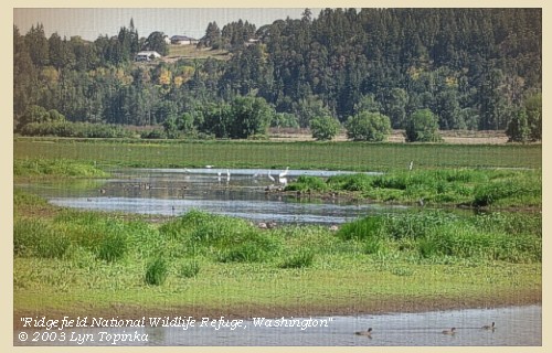
| Lewis and Clark's camp of March 29, 1806, was at the west end of today's Ridgefield National Wildlife Refuge. |
| Sunday, March 30, 1806 |
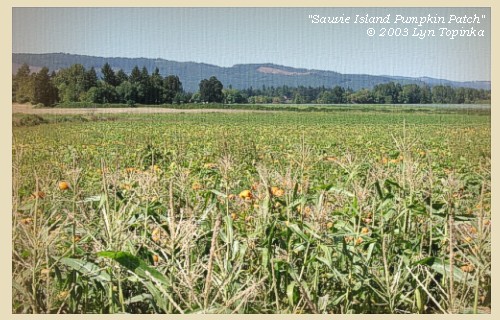
| Soon after our departure ...... We passed, also, several fishing camps, on Wappatoo island [Sauvie Island], |
| and then halted for breakfast on the north side of the river, near our camp of the 4th of November [in Ridgefield National Wildlife Refuge]. Here we were visited by several canoes from two villages on Wappatoo island [Sauvie Island]; the first, about two miles above us, is called Clahnaquah, the other a mile above them, has the name of Multnomah. ...... |
| "... about 5 miles Still higher up and on the N E. Side we halted for brackfast at the place which We had encamped the 4th of November last. here we were visited by several canoes of Indians from two Towns a Short distance above on the Wappato Island. ... at 10 a.m. we Set out and had not proceeded far before we came to a landing place where there was Several large canoes hauled up, and Sitting in a canoe, appaearantly waiting our arival with a view to join the fleet indian who was then along Side of us. this man informed he was a 'Shoto' and that his nation resided a little distance from the river. we landed an one of the indians pointed to the Shoto village which is Situated back of Pond which lies parrelal with the river on the N E. Side nearly opposit the Clan-nah quah village. ..." [Clark, March 30, 1806] |
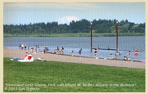
| Lewis and Clark are passing Sauvie Island on their right (left bank of the Columbia), and the Vancouver Lake area on their left (right bank of the Columbia). |
| There are good views of Mount St. Helens, Mount Adams, and Mount Hood from Vancouver Lake. On a clear day, Mount Rainier and Mount Jefferson can also be seen. |
|
|
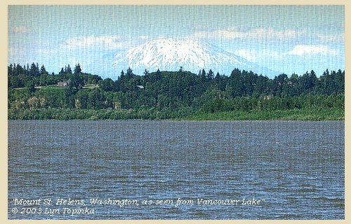
Mount St. Helens, Washington: as seen from Vancouver Lake, Washington. Copyright © 2003 Lyn Topinka, private archives, used with permission. 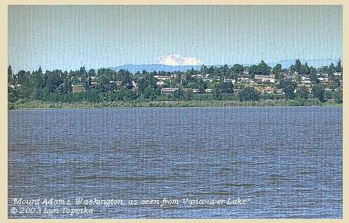
Mount Adams, Washington: as seen from Vancouver Lake, Washington. Copyright © 2003 Lyn Topinka, private archives, used with permission. 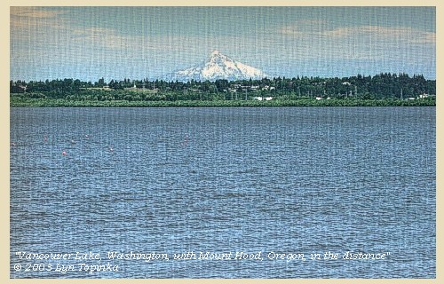
Mount Hood, Oregon: as seen from Vancouver Lake, Washington. Copyright © 2003 Lyn Topinka, private archives, used with permission. 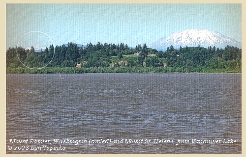
Mount Rainier, Washington (circled): as seen from Vancouver Lake, Washington. Copyright © 2003 Lyn Topinka, private archives, used with permission. 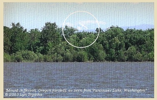
Mount Jefferson, Oregon (circled): as seen from Vancouver Lake, Washington. Copyright © 2003 Lyn Topinka, private archives, used with permission. |
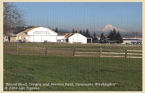
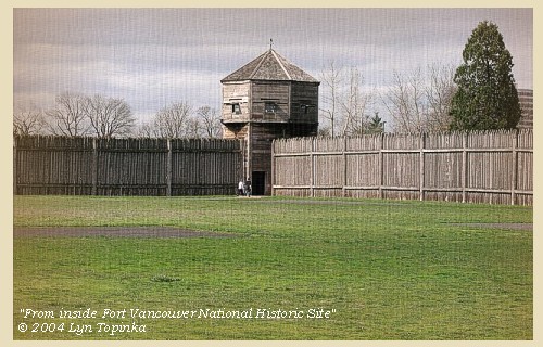
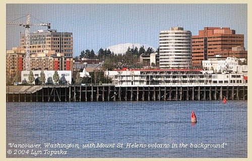
| About sunset we reached a beautiful prairie [Fort Plain, site of today's Vancouver, Washington, area around Fort Vancouver and Pearson Airpark, to Ryan Point], |
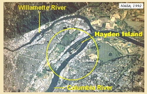
| opposite the middle of what we had called Image-canoe island [Hayden Island], |
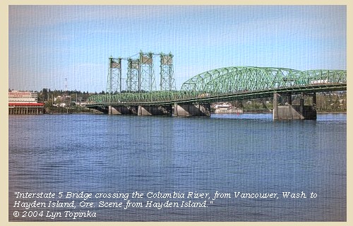
| Between 1915 and 1917, the Interstate-5 bridge was constructed, connecting Hayden Island, Oregon, with Vancouver, Washington. |
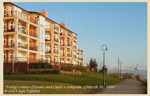
| and having made twenty-three miles, encamped for the night [downstream of Ryan Point, Washington, and upstream of the Interstate 5 Bridge]. In the prairie [Fort Plain] is a large pond or lake [one of the ponds near Fort Vancouver, now filled in], and an open grove of oak borders the back part. There are many deer and elk in the neighbourhood, but they are very shy, and the annual fern which is now abundant and dry, make such a rustling as the hunters pass through it, that they could not come within reach of the game, and we obtained nothing but a single duck. |
| "... Encamped in a Small Prarie above a large Pond on N. E and opposit the Center of image Canoe Island. ..." [Clark, March 30, 1806] |
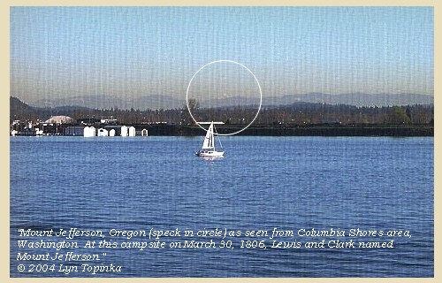
| " ... we made 22 Miles only to day the wind and a Strong current being against us all day, with rain. discovered a high mountain S E. Covered with Snow which we call Mt. Jefferson ..." [Clark, March 30, 1806] |
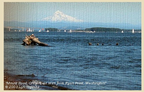
| " ... we had a view of mount St. helines and Mount Hood. the 1st is the most noble looking object of it's kind in nature. it's figure is a regular cone. both these mountains are perfectly covered with snow; at least the parts of them which are visible. ..." [Lewis, March 30, 1806] |
| " ... Saw mount rainey [Mount St. Helens] and Mount Hood which is verry white with Snow &C ..." [Ordway, March 30, 1806] |
| " ... We saw this day Mount Rainey [Mount St. Helens] & Mount hood; they appeared white & was covered with Snow. ..." [Whitehouse, March 30, 1806] |
|
|
|
The Camp - March 30, 1806:
Downstream of Ryan Point, Vancouver, Washington, and upstream of the Interstate 5 Bridge, at present-day Columbia River Drive and Columbia Shores Boulevard. This area is now covered with condominiums. |
| Home | Previous | Continue |
If you have questions or comments please contact: GS-CVO-WEB@usgs.gov
June/July 2004, Lyn Topinka
The Volcanoes of Lewis and Clark Home Page | CVO Home Page


