The Volcanoes of
Lewis and Clark
March 31, 1806
On the Banks of the Columbia - Ryan Point to Cottonwood Beach Camp
 
Home
The Volcanoes of Lewis and Clark

Map of the Journey
Volcanoes, Basalt Plateaus, Major Rivers, etc.

The Volcanoes
Mount Adams, Mount Hood, Mount Jefferson, Mount Rainier, and Mount St. Helens

CALENDAR of the Journey
October 1805 to June 1806

Along the Journey
Pacific Northwest Maps - Columbia River, Volcanoes, Flood Basalts, Missoula Floods, Geology, etc.

The Corps of Discovery
The Journey of Lewis and Clark

About the Reference Materials
The Journals, Biddle/Allen, DeVoto, Gass, Moulton, Topo Maps, and others

USGS Lewis and Clark Links
Links to USGS Websites highlighting the Lewis and Clark Journey

Resources
Publications Referenced and Websites Visited


PREVIOUS

March 30
Vancouver, Washington, Ridgefield NWR to Ryan Point
March 31

On the Banks of the Columbia,
Ryan Point to Cottonwood Beach Camp

Mount Hood, Portland International Airport, Government Island and Government Island State Recreation Area, Interstate 205 Bridge, Lady Island, Cottonwood Beach, Sandy River, Sandy River in 1805, Lewis and Clark State Recreation Area, Washougal River, Mount Hood
CONTINUE

April 1
Gathering Provisions, Cottonwood Beach Camp and the Sandy River
 

On October 7, 1805, Lewis and Clark and the "Corps of Discovery" began their journey down the Clearwater River and into the volcanics of the Pacific Northwest. The Corps travelled from the Clearwater to the Snake and down the "Great Columbia", finally reaching the Pacific Ocean on November 15, 1805. Along the journey they encountered the lava flows of the Columbia Plateau, river channels carved by the great "Missoula Floods", and the awesome beauty of five Cascade Range volcanoes.

Map, Lewis and Clark in the Pacific Northwest, click for brief
                         summary
[Click map for brief summary about the area]


Heading for Home - March 1806
On the Banks of the Columbia - Ryan Point to Cottonwood Beach Camp
 

Lewis and Clark's camp of March 30, 1806, downstream of Ryan Point, Vancouver, Washington, and upstream of the Interstate 5 Bridge, at present-day Columbia River Drive and Columbia Shores Boulevard. This area is now covered with condominiums.

Monday, March 31, 1806
We set out very early, and at eight o'clock landed on the north side of the river [Washington State] and breakfasted.

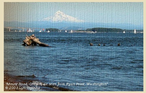
Mount Hood is visible along this stretch of the river.


Along the Journey - March 31, 1806
Mount Hood from Ryan Point

Mount Hood from Ryan Point:
Mount Hood, at 11,245 feet high, is the fourth highest peak in the Cascade Range and the highest in the state of Oregon. The peak dominates the skyline from the Portland, Oregon, metropolitan area to the wheat fields of Wasco and Sherman Counties of eastern Oregon.


Map, the Volcanoes of Lewis and Clark, click to enlarge Map, 1993, Mount Hood and Vicinity, click to enlarge Map, 1814, Lewis and Clark on the Columbia, click to enlarge Map, 1853, Washington and Oregon and the Columbia River, click to enlarge Map, 1855, Columbia River, Vancouver to the Pacific, click to enlarge Map, 1860, Columbia River, Washington, Oregon, click to enlarge Image, Mount Hood, Oregon, as seen from Timberline, click to enlarge Image, 2004, Mount Hood from Ryan Point, March 30, 1806
  1. Map, "Lewis and Clark Volcano Sitings"
  2. 1993 Map, Mount Hood and Vicinity, showing river drainages which flow into the Columbia river. (Click to enlarge). Includes Hood River and the Sandy River. Map modified from: Brantley and Scott, 1993.
  3. 1814 Map, Lewis and Clark's map of the Columbia River (section of original). (Click to enlarge.) Map includes three of the five volcanoes Lewis and Clark saw and commented on. While the journals mention the expedition seeing Mount Adams, it does not appear on their map. Mount Jefferson is to the south (bottom) and off the map. From the "Nicholas Biddle/Paul Allen" 1814 publication. Original Map: "A Map of Lewis and Clark's Track, Across the Western Portion of North America, From the Mississippi to the Pacific Ocean". From: History of the expedition under the command of Captains Lewis and Clark : to the sources of the Missouri, thence across the Rocky Mountains and down the river Columbia to the Pacific Ocean : performed during the years 1804-5-6 : by order of the government of the United States / prepared for the press by Paul Allen. Philadelphia : Bradford and Insskeep, 1814. Harold B. Lee Library, Brigham Young University #upbover maps37. -- Brigham Young University, Harold B. Lee Library Website, 2004.
  4. 1853 Map, Washington and Oregon and the Columbia River, from the Clearwater River to the Snake River and down the Columbia River to the Pacific Ocean (section of original). (Click to enlarge). Includes: Clearwater River (Kooskooski), Lapwai Creek (Lapwai R.), Snake River (Saptin or Lewis R.), Columbia River (Columbia R.), Yakima River (Yakima R.), Walla Walla River (Wallawalla R.), Umatilla River (Umatilla R.), Willow Creek (Quesnells R.), John Day River (John day's R.), Deschutes River (Fall R.), Willamette River (Willammette R.), and Cowlitz River (Cowlitz R.). Original Map: "Map of California, Oregon, Washington, Utah, and New Mexico (1853)", by Thomas Cowperthwait & Co. Washington State University Archives #WSU22. -- Washington State University Library Collections Website, 2003
  5. 1855 Map, Columbia River from Vancouver to the Pacific, including Mount St. Helens (section of original). (Click to enlarge). Original Map: "Map of Oregon and Washington Territories: showing the proposed Northern Railroad route to the Pacific Ocean, by John Disturnell, 1855. University of Washington Archives #UW155. -- University of Washington Library Collections Website, 2002
  6. 1860 Map, Columbia River, Washington State, and Oregon (section of original). (Click to enlarge). Original Map: Map of Oregon, Washington, and British Columbia, (1860). This map dates between March 2nd, 1861 (when the Dakota Territory was formed) and March 4th, 1863 (when the Idaho Territory was formed from eastern Washington and western Dakota) Nearing retirement from a thirty year long and rather successful career, S. Augustus Mitchell printed this map showcasing Oregon, the Territory of Washington, and British Columbia. Washington became a territory in 1853, arguing that distances to Willamette Valley kept them from obtaining a voice in the Oregon territorial government. As this map shows, when it split from Oregon proper the Washington territory included parts of Wyoming and Montana and all of Idaho. Territorial government for Idaho would not be approved until 1863. When Mitchell retired he left the business for his son to manage. Washington State University Archives #WSU7. -- Washington State University Archives, 2004
  7. Image, Mount Hood, Oregon, as seen from Timberline parking lot. (Click to enlarge). Photographer: Lyn Topinka. -- USGS Cascades Volcano Observatory Photo Archives, 2004
  8. 2003, Mount Hood, Oregon, as seen from Ryan Point, Washington. (Click to enlarge). Copyright © 2003 Lyn Topinka, private archives, used with permission.


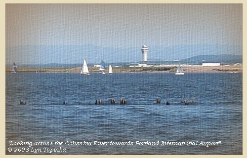
Directly opposite is a large wooden house, belonging to the Shahala nation, [location near today's Portland International Airport, Portland, Oregon] the inhabitants of which came over to see us. We had observed in descending the river last year [November 4, 1805], that there were at the same place, twenty-four other houses built of wood and covered with straw, all of which are now destroyed: on inquiry the Indians informed us, that their relations whom we saw last fall, usually visit them at that season for the purpose of hunting deer and elk, and collecting wappatoo, but that they had lately returned to their permanent residence at the Rapids, we presume in order to prepare for the salmon season, as that fish will soon begin to run.


Along the Journey - March 31, 1806
Columbia River and Portland International Airport, 2003

Portland International Airport:
Today's Portland International Airport (PDX) was the former site of a Neerchokioo village, used by the Shahala Indians as a temporary residence for gathering wapato, a potato-like water root. Visited twice by Lewis and Clark, the site is now under the airport parking structure. PDX is located 10 miles east of downtown Portland, Oregon. -- Lewis and Clark Bicentennial in Oregon Website, 2002


Map, 1985, Hayden Island to Portland International Airport, click to enlarge Image, 2003, Portland International Airport, Portland, Oregon
  1. 1985 Map, Hayden Island to Portland International Airport (section of original). (Click to enlarge). Includes Vancouver, Washington, Interstate 5 Bridge, Hayden and Tomahawk Islands, Ryan Point, and Portland International Airport (PDX). Office of Coast Surveys, Historical Maps and Charts, Columbia River, Vancouver to Bonneville, 1985, Chart#18531, 1:40,000. -- NOAA Office of Coast Survey Website, 2004
  2. 2003, Looking across the Columbia River towards Portland International Airport, Portland, Oregon. (Click to enlarge). Image shot from Ryan Point, Washington. Copyright © 2003 Lyn Topinka, private archives, used with permission.


At ten o'clock we resumed our route along the north side of the river, and having passed Diamond island [Government Island],


Along the Journey - March 31, 1806
Government Island, 2003

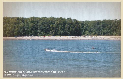
Government Island and Government Island State Recreation Area:
In 1805 Lewis and Clark reached a cluster of Islands - the easternmost one they called "Diamond Island" because of it's shape. Their camp of November 3, 1805 was on this island. Today, the largest island in this cluster is known as Government Island, a name acquired when the military grazed cattle on the island. Government, Lemon, and McGuire Islands are located in the Columbia River northeast of Portland International Airport between Columbia River River Mile 111.5 and River Mile 119. The island complex, consists of approximately 2,200 acres. Access to Government Island is by boat only. There are two docks and a floating tie-up on the north side of the island. With 15 miles of shoreline and a free primitive campground, the park is popular with anglers. The interior of the island is still used as a cattle ranch and also contains protected natural areas. Entry to the interior is prohibited. -- Port of Portland Website, 2002, and Oregon State Parks and Recreation Website, 2003


Map, 1887, Camas and Washougal vicinity, click to enlarge Map, 1985, Government Island, click to enlarge NASA Image, 1992, Columbia River with Portland, Oregon, and Vancouver, Washington, click to enlarge NASA Image, 1992, Columbia River and Government Island, click to enlarge Image, 2003, Government Island Image, 2003, Interstate 205 Bridge
  1. 1887 Map (section of original), Columbia River and the Camas and Washougal vicinity, including Government Island. (Click to enlarge). Government Island, while not named on this map, is the large island located to the left of Lady Island, the island located at the mouth of the Washougal River. Original Map: The Columbia River from Celilo to the mouth showing locations of the salmon fisheries, 1887. Scale ca. 1:375,000, Relief shown by hachures. U.S. Army Corps of Engineers, Engineer Office, G.P.O. 1888. University of Washington Archives #UW128. -- University of Washington Library Archives Website, 2002
  2. 1985 Map, Government Island (section of original). (Click to enlarge). Office of Coast Surveys, Historical Maps and Charts, Columbia River, Vancouver to Bonneville, 1985, Chart#18531, 1:40,000. -- NOAA Office of Coast Survey Website, 2004
  3. 1992, NASA Image, Columbia River, Portland, Oregon, and Vancouver, Washington (section of original). (Click to enlarge). View from space - west-looking, low-oblique photograph, showing a section of the Columbia River with Government Island, the Sandy River, Portland, Oregon, and Vancouver, Washington, September 1992. The Columbia River is flowing from bottom (east) to top (west). NASA Earth from Space #STS047-096-066. -- NASA Earth from Space Website, 2002
  4. 1992, NASA Image, Columbia River and Government Island (section of original). (Click to enlarge). View from space - West-looking, low-oblique photograph, showing a section of the Columbia River with Government Island, September 1992. Interstate 205 (white line, center) can be seen crossing Government Island from Portland, Oregon (left) to Vancouver, Washington (right). NASA Earth from Space #STS047-096-066. -- NASA Earth from Space Website, 2002
  5. 2003, Government Island and Government Island State Recreation Area. (Click to enlarge). Copyright © 2003 Lyn Topinka, private archives, used with permission.
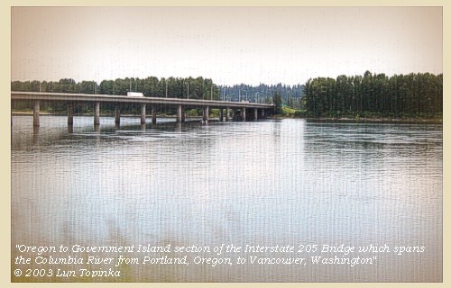
  6. 2003, Government Island and the Interstate 205 Bridge. (Click to enlarge). The Interstate 205 bridge connects Portland, Oregon, with Vancouver, Washington, and crosses Government Island. Copyright © 2003 Lyn Topinka, private archives, used with permission.


Interstate 205 Bridge, 2003

Interstate-205 Bridge:
In 1982, the Interstate-205 Bridge was completed, spanning the Columbia River from Portland, Oregon, to Vancouver, Washington. Part of the bridge crosses Government Island.


Map, 1985, Government Island, click to enlarge Image, 2003, Interstate 205 Bridge
  1. 1985 Map, Government Island (section of original). (Click to enlarge). Office of Coast Surveys, Historical Maps and Charts, Columbia River, Vancouver to Bonneville, 1985, Chart#18531, 1:40,000. -- NOAA Office of Coast Survey Website, 2004
  2. 2003, Government Island and the Interstate 205 Bridge. (Click to enlarge). The Interstate 205 bridge connects Portland, Oregon, with Vancouver, Washington, and crosses Government Island. Copyright © 2003 Lyn Topinka, private archives, used with permission.


and Whitebrant island [Lady Island],


Along the Journey - March 31, 1806
Lady Island, 2003

Lady Island:
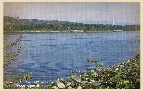
Lady Island was given two names by Lewis and Clark. On the draft map the island was labeled "Fowls I", but on the route map the island was labeled "White Brant Isld", after the lesser snow goose. Previously in 1792, Lieutentant William Broughton had named the island "Johnstone Island". The present name is for Joseph Lady, who in 1853 had a land claim on the island. Today Lady Island is part of the Camas Mill, a pulp and paper manufacturing complex that is bound on three sides by the City of Camas, Washington. A little over a quarter of the mill site lies north of the Camas Slough (an arm of the Columbia River that connects to the Washougal River). The rest of the mill resides on Lady Island which is situated directly south of the slough and fronts the Columbia River. The wastewater treament system and a solid waste landfill are located on Lady Island. -- Washington State Historical Society Website, 2002, and Washington State Department of Ecology Website, 2003


Map, 1887, Camas and Washougal vicinity, click to enlarge Map, 1985, Lady Island, Washougal River, Sandy River, click to enlarge NASA Image, 1992, Columbia River and the Sandy River area, click to enlarge Image, 2003, Lady Island
  1. 1887 Map (section of original), Columbia River and the Camas and Washougal vicinity, including Lady Island. (Click to enlarge). Lady Island, while not named on this map, is the island located at the mouth of the Washougal River, by the town of "La Camas", today's Camas, Washington. Original Map: The Columbia River from Celilo to the mouth showing locations of the salmon fisheries, 1887. Scale ca. 1:375,000, Relief shown by hachures. U.S. Army Corps of Engineers, Engineer Office, G.P.O. 1888. University of Washington Archives #UW128. -- University of Washington Library Archives Website, 2002
  2. 1985 Map, Lady Island, Washougal River, Sandy River. (Click to enlarge). Office of Coast Surveys, Historical Maps and Charts, Columbia River, Vancouver to Bonneville, 1985, Chart#18531, 1:40,000. -- NOAA Office of Coast Survey Website, 2004
  3. 1992, NASA Image, Columbia River and the Sandy River area (section of original). (Click to enlarge). View from space - west-looking, low-oblique photograph, showing a section of the Columbia River with Government Island, Lady Island, Reed Island, Sandy River, Washougal River, Cottonwood Beach, and Portland, Oregon and Vancouver, Washington, September 1992. The Columbia River is flowing from bottom (east) to top (west). NASA Earth from Space #STS047-096-066. -- NASA Earth from Space Website, 2002
  4. 2003, Lady Island from across the Columbia River. (Click to enlarge). The plume from the Camas Pulp Mill is visible on the right. Image taken from Chinook Landing, Oregon. Copyright © 2003 Lyn Topinka, private archives, used with permission.


halted for the night at the lower point of a handsome prairie [near Cottonwood Beach, Washougal, Washington].


Along the Journey - March 31, 1806
Cottonwood Beach, 2003

Cottonwood Beach:
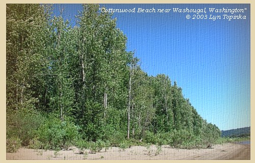
Between March 31 and April 5, 1806 the Corps of Discovery camped near present day Cottonwood Beach in Washougal. From this campsite, William Clark also led a group of men back down the Columbia to discover the Willamette River, which they had missed on both their outward and return voyages. Presently, the cities of Washougal and Camas, Port of Camas/Washougal, and the Clark County Parks Department, are collaborating on creating a regional park at this location and it has been named Capt. William Clark Park at Cottonwood Beach. -- City of Washougal, Washington, Website, 2002


Map, 1948, Reed Island, Steigerwald Lake, Cottonwood Point, and Point Vancouver, click to enlarge Map, 1948, Reed Island, Steigerwald Lake, Cottonwood Point, and Point Vancouver, click to enlarge NASA Image, 1992, Columbia River and the Sandy River area, click to enlarge Image, 2003, Cottonwood Beach
  1. 1948 Map, Columbia River with Reed Island, Steigerwald Lake, Cottonwood Point, and Point Vancouver. (Click to enlarge). Cottonwood Beach is downstream (left) of Cottonwood Point. Office of Coast Surveys, Historical Maps and Charts, Columbia River, Vancouver to Bonneville, 1948, Chart#6156, 1:40,000. -- NOAA Office of Coast Survey Website, 2004
  2. 1985 Map (section of original), Reed Island, Steigerwald Lake, Cottonwood Point, and Point Vancouver. (Click to enlarge). Cottonwood Beach is downstream (left) of Cottonwood Point. Office of Coast Surveys, Historical Maps and Charts, Columbia River, Vancouver to Bonneville, 1985, Chart#18531, 1:40,000. -- NOAA Office of Coast Survey Website, 2004
  3. 1992, NASA Image, Columbia River and the Sandy River area (section of original). (Click to enlarge). View from space - west-looking, low-oblique photograph, showing a section of the Columbia River with Government Island, Lady Island, Reed Island, Sandy River, Washougal River, Cottonwood Beach, and Portland, Oregon and Vancouver, Washington, September 1992. The Columbia River is flowing from bottom (east) to top (west). NASA Earth from Space #STS047-096-066. -- NASA Earth from Space Website, 2002
  4. 2003, Cottonwood Beach, near Washougal, Washington. (Click to enlarge). Copyright © 2003 Lyn Topinka, private archives, used with permission.


Our camp [Cottonwood Beach] which is twenty-five miles from that of last night [downstream of Ryan Point, Vancouver, Washington], is situated opposite to the upper entrance of Quicksand river: [Sandy River]


Along the Journey - March 31, 1806
Sandy River, Oregon, 2003

Sandy River:
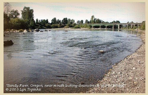
The Sandy River Basin is located within Multnomah and Clackamas Counties in Oregon, and drains an area of about 508 square miles. The Sandy and many of its tributaries originate high on the slopes of Mount Hood, and then flows approximately 56 miles in a northwesterly direction to join the Columbia River near Troutdale, Oregon, at Columbia River Mile (RM) 120.5. The Sandy River Basin is comprised of several watersheds, many of which are uniquely distinct in terms of hydrology and geomorphology. Principal tributaries include the ZigZag River, Still Creek and Salmon River in the Upper Basin, and the Bull Run River, Little Sandy River, Gordon Creek, Cedar Creek and Beaver Creek in the Lower Basin. Many other smaller tributaries located throughout the basin contribute significantly to stream flows, and provide habitat for a wide array of fish and wildlife. Where the Sandy and Columbia Rivers merge, sediments have deposited over the years to form a large delta, called the Sandy River Delta, which covers approximately 1,400 acres. This area was designated a Special Management Area in 1986 and was purchased by the U.S. Forest Service (USFS) in 1991. It is now part of the Columbia River Gorge Scenic Area. The Sandy River Delta was acquired to protect and enhance the natural resource values of the site, particularly the floodplain character and associated wetlands and to provide for compatible recreation uses. The mouth of the Sandy River is typically shallow and underlain almost entirely with sand and other fine sediments, and is influenced by tidal effects. -- Columbia Basin Fish and Wildlife Authority Website, 2003


Map, 1993, Mount Hood and Vicinity, click to enlarge Map, 1814, Lewis and Clark on the Columbia, click to enlarge Map, 1833, Illman and Pilbrow, Columbia River, click to enlarge Map, 1887, Camas and Washougal vicinity, click to enlarge Map, 1948, Lady Island, Washougal River, Sandy River, click to enlarge Map, 1985, Lady Island, Washougal River, Sandy River, click to enlarge NASA Image, 1992, Columbia River with Portland, Oregon, and Vancouver, Washington, click to enlarge NASA Image, 1992, Columbia River and the Sandy River area, click to enlarge Image, 2003, Sandy River, Oregon
  1. 1993 Map, Mount Hood and Vicinity, showing river drainages which flow into the Columbia river. (Click to enlarge). Includes Hood River and the Sandy River. Map modified from: Brantley and Scott, 1993.
  2. 1814 Map, Lewis and Clark's map of the Columbia River (section of original). (Click to enlarge.) Shows the Sandy River ("Quicksand R."). Map also includes three of the five volcanoes Lewis and Clark saw and commented on. While the journals mention the expedition seeing Mount Adams, it does not appear on their map. Mount Jefferson is to the south (bottom) and off the map. From the "Nicholas Biddle/Paul Allen" 1814 publication. Original Map: "A Map of Lewis and Clark's Track, Across the Western Portion of North America, From the Mississippi to the Pacific Ocean". From: History of the expedition under the command of Captains Lewis and Clark : to the sources of the Missouri, thence across the Rocky Mountains and down the river Columbia to the Pacific Ocean : performed during the years 1804-5-6 : by order of the government of the United States / prepared for the press by Paul Allen. Philadelphia : Bradford and Insskeep, 1814. Harold B. Lee Library, Brigham Young University #upbover maps37. -- Brigham Young University, Harold B. Lee Library Website, 2004.
  3. 1833 Map (section of original), Columbia River. (Click to enlarge). Includes Mount Hood and Mount Jefferson. Note: Mount Baker is depicted (upper middle) but Mounts Adams, Rainier and St. Helens are missing. The Columbia River is shown as "Oregon River" at its mouth and "Columbia or Oregon R." further inland. "Wappatoo Valley" is labeled. Also shows Fort Clatsop ("F. Clatsop or F. George"), the Willamette River ("Multnomah R."), Sandy River ("Quicksand R."), John Day River ("R.La Page"), Walla Walla River ("Wallwullah R."), Snake River ("Lewis R."), and the Yakima River ("Tapete R."). Original Map: Oregon Territory, 1833. Creator: Illman & Pilbrow, published by Illman & Pilbrow, New York. Comments: Illman & Pilbrow is the engraving firm which copyrighted and published this map, the actual artist is unknown. Washington State University Digital Maps Collection #WSU323. University of Washington Digital Maps Collection #UW104. -- Washington State University Early Washington Maps Digital Collection Website, 2004
  4. 1887 Map (section of original), Columbia River and the Camas and Washougal vicinity, including the Sandy River. (Click to enlarge). Original Map: The Columbia River from Celilo to the mouth showing locations of the salmon fisheries, 1887. Scale ca. 1:375,000, Relief shown by hachures. U.S. Army Corps of Engineers, Engineer Office, G.P.O. 1888. University of Washington Archives #UW128. -- University of Washington Library Archives Website, 2002
  5. 1948 Map, Lady Island, Washougal River, Sandy River. (Click to enlarge). Office of Coast Surveys, Historical Maps and Charts, Columbia River, Vancouver to Bonneville, 1948, Chart#6156, 1:40,000. -- NOAA Office of Coast Survey Website, 2004
  6. 1985 Map, Lady Island, Washougal River, Sandy River. (Click to enlarge). Office of Coast Surveys, Historical Maps and Charts, Columbia River, Vancouver to Bonneville, 1985, Chart#18531, 1:40,000. -- NOAA Office of Coast Survey Website, 2004
  7. 1992, NASA Image, Columbia River, Portland, Oregon, and Vancouver, Washington (section of original). (Click to enlarge). View from space - west-looking, low-oblique photograph, showing a section of the Columbia River with Government Island, the Sandy River, Portland, Oregon, and Vancouver, Washington, September 1992. The Columbia River is flowing from bottom (east) to top (west). NASA Earth from Space #STS047-096-066. -- NASA Earth from Space Website, 2002
  8. 1992, NASA Image, Columbia River and the Sandy River area (section of original). (Click to enlarge). View from space - west-looking, low-oblique photograph, showing a section of the Columbia River with Government Island, Lady Island, Reed Island, Sandy River, Washougal River, Cottonwood Beach, and Portland, Oregon and Vancouver, Washington, September 1992. The Columbia River is flowing from bottom (east) to top (west). NASA Earth from Space #STS047-096-066. -- NASA Earth from Space Website, 2002
  9. 2003, Sandy River, Oregon, near the mouth, looking downstream towards the Interstate 84 Bridge. (Click to enlarge). Copyright © 2003 Lyn Topinka, private archives, used with permission.


The Sandy River in 1805:
In 1805, Meriwether Lewis and William Clark named a river on the south side of the Columbia River gorge the "Quicksand River." Their description of a wide, shallow river with a bed "formed entirely of quicksand," bears little resemblance to the narrow, moderately deep river we call today the Sandy River. What happened? The answer lay 50 miles away at Mount Hood. An eruption in the 1790's caused a tremendous amount of volcanic rock and sand to enter the Sandy River drainage. That sediment was still being flushed downstream when Lewis and Clark saw and named the river. Since 1806, the river has removed the excess sediment from its channel. The Toutle River in southwest Washington was similarly affected by the 1980 eruptions of Mount St. Helens. -- Gardner, et.al., 2000


Lewis and Clark State Recreation Area:
Located at the western gateway of the Columbia River Gorge, the Lewis and Clark State Recreation Area honors its legendary namesakes who camped and explored here in November, 1805 and March/April 1806. The park is situated near the mouth of the Sandy River where it spills into the mighty Columbia River and at one of the entrances to the Historic Columbia River Highway. One of the most popular swimming spots on the Sandy River is adjacent to the park, as well as a public boat launch. A trail climbs the cliffs to Broughton's Bluff, which serves as a geologic boundary between the foothills of the Cascade Mountain Range and the neighboring Willamette Valley to the west. The park has interpretive signs and botanical trail. -- Lewis and Clark Bicentennial in Oregon Website, 2002, and Oregon State Parks and Recreation Website, 2002


a little below a stream from the north empties itself into the Columbia [Washougal River], near the head of Whitebrant island [Lady Island] It is about eighty yards wide, and at present discharges a large body of very clear water, which near the Columbia overflows its low banks, and forms several large ponds. The natives inform us that this river is of no great extent, and rises in the mountains near us, and that at a mile from its mouth it is divided into two nearly equal branches, both of which are incapable of being navigated, on account of their numerous falls and rapids. Not being able to learn any Indian name, we called it Seal river [Washougal River], from the abundance of those animals near its mouth. At the same place we saw a summer duck, or a wood duck, as it is sometimes called; it is the same with those of the United States, and the first we had seen since entering the Rocky mountains last summer. The hunters who had been obliged to halt below Seal river [Washougal River] on account of the waves being too high for their small canoe, returned after dark with the unwelcome news that game was scarce in that quarter.


Along the Journey - March 31, 1806
Washougal River, Washington, 2003

Washougal River:
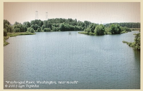
The Washougal River is located in southwest Washington, originating in Skamania County and flowing southwesterly into Clark County, joining the Columbia River at River Mile (RM) 121 at the town of Camas. The Washougal and Salmon Creek watersheds to the west encompasses approximately 240 square miles. This region lies in a geographical area known as the Willamette-Puget Trough, formed by the Cascade and Pacific Coast Mountain ranges. The towns of Camas and Washougal are located on the short confined floodplain at the mouth of the Washougal River. To the north and east of Washougal, the older rocks belong to several geologic formations, including the Skamania Volcanics and the Columbia River basalt group. West of Washougal, a thick sequence of sediments, deposited during the Miocene through the Pleistocene epochs, fills a structural basin formed during faulting and downwarping of the older rocks. These sediments belong to several geologic formations, including the Sandy River mudstone and the Troutdale Formation, both of Eocene age. During the late Pleistocene time, large quantities of sediments were deposited over the Troutdale Formation. -- Columbia Basin Fish and Wildlife Authority Website, 2003


Map, 1814, Lewis and Clark on the Columbia, click to enlarge Map, 1887, Camas and Washougal vicinity, click to enlarge Map, 1985, Lady Island, Washougal River, Sandy River, click to enlarge NASA Image, 1992, Columbia River and the Sandy River, click to enlarge Image, ca.1907, Washougal River Bridge, click to enlarge Image, 2003, Washougal River, near mouth
  1. 1887 Map (section of original), Columbia River and the Camas and Washougal vicinity, including the Sandy River. (Click to enlarge). Original Map: The Columbia River from Celilo to the mouth showing locations of the salmon fisheries, 1887. Scale ca. 1:375,000, Relief shown by hachures. U.S. Army Corps of Engineers, Engineer Office, G.P.O. 1888. University of Washington Archives #UW128. -- University of Washington Library Archives Website, 2002
  2. 1814 Map, Lewis and Clark's map of the Columbia River (section of original). (Click to enlarge.) Shows the Washougal River ("Seal R."). Map also includes three of the five volcanoes Lewis and Clark saw and commented on. While the journals mention the expedition seeing Mount Adams, it does not appear on their map. Mount Jefferson is to the south (bottom) and off the map. From the "Nicholas Biddle/Paul Allen" 1814 publication. Original Map: "A Map of Lewis and Clark's Track, Across the Western Portion of North America, From the Mississippi to the Pacific Ocean". From: History of the expedition under the command of Captains Lewis and Clark : to the sources of the Missouri, thence across the Rocky Mountains and down the river Columbia to the Pacific Ocean : performed during the years 1804-5-6 : by order of the government of the United States / prepared for the press by Paul Allen. Philadelphia : Bradford and Insskeep, 1814. Harold B. Lee Library, Brigham Young University #upbover maps37. -- Brigham Young University, Harold B. Lee Library Website, 2004.
  3. 1985 Map, Lady Island, Washougal River, Sandy River. (Click to enlarge). Office of Coast Surveys, Historical Maps and Charts, Columbia River, Vancouver to Bonneville, 1985, Chart#18531, 1:40,000. -- NOAA Office of Coast Survey Website, 2004
  4. 1992, NASA Image, Columbia River and the Sandy River area (section of original). (Click to enlarge). View from space - west-looking, low-oblique photograph, showing a section of the Columbia River with Government Island, Lady Island, Reed Island, Sandy River, Washougal River, Cottonwood Beach, and Portland, Oregon and Vancouver, Washington, September 1992. The Columbia River is flowing from bottom (east) to top (west). NASA Earth from Space #STS047-096-066. -- NASA Earth from Space Website, 2002
  5. ca.1907, Washoughal River Bridge. (Click to enlarge). This 180-foot span steel bridge crosses the Washougal River. Image from the 1906-1908 Biennial Report. -- Washington State Department of Transportation Website, 2003
  6. 2003, Washougal River, Washington, near mouth. (Click to enlarge). Image taken looking downstream from 6th Street Bridge. Copyright © 2003 Lyn Topinka, private archives, used with permission.


" ... The three Indians encamped near us and visited our fire we entered into a kind of a Conversation by signs, of the Country and Situation of the rivers. they informed us that Seal river headed in the mountains at no great distance. quick Sand river was Short only headed in Mt. Hood which is in view and to which he pointed. this is a circumstance we did not expect as we had heretofore deemed a comsiderable river. ..." [Clark, March 31, 1806]
" ... Mount Hood bears East from this place and is distant from this place about 40 miles. ..." [Clark, March 31, 1806]


Along the Journey - March 31, 1806
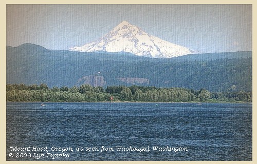
Mount Hood, Oregon, as seen from Washougal, Washington, 2003

Mount Hood:
Mount Hood, at 11,245 feet high, is the fourth highest peak in the Cascade Range and the highest in the state of Oregon. The peak dominates the skyline from the Portland, Oregon, metropolitan area to the wheat fields of Wasco and Sherman Counties of eastern Oregon.


Map, the Volcanoes of Lewis and Clark, click to enlarge Map, 1993, Mount Hood and Vicinity, click to enlarge Map, 1814, Lewis and Clark on the Columbia, click to enlarge Map, 1853, Washington and Oregon and the Columbia River, click to enlarge Map, 1855, Columbia River, Vancouver to the Pacific, click to enlarge Map, 1860, Columbia River, Washington, Oregon, click to enlarge Image, Mount Hood, Oregon, as seen from Timberline, click to enlarge Image, 2003, Mount Hood, Oregon, from Washougal, Washington
  1. Map, "Lewis and Clark Volcano Sitings"
  2. 1993 Map, Mount Hood and Vicinity, showing river drainages which flow into the Columbia river. (Click to enlarge). Includes Hood River and the Sandy River. Map modified from: Brantley and Scott, 1993.
  3. 1814 Map, Lewis and Clark's map of the Columbia River (section of original). (Click to enlarge.) Map includes three of the five volcanoes Lewis and Clark saw and commented on. While the journals mention the expedition seeing Mount Adams, it does not appear on their map. Mount Jefferson is to the south (bottom) and off the map. From the "Nicholas Biddle/Paul Allen" 1814 publication. Original Map: "A Map of Lewis and Clark's Track, Across the Western Portion of North America, From the Mississippi to the Pacific Ocean". From: History of the expedition under the command of Captains Lewis and Clark : to the sources of the Missouri, thence across the Rocky Mountains and down the river Columbia to the Pacific Ocean : performed during the years 1804-5-6 : by order of the government of the United States / prepared for the press by Paul Allen. Philadelphia : Bradford and Insskeep, 1814. Harold B. Lee Library, Brigham Young University #upbover maps37. -- Brigham Young University, Harold B. Lee Library Website, 2004.
  4. 1853 Map, Washington and Oregon and the Columbia River, from the Clearwater River to the Snake River and down the Columbia River to the Pacific Ocean (section of original). (Click to enlarge). Includes: Clearwater River (Kooskooski), Lapwai Creek (Lapwai R.), Snake River (Saptin or Lewis R.), Columbia River (Columbia R.), Yakima River (Yakima R.), Walla Walla River (Wallawalla R.), Umatilla River (Umatilla R.), Willow Creek (Quesnells R.), John Day River (John day's R.), Deschutes River (Fall R.), Willamette River (Willammette R.), and Cowlitz River (Cowlitz R.). Original Map: "Map of California, Oregon, Washington, Utah, and New Mexico (1853)", by Thomas Cowperthwait & Co. Washington State University Archives #WSU22. -- Washington State University Library Collections Website, 2003
  5. 1855 Map, Columbia River from Vancouver to the Pacific, including Mount St. Helens (section of original). (Click to enlarge). Original Map: "Map of Oregon and Washington Territories: showing the proposed Northern Railroad route to the Pacific Ocean, by John Disturnell, 1855. University of Washington Archives #UW155. -- University of Washington Library Collections Website, 2002
  6. 1860 Map, Columbia River, Washington State, and Oregon (section of original). (Click to enlarge). Original Map: Map of Oregon, Washington, and British Columbia, (1860). This map dates between March 2nd, 1861 (when the Dakota Territory was formed) and March 4th, 1863 (when the Idaho Territory was formed from eastern Washington and western Dakota) Nearing retirement from a thirty year long and rather successful career, S. Augustus Mitchell printed this map showcasing Oregon, the Territory of Washington, and British Columbia. Washington became a territory in 1853, arguing that distances to Willamette Valley kept them from obtaining a voice in the Oregon territorial government. As this map shows, when it split from Oregon proper the Washington territory included parts of Wyoming and Montana and all of Idaho. Territorial government for Idaho would not be approved until 1863. When Mitchell retired he left the business for his son to manage. Washington State University Archives #WSU7. -- Washington State University Archives, 2004
  7. Image, Mount Hood, Oregon, as seen from Timberline parking lot. (Click to enlarge). Photographer: Lyn Topinka. -- USGS Cascades Volcano Observatory Photo Archives, 2004
  8. 2003, Mount Hood, Oregon, as seen from Washougal, Washington, across from the mouth of the Sandy River, Oregon. (Click to enlarge). Copyright © 2003 Lyn Topinka, private archives, used with permission.


Along the Journey - March 31, 1806
The Camp - March 31 through April 5, 1806:
Cottonwood Beach, Washougal, Washington.


Home Previous Continue


If you have questions or comments please contact: GS-CVO-WEB@usgs.gov
June/July 2004, Lyn Topinka
The Volcanoes of Lewis and Clark Home Page | CVO Home Page