The Volcanoes of
Lewis and Clark
March 29, 1806
Heading Home - Deer Island to Ridgefield
 
Home
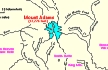
The Volcanoes of Lewis and Clark

Map of the Journey
Volcanoes, Basalt Plateaus, Major Rivers, etc.

The Volcanoes
Mount Adams, Mount Hood, Mount Jefferson, Mount Rainier, and Mount St. Helens

CALENDAR of the Journey
October 1805 to June 1806

Along the Journey
Pacific Northwest Maps - Columbia River, Volcanoes, Flood Basalts, Missoula Floods, Geology, etc.

The Corps of Discovery
The Journey of Lewis and Clark

About the Reference Materials
The Journals, Biddle/Allen, DeVoto, Gass, Moulton, Topo Maps, and others

USGS Lewis and Clark Links
Links to USGS Websites highlighting the Lewis and Clark Journey

Resources
Publications Referenced and Websites Visited


PREVIOUS

March 25-28
Heading Home, Puget Island to Deer Island
March 29

Heading Home,
Deer Island to Ridgefield NWR

Deer Island, Puget Trough and Willamette Valley and the Boring Lava Field, St. Helens (Oregon) and Mount St. Helens, Mount Hood, and Mount Adams, Multnomah Channel, Sauvie Island, Lewis River, Bachelor Island, Ridgefield NWR
CONTINUE

March 30
Vancouver, Washington, Sauvie Island to Vancouver, Washington
 

On October 7, 1805, Lewis and Clark and the "Corps of Discovery" began their journey down the Clearwater River and into the volcanics of the Pacific Northwest. The Corps travelled from the Clearwater to the Snake and down the "Great Columbia", finally reaching the Pacific Ocean on November 15, 1805. Along the journey they encountered the lava flows of the Columbia Plateau, river channels carved by the great "Missoula Floods", and the awesome beauty of five Cascade Range volcanoes.

Map, Lewis and Clark in the Pacific Northwest, click for brief
                         summary
[Click map for brief summary about the area]


Heading for Home - March 1806
Back on the Columbia - Deer Island to Ridgefield
 

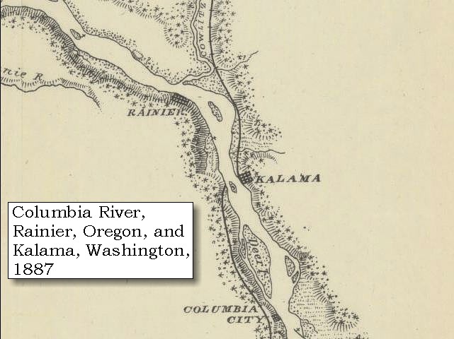
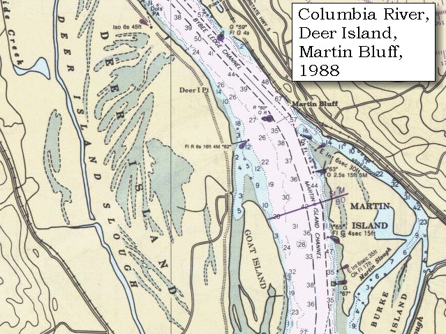
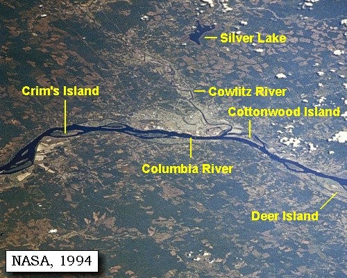
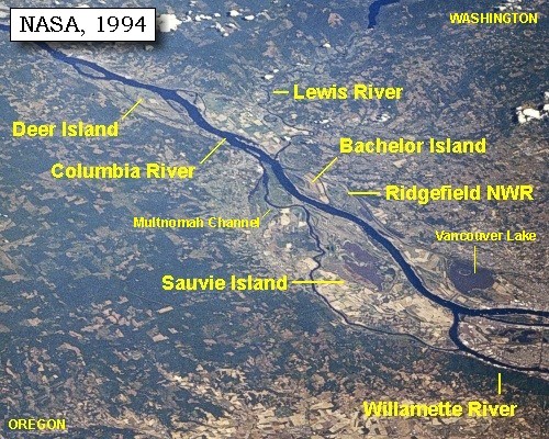
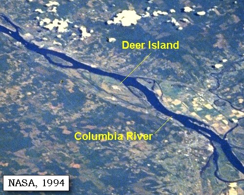
Lewis and Clark's camp of March 28, 1806, was on the eastern shore of Deer Island, towards the downstream tip.

Saturday, March 29, 1806
At an early hour we proceeded along the side of Deer island [Deer Island (Elallah Island)], and halted for breakfast at the upper end of it,
"... we Set out very early this morning and proceeded to the head of deer island and took brackfast. the morning was very cold wind Sharp and keen off the rainge of Mountains to the East Covered with snow. ..." [Clark, March 29, 1806]


Along the Journey - March 29, 1806
Deer Island Map, 1887

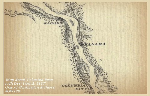
Deer Island:
Deer Island is Holocene and Pleistocene alluvium, unconsolidated, poorly sorted to well-sorted, massive to laminated, commonly cross-stratified sand, silt, and minor gravel of the Columbia River floodplain. Locally includes fine-grained lacustrine, aeolian, and organic-rich marsh deposits. -- Evarts, 2002


Map, 1814, Lewis and Clark on the Columbia, click to enlarge Map, 1887, Kalama vicinity, click to enlarge Map, 1887, Lewis River vicinity, click to enlarge Map, 1988, Deer Island, and Martin Bluff, Washington, click to enlarge NASA Image, 1994, Columbia River, Crim's Island to Deer Island, click to enlarge NASA Image, 1994, Columbia River, Deer Island to the Willamette River, click to enlarge NASA Image, 1994, Columbia River and Deer Island, click to enlarge
  1. 1814 Map, Lewis and Clark's map of the Columbia River (section of original). (Click to enlarge.) Shows Deer Island ("Deer I."). Map also includes three of the five volcanoes Lewis and Clark saw and commented on. While the journals mention the expedition seeing Mount Adams, it does not appear on their map. Mount Jefferson is to the south (bottom) and off the map. From the "Nicholas Biddle/Paul Allen" 1814 publication. Original Map: "A Map of Lewis and Clark's Track, Across the Western Portion of North America, From the Mississippi to the Pacific Ocean". From: History of the expedition under the command of Captains Lewis and Clark : to the sources of the Missouri, thence across the Rocky Mountains and down the river Columbia to the Pacific Ocean : performed during the years 1804-5-6 : by order of the government of the United States / prepared for the press by Paul Allen. Philadelphia : Bradford and Insskeep, 1814. Harold B. Lee Library, Brigham Young University #upbover maps37. -- Brigham Young University, Harold B. Lee Library Website, 2004.
  2. 1887 Map (section of original), Columbia River and the Kalama vicinity, including Deer Island. (Click to enlarge). Original Map: The Columbia River from Celilo to the mouth showing locations of the salmon fisheries, 1887. Scale ca. 1:375,000, Relief shown by hachures. U.S. Army Corps of Engineers, Engineer Office, G.P.O. 1888. University of Washington Archives #UW128. -- University of Washington Library Archives Website, 2002
  3. 1887 Map (section of original), Columbia River and the Lewis River vicinity, including Deer Island. (Click to enlarge). Original Map: The Columbia River from Celilo to the mouth showing locations of the salmon fisheries, 1887. Scale ca. 1:375,000, Relief shown by hachures. U.S. Army Corps of Engineers, Engineer Office, G.P.O. 1888. University of Washington Archives #UW128. -- University of Washington Library Archives Website, 2002
  4. 1988 Map, Deer Island, Oregon, and Martin Bluff, Washington (section of original). (Click to enlarge). Office of Coast Surveys, Historical Maps and Charts, Upper section: Columbia River, Crims Island to Saint Helens, 1988, Chart#18523, 1:40,000, Lower section: Columbia River, Saint Helens to Vancouver, 1988, Chart#18524, 1:40,000. -- NOAA Office of Coast Survey Website, 2004
  5. 1994, NASA Image, Columbia River from Crim's Island to Deer Island (section of original). (Click to enlarge). View from space - north-northeast-looking, low-oblique photograph, showing a section of the Columbia River from Crim's Island to Deer Island, including the Cowlitz River, October 1994. The Columbia River is flowing right to left in this image (east to west). Washington State is the upper half of the image (north) and Oregon is to the bottom half (south). NASA Earth from Space #STS068-262-025. -- NASA Earth from Space Website, 2002
  6. 1994, NASA Image, Columbia River from Deer Island to the Willamette River (section of original). (Click to enlarge). View from space - north-northeast-looking, low-oblique photograph, showing a section of the Columbia River from Deer Island to the Willamette River, including the Lewis River, Sauvie Island, Bachelor Island, and the Ridgefield National Wildlife Refuge, October 1994. The Columbia River is flowing from lower right to upper left in this image (southeast to northwest). Washington State is the upper right of the image and Oregon is to the bottom left. NASA Earth from Space #STS068-262-025. -- NASA Earth from Space Website, 2002
  7. 1994, NASA Image, Columbia River and Deer Island (section of original). (Click to enlarge). View from space - north-northeast-looking, low-oblique photograph, showing a section of the Columbia River and Deer Island, Oregon, October 1994. NASA Earth from Space #STS068-262-025. -- NASA Earth from Space Website, 2002


which is properly the commencement of the great Columbian valley. [the Puget Trough and Willamette Valley]


Along the Journey - March 29, 1806
Puget Trough and Willamette Valley:
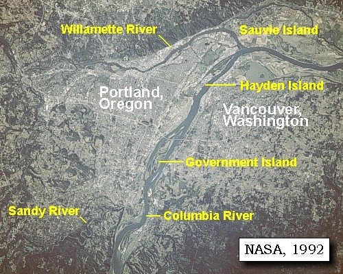
The Puget-Willamette Lowlands extend from the United States-Canadian border south to Eugene, Oregon, between the Coast Ranges and the Cascade Mountains. The climate is subhumid to humid. The northern part is a flat glacial plain interrupted by the complex bays and inlets of Puget Sound. The southern part of the lowlands consists of alluvial valleys along the Cowlitz, Columbia, and Willamette Rivers. Most of Oregon's population, technology and agricultural centers, and important transportion, power, and communications lifelines are located in the Willamette Valley of western Oregon. The lowlands of the Willamette Valley extend about 75 miles along the Willamette River and contain the major cities of Portland, Salem, Corvallis, and Eugene. The valley is part of the Willamette River drainage basin, which covers 12,300 square miles between the crest of the Oregon Coast Range on the west and the Cascade Range to the east. The Willamette River is the largest river in the valley and is fed by several major tributaries, including the McKenzie, Calapooia, Santiam, Tualatin, Yamhill, and Clakamas Rivers. The valley is the major source of ground and surface water for the population centers. -- Radbruch-Hall, et.al., 1982, USGS Professional Paper 1183, and Givler and Wells, 2001


Map, the Volcanoes of Lewis and Clark, click to enlarge Map, 1814, Lewis and Clark on the Columbia, click to enlarge Map, 1833, Illman and Pilbrow, Columbia River, click to enlarge NASA Image, 1994, Willamette Valley, click to enlarge
  1. Map, The Volcanoes of Lewis and Clark, including Geologic Provinces and major Geographic Features (Click to enlarge). Map created by Lyn Topinka, USGS/CVO, 2002; Geologic Provinces based on "USGS/NPS Geology in the Parks" Website, 2002. -- USGS/CVO Web Graphics Collection, 2004
  2. 1814 Map, Lewis and Clark (section of original). (Click to enlarge.) Lewis and Clark marked the valley on the map and labeled it "Wappatoo Valley". From the "Nicholas Biddle/Paul Allen" 1814 publication. Original Map: "A Map of Lewis and Clark's Track, Across the Western Portion of North America, From the Mississippi to the Pacific Ocean". From: History of the expedition under the command of Captains Lewis and Clark : to the sources of the Missouri, thence across the Rocky Mountains and down the river Columbia to the Pacific Ocean : performed during the years 1804-5-6 : by order of the government of the United States / prepared for the press by Paul Allen. Philadelphia : Bradford and Insskeep, 1814. Harold B. Lee Library, Brigham Young University #upbover maps37. -- Brigham Young University, Harold B. Lee Library Website, 2004.
  3. 1833 Map (section of original), Columbia River. (Click to enlarge). Includes Mount Hood and Mount Jefferson. Note: Mount Baker is depicted (upper middle) but Mounts Adams, Rainier and St. Helens are missing. The Columbia River is shown as "Oregon River" at its mouth and "Columbia or Oregon R." further inland. "Wappatoo Valley" is labeled. Also shows Fort Clatsop ("F. Clatsop or F. George"), the Willamette River ("Multnomah R."), Sandy River ("Quicksand R."), John Day River ("R.La Page"), Walla Walla River ("Wallwullah R."), Snake River ("Lewis R."), and the Yakima River ("Tapete R."). Original Map: Oregon Territory, 1833. Creator: Illman & Pilbrow, published by Illman & Pilbrow, New York. Comments: Illman & Pilbrow is the engraving firm which copyrighted and published this map, the actual artist is unknown. Washington State University Digital Maps Collection #WSU323. University of Washington Digital Maps Collection #UW104. -- Washington State University Early Washington Maps Digital Collection Website, 2004
  4. 1994, NASA Image, Aerial view of Washington and Oregon, including the Willamette Valley. (Click to enlarge). NASA Astronaut Photography of Earth #STS068-276-55, October 3, 1994. -- NASA Astronaut Photography of Earth Website, 2002


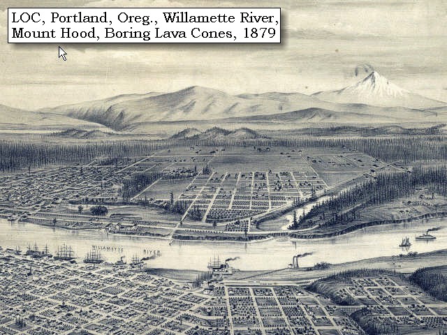
Geology of the Willamette Valley:
The Willamette valley consists of four sub-basins: the southern and northern Willamette basins, the Tualatin basin, and the Portland basin. The Waldo Hills separate the southern Willamette basin from the northern basin, and the Chehalem Mountains separate the northern basin from the Tualatin Basin. Northeast of the Tualatin basin, the Tualatin Mountains form the divide with the Portland Basin. The Willamette Valley lies within a fore-arc basin between the Cascade Volcanic Arc and the Coast Ranges that may have originated in early Tertiary time. Some of the sub-basins have accumulated several hundred meters of sediment in late Cenozoic time. The northern basins also contain lavas of the Miocene Columbia River Basalt Group (CRBG). Flows of the CRBG entered the valley approximately 16 million years ago through a low in the Cascade Range and spread into the Portland and northern Willamette basins. The Tualatin Mountains, Chehalem Mountains, Waldo Hills, and Salem Hills are largely composed of CRBG flows that dip inward toward the basin centers. Approximately 3.0 million to 260,000 years ago, the Boring Lavas were erupted from several vents throughout the northern Willamette, Portland, and Tualatin basins. Boring Lavas capped the Oregon City plateau and created many of the prominent small cone-shaped hills and mountains southeast of downtown Portland. Between 15,000 and 12,700 years ago catastrophic floods from glacial Lake Missoula inundated the majority of the Willamette Valley. These floods reached up to 120 meters above sea level covering the valley with up to 35 meters of sediment and depositing ice-rafted boulders foreign to the Willamette Valley as far south as Eugene, Oregon. -- Gannett and Caldwell


Boring Lava Field:
Metropolitan Portland, Oregon, and an area east of Vancouver, Washington, includes most of a Plio-Pleistocene volcanic field. which erupted from several vents throughout the northern Willamette, Portland, and Tualatin basins. The field was identified by Trimble in 1963, who named it after the hills east of Portland. It consists of at least 50 small monogenetic centers, composed chiefly of mafic andesite. The eruptive features mostly are short stubby lava flows, who compositions are very similar to comparable units in the High Cascades. The field ranges in age from about 3 to 1 million years. -- Allen, 1990, IN: Wood and Kienle, and Hammond, 1989.


Map, Boring Lava Vents, click to enlarge Engraving detail, 1879, Portland Oregon and Mount Hood, click to enlarge Image, 2003, Columbia River and Rocky Butte, Oregon
  1. Map, Portland, Oregon, and Vancouver, Washington, and the Boring Lava Field. Location and elevation of 95 vents. -- Allen, 1975
  2. 1879, Detail of engraving of Portland, Oregon, Mount Hood, and Boring Lava cones. (Click to enlarge). The Columbia River is just visible, middle left. The Willamette River is in the foreground. Also visible are cones of the Boring Lava Field, middleground. Created by E.S. Glover. Published 1879, San Francisco. "Bird's-eye-view", looking east to the Cascade Mountains. Original lithograph shows Mount Rainier, Mount St. Helens, Mount Adams, and Mount Hood, and also the Columbia River and the Willamette River. Reference #LC Panoramic Maps #722. -- Library of Congress American Memories Website, 2002
  3. 2003, Looking across the Columbia River at the Rocky Butte, a Boring Lava cone. (Click to enlarge). Copyright © 2003 Lyn Topinka, private archives, used with permission.


We were here joined by three men of the Towahnahiook nation, with whom we proceeded

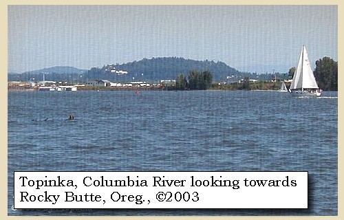
Lewis and Clark have reached the location of today's St. Helens, Oregon, on the left bank (their right) of the Columbia River.


Along the Journey - March 29, 1806
St. Helens, Oregon, map, 1887

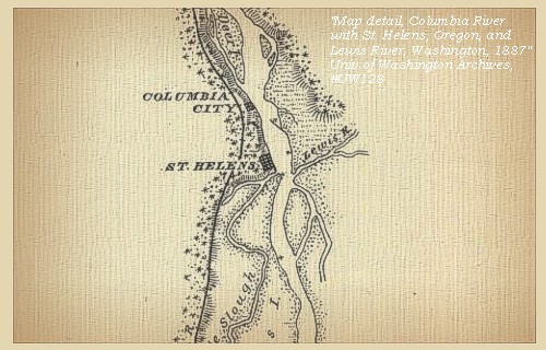
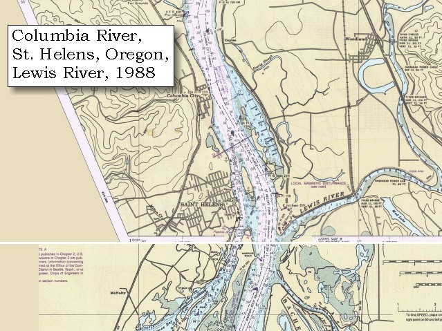
St. Helens, Oregon:
St. Helens, Oregon, is a deep-water seaport located on the Columbia River 29 miles northwest of Portland, and 66 miles southwest of Astoria. The hard black Columbia River basalt which underlies the city of St. Helens is part of the series of lava flows that came down the ancestral Columbia River valley 12 million to 14 million years ago. Meriwether Lewis and William Clark passed the rocky bluffs on which St. Helens was later to be built, in the winter of 1805 on their journey to the Pacific Ocean. In 1854, Columbia County was created, being formerly a part of Washington County. After a heated battle, St. Helens was named the county seat in August 1903. The old courthouse made of locally quarried stone, was built in 1906. The resent town site was chartered by an act of the Legislature on February 25, 1889. The post office was established in 1853. Views can be seen of Mount Hood, Mount Adams and Mount St. Helens. -- Allen, 1985, Time Travel in Oregon, and St. Helens Chamber of Commerce Website, 2003


Map, 1853, Washington and Oregon and the Columbia River, click to enlarge Map, 1887, Lewis River vicinity, click to enlarge Map, 1988, Downstream end of St. Helens, Oregon, and Lewis River, Washington, click to enlarge
  1. 1853 Map, Washington and Oregon and the Columbia River, from the Clearwater River to the Snake River and down the Columbia River to the Pacific Ocean (section of original). (Click to enlarge). Includes: Clearwater River (Kooskooski), Lapwai Creek (Lapwai R.), Snake River (Saptin or Lewis R.), Columbia River (Columbia R.), Yakima River (Yakima R.), Walla Walla River (Wallawalla R.), Umatilla River (Umatilla R.), Willow Creek (Quesnells R.), John Day River (John day's R.), Deschutes River (Fall R.), Willamette River (Willammette R.), and Cowlitz River (Cowlitz R.). Original Map: "Map of California, Oregon, Washington, Utah, and New Mexico (1853)", by Thomas Cowperthwait & Co. Washington State University Archives #WSU22. -- Washington State University Library Collections Website, 2003
  2. 1887 Map (section of original), Columbia River and the Lewis River vicinity. (Click to enlarge). Bachelor Island, while not named on the map, is the island south (below) the Lewis River. Original Map: The Columbia River from Celilo to the mouth showing locations of the salmon fisheries, 1887. Scale ca. 1:375,000, Relief shown by hachures. U.S. Army Corps of Engineers, Engineer Office, G.P.O. 1888. University of Washington Archives #UW128. -- University of Washington Library Archives Website, 2002
  3. 1988 Map, St. Helens, Oregon, and Lewis River, Washington (section of original). (Click to enlarge). Office of Coast Surveys, Historical Maps and Charts, Upper section: Columbia River, Crims Island to Saint Helens, 1988, Chart#18523, 1:40,000, Lower section: Columbia River, Saint Helens to Vancouver, 1988, Chart#18524, 1:40,000. -- NOAA Office of Coast Survey Website, 2004


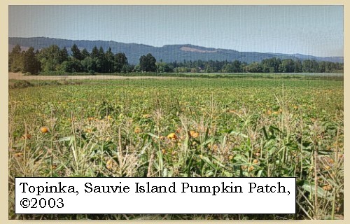
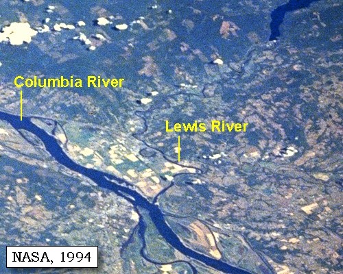
till at the distance of fourteen miles from our camp of last evening we reached a large inlet or arm of the river, about three hundred yards wide, up which they went to their villages. [Multnomah Channel, heading down the east side of Sauvie Island]
"... after breakfast we proceeded on and at the distance of 14 miles from our encampment of the last evening we passed a large inlet 300 yds in width. this inlet or arm of the river extends itself to the South 10 or 12 M. to the hills on that side of the river and receives the waters of a small creek which heads with killamucks river and that of a bayau which passes out of the Columbia about 20 miles above, the large Island thus formed we call wappetoe island. ..." [Lewis, March 29, 1806]


Along the Journey - March 29, 1806
Multnomah Channel and the Sauvie Island Bridge, 2003

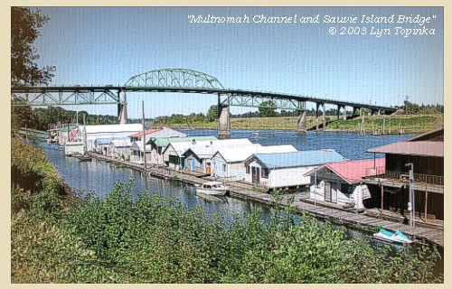
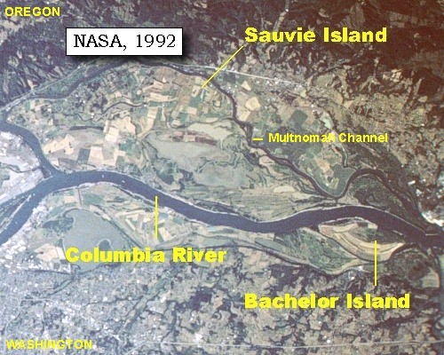
Multnomah Channel:
Multnomah Channel has also been known as the Willamette Slough (1887 map). The channel separates Sauvie Island from mainland Oregon, and is a favorite recreation spot of boaters.


Map, 1814, Lewis and Clark on the Columbia, click to enlarge Map, 1854, Columbia River, Fort Vancouver area, click to enlarge Map, 1887, Sauvie Island vicinity, click to enlarge Map, 1988, Downstream end of Sauvie Island, Bachelor Island, Multnomah Channel, Lewis River, click to enlarge NASA Image, 1994, Columbia River, Deer Island to the Willamette River, click to enlarge NASA Image, 1994, Columbia River upstream of Vancouver, showing Sauvie Island, click to enlarge Image, 2003, Multnomah Channel and Sauvie Island Bridge
  1. 1814 Map, Lewis and Clark's map of the Columbia River (section of original). (Click to enlarge.) The Multnomah Channel is depicted but not named. Map includes three of the five volcanoes Lewis and Clark saw and commented on. While the journals mention the expedition seeing Mount Adams, it does not appear on their map. Mount Jefferson is to the south (bottom) and off the map. From the "Nicholas Biddle/Paul Allen" 1814 publication. Original Map: "A Map of Lewis and Clark's Track, Across the Western Portion of North America, From the Mississippi to the Pacific Ocean". From: History of the expedition under the command of Captains Lewis and Clark : to the sources of the Missouri, thence across the Rocky Mountains and down the river Columbia to the Pacific Ocean : performed during the years 1804-5-6 : by order of the government of the United States / prepared for the press by Paul Allen. Philadelphia : Bradford and Insskeep, 1814. Harold B. Lee Library, Brigham Young University #upbover maps37. -- Brigham Young University, Harold B. Lee Library Website, 2004.
  2. 1853-54 Map, Columbia River, including the Fort Vancouver area (section of original). (Click to enlarge). Sauvie Island is depicted but not named, and so is the Multnomah Channel which separates Sauvie Island from the Oregon mainland. Includes Longview, Washington (Monticello), Coweeman River (Minter R.), Kalama River (Ca-la-ma R.), Lewis River (Cath-la-pootle R.), Willamette River, Fort Vancouver, Cape Horn, and "The Cascades". Vancouver Lake is depicted but not labeled. Original Map: "Rocky Mountains to Puget Sound : from explorations and surveys / made under the direction of the Hon. Jefferson Davis, Secretary of War by Isaac I. Stevens Governor of Washington Territory, 1853-4." Inset: (Supplementary sketch) Reconnaissance of the railroad route from Wallawalla to Seattle via Yak-e-mah River & Snoqualmie Pass. By A. W. Tinkham in January 1854. Drawn by J. R. P. Mechlin. 20 x 28 cm. Topographer, John Lambert, Published in Washington D.C., 1859, 1:1,200,000, Notes: From the U.S. War Department, Explorations and Surveys for a Railroad Route from the Mississippi River to the Pacific Ocean, Topographical Maps, to Illustrate the Various Reports, U.S. Library of Congress American Memories Reference "LC Railroad Maps #156". -- U.S. Library of Congress, American Memories Website, 2004
  3. 1887 Map (section of original), Columbia River and the Sauvie Island vicinity. (Click to enlarge). Bachelor Island, while not named on the map, is the island south (below) the Lewis River (upper right). The Willamette Slough is today called the Multnomah Channel. Original Map: The Columbia River from Celilo to the mouth showing locations of the salmon fisheries, 1887. Scale ca. 1:375,000, Relief shown by hachures. U.S. Army Corps of Engineers, Engineer Office, G.P.O. 1888. University of Washington Archives #UW128. -- University of Washington Library Archives Website, 2002
  4. 1988 Map, Downstream end of Sauvie Island, Bachelor Island, Multnomah Channel, Lewis River (section of original). (Click to enlarge). Office of Coast Surveys, Historical Maps and Charts, Columbia River, Saint Helens to Vancouver, 1988, Chart#18524, 1:40,000. -- NOAA Office of Coast Survey Website, 2004
  5. 1994, NASA Image, Columbia River from Deer Island to the Willamette River (section of original). (Click to enlarge). View from space - north-northeast-looking, low-oblique photograph, showing a section of the Columbia River from Deer Island to the Willamette River, including the Lewis River, Sauvie Island, Bachelor Island, and the Ridgefield National Wildlife Refuge, October 1994. The Columbia River is flowing from lower right to upper left in this image (southeast to northwest). Washington State is the upper right of the image and Oregon is to the bottom left. NASA Earth from Space #STS068-262-025. -- NASA Earth from Space Website, 2002
  6. 1994, NASA Image, Columbia River and Sauvie Island (section of original). (Click to enlarge). View from space - north-northeast-looking, low-oblique photograph, showing a section of the Columbia River and Sauvie Island, Oregon, October 1994. NASA Earth from Space #STS068-262-025. -- NASA Earth from Space Website, 2002
  7. 2003, Multnomah Channel and Sauvie Island Bridge, taken from Oregon Highway 30. (Click to enlarge). Copyright © 2003 Lyn Topinka, private archives, used with permission.


Sauvie Island pumpkin patch, 2003

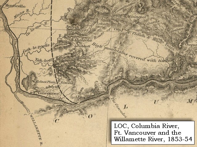
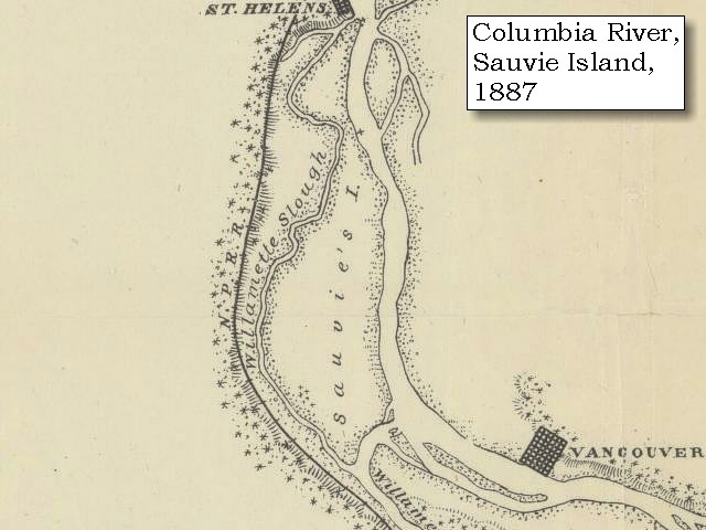
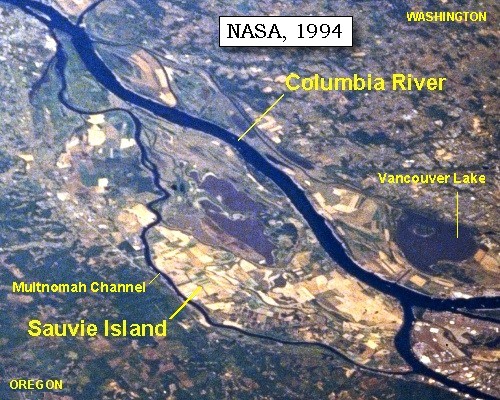
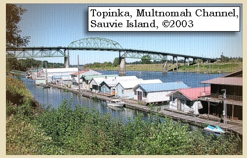
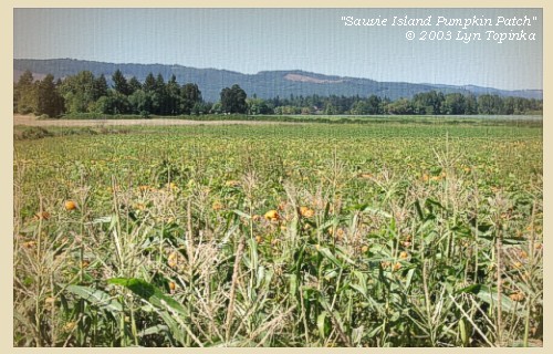
Sauvie Island:
Sauvie Island contains approximately 24,000 acres of land and lakes, and had its origin in alluvial deposits from the Columbia and Willamette rivers as their velocities decreased by changes in direction and by lava extrusions located on the north end. The island is 16 miles long and 4.5 miles at the widest point. The Sauvie Island wildlife area includes 8,053 acres of deeded land and 3,490 acres of land leased from the Division of State Lands for wildlife management purposes. The island is bounded on the east by the Columbia River; on the south by the Willamette River and on the west by the Multnomah Channel. Across the river on the Washington side, Scappoose Bay provides fish and wildlife habitat. -- Columbia Basin Fish and Wildlife Authority Website, 2002, Oregon State Archives Website, 2002, and Washington State Historical Society Website, 2002


Map, 1814, Lewis and Clark on the Columbia, click to enlarge Map, 1854, Columbia River, Fort Vancouver area, click to enlarge Map, 1887, Sauvie Island vicinity, click to enlarge Map, 1988, Downstream end of Sauvie Island, Bachelor Island, Multnomah Channel, Lewis River, click to enlarge NASA Image, 1994, Columbia River, Deer Island to the Willamette River, click to enlarge NASA Image, 1994, Columbia River upstream of Vancouver, showing Sauvie Island, click to enlarge NASA Image, 1992, Columbia River with Portland, Oregon, and Vancouver, Washington, click to enlarge NASA Image, 1992, Columbia River upstream of Vancouver, showing Sauvie Island, click to enlarge Image, 2003, Multnomah Channel and Sauvie Island Bridge Image, 2003, Sauvie Island
  1. 1814 Map, Lewis and Clark's map of the Columbia River (section of original). (Click to enlarge.) Sauvie Island is labeled "Wappatoo I.". Map also includes three of the five volcanoes Lewis and Clark saw and commented on. While the journals mention the expedition seeing Mount Adams, it does not appear on their map. Mount Jefferson is to the south (bottom) and off the map. From the "Nicholas Biddle/Paul Allen" 1814 publication. Original Map: "A Map of Lewis and Clark's Track, Across the Western Portion of North America, From the Mississippi to the Pacific Ocean". From: History of the expedition under the command of Captains Lewis and Clark : to the sources of the Missouri, thence across the Rocky Mountains and down the river Columbia to the Pacific Ocean : performed during the years 1804-5-6 : by order of the government of the United States / prepared for the press by Paul Allen. Philadelphia : Bradford and Insskeep, 1814. Harold B. Lee Library, Brigham Young University #upbover maps37. -- Brigham Young University, Harold B. Lee Library Website, 2004.
  2. 1853-54 Map, Columbia River, including the Fort Vancouver area (section of original). (Click to enlarge). Sauvie Island is depicted but not named. Includes Longview, Washington (Monticello), Coweeman River (Minter R.), Kalama River (Ca-la-ma R.), Lewis River (Cath-la-pootle R.), Willamette River, Fort Vancouver, Cape Horn, and "The Cascades". Vancouver Lake is depicted but not labeled. Original Map: "Rocky Mountains to Puget Sound : from explorations and surveys / made under the direction of the Hon. Jefferson Davis, Secretary of War by Isaac I. Stevens Governor of Washington Territory, 1853-4." Inset: (Supplementary sketch) Reconnaissance of the railroad route from Wallawalla to Seattle via Yak-e-mah River & Snoqualmie Pass. By A. W. Tinkham in January 1854. Drawn by J. R. P. Mechlin. 20 x 28 cm. Topographer, John Lambert, Published in Washington D.C., 1859, 1:1,200,000, Notes: From the U.S. War Department, Explorations and Surveys for a Railroad Route from the Mississippi River to the Pacific Ocean, Topographical Maps, to Illustrate the Various Reports, U.S. Library of Congress American Memories Reference "LC Railroad Maps #156". -- U.S. Library of Congress, American Memories Website, 2004
  3. 1887 Map (section of original), Columbia River and the Sauvie Island vicinity. (Click to enlarge). Bachelor Island, while not named on the map, is the island south (below) the Lewis River. Original Map: The Columbia River from Celilo to the mouth showing locations of the salmon fisheries, 1887. Scale ca. 1:375,000, Relief shown by hachures. U.S. Army Corps of Engineers, Engineer Office, G.P.O. 1888. University of Washington Archives #UW128. -- University of Washington Library Archives Website, 2002
  4. 1988 Map, Downstream end of Sauvie Island, Bachelor Island, Multnomah Channel, Lewis River (section of original). (Click to enlarge). Office of Coast Surveys, Historical Maps and Charts, Columbia River, Saint Helens to Vancouver, 1988, Chart#18524, 1:40,000. -- NOAA Office of Coast Survey Website, 2004
  5. 1994, NASA Image, Columbia River from Deer Island to the Willamette River (section of original). (Click to enlarge). View from space - north-northeast-looking, low-oblique photograph, showing a section of the Columbia River from Deer Island to the Willamette River, including the Lewis River, Sauvie Island, Bachelor Island, and the Ridgefield National Wildlife Refuge, October 1994. The Columbia River is flowing from lower right to upper left in this image (southeast to northwest). Washington State is the upper right of the image and Oregon is to the bottom left. NASA Earth from Space #STS068-262-025. -- NASA Earth from Space Website, 2002
  6. 1994, NASA Image, Columbia River and Sauvie Island (section of original). (Click to enlarge). View from space - north-northeast-looking, low-oblique photograph, showing a section of the Columbia River and Sauvie Island, Oregon, October 1994. NASA Earth from Space #STS068-262-025. -- NASA Earth from Space Website, 2002
  7. 1992, NASA Image, Columbia River, Portland, Oregon, and Vancouver, Washington (section of original). (Click to enlarge). View from space - west-looking, low-oblique photograph, showing a section of the Columbia River with Government Island, the Sandy River, Portland, Oregon, and Vancouver, Washington, September 1992. The Columbia River is flowing from bottom (east) to top (west). NASA Earth from Space #STS047-096-066. -- NASA Earth from Space Website, 2002
  8. 1992, NASA Image, Columbia River upstream of Vancouver, Washington, showing Bachelor Island and the Ridgefield National Wildlife Refuge (section of original). (Click to enlarge). View from space - west-looking, low-oblique photograph, showing a section of the Columbia River upstream of Vancouver, Washington, September 1992. Bachelor Island is on the right side of the image, just barely discernible as an island (light colored yellowish area). Bachelor Island Slough separates Bachelor Island from the mainland. The area next to the Columbia on the right and the left side of Bachelor Island is part of the Ridgefield National Wildlife Refuge. The upper half of the image is Sauvie Island, with the Willamette River on it's left, the Columbia River on the bottom, and the Multnomah Channel on the upper side. NASA Earth from Space #STS047-096-066. -- NASA Earth from Space Website, 2002
  9. 2003, Multnomah Channel and Sauvie Island Bridge, taken from Oregon Highway 30. (Click to enlarge). Copyright © 2003 Lyn Topinka, private archives, used with permission.
  10. 2003, Sauvie Island pumpkin patch. (Click to enlarge). Copyright © 2003 Lyn Topinka, private archives, used with permission.


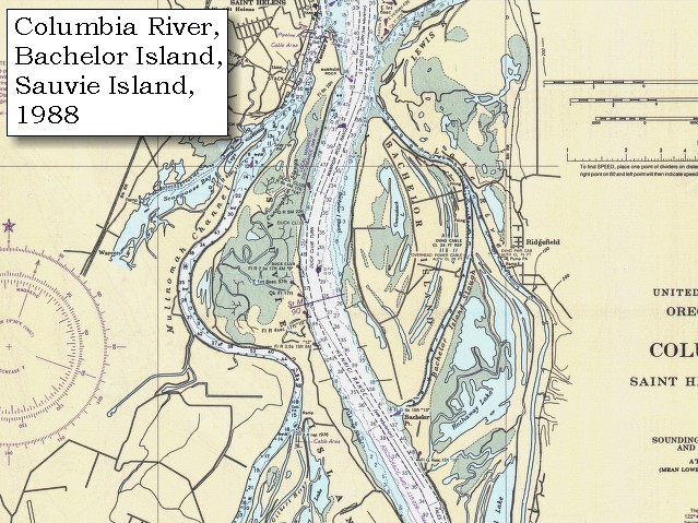
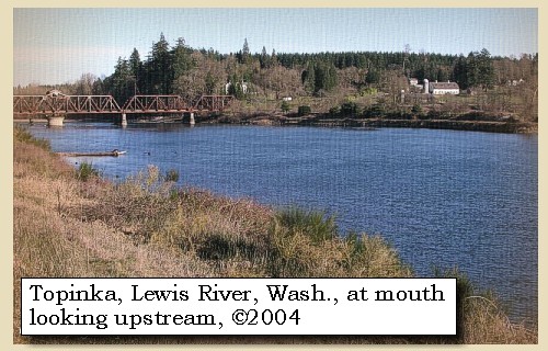
A short distance above this inlet a considerable river empties itself from the north side of the Columbia. Its name is Chawahnahiooks [Lewis River]. It is about one hundred and fifty yards wide, and at present discharges a large body of water, though the Indians assure us that at a short distance above its mouth, the navigation is obstructed by falls and rapids.


Along the Journey - March 29, 1806
Lewis River, 2004

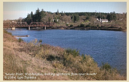
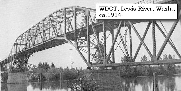
Lewis River:
The Lewis River is merges with the Columbia River at River Mile (RM) 87. The watershed is approximately 93 miles long, has a total fall of approximately 12,000 feet, drains an area of about 1,050 square miles, and comprises two large drainages, the North Fork and East Fork, which converge approximately 3.5 miles upriver from the confluence with the Columbia River. The headwaters of the Lewis arise on the southern flanks of Mount St. Helens and Mount Adams. The mainstem of the Lewis, also known as the North Fork, flows southwesterly through three impoundments, Swift Reservoir (RM 48), Yale Reservoir (34), and Merwin Lake (RM 19.5). The majority of the Lewis River basin is forested, typical of the southern Washington Cascade Mountains. However, an area of approximately 30 square miles within the upper basin was denuded by the May 18, 1980 eruption of Mount St. Helens The major tributaries within the Lewis River system below Merwin Dam include the East Fork Lewis River, Johnson Creek, and Cedar Creek. The basin has a complex geologic history, having undergone Tertiary volcanism, several glaciations, and interglacial erosion and deposition. Lewis and Clark used "Chah wah na hi ook River" to identify a "Small river" that entered the Columbia on the north shore. Their name was a figurative form of the Chinookan term for "enemies." In 1853 a railroad surveyor charted the river as "Cathlapootle", a distortion of a common name for the river used by early explorers, fur traders, and settlers. Today the river is named for Adolphus Lee Lewis, a descendent of an Hudson Bay Company employee who homesteaded near the river's mouth. -- Columbia Basin Fish and Wildlife Authority Website, 2004, and Washington State Historical Society, 2004, "Lasting Legacy"


Map, 1978, Mount St. Helens and its stream drainages, click to enlarge Map, 1999, Mount Adams and Vicinity, click to enlarge Map, 1814, Lewis and Clark on the Columbia, click to enlarge Map, 1854, Columbia River, Fort Vancouver area, click to enlarge Map, 1887, Lewis River vicinity, click to enlarge Map, 1988, Downstream end of St. Helens, Oregon, and Lewis River, Washington, click to enlarge NASA Image, 1994, Columbia River, Deer Island to the Willamette River, click to enlarge NASA Image, 1994, Columbia River and Crim's Island vicinity, click to enlarge Image, ca.1914, Lewis River Bridge, click to enlarge Image, 2004, Lewis River, at mouth looking upstream
  1. 1978 Map, Mount St. Helens and Vicinity, and its major river drainages. (Click to enlarge). Swift Creek, Pine Creek, and the Muddy River drain the southern flanks of Mount St. Helens and drain into the Lewis River. The Kalama River drains west into the Columbia River. The North and South Fork Toutle Rivers drain to the north west and enter the Cowlitz (a tributary from Mount Rainier), which drains into the Columbia River south of Longview, Washington. Map modified from Crandell and Mullineaux, 1978, USGS Bulletin 1383-C.
  2. 1999 Map, Mount Adams and Vicinity, with major river drainages. (Click to enlarge). The headwaters of the Lewis River are shown on the left of the map. Map also includes the Wind River, Little White Salmon River, White Salmon River, and Klickitat River which flow into the Columbia River. Map modified from Vallance, 1999, USGS Bulletin 2161.
  3. 1814 Map, Lewis and Clark's map of the Columbia River (section of original). (Click to enlarge.) Shows the Lewis River ("Chah-wah-nahi-ooks R."). Map includes three of the five volcanoes Lewis and Clark saw and commented on. While the journals mention the expedition seeing Mount Adams, it does not appear on their map. Mount Jefferson is to the south (bottom) and off the map. From the "Nicholas Biddle/Paul Allen" 1814 publication. Original Map: "A Map of Lewis and Clark's Track, Across the Western Portion of North America, From the Mississippi to the Pacific Ocean". From: History of the expedition under the command of Captains Lewis and Clark : to the sources of the Missouri, thence across the Rocky Mountains and down the river Columbia to the Pacific Ocean : performed during the years 1804-5-6 : by order of the government of the United States / prepared for the press by Paul Allen. Philadelphia : Bradford and Insskeep, 1814. Harold B. Lee Library, Brigham Young University #upbover maps37. -- Brigham Young University, Harold B. Lee Library Website, 2004.
  4. 1853-54 Map, Columbia River, including the Fort Vancouver area (section of original). (Click to enlarge). Includes Longview, Washington (Monticello), Coweeman River (Minter R.), Kalama River (Ca-la-ma R.), Lewis River (Cath-la-pootle R.), Willamette River, Fort Vancouver, Cape Horn, and "The Cascades". Vancouver Lake is depicted but not labeled. Original Map: "Rocky Mountains to Puget Sound : from explorations and surveys / made under the direction of the Hon. Jefferson Davis, Secretary of War by Isaac I. Stevens Governor of Washington Territory, 1853-4." Inset: (Supplementary sketch) Reconnaissance of the railroad route from Wallawalla to Seattle via Yak-e-mah River & Snoqualmie Pass. By A. W. Tinkham in January 1854. Drawn by J. R. P. Mechlin. 20 x 28 cm. Topographer, John Lambert, Published in Washington D.C., 1859, 1:1,200,000, Notes: From the U.S. War Department, Explorations and Surveys for a Railroad Route from the Mississippi River to the Pacific Ocean, Topographical Maps, to Illustrate the Various Reports, U.S. Library of Congress American Memories Reference "LC Railroad Maps #156". -- U.S. Library of Congress, American Memories Website, 2004
  5. 1887 Map (section of original), Columbia River and the Lewis River vicinity. (Click to enlarge). Bachelor Island, while not named on the map, is the island south (below) the Lewis River. Original Map: The Columbia River from Celilo to the mouth showing locations of the salmon fisheries, 1887. Scale ca. 1:375,000, Relief shown by hachures. U.S. Army Corps of Engineers, Engineer Office, G.P.O. 1888. University of Washington Archives #UW128. -- University of Washington Library Archives Website, 2002
  6. 1988 Map, St. Helens, Oregon, and Lewis River, Washington (section of original). (Click to enlarge). Office of Coast Surveys, Historical Maps and Charts, Upper section: Columbia River, Crims Island to Saint Helens, 1988, Chart#18523, 1:40,000, Lower section: Columbia River, Saint Helens to Vancouver, 1988, Chart#18524, 1:40,000. -- NOAA Office of Coast Survey Website, 2004
  7. 1994, NASA Image, Columbia River from Deer Island to the Willamette River (section of original). (Click to enlarge). View from space - north-northeast-looking, low-oblique photograph, showing a section of the Columbia River from Deer Island to the Willamette River, including the Lewis River, Sauvie Island, Bachelor Island, and the Ridgefield National Wildlife Refuge, October 1994. The Columbia River is flowing from lower right to upper left in this image (southeast to northwest). Washington State is the upper right of the image and Oregon is to the bottom left. NASA Earth from Space #STS068-262-025. -- NASA Earth from Space Website, 2002
  8. 1994, NASA Image, Columbia River at the junction with the Lewis River (section of original). (Click to enlarge). View from space - north-northeast-looking, low-oblique photograph, showing a section of the Columbia River at the spot where the Lewis River enters, October 1994. In this photograph, the Columbia River is running from right to left, with Washington State to the east (upper 3/4 of image) and Oregon to the west (lower left quarter). Lake Merwin, created by Merwin Dam, is shown in the upper right corner. NASA Earth from Space #STS068-262-025. -- NASA Earth from Space Website, 2002
  9. ca.1914, Lewis River Bridge. (Click to enlarge). Bridge crossing the Lewis River, near Woodland, Washington. Image from the Washington State Department of Transportation Archives, 1912-1914 Biennial Report. -- Washington State Department of Transportation Website, 2003
  10. 2004, Lewis River, Washington, at mouth looking upstream. (Click to enlarge). Copyright © 2004 Lyn Topinka, private archives, used with permission.


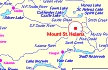
Three miles beyond the inlet is an island near the north shore of the river [Bachelor Island], behind the lower end of which is a village of Quathlapotles, where we landed, about three o'clock. ......


Along the Journey - March 29, 1806
Bachelor Island and Mount St. Helens, 2003

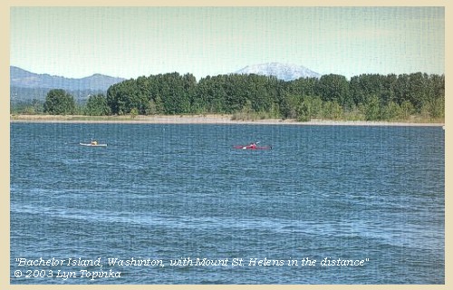
Bachelor Island:
Lewis and Clark first called the island "Green Bryor Isd," when they traveled downriver in 1805 but changed the name to "Quathlahpotle Island" in 1806. They honored the large village of 14 wooden houses and 900 inhabitants on the mainland, naming the island for the native village. The present name is of local origin, in honor of an unmarried man who took a donation claim on the island. Bachelor Island is now part of the Ridgefield National Wildlife Refuge. -- Washington State Historical Society Website, 2002, "Lasting Legacy"


Map, 1887, Lewis River vicinity, click to enlarge Map, 1988, Downstream end of Sauvie Island, Bachelor Island, Multnomah Channel, Lewis River, click to enlarge NASA Image, 1994, Columbia River, Deer Island to the Willamette River, click to enlarge NASA Image, 1992, Columbia River upstream of Vancouver, showing Bachelor Island, click to enlarge Image, 2003, Bachelor Island with Mount St. Helens
  1. 1887 Map (section of original), Columbia River and the Lewis River vicinity, including Bachelor Island. (Click to enlarge). Bachelor Island, while not named on the map, is the island south (below) the Lewis River. Original Map: The Columbia River from Celilo to the mouth showing locations of the salmon fisheries, 1887. Scale ca. 1:375,000, Relief shown by hachures. U.S. Army Corps of Engineers, Engineer Office, G.P.O. 1888. University of Washington Archives #UW128. -- University of Washington Library Archives Website, 2002
  2. 1988 Map, Downstream end of Sauvie Island, Bachelor Island, Multnomah Channel, Lewis River (section of original). (Click to enlarge). Office of Coast Surveys, Historical Maps and Charts, Columbia River, Saint Helens to Vancouver, 1988, Chart#18524, 1:40,000. -- NOAA Office of Coast Survey Website, 2004
  3. 1994, NASA Image, Columbia River from Deer Island to the Willamette River (section of original). (Click to enlarge). View from space - north-northeast-looking, low-oblique photograph, showing a section of the Columbia River from Deer Island to the Willamette River, including the Lewis River, Sauvie Island, Bachelor Island, and the Ridgefield National Wildlife Refuge, October 1994. The Columbia River is flowing from lower right to upper left in this image (southeast to northwest). Washington State is the upper right of the image and Oregon is to the bottom left. NASA Earth from Space #STS068-262-025. -- NASA Earth from Space Website, 2002
  4. 1992, NASA Image, Closer-in, Columbia River upstream of Vancouver, Washington, showing Bachelor Island and the Ridgefield National Wildlife Refuge (section of original). (Click to enlarge). View from space - west-looking, low-oblique photograph, showing a section of the Columbia River upstream of Vancouver, Washington, September 1992. Bachelor Island is on the right side of the image, just barely discernible as an island (light colored yellowish area). Bachelor Island Slough separates Bachelor Island from the mainland. The area next to the Columbia on the right and the left side of Bachelor Island is part of the Ridgefield National Wildlife Refuge. The upper half of the image is Sauvie Island, with the Willamette River on it's left, the Columbia River on the bottom, and the Multnomah Channel on the upper side. NASA Earth from Space #STS047-096-066. -- NASA Earth from Space Website, 2002
  5. 2003, Bachelor Island, Washington, with Mount St. Helens in the distance. (Click to enlarge). View as seen from Sauvie Island, Oregon. Copyright © 2003 Lyn Topinka, private archives, used with permission.


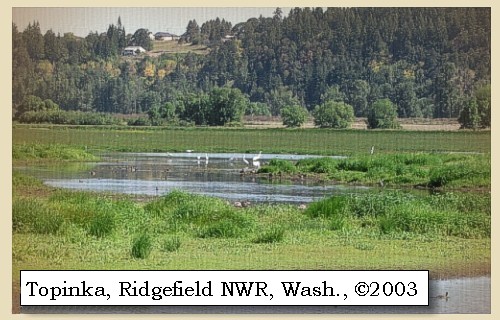
After remaining some time we embarked, and coasting along this island, which after the nation we called Quathlapotle island [Bachelor Island], encamped for this night in a small prairie on the north side of the Columbia [in today's Ridgefield National Wildlife Refuge],


Along the Journey - March 29, 1806
Ridgefield National Wildlife Refuge, 2003

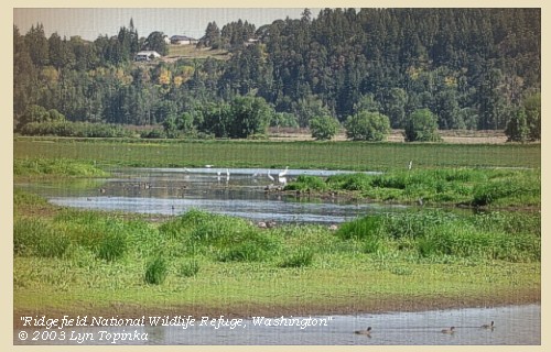
Ridgefield National Wildlife Refuge:
The Ridgefield National Wildlife Refuge Complex is comprised of five refuges located in the southwest part of the state of Washington: Ridgefield north of Vancouver; Conboy in the southcentral part of the state; and Franz Lake, Pierce and Steigerwald Lake all located in the Columbia River Gorge. The refuge north of Vancouver, Washington, was established in 1965 in response to a need to establish vital winter habitat for the dusky Canada goose whose nesting areas in Alaska were severly impacted by the violent earthquake of 1964. This refuge is the location of two Lewis and Clark campsites (November 4, 1805 and March 29, 1806), and is an ancient Chinook townsite visited by the Expedition. In their journals, Lewis and Clark described the wapato plants that were harvested by the Chinook women, as well as, the geese and ducks that kept them awake at night. These species are still here today. Trails, auto tour, and wildlife viewing. Located 14 miles north of Vancouver, Washington. -- U.S. Fish and Wildlife Service Website, 2002, Lewis and Clark Bicentennial Website, 2002, and Lewis and Clark Bicentennial in Oregon Website, 2002


Map, 1887, Lewis River vicinity, click to enlarge NASA Image, 1994, Columbia River, Deer Island to the Willamette River, click to enlarge Image, 2003, Ridgefield National Wildlife Refuge
  1. 1887 Map (section of original), Columbia River and the Lewis River vicinity. (Click to enlarge). Today's Ridgefield National Wildlife Refuge is located below the Lewis River. Original Map: The Columbia River from Celilo to the mouth showing locations of the salmon fisheries, 1887. Scale ca. 1:375,000, Relief shown by hachures. U.S. Army Corps of Engineers, Engineer Office, G.P.O. 1888. University of Washington Archives #UW128. -- University of Washington Library Archives Website, 2002
  2. 1994, NASA Image, Columbia River from Deer Island to the Willamette River (section of original). (Click to enlarge). View from space - north-northeast-looking, low-oblique photograph, showing a section of the Columbia River from Deer Island to the Willamette River, including the Lewis River, Sauvie Island, Bachelor Island, and the Ridgefield National Wildlife Refuge, October 1994. The Columbia River is flowing from lower right to upper left in this image (southeast to northwest). Washington State is the upper right of the image and Oregon is to the bottom left. NASA Earth from Space #STS068-262-025. -- NASA Earth from Space Website, 2002
  3. 2003, Ridgefield National Wildlife Refuge. (Click to enlarge). Copyright © 2003 Lyn Topinka, private archives, used with permission.


having made by estimate nineteen miles. ......


Along the Journey - March 29, 1806
The Camp - March 29, 1806:
In today's Ridgefield National Wildlife Refuge.


Home Previous Continue


If you have questions or comments please contact: GS-CVO-WEB@usgs.gov
June/July 2004, Lyn Topinka
The Volcanoes of Lewis and Clark Home Page | CVO Home Page