Cascade Range Volcanoes
|
|
Please Note:
This collection of Historical Maps (and a few select journals) is by no means complete and there are NO MAPS to be seen here. This list is designed simply to be a reference point for students of history to begin to look for "historical" maps which depict the Cascade Range Volcanoes. This list is arranged in "timeline" form. Volcano names, spelling, elevations, and occasional interesting tidbits are given. To look directly at any map, please use any search engine and search for the particular map collection referenced.
[Back to Menu] |
|
1790
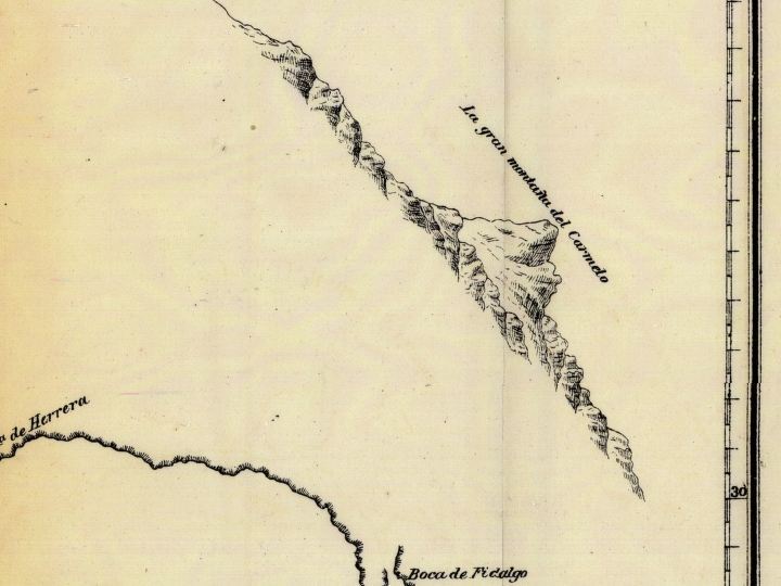
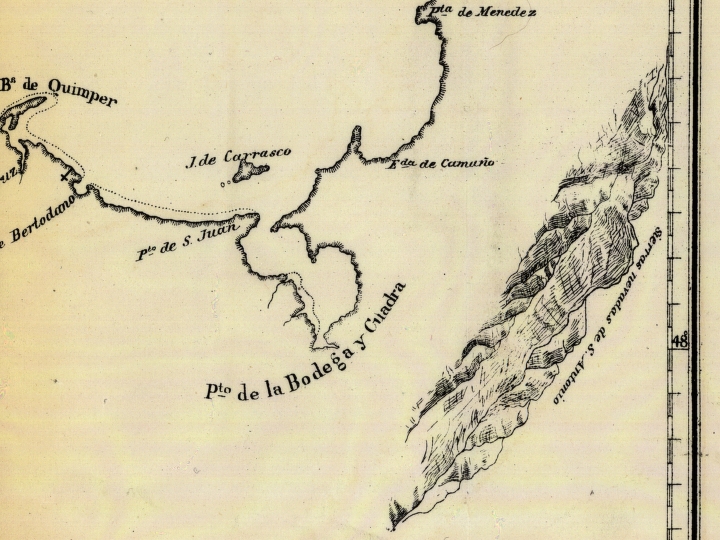
Quimper:
Map of the "Northwest Coast of North America -- Strait of Juan de Fuca" -- Plano del Estrecho de Fuca reconocido por el Alferez de Navio de la Rl. Armada Dn. Manuel Quimper: en la Espedici?n que hizo con la Balandra de S.M. de su mando nobrada la Princesa Rl. en el a?o de 1790 (1790) -- the map identifies coastal features in Spanish along the Straits of Juan de Fuca including the Canal de Lopez de Haro
1792
1798
George Vancouver:
Map of Vancouver, 1798, by George Vancouver, H.J. Toudy & Co.
Shows topography of the Pacific Northwest including part of
Vancouver Island and northwestern Oregon Country.
Identifies Canal de Arro
involved in the disputed boundary between
Great Britain and the United States
"H. J. Toudy & Co. Lith."
George Vancouver: A Chart showing part of the coast of N.W. America, with the tracks of His Majesty's sloop Discovery and armed tender Chatham; Commanded by George Vancouver Esq., and prepared under his immediate inspection by Lieu. Joseph Baker, in which the Continental Shore has been traced and determined from Lat:46.30N., and Long.236.12E. to Lat:52.15N and Long.232.40E., at the different periods shown by the Tracks The parts not shaded are taken from Spanish Authorities. Published May 1st, 1798 by J. Edwards Pall Mall & G. Robinson Paternoster Row. -- map source: Washington State University Online Map Collection, 2002
1802, 1811, 1814
Arrowsmith:
A map exhibiting all the new discoveries in the
interior parts of North America : inscribed by permission to the
honourable governor and company of adventurers of
England trading into Hudsons Bay in testimony of their liberal
communications to their most obedient
and very humble servant A. Arrowsmith, January 1st 1795.
Additions to 1802. Additions to 1811.
Additions to 1814.
1803(?)
King:
Lewis and Clark carried this map. Annotations in brown
ink by Meriwether Lewis. Tracing showing the Mississippi,
the Missouri for
a short distance above Kansas, Lakes Michigan, Superior,
and Winnipeg, and the country onwards to the Pacific.
Pen and ink.
Created by Nicholas King.
1805
Lewis and Clark:
A map of part of the continent of North America:
between the 35th and 51st degrees of north latitude, and extending
from 890 degrees of west longitude to the Pacific Ocean --
compiled from the authorities of the best informed travellers
by M. Lewis; copied by Nicholas King, 1805.
Note from map folder: Map was copied from a sketch by William Clark,
not one by Meriwether Lewis as indicated in the title.
This scomposite map was prepared by Nicholas King, at the request
of Thomas Jefferson and Albert Gallatin, secretary of the treasury. It
represents the geographical knowledge of the trans-Mississippi West
available to government officials on the eve of the expedition. It is
believed that Lewis and Clark carried this map at least as far as the
Mandan-Hidatsa village in present day North Dakota, where Lewis added
additional information obtained from fur traders and Native Americans.
1806
1814
Lewis & Clark (Biddle/Allen):
A Map of Lewis and Clark's Track Across the
Western Portion of North America, From the
Mississippi to the Pacific Ocean,
By Order of the Executive of the
United States in 1804, 5 & 6.
Copied by Samuel Lewis from the Original Drawing of Wm.
Clark.
Publication Date: 1814, Publisher:
London: Printed for Longman, Hurst, Rees, Orme and Brown
Though the Lewis and Clark expedition occurred
during the years 1804 to 1806, Clark's journal
was not published until 1814. This map
comes from the first British printing of
that journal, occurring in that same year, 1814.
[via the Library of Congress Website:
A map of Lewis and Clark's track,
across the western portion of North America
from the Mississippi to the Pacific Ocean: by
order of the executive of the United States in
1804, 5 & 6 / copied by Samuel Lewis from the
original drawing of Wm. Clark ; Saml. Harrison, fct.
Created/Published: Philadelphia: Bradford and Inskeep, 1814,
From Lewis, Meriwether,
History of the expedition under the command of
Captains Lewis and Clark, 1814.]
1814
Mathew Carey:
Missouri territory formerly Louisiana,
by Mathew Carey, Created/Published 1814
1823
Tanner:
(Composite of) A Map of North America, Constructed According To The Latest
Information: by H.S. Tanner, 1822, Engraved & Published by H.S. Tanner,
Philadelphia, 1822, Printed by Wm Duffee, American Atlas, Published, 1823.
1823
Wyld:
Map of North America from 20 to 80 Degrees north Latitude, Exhibiting The
recent Discoveries, Geographical and Nautical; Drawn chiefly from the
Authorites of M. De Humboldt, Lieutt. Pike, Messrs. Lewis and Clarke, Sir
Alexr. MacKenzie, Mr. Hearne, Coll. Bouchette, Captns. Vancouver, Ross,
Parry & Franklin, also describing the Boundary Lines between the
Territories of Great Britain & Spain with the United States. London,
Published by Jas. Wyld, (successor to W. Faden) ... Geographer to His
Majesty; and to H.R.H. the Duke Of York, June 1st 1823.
1826
Warren:
U.S. Pacific R.R., Exp. & Surveys,
Reduced Section of Map of North America, Including all the Recent
Geographical Discoveries, 1826. Lt. Warrens Memoir Plate III.
Litho. of J. Bien, New York.
1827
Vandermaelen:
Partie des Etats-Unis, No.38, 1827, by Phillippe Marie Guillaume Vandermaelen.
The map identifies forts, rivers, and mountains.
Indian tribes and populations are identified. It includes
notes and dates from the routes of
several exploratory expeditions, including Lewis & Clark.
It also includes general notes about the areas on the map.
This map was removed from the author's Atlas Universel.
When published, this was the first world atlas to be published on a uniform scale.
This atlas was also the first to be made completely by lithography,
using new techniques developed specificaly for this atlas.
1827
1832
Tanner:
United States of America, by H.S. Tanner, 1832, 4th. ed,
Henry Tanner, 1832, Philadelphia,
Engraved by H.S. Tanner, assisted by E.B. Dawson, W. Allen & J. Knight."
With 16 inset maps: along left margin; Albany, Boston, New York, Environs
of Philadelphia and Trenton, Environs of Baltimore and Washington, Cincinnati,
Charleston, New Orleans, in center; Oregon and Mandan Districts, along right margin;
Boston, New York, Philadelphia, Baltimore, Washington, South part of Florida, and
profiles, and statistical tables.
Title cartouche engraved by J.W. Steel.
Shows county seats, canals, railroads, and roads.
1833
Illman & Pilbrow:
Oregon Territory, 1833.
by Illman & Pilbrow.
1834
Arrowsmith:
British North America, by Permission Dedicated to The Hon. Hudsons Bay
Company, "Containing the latest information which their documents
furnish", by their Obedient Servant, J. Arrowsmith.
(segment of map only online)
1834
Walker:
British North America, 1934, by J. & C. Walker, Published: Longdon, Baldwin & Cradock.
1835
Burr:
Oregon Territory, Illman & Pilbrow, 1833,
Published by David H. Burr, 1835.
Publication: A New Universal Atlas;
Comprising Separate Maps of all the
Principal Empires, Kingdomes & Staets
Throughout the World; and forming a
distince Atlas Of The United States.
Carefully Compiled from the best
Authorities Extant by David H. Burr.
Published by D.S. Stone, N. York.
Printed by Cammeyer & Clark, N.Y.
1836
Gallatin:
Map of the Indian tribes of North America,
about 1600 A.D. along the Atlantic, & about 1800 A.D.
westwardly, published by the
Amer. Antiq. Soc. from a drawing by
Hon. A. Gallatin. Published by "The Society", 1836.
American Antiquarian Society. Transactions and collections.
Vol. 2, 1836, fol. p. 264.
Hand colored to show the location of Indian tribes and
11 linguistic families.
1836
Tanner:
North America, 1836, by H.S. Tanner, Pennsylvania, Philadelphia, Publisehd
by H.S. Tanner, Tanner's Universal Atlas, 1836.
1838
Samuel Parker:
Map of Oregon Territory by Samuel Parker, 1838.
See listing below from College
of the Siskiyous Map Collection.
1838
Washington Hood:
Map of the United States Territory of Oregon, West of the Rocky Mountains,
"Exhibiting the various Trading depots or Forts occupied by the British
Hudson Bay Company connected with the Western and northwestern Fur Trade",
1938, by Washington Hood
1839
Burr:
Map of the United States of North America
with parts of the adjacent countries;
by David H. Burr (late topographer
to the Post Office,)
Geographer to the House of Representatives of the U.S.,
Published: London, 1839.
1839
Hall J. Kelley:
Territory of Oregon and High California, by Hall J. Kelley, 1839
1840
Greenhow - Burr:
The North-West-Coast of North America and Adjacent Territories, Compiled from the best
authorities under the direction of Robert Greenhow to accompany his Memoir on the Northwest
Coast Published by order of the Senate of the United States, drawn by David H. Burr, Lithog.
S.D. Longtree.
1841
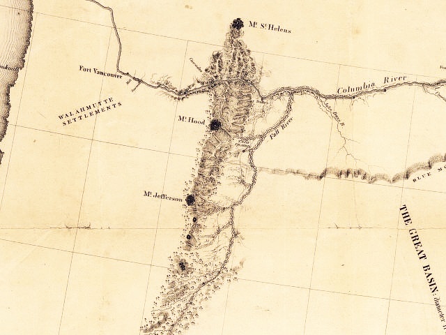
Charles Wilkes:
Map of the Oregon Territory.
Publication date: 1841.
In 1836, Congress approved the sum of $300,000 for
a purely scientific exploratory expedition.
The expedition, headed by Charles Wilkes,
left in 1838 and returned in 1842. The scientific
expedition visited at least cursorily
most every non-civilised coastal area in the world,
including the Pacific Northwest in 1841.
A large number of Puget Sound names which are still
in use today were provided by Wilkes' expedition, Commencement Bay (where he
started his charting of the sound) and Elliott Bay among them.
Charles Wilkes: Map of Upper California by the U.S. Ex. Ex. and Best Authorities. The Expedition, 1841. From his Narrative of the United States Exploring Expedition, Philadelphia, Lea & Blanchard, 1845. This is one of the maps resulting from the Navy Exploring Expedition of 1838-1842 commanded by Commodore Charles Wilkes (1798-1877). -- map source: University of Arizona Online Map Collection, 2002
1844
Duflot de Mofras:
"Carte De La Cote De L'Amerique Sur L'Ocean Pacifique Septentrional
Le Territoire De L'Oregon, Les Californies, ...",
Publisher: Paris, Arthus Bertrand, Atlas Map, by Eugene Duflot de
Mofras, 1844.
1844
Greenhow:
Map of the western and middle portions of North American
to illustrate the history of Oregon and California, and the other
countries on the north-west coast by Robert Greenhow, (1844)
1844
Lee and Frost:
1844 Map of Oregon, from D.Lee and J.H. Frost in Ten Years In
Oregon
1844
Charles Wilkes:
Map of the Oregon Territory,
United States Exploring Expedition, Charles Wilkes,
1844, James Wyld Publisher, London.
"Map of the Oregon Territory by the U.S. Ex. Ex. Charles Wilkes, Esqr.
Commander, 1841. Re-Published by James Wyld ... London, 1844."
1845
Charles Wilkes:
Map of Wilkes, 1845.
Publication date: 1873,
H.J. Toudy & Co. Lith.
ca. 1845
Farnham:
Map of the Californias, by T.J. Farnham, ca.1845
1845
Fremont:
Map of an exploring
expedition to the Rocky Mountains in the year 1842 and to Oregon & north California in the years 1843-44 / by
Brevet Capt. J.C. Fr?mont of the Corps of Topographical Engineers under the orders of Col. J.J. Abert, Chief of
the Topographical Bureau ; lith. by E. Weber Co., Baltimore, Md., 1845
1846
DeSmet:
Oregon Territory, 1846,
by Pierre-Jean de Smet, Published 1847.
1846 ... and 1847
Mitchell:
A new map of Texas, Oregon and California, by S. Agustus Mitchell, 1846.
Map of Oregon and Upper California,
by S. Augustus Mitchell, Philadelphia, 1847.
1848
DeSmet:
Nouvelle carte du territoire de l'Oregon
dressee par le Re. P. De Smet, de la
Compagnie de Jesus 1846.
Publication date: 1848, Publisher:
Grand, Impr. & lith. de Ve. Van de Schelden. In French.
Maps shows the locations of missions, churches,
and the travels of Pierre-Jean de Smet.
Father Pierre Jean De Smet came to the northwest
in 1840, as a "black robe" missionary to the
Flathead Indians. With them, he travelled
through Wyoming, Idaho, and Montana until 1841,
when he was appointed Superior of the Oregon Missions.
He remained at that post until
1846, after which he returned east.
1848
Fremont - Preuss:
Map of Oregon And Upper California From the Surveys of John
Charles Fremont And other Authorities. Drawn By Charles Preuss
Under the Order of the Senate Of The United States, Washington
City 1848. Lithy. by E. Weber & Co., Balto.
1848
Warre:
Warre's Travels in North America, 1848.
Henry Warre was sent by the British
government to visit Northwest America
and make notes on the area from a military point
of view. At the time, America and
Britain were engaged in a very unfriendly
conflict as to the exact location of the
American-British border.
The routes of Warre's party are shown
on the map here, with the red his journey
out and the blue his return journey. They
spent six months in the Pacific Northwest
in 1845. Warre brought along his watercolors,
and has provided us with a number of
sketches of the area of his travels.
By the time Warre and party returned to
Montreal and had their reports forwarded
to England, the British government had
already decided to settle on the
49th parallel as the area's border.
1848 ... also 1851
Ensigns & Thayer:
Ornamental Map Of The United States & Mexico, Wall Map, New York, Ensign,
Thayer & Co., 1851.
The 1851 edition "Same as the 1848 edition, but shows different states in
the western U.S. ...
Blanchard's name is dropped. Date is estimated from the U.S. western
states."
1849
Colton - Bonneville:
Map to Illustrate Capt Bonneville's Adventures among the Rocky Mountains.
Compiled by J.H. Colton, New York. Geo. P. Putnam, 1849.
Captain Benjamin Bonneville, on leave from the
U.S. Army, took a four year expedition, from 1832 to 1836,
into the American
west. They travelled parallel to the course
of the Snake and the Columbia, and
though they did reach Fort Walla Walla, they
never managed to reach as far as Fort Vancouver
or the Willamette Valley before turning
back into modern day Idaho. From
there, they turned south, and headed down into
California (then part of Mexico).
1849
Ross:
Map of the Columbia to illustrate Ross's Adventures,
by Alexander Ross, 1849, Published by Smith, Elder and Co. (London).
"The author of this map (and the book it comes in) was a trader in
the employ of John Jacob Astor's Pacific Fur Company, and took part in
Astor's first expedition to the northwest to extablish the
profitability of the fur trade there.
The expedition departed by sea from New York
City in late 1810, and arrived at the mouth of the Columbia River
in March of 1811, where it built Fort Astoria.
Over the years he spent in the
the northwest, he travelled the length and breadth of the future
state of Washington (with the notable exception of the areas west of the
Cascade Mountains), and also assisted in the building of
Fort Okanogan and Fort Nez Perce. He remained in the
northwest until 1823, at
which point he travelled to what would later become Montana,
where he would remain until his death in 1856."
1849
Charles Wilkes:
Map of the Oregon Territory, from the Best Authorities, 1849
Publication date: 1849,
Publishers: Philadelphia, Lee and Blanchard, 1849
From: Western America Charles Wilkes. 1849.
"This map is a direct refinement of Charles Wilkes'
1841 Map of the Oregon Territory, mostly with respect to refinements
and additions in the placement of mountain ranges.
Terrain has been added to Vancouver Island,
Mt. McLaughlin on the very southern edge of the
map has been moved to a more correct location, and so forth."
1849
James Wyld:
Map of the gold regions of California.
1850
Cowperthwait:
A New Map of the State of California, the territories of Oregon & Utah, and the chief part
of New Mexico.
A hand colored map including the Oregon Territory --
comprising the area that would later split into Washington Territory in
1853. The map also includes the newly formed State of California.
This map, published by Thomas Cowperthwait & Co.,
may be from an atlas set contracted to him by S. Augustus Mitchell.
Cowperthwait began publishing Mitchell's New Universal Atlas in 1850,
printing the atlas until 1856. (At that time it was taken over
by another well-known mapmaker, Charles DeSilver.)
Cowperthwait continued to use Mitchell maps in various forms well into the
1880s.
Publication date: 1850, Publisher: Pennsylvania, Thomas Cowperthwait & Co.
1852
Biedermann - Meyer's Hand Atlas:
A New Map of the State of California, the territories of Oregon & Utah:
compiled after the best authorities, 1852.
A hand colored map including the Oregon Territory --
comprising the area that would later split into Washington Territory in 1853.
The map also includes the recently formed State of California.
This map is numbered 144 from Joseph Meyer's "Meyer's Hand Atlas",
published by the Bilbiographic Institution of Hildburghausen
(Germany).
Publication date: 1852, Publisher:
Hildburghausen - The Bibliographic Institution
1852
Colton - Horn:
Colton Map for Horn's Overland Guide to California and Oregon, 1852.
Section only online.
1853 - 1854
Pacific Railroad Surveys:
1853
1853
Colton:
Washington and Oregon, 1853, by J.H. Colton & Co.
1853
Cowperthwait:
A New Map of the State of California,
the territories of Oregon, Washington,
Utah, & New Mexico.
Publication date: 1853,
Publisher: Pennsylvania, Thomas Cowperthwait & Co.
1854
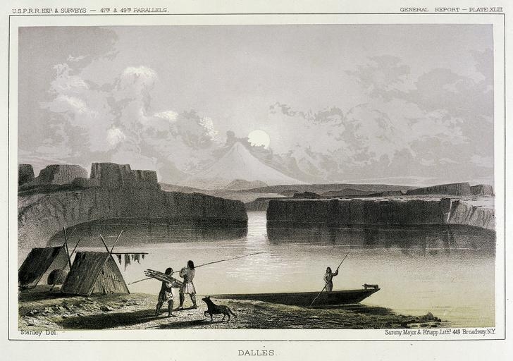
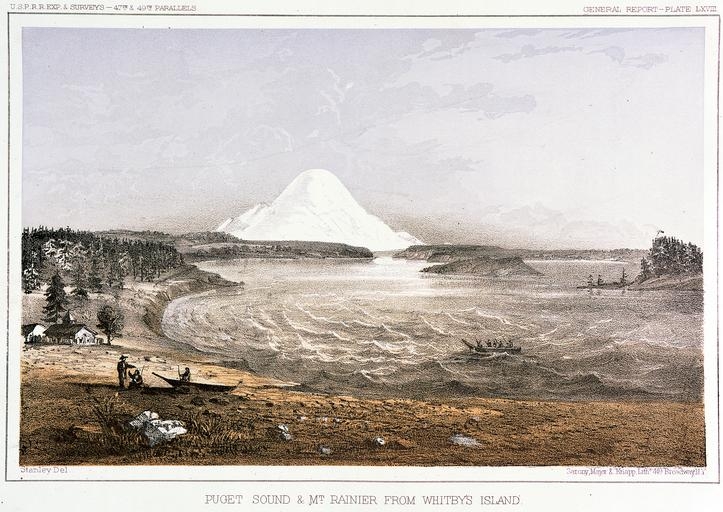
U.S. War Department:
Explorations and Surveys for a Rail Road Route from the Mississippi River
to the Pacific Ocean, War Department. Route near the 47th and 49th
Parallels., Map No. 3, Rocky Mountains to Puget Sound: From Explorations
and Surveys made under the direction of the Hon. Jefferson Davis
Secretary of War, by Isaac I. Stevens, Governor of Washington Territory,
1853-1854.
[See Pacific Railroad Surveys, 1853-1854, above, and 1860 entry below]
1854
Hitchcock:
Geology of the United States and adjacent parts of Canada
as represented by Edward Hitchcock (1854) Original map in
color.
1855
Disturnell:
Map of Oregon and Washington Territories, showing
the proposed Northern Railroad route to the
Pacific Ocean, 1855, by John Disturnell, New York.
The 1850s were marked by the push for a transcontinental
railway, and this map shows one of the
northernmost of the possible routes.
Surveys completed in 1855, apparently after this map
was constructed, pointed to a slightly more southerly
route for the eventual Northern
Pacific Railway. The route sketched here approximates
several eventual routes. The Montana and east portions
approximates that followed
by the Burlington Northern, while that in Washington,
Oregon, and Idaho follows the Northern Pacific's
eventual route in those states.
1855
Egloffstein:
Skeleton map exhibiting the route
explored by Capt. J. W. Gunnison U.S.A., 38 parallel of north latitude (1853), also that of the 41
parallel of latitude explored by
Lieutenant E. G. P. Beckwith 3d. Arty., (1854),
by F.W. Egloffstein, 1855
From Pacific Railroad Series, Vol 4.
[See Pacific Railroad Surveys, 1853-1854, above]
1855
Gibbs:
Map of the Western District of Washington Territory. Manuscript map depicting the western district of Washington Territory, drawn by George Gibbs, and approved by Isaac Stevens, 1855. The map includes the area of western Washington, from the Pacific Coast to the Cascade Mountain Range. Portions of the northwest corner of Oregon and southwest part of coastal British columbia are also shown.
Goodwin:
Map of California And The Adjacent Country, Compiled by F. Goodwin From
the best Authors and actual Observation. 1855.
Lith. of Geo. E. Leafe, N.Y., Pocket Map.
1855
Marcou:
Geology of the United States and adjacent parts of Canada
as represented by Marcou (1855) Original map in
color.
1855
Tilton:
Map of a part of Washington Territory, to accompany
the report of the Surveyor General, 1855.
James Tilton, Washington Surveyor General's Office, 1855.
Publisher: Olympia, Washington Territory, Surveyor Generals Office (Baltimore, Lith. by A.
Hoen & Co.)
1855
Williamson and Abbot:
1) From the northern boundary of California
to the Columbia River : from explorations
and surveys, made under the
direction of Hon. Jefferson Davis, Sec. of War
by Lieut. R. S. Williamson, U.S. Topl. Engrs.
and Lieut. H. L. Abbot,
U.S. Topl. Engrs., H. C. Fillebrown,
J. Young, and C. D. Anderson, Assts., 1855.
2) From San Francisco Bay to the northern boundary
of California : from explorations and surveys,
made under the direction of Hon. Jefferson Davis.
Sec of War by Lieut. R. S. Williamson,
U.S. Topl. Engrs. and Lieut. H. L. Abbot,
U.S. Topl. Engrs.,
H. C. Fillebrown, J. Young,
and C. D. Anderson, Assts., 1855.
[See Pacific Railroad Surveys, 1853-1854, above]
1856
DeSilver:
A new map of the State of California,
the Territories of Oregon, Washington, Utah & New
Mexico, by Charles DeSilver.
Publication date: 1856, Publisher: Philadelphia, Charles
DeSilver. Hand colored.
1856
1856
Preston:
Preston's Sectional and County Map of Oregon and Washington, west of the Cascade Mountains,
Compiled from United States Surveys and other authentic sources, by J.W. Trutch and G.W.
Hyde, 1856., A.H. Burley, Stationer, Chicago, Ill., Engraved by Ferd. Mayer & Co., New York.
1857
Colton:
The Territories of Washington and Oregon, 1857
1857
Hudson's Bay Company:
Aboriginal Map of North America denoting the
Boundaries and the Locations of various Indian Tribes.
The Hudson's Bay Company had grown from being a
small fur company to a powerful monopoly which held exclusive trade rights
throughout western Canada. This map comes from a
British Parliamentary Committee report on the Hudson's Bay Company which
resulted in the HBC being stripped of their exclusive
rights in south central Canada (in the provinces of Alberta, Saskatchewan, and
Manitoba), with the land being turned over to Canada for settlement.
Published date: 1857, Publisher: London
1857
Kohl:
A Map showing the Progress of Discovery on the West Coast of the U.S.
and Vancouver Island, composed by J.G. Kohl, 1857.
1857
Meany:
Meany's Historical Map of Washington (1857).
Received as part of the Edmond S. Meany papers held in Manuscripts, Special Collections, University Archives at the University of Washington Libraries, shows dates and treaty information highlighted in brown, missions in red, Indian reservations in blue, battles and mountain passes in black, and forts with population numbers[?] in green.
Events noted on map range from 1810 to 1857. Map is Pen-and-ink (India) on paper.
(NOTE: this web compiler could find no indication WHEN this map was drawn. Glacier Peak did not appear by name on any other maps until 1896).
1857
Rogers and Johnston:
Territories of Washington and Oregon, 1857,
by Prof. H.D. Rogers, and A.Keith Johnston, F.R.S.E.,
Engraved by W & A.K. Johnston, Edinburgh.
1857
Stevens and Carlton:
Map of the Indian Nations and Tribes of the
Territory of Washington and of the Territory of
Nebraska west of the mouth of the
Yellowstone. Made under the direction of
Isaac I. Stevens, Gov. of Wash. Terr. & Sup't of Ind. Affairs,
March 1857, Drawn by William H. Carlton, Surveyor and Top Eng.,
1857
1857
Swan:
Map of the Western Portion of Washington Territory, Compiled by J.G.
Swan, New York, Harper & Brothers, 1857.
In 1852, James G. Swan was invited to come
visit Shoalwater Bay, now known as Willapa Bay,
in the Washington territory.
Swan spent several years there, engaging
in the oyster business. In 1856 he went to the
nation's capital as a private secretary
to Congreeman Isaac Stevens, and there
found time to write the book that this
map is found in. Swan returned to the northwest
in 1858, and was one of the major figures
in the early history of Port Townsend.
1857
Tilton:
Map of a part of Washington Territory lying west of the Cascade Mounts, to accompany
the report of the Surveyor General, 1857.
James Tilton, Washington Surveyor General's Office, 1857.
Publisher: Olympia, Washington Territory, Surveyor Generals Office
(Philadelphia, P.S. Duval & Son)
1857
Wagner & McGuigan:
Washington Territory West of the cascade Mountains, 1857
ca. 1858
Mitchell:
"Map of North America" (from 1858) in Mitchell's school atlas:
comprising the maps and tables designed to accompany Mitchell's
school and family geography.
Philadelphia: E.H. Butler and Co., 1866, c1865.
ca. 1858
U.S. War Department:
Map of the territory of the United States from the
Mississippi River to the Pacific Ocean;
ordered by the Hon. Jeff'n Davis, Secretary of War,
To accompany the Reports of the Explorations
for a Railroad Route.
Made in accordance with the 10th & 11th sections of the Army
Appropriation, Act fo March 3rd. 1853.
Compiled from authorized explorations and
other reliable data by
Lieut. G.K. Warren, Topl. Engrs.
In the Office of Pacific R.R.Surveys, War Dep, under the direction of
BVT. Maj. W.H. Emory. Topl. Engrs. in 1854 and of
Capt. A.A. Humphreys. Topl. Engrs. 1854-5-6-7-8.
Drawn by E. Freyhold, Engr. on Stone by J.Bien, 60 Fulton St., N.Y.
[See Pacific Railroad Surveys, 1853-1854, above]
1859
Custer:
Boundary Commission: Henry Custer's Explorations (1857)
Actual survey work (North Cascades)
began in 1857. A Northwest Boundary Commission was
created that year, operating under the authority of the State
Department and headed by Archibald Campbell.
Campbell hired surveyors astronomers, geologists, naturalists,
and artists for the
survey team; his principal assistant was Lieutenant
John G. Parke, a U.S. Topographical Engineer who
served as chief astronomer and
surveyor. Other members of the team included ...
and Henry Custer, topographer ...
1859
Fiala:
General Map of the United States & Their Territory
between the Mississippi & the Pacific Ocean.
1. Showing the different surveyed
routes from the Mississippi valley to the
coast of Pacific Ocean, 2. the new established &
proposed Post Routes, 3. the recently
discovered gold, silver, and copper
region in Kansas, Nebraska and Arizona.
Compiled from the various P.R.R. Surveys & the best
authorities which could be obtained,
by John T. Fiala, C.E., 1859
Engraved on stone by A. Janicke.
1859
McGowan:
Map of the United States west of the Mississippi
showing the routes to Pike's Peak, overland
mail route to California and Pacific rail
road surveys. To which are added the new state
& territorial boundaires, the principal mail &
rail road routes with all the
arrangements & corrections made by Congress up
to the date of its issue. Compiled and drawn from
U.S. land & coast surveys
and other reliable sources, by
D. McGowan and Geo. H. Hildt, 1859. Hand colored.
Detailed general map framed in decorative
borders showing drainage, state boundaries,
cities and towns, and the transportation and
communication networks. An excellent
example of a promotional map to encourage emigration.
1859
U.S. Army Corps:
Map of the State of Oregon and Washington Territory, compiled in The Bureau of Topo.Eng.,
chiefly for military purposes, by order of Hon. John B. Floyd, Sec. of War, 1859.
U.S. Army Corps of Topographical Engineers, and the U.S. Army, Department of Oregon, J.B.
Floyd and W.H. Dougal.
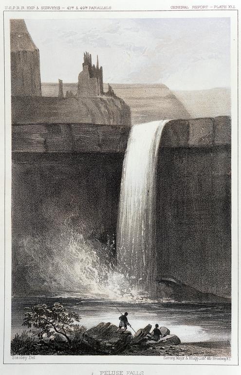
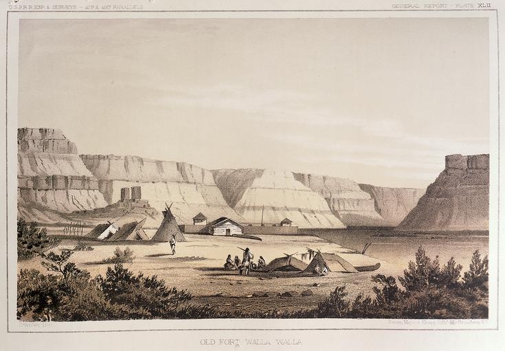
1860
U.S. War Department:
Images of engravings from U.S. War Department's Reports of explorations
and surveys to ascertain the most practicable and economical route for a
railroad from the Mississippi River to the Pacific Ocean, 1860, v.12,
pt.1.
[See also 1854 entry]
1860 ... also 1864 to 1867
Colton:
1) Colton's Map of Oregon, Washington, Idaho and British Columbia, 1860.
2) Colton's Map of the States and Territories West of the Mississippi River
to the Pacific Ocean, Showing the Overland Routes, Projects Rail Road
Lines, & c., Published by J.H. Colton, New York, 1864.
3) Colton's Map of Oregon, Washington, Idaho, Montana, and British Columbia,
by G.W. and C.B. Colton & Company, 1867.
[Also see Colton Map, 1862, and Colton Map 1876 for different spellings, elevations,
etc.]
1860 ... also 1861 - 1877
Mitchell:
Map of Oregon, Washington, and part of British Columbia, by S. Augustus Mitchell,
Pennsylvania (?), 1860.
Other Mitchell maps using same Cascade peaks nomenclature --
1) Map of Oregon, Washington, and part of British Columbia", dates between March 2nd, 1861
(when the Dakota Territory was formed) and March 4th, 1863 (when the Idaho Territory was
formed from eastern Washington and western Dakota).
2) Map of Oregon, Washington, and Part of Idaho, dates from between March 4th, 1864
(when the Idaho Territory was formed) and May 26th, 1864 (when the Montana Territory was
formed out of eastern Idaho).
3) Map of Oregon, Washington, Idaho, and Montana (1866)
4) Map of Oregon, Washington, Idaho, and Montana (1867)
5) Map of Oregon, Washington, Idaho, and Montana (1869)
6) Map of Oregon, Washington, Idaho, and Montana (1874)
7) Map of Oregon, Washington, Idaho, and Montana (1877)
1861
James Tilton:
Map of a part of Washington Territory, to accompany
the report of the Surveyor General,
1861.
James Tilton, United States Surveyor General, 1861.
Removed from:
Message of the President of the United States to the two
houses of Congress at the commencement of the second session
of the thirty-seventh Congress. Washington : G.P.O., 1861.
1862
Colton:
Colton's Rail-Road and Military Map of
the United States, Mexico, the West Indies, &c.,
by J.H. Colton, New York, 1862,
Includes census information for 1860.
Detailed general map of portions of
North America framed in decorative borders
showing drainage, international and state
boundaries, cities
and towns, forts, railroads in operation,
and proposed lines.
[See Colton entry of 1860 above for more Colton maps]
1862 ... also 1863 to 1888
Surveyor General:
Map of public surveys in the Territory of Washington
to accompany report of Surveyor General, (1862)
United States General Land Office.
Publication date: 1862.
Maps similarly done in the 1863, 1865, 1876, 1879, 1880, 1883, 1884, 1888.
1863 - 1865? ... also 1873
Williams:
Map of Washington, Oregon, and Idaho, by J. David Williams, Ferd. Mayer & Co., 1863-1865?.
Also published in 1873
1863 ... also 1864
Johnson and Ward:
Johnson's Washington, Oregon, and Idaho, 1863,
by Johnson and Ward. Also published in 1864.
"Map publisher Alvin Jewitt Johnson purchased
steel plate engravings and copyrights from
mapmaker J.H. Colton sometime around 1859. To
conserve the plates, Johnson transferred the
information from steel to lithographic stone,
making updated adjustments/corrections when
needed. He also added decorative borders and
colors applied by hand to the maps."
1865
Johnson:
Johnson's Oregon and Washington, by A.J. Johnson, New York, 1865.
Similar map published in 1873 with
"Mt. Thielson" being called "Scotts Peak".
See 1873 below.
1865
Wilson:
Map of Public Surveys in the Territory of
Washington, to Accompany Report of Surveyor
General, 1865
1866
Holdredge:
1) Washington;
2) Oregon;
3) California;
From:
State, Territorial and Ocean Guide Book of the Pacific: Containing the
Time and Distance Tables, on or Connecting with the Pacific Coast and
the Interior, To Which Are Added Nine Large and Reliable Maps Showing
Principal Towns, Routes of Communication, etc., San Francisco; Published
Semi-Annually by Sterling M. Holdredge., 1866.
1867
Boyd:
Map of part of the United States exhibiting the
principal mail routes west of the Mississippi River, by
E.D. Boyd, 1867, Hand colored.
1867
Mitchell:
County Map of California, 1867, by S. Augustus Mitchell, Jr.
1868
Bancroft:
Bancroft's Map of Oregon, Washington,
Idaho, Montana,
and British Columbia, Published by H.H. Bancroft, & Comp.,
Booksellers & Stationers, San
Francisco Cal., 1868.
Publication date: 1868, Publisher: San Francisco,
H.H. Bancroft & Company.
1870
Linsley:
Journal, Daniel Linsley, Glacier Peak
1871
Charles Wilkes:
Map of the Oregon Territory, by Charles Wilkes, Created/Published in 1871
ca.1872
1873
Johnson:
Johnson's Oregon and Washington, by A.J. Johnson, New York, 1873.
Similar map published in 1865 with "Scotts Peak" being called "Mt. Thielson".
See 1865 above.
1873 ... also 1874
Gray:
Map of Oregon and Washington (1873), by F.A. Gray, Published by O.W. Gray
& Son, 1873.
Oregon and Washington, 1874, by Ormando Willis Gray and Frank A. Gray, Stedman, Brown & Lyon.
[See 1891 for later Gray and Son map]
1876 ... also 1880 - 1886
Colton:
1) Colton's Oregon, Washington, and Idaho, by G.W. and C.B. Colton &
Company, 1876.
2) Colton's township map of Oregon & Washington Territory,
issued by the Oregon Railway and Navigation Co.,
by G.W. and C.B. Colton & Company, ca.1880,
3) Similar map also published in 1886,
with the addition of Paulina L. and East L.
1876
Rand McNally:
Map of Oregon, 1876, by Rand McNally and Company.
Indexed map of Oregon showing the
railroads in the state and the express
company doing business over each,
also, counties, lakes & rivers.
1877
Williams:
William's New Trans-Continental Pap of the
Pacific R.R.
and routes of overland travel to Colorado, Nebraska,
the Black Hills, Utah, Idaho,
Nevada, Montana, California and the Pacific Coast,
Henry T. Williams, Publisher, 1877
1881
U.S. Army Corps of Engineers:
Map of the Department of the Columbia, 1881, by
T.W. Symons, U.S. Army Corps of Engineers.
1881
Rand McNally:
Map of Washington, 1881, by
Rand McNally and Company
1882
Bowen & Co:
Map of Juan de Fuca's Sea sometimes called Puget Sound:
embracing the Mediterranean section common to British
Columbia and Washington Territory and it Geographical
Relations to the Great River Valleys and
Inter-Oceanic Traffic of the World, by Amos Bowman, Mining and Civil
Engineer , Published by Alfred D. Bowen & Co., as a Premium to the
Subscribers of the Northwest Enterprise, Anacortes W.T. 1882.
1883
George F. Cram:
Cram's Rail Road & Township Map of Washington,
George F. Cram Company, Chicago, Ill. 1883.
[Compare with his map of 1896]
1883
Bien & Co.
Map of the Northern Pacific Railroad, its branches and allied lines.
Publication date: 1883, Publisher: New York, Julius Bien & Co. lith.
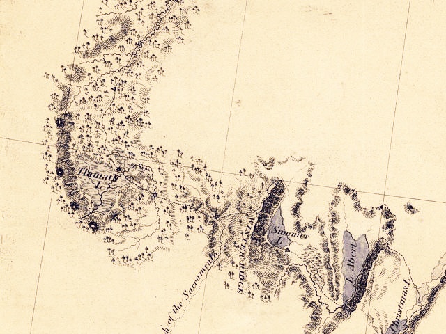
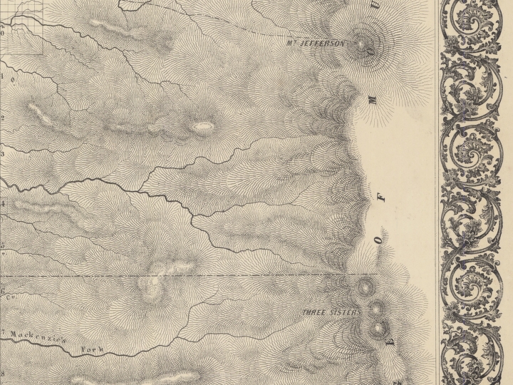
1883
USGS
U.S. Geological Survey, 1883, Fifth Annual Report Plate XLIV
1884
Bradley
County and township map of Oregon and Washington, by William M. Bradley,
1884, Published by Wm Bradley & Bro., Philadelphia.
Compare to his 1887 map listed below.
1884
George F. Cram:
Washington Territory, 1884.
Geo.F. Cram, Engraver and Publisher, Chicago, Ill.
George F. Cram: Oregon, 1884. Geo.F. Cram, Engraver and Publisher, Chicago, Ill. -- map source: Washington State University Online Map Collection, 2002
1885 ... and 1894
McGee:
Geological Map of the United States
1886
Phillips & Hunt:
Washington and Oregon, 1886,
Phillips & Hunt.
1886
Union Pacific Railroad:
Union Pacific Railroad map showing line of branches from
U.P.R.R. to Portland Oregon,
Puget Sound Wash, Terr, to Montana : to
accompany report of G.M. Dodge Chief Eng., (1886)
1886
Northern Pacific Railroad:
Map of the Northern Pacific Railroad and Connections, 1886, by Henry Jacob
Winser, Published 1888, St. Paul, Northern News Co.
In 1888, the Northern Pacific finally completed the last
requirement of its original charter, the construction of a
direct route to the Puget
Sound. Stampede Pass across the Cascades opened in May of 1888.
1887 ... also 1889 and ca.1894
Bradley:
County and township map of Oregon and Washington, by William M. Bradley,
1887, Published by Wm Bradley & Bro., Philadelphia.
Compare to his 1884 map listed above.
Also, Washington and Oregon, 1889, by Wm. M. Bradley.
Washington and Oregon, ca.1894, by Bradley & Company.
1887
Colton:
1887
Grant:
Rail Road & Township Map of Washington, 1887,
Grant's Map of Washington Territory,
from Grant's Standard Indexed Atlas
1888
Coast and Geodetic Survey:
Pacific Coast from San Francisco bay to the Strait of Juan de Fuca, 1888, by the U.S. Coast and Geodetic Survey.
1888
Johnstone:
"The Unique Map of California", by E.McD. Johnstone, Published under the auspices of the
Southern Pacific Compnay, and the State Board of Trade of California.
Has inset pictures.
1888
Rand, McNally & Co.:
Washington Territory, ca.1888
1888
Union Pacific Railroad:
Tourist map of Union Pacific, the overland route and connecting lines,
1888, by the Union Pacific Railroad Company.
In 1888, the Union Pacific Railroad Company was
touting tourist points of interest on their
transcontinental railroad route. While the
boundaries and geography of the United States is
somewhat skewed, the map does include inset
pictures of scenic places found along the
track. The Transcontinental Railroad took four
years to complete (1865-1869). Stretching some
1,700 miles, the Central Pacific pushed
east from Sacramento as the Union Pacific left
Omaha, Nebraska and traveled through the Platte River Valley.
The two lines met at the
summit of Promontory Point near Ogden, Utah on
May 10, 1869 and helped unite the country both physically and mentally.
While Washington State is represented only minimally
on this rendering, the map in fact came from a
pamphlet selling points of interest for
Washington and Oregon. The "Columbia Tours" as they
were called included special promotional
rates for traveling north out of Portland to
four destinations, including Alaska, the Cascade Mountains,
and Crater Lake. The trip from Portland to Seattle took three hours.
ca.1888
Map, ca.1888
1889 ... also ca.1884
Bradley:
Washington and Oregon,
1889, Bradley & Company.
Also map - Washington and Oregon, ca.1894,
From: Bradley's atlas of the world for commercial and library
reference, Wm. M. Bradley & Company, 1895.
1891
Gray:
Oregon and Washington, 1891, by O.W. Gray & Son.
[See 1874 entry for earlier Gray Map]
1891
Mathews-Northrup Co.:
Map of Washington and Oregon.
Publication date: 1891, Publisher: Buffalo and New York, Mathews-Northrup Co. 1891
By 1889, Congress granted the Washington Territory its statehood.
This map shows the counties of both Oregon and Washington States.
Note that by 1891 all of Washington state held
county designations. While little is known of the Mathews-Northrup Co.,
this map could befrom the company's Century Atlas. Other known characteristics
common to the company is a "piano-key" border and that color was
printed, not hand applied, onto the map.
1891
Pacific Coast Steamship
Company:
Map showing routes of the Pacific Coast Steamship Company,
Steamship information on verso, Published 1891, Rand
McNally and Company
1891
Walker:
Washington, (1891)
Henry Walker
1892
Grant:
Washington, (1892)
Bankers' and brokers' railroad atlas.
Grant's bankers' and brokers' railroad atlas.
Alexander A. Grant.
This map is almost an exact duplicate of Henry Walker's 1891 'Washington'. [See above]
ca.1892
Northern Pacific Railroad:
Map of Washington, Oregon and part of Idaho, ca.1892, published by Rand, McNally & Co.
1893
Pacific Forest Reserve
1895
Rand McNally:
Rand, McNally & Co's New 11 x 14 Maps, of Washington, Oregon,
and California, 1895
1896
George F. Cram:
Cram's township and railroad map of Washington, 1896.
[Compare with his map of 1883]
1896
C.H. Crocker:
The Pacific Northwest, Oregon, Washington, Idaho, prepared by C.H. Crocker, 1896.
This map is issued by the Pacific Northwest Immigration Board, which was established and is
maintained by the business men of the city of Portland, Oregon.
1897
U.S. General Land Office:
Map of the State of Washington (1897).
United States General Land Office.
1898
1899
Baker:
New map of the Puget Sound Country, A Valuable Compendium of Useful
Information and Complete Railway and Navigation Guide for Travelers and
Settlers,
by Charles H. Baker & Co., Compilers, 1899.
1899
USGS:
U.S. Geological Survey Glacier Peak Quad, 1899,
1:125,000, topographic quadrangle.
"Surveyed in 1897-99"
"Contour interval 100 feet. Datum is mean sea level."
Publication date: 1955
1899
Mount Rainier National Park established March 2, 1899.
1899
U.S. General Land Office:
Mount Ranier Forest Reserve, Washington, 1899,
United States General Land Office, Drafting Division
1899
USGS:
Mount Rainier Forest Reserve, Washington, showing classification of lands,
1899, U.S. Geological Survey, Annual Report, by Fred G. Plummer
1901
"Etas-Unis" (from 1901) in Nouveau Larousse illustr?;
dictionnaire universel encyclop?dique,
publi? sous la direction de Claude Aug?. Paris,
Librairie Larousse. 1898-1904. (In French) Also
"Etas-Unis (partie occidentale et cote orientale)"
(from 1901) in
Nouveau Larousse illustr?; dictionnaire
universel encyclop?dique, publi?
sous la direction de Claude Aug?. Paris,
Librairie Larousse. 1898-1904. (In French)
1902
Chittenden:
Map of the Trans-Mississippi of the United States during the period
of the American fur trade as conducted from St.
Louis between the years 1807 and 1843., Created/Published: 1902,
From: History of the Fur Trade of the Far West,
by H.M. Chittenden, vol. 3.
1902
Crater Lake National Park Established
1905, 1912
1907
U.S. Army Corps Engineers:
Mount Rainier National Park, 1907, U.S. Army Corps of Engineers, Compiled
from various sources, Under direction of Maj. H.N. Chittenden, Corps of
Engineers, U.S.A., by Eugene Ricksecker, Asst.Engr., November 1906,
Revised to October 1907, Scale 2 miles to 1 inch.
1907
Dixen:
Map showing location and subdivisions of the Shasta and surrounding
tribes, by Roland B. Dixen, 1907
1908
USGS:
USGS Topo Map, 1908,
USGS Professional Paper No.60, Plate IX
1909
Oregon Railway and Navigation Co.:
Outings in Oregon, 1909,
Oregon Railway and Navigation Company, Passenger Dept.,
This map comes from a tourism brochure promoting travel
within the state of Oregon. Its indicative of the change in focus on the part of the
railroads - with no further income coming in from land grants,
and the rush to homestead long since declined to a relative trickle, railroads
turned their focus to promoting train travel,
or tourism, as a greater source of income for themselves.
-- map source: Washington State University Online Map Collection, 2002
1910
Hammond & Co.:
Oregon, 1910, New Reference Atlas of the World
C.S. Hammond & Company, New York.
1912
Easton:
A Map of Mt. Baker, Wash., The Wonderland of the Northwest, Drawn by Easton, The Art
Jeweler, Historian of the Mt. Baker Club, Copyrighted 1912, by C.F. Easton.
Publisher: Bellingham, Wash., Engberg Pharmacy.
1914
Renshawe:
Panoramic view of the Mount Rainier National Park, Washington, 1914,
Prepared by John H. Renshawe from topographic sheet of the United States
Geological Survey, Engraved and printed by the United States Geological
Survey.
1915
Great Northern Railway:
Map of the Great Northern Railway system showing through See America First
Route from Chicago and Kansas City, 1915.
The Great Northern finished its transcontinental route in 1893,
crossing the cascades at Stevens' Pass.
This map comes from a tourism brochure, promoting
cross-country railroad travel as a means for easterners
to visit the western states.
1915
U.S. Forest Service:
Rainier National Forest, Washington (1915), Map of Rainier National Forest
and directions to hunters and campers (1915),
U.S. Department of Agriculture, Forest Service, Henry S. Graves, Forester,
Rainier National Forest, Washington, Willamette Meridian, 1915, Compiled
by R.H. Robertson, Portland, Oregon, Printed by the U.S. Geological Survey
1915
USGS:
Geologic and Topographic Map of the Shasta Route, From Seattle,
Washington to San Francisco, California, 1915,
USGS Bulletin 614, Sheet 8
1919
USGS:
USGS Topo Map, September 1894, reprinted in 1919
1924
USGS:
Mount Rainier, Wash., 1924,
U.S. Geological Survey 1:125,000 topographic quadrangle,
Topography by C.P. McKinley and W.R. Chenoweth, Control in part by U.S.
Coast and Geodetic Survey, Surveyed in 1924, Park area reduced from map of
Mt. Rainier National Park.,
1925
Burlington Northern:
Burlington system connections.
Publication date: 1925, Publisher: Chicago, Poole Bros.
1925
Rider:
Rider's California "Mt. Shasta and Vicinity" Map, 1925, Sheet No.7,
map was "reprinted
from the Geological and Topographic map
of the Coast Route compiled by the
Untied States Geological Survey, George Otis Smith, Director
ca. 1929
"Stati Uniti - Ufficio Cartografica del Touring Club Italiano" in
Enciclopedia italiana di scienze, lettere ed arti. Roma: Istitvto Giovanni
Treccani. 1929-39.
(In Italian)
1934
USGS:
USGS Topo Map, September 1894, reprinted in 1934
|

If you have questions or comments please contact: GS-CVO-WEB@usgs.gov
2008 - 2011, Lyn Topinka
Return to: Volcanoes and History | CVO Home Page