The Volcanoes of
Lewis and Clark
Lewis and Clark
|
November 7, 1805 Nearing the Pacific - Wallace Island to Pillar Rock |
|
Home
The Volcanoes of Lewis and Clark Map of the Journey Volcanoes, Basalt Plateaus, Major Rivers, etc. The Volcanoes Mount Adams, Mount Hood, Mount Jefferson, Mount Rainier, and Mount St. Helens CALENDAR of the Journey October 1805 to June 1806 Along the Journey Pacific Northwest Maps - Columbia River, Volcanoes, Flood Basalts, Missoula Floods, Geology, etc. The Corps of Discovery The Journey of Lewis and Clark About the Reference Materials The Journals, Biddle/Allen, DeVoto, Gass, Moulton, Topo Maps, and others USGS Lewis and Clark Links Links to USGS Websites highlighting the Lewis and Clark Journey Resources Publications Referenced and Websites Visited |
PREVIOUS
November 6 Heading to the Pacific, Prescott Beach to Wallace Island |
November 7
Nearing the Pacific, Wallace Island to Pillar Rock Wallace Island, Mount St. Helens, Puget Island, Cathlamet (Washington) and the Cathlamet Channel, Julia Butler Hansen NWR, Tenasillahe Island, Saddle Mountain, Skamokawa (Washington), Cathlamet Bay and the Lewis and Clark NWR, Columbia River Estuary, "View of the Ocian", Pillar Rock |
CONTINUE
November 8-9 Nearing the Pacific, Pillar Rock to Grays Point |
|
To the Pacific - November 1805
Nearing the Pacific - Wallace Island to Pillar Rock |
| Lewis and Clark's camp of November 6, 1805, was on the Washington side of the Columbia River, between Eagle Cliff and Cape Horn, across from Wallace Island. |
| Thursday, November 7, 1805 |
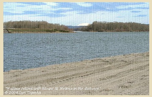
| The morning was rainy and the fog so thick that we could not see across the river. We observed however, opposite to our camp, the upper point of an island [Wallace Island], between which and the steep hills on the right [between Eagle Cliff and Cape Horn] we proceeded for five miles. |
| Mount St. Helens is visible along this stretch of the Columbia. |
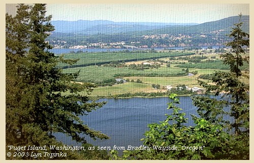
| Three miles lower is the beginning of an island [Puget Island] separated from the right shore by a narrow channel [Cathlamet Channel]; |
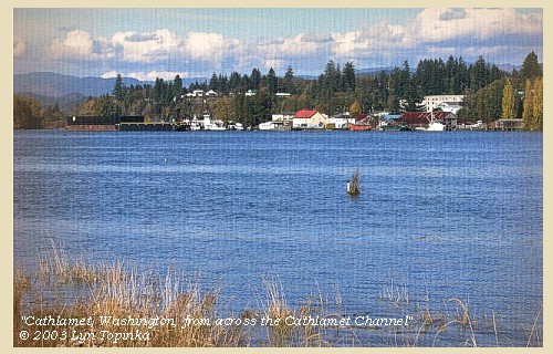
| down this we proceeded under the direction of some Indians whom we had just met going up the river, and who returned in order to show us their village. It consists of four houses only, situated on this channel [Cathlamet Channel] |
| The town of Cathlamet, Washington, is situated on the Cathlamet Channel, behind Puget Island. |
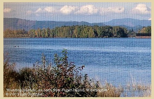
| behind several marshy islands [Hunting Islands] formed by two small creeks [Elochman River and Nelson Creek merging into the Elochoman Slough]. |
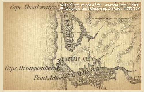
| Lewis and Clark are entering the upstream edge of the "Columbia River Estuary", the upper end which is the Julia Butler Hansen National Wildlife Refuge for Columbian White-tailed Deer. The Hunting Islands are one of the many islands in the refuge. |
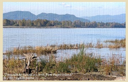
| On our arrival they gave us some fish, and we afterwards purchased wappatoo roots, fish, three dogs, and two otter skins, for which we gave fishhooks chiefly, that being an article of which they are very fond. After remaining with them about an hour, we proceeded down the channel [Cathlamet Channel] with an Indian dressed in a sailor's jacket for our pilot, and on reaching the main channel [of the Columbia River] were visited by some Indians who have a temporary residence on a marshy island in the middle of the river [Tenasillahe Island] where is a great abundance of water fowl. |
| "... a large marshey Island near the middle of the river near which Several Canoes Came allong Side with Skins, roots fish &c. to Sell, and had a temporey residence on this Island, here we See great numbers of water fowls about those marshey Islands; ..." [Clark, November 7, 1805] |
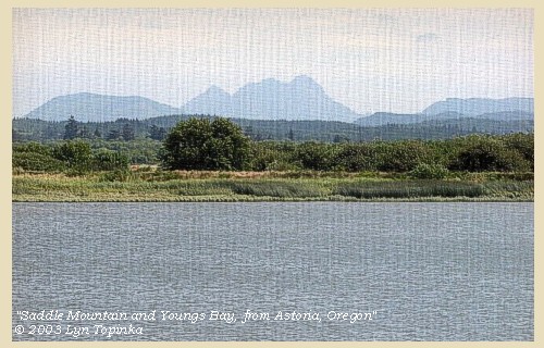
| Here the mountainous country again approaches the river on the left [vicinity of Clifton, Oregon], and a higher mountain is distinguished towards the southwest. [Saddle Mountain] |
| "... a high mountn. to the S.W. about 20 miles ..." [Clark, November 7, 1805] |
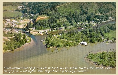
| At a distance of twenty miles from our camp we halted at a village of Wahkiacums, consisting of seven ill-looking houses, built in the same form with those above, and situated at the foot of the high hills on the right, behind two small marshy islands [Skamokawa, Washington, area] , |
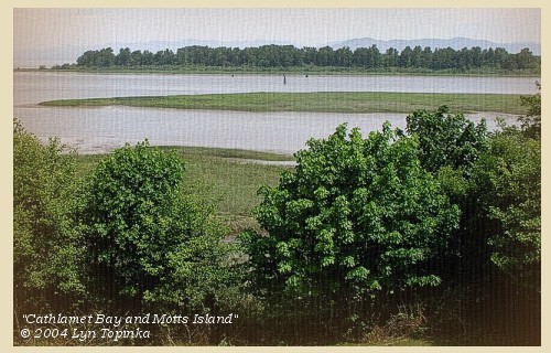
| We merely stopped to purchase some food and two beaver skins, and then proceeded. Opposite to these islands the hills on the left retire, and the river widens into a kind of bay crowded with low islands [Cathlamet Bay, Oregon side of the Columbia, today part of the Lewis and Clark National Wildlife Refuge.], subject to be overflowed occasionally by the tide. |
| "... the river widens into a kind of Bay & is Crouded with low Islands Subject to be Covered by the tides ..." [Clark, November 7, 1805] |
| We had not gone far from this village when the fog cleared off, and we enjoyed the delightful prospect of the ocean; that ocean, the object of all our labours, the reward of all our anxieties. This cheering view exhilirated the spirits of all the party, who were still more delighted on hearing the distant roar of the breakers. |
| " ... Great joy in camp we are in View of the Ocian, this great Pacific Octean which we been So long anxious to See. and the roreing or noise made by the waves brakeing on the rockey Shores (as I Suppose) may be heard distictly ..." [Clark, November 7, 1805] |
| We went on with great cheerfulness under the high mountainous country which continued along the right bank; the shore was however so bold and rocky, that we could not, until after going fourteen miles from the last village, find any spot fit for an encampment [downstream of Jim Crow Point across from Pillar Rock]. |
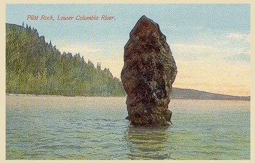
| "... we proceeded on about 12 miles below the Village under a high mountaneous Countrey on the Stard. Side. Shore boald and rockey and Encamped under a high hill on the Stard. Side opposit to a rock Situated half a mile from the Shore, about 50 feet high and 20 feet Diamieter ..." [Clark, November 7, 1805] |
| At that distance, having made during the day thirty-four miles, we spread our mats on the ground, and passed the night in the rain. Here we were joined by our small canoe, which had been separated from us during the fog this morning. |
|
|
|
The Camp - November 7, 1805:
Camped opposite Pillar Rock, between Brookfield and Dahlia, Washington, west of Jim Crow Point. |
| Home | Previous | Continue |
If you have questions or comments please contact: GS-CVO-WEB@usgs.gov
June/July 2004, Lyn Topinka
The Volcanoes of Lewis and Clark Home Page | CVO Home Page


