|
November 5, 1805 Heading to the Pacific - Ridgefield to Prescott Beach |
|
Home
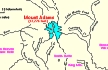
The Volcanoes of Lewis and Clark Map of the Journey Volcanoes, Basalt Plateaus, Major Rivers, etc. The Volcanoes Mount Adams, Mount Hood, Mount Jefferson, Mount Rainier, and Mount St. Helens CALENDAR of the Journey October 1805 to June 1806 Along the Journey Pacific Northwest Maps - Columbia River, Volcanoes, Flood Basalts, Missoula Floods, Geology, etc. The Corps of Discovery The Journey of Lewis and Clark About the Reference Materials The Journals, Biddle/Allen, DeVoto, Gass, Moulton, Topo Maps, and others USGS Lewis and Clark Links Links to USGS Websites highlighting the Lewis and Clark Journey Resources Publications Referenced and Websites Visited |
PREVIOUS
November 4 Vancouver, Washington, Columbia River Slough to Ridgefield NWR |
November 5
Heading to the Pacific, Ridgefield NWR to Prescott Beach, Oregon Ridgefield NWR, Bachelor Island, Lewis River, Warrior Point, Multnomah Channel, Sauvie Island, St. Helens (Oregon), Mount St. Helens, Mount Adams, and Mount Hood, Martin Bluff, Deer Island, Goble Volcanics, Kalama River, Prescott Beach, Coast Range, Puget Trough and the Willamette Valley, Boring Lava Field |
CONTINUE
November 6 Heading to the Pacific, Prescott Beach to Wallace Island |
On October 7, 1805, Lewis and Clark and the
"Corps of Discovery" began their journey
down the Clearwater River and into the volcanics
of the Pacific Northwest. The Corps travelled from the
Clearwater to the Snake and down the
"Great Columbia", finally reaching the
Pacific Ocean on November 15, 1805.
Along the journey they encountered the
lava flows of the Columbia Plateau,
river channels carved by the great "Missoula Floods",
and the awesome beauty of five Cascade Range volcanoes.

[Click map for brief summary about the area] |
|
To the Pacific - November 1805
Heading to the Pacific - Ridgefield to Prescott Beach |
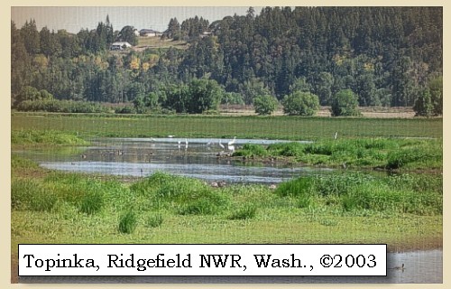
| Lewis and Clark's camp of November 4, 1805, was in today's Ridgefield National Wildlife Refuge. |
| Tuesday, November 5, 1805 |
| Our choice of a camp had been very unfortunate; for on a sand island opposite to us [???] were immense numbers of geese, swan-ducks, and other wild fowl, who, during the whole night, serenaded us with a confusion of noises which completely prevented our sleeping. [Ridgefield National Wildlife Refuge] During the latter part of the night it rained, and we therefore willingly left our encampment at an early hour. |
| "... Rained all the after part of last night, rain continues this morning, I lept but verry little last night for the noise Kept dureing the whole of the night by the Swans, Geese, white & Grey Brant Ducks &c. on a Small Sand Island close under the Lard. Side; they were emensely noumerous, and their noise horid ..." [Clark, November 5, 1805] |
|
|
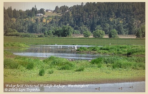
Ridgefield National Wildlife Refuge: The Ridgefield National Wildlife Refuge Complex is comprised of five refuges located in the southwest part of the state of Washington: Ridgefield north of Vancouver; Conboy in the southcentral part of the state; and Franz Lake, Pierce and Steigerwald Lake all located in the Columbia River Gorge. The refuge north of Vancouver, Washington, was established in 1965 in response to a need to establish vital winter habitat for the dusky Canada goose whose nesting areas in Alaska were severly impacted by the violent earthquake of 1964. This refuge is the location of two Lewis and Clark campsites (November 4, 1805 and March 29, 1806), and is an ancient Chinook townsite visited by the Expedition. In their journals, Lewis and Clark described the wapato plants that were harvested by the Chinook women, as well as, the geese and ducks that kept them awake at night. These species are still here today. Trails, auto tour, and wildlife viewing. Located 14 miles north of Vancouver, Washington. -- U.S. Fish and Wildlife Service Website, 2002, Lewis and Clark Bicentennial Website, 2002, and Lewis and Clark Bicentennial in Oregon Website, 2002 
|
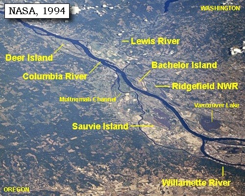
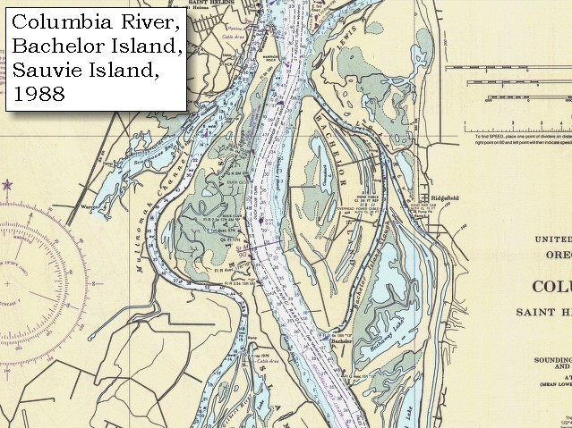
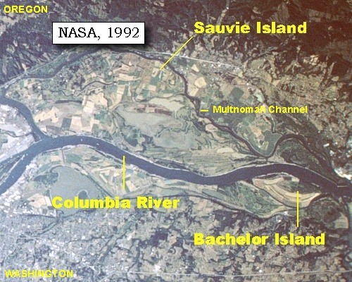
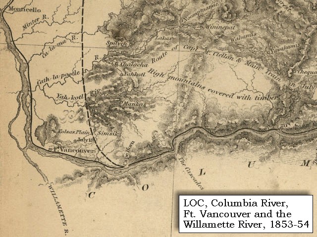
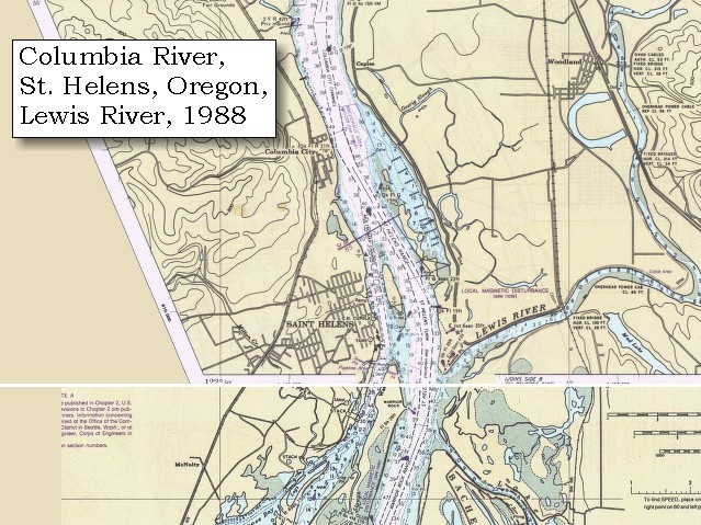
| We passed at three miles a small prairie, where the river is only three quarters of a mile in width. ...... At eight miles we came to the lower point of an island [the island there today is Bachelor Island], separated from the right side by a narrow channel [Bachelor Island Slough], |
|
|
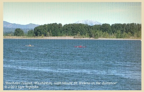
Bachelor Island: Lewis and Clark first called the island "Green Bryor Isd," when they traveled downriver in 1805 but changed the name to "Quathlahpotle Island" in 1806. They honored the large village of 14 wooden houses and 900 inhabitants on the mainland, naming the island for the native village. The present name is of local origin, in honor of an unmarried man who took a donation claim on the island. Bachelor Island is now part of the Ridgefield National Wildlife Refuge. -- Washington State Historical Society Website, 2002, "Lasting Legacy"

|
| on which, a short distance above the end of the island, is situated a large village ...... the front has fourteen houses, which are ranged for a quarter of a mile along the channel. ...... |
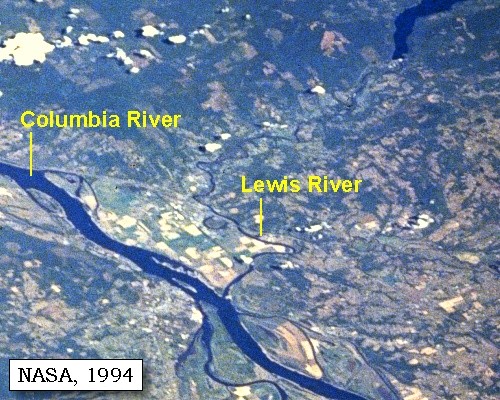
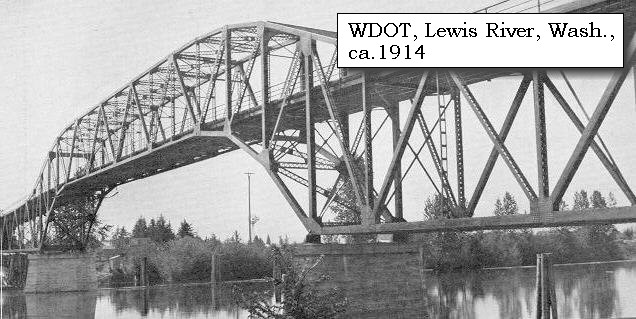
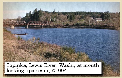
| The Lewis River enters the Columbia River at the downstream end of Bachelor Island. Lewis and Clark missed the mouth of the Lewis River on their journey in 1805, but noted it in the journals on March 29, 1806, on the return. |
|
|
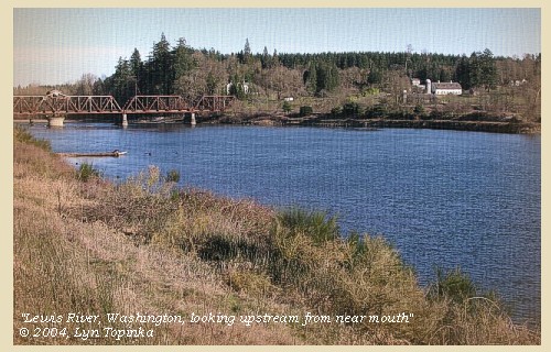
Lewis River: The Lewis River is merges with the Columbia River at River Mile (RM) 87. The watershed is approximately 93 miles long, has a total fall of approximately 12,000 feet, drains an area of about 1,050 square miles, and comprises two large drainages, the North Fork and East Fork, which converge approximately 3.5 miles upriver from the confluence with the Columbia River. The headwaters of the Lewis arise on the southern flanks of Mount St. Helens and Mount Adams. The mainstem of the Lewis, also known as the North Fork, flows southwesterly through three impoundments, Swift Reservoir (RM 48), Yale Reservoir (34), and Merwin Lake (RM 19.5). The majority of the Lewis River basin is forested, typical of the southern Washington Cascade Mountains. However, an area of approximately 30 square miles within the upper basin was denuded by the May 18, 1980 eruption of Mount St. Helens The major tributaries within the Lewis River system below Merwin Dam include the East Fork Lewis River, Johnson Creek, and Cedar Creek. The basin has a complex geologic history, having undergone Tertiary volcanism, several glaciations, and interglacial erosion and deposition. Lewis and Clark used "Chah wah na hi ook River" to identify a "Small river" that entered the Columbia on the north shore. Their name was a figurative form of the Chinookan term for "enemies." In 1853 a railroad surveyor charted the river as "Cathlapootle," a distortion of a common name for the river used by early explorers, fur traders, and settlers. Today the river is named for Adolphus Lee Lewis, a descendent of an Hudson Bay Company employee who homesteaded near the river's mouth. -- Columbia Basin Fish and Wildlife Authority Website, 2004, and Washington State Historical Society, 2004, "Lasting Legacy" 

|
| The river here again widens to the space of a mile and a half. As we descended we soon observed, behind a sharp point of rocks [Warrior Point on Sauvie Island], |
|
|
|
Warrior Point:
Both the northern quarter-mile of the tip of Sauvie Island (Warrior Point) and the usually submerged Warrior Rock are composed of the hard black Columbia River basalt that also underlies the city of St. Helens, Oregon. These basalts are part of the series of lava flows that came down the ancestral Columbia River valley 12 million to 14 million years ago. Warrior Rock is a basalt reef that lies beneath the surface of the Columbia River during high water, near the east side of Sauvie Island, three-quarters of a mile south of its northern tip. Warrior Rock takes it name from Warrior Point, the prominent basalt pinnacle that stands 38 feet above sea level near the north end of Sauvie Island. Nathaniel Wyeth of Boston established a temporary fort in 1832 at Warrior Point. -- Allen, 1985, Time Travel in Oregon, and St. Helens Chamber of Commerce Website, 2003 |
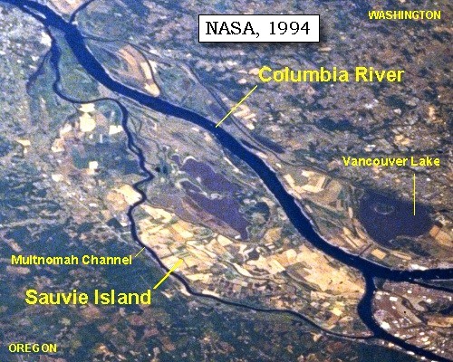
| a channel a quarter of a mile wide [Multnomah Channel], |
|
|
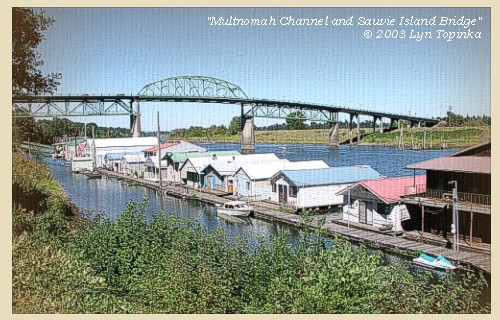
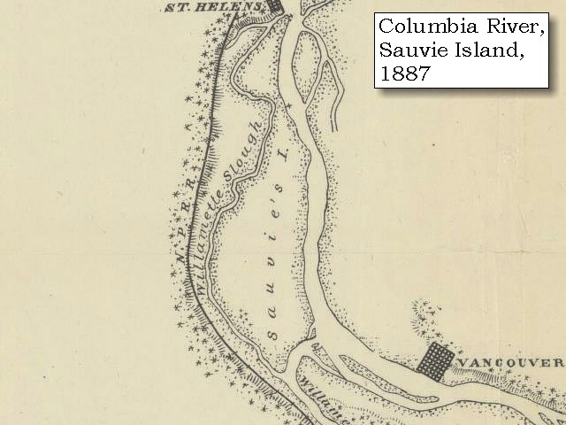
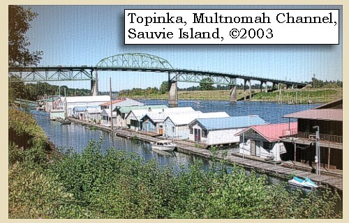
Multnomah Channel: Multnomah Channel has also been known as the Willamette Slough (1887 map). The channel separates Sauvie Island from mainland Oregon, and is a favorite recreation spot of boaters.
|
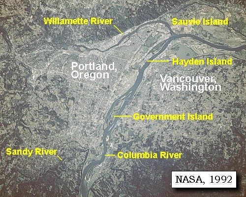
| which we suppose must be the one taken by the canoes yesterday on leaving Image-canoe island [the upstream end of Sauvie Island, on the 1805 journey down the Columbia, Lewis and Clark did not separate Sauvie Island from Hayden Island.]. |
|
|
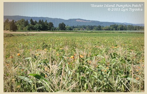
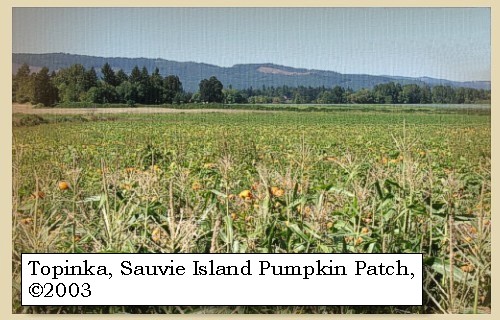
Sauvie Island: Sauvie Island contains approximately 24,000 acres of land and lakes, and had its origin in alluvial deposits from the Columbia and Willamette rivers as their velocities decreased by changes in direction and by lava extrusions located on the north end. The island is 16 miles long and 4.5 miles at the widest point. The Sauvie Island wildlife area includes 8,053 acres of deeded land and 3,490 acres of land leased from the Division of State Lands for wildlife management purposes. The island is bounded on the east by the Columbia River; on the south by the Willamette River and on the west by the Multnomah Channel. Across the river on the Washington side, Scappoose Bay provides fish and wildlife habitat. -- Columbia Basin Fish and Wildlife Authority Website, 2002, Oregon State Archives Website, 2002, and Washington State Historical Society Website, 2002
|
| A mile below the channel [Multnomah Channel] are some low cliffs of rocks [on the left bank is the location of today's St. Helens, Oregon] |
|
|
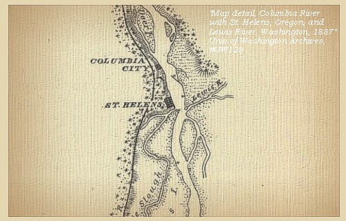
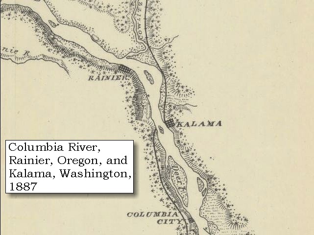
St. Helens, Oregon: St. Helens, Oregon, is a deep-water seaport located on the Columbia River 29 miles northwest of Portland, and 66 miles southwest of Astoria. The hard black Columbia River basalt which underlies the city of St. Helens is part of the series of lava flows that came down the ancestral Columbia River valley 12 million to 14 million years ago. Meriwether Lewis and William Clark passed the rocky bluffs on which St. Helens was later to be built, in the winter of 1805 on their journey to the Pacific Ocean. In 1854, Columbia County was created, being formerly a part of Washington County. After a heated battle, St. Helens was named the county seat in August 1903. The old courthouse made of locally quarried stone, was built in 1906. The resent town site was chartered by an act of the Legislature on February 25, 1889. The post office was established in 1853. Views can be seen of Mount Hood, Mount Adams and Mount St. Helens. -- Allen, 1985, Time Travel in Oregon, and St. Helens Chamber of Commerce Website, 2003 
|
| near which is a large island on the right side, and two small islands a little further on. Here we met two canoes ascending the river. At this place the shore on the right becomes bold and rocky, [Martin Bluff] and the bank is bordered by a range of high hills covered with a thick growth of pine: |
|
|
|
Geology of Martin Bluff:
Andesitic to rhyolitic tuff (Eocene), pumiceous lapilli tuff, and pumiceous and lithic tuff breccia lithologically similar to tuff of the Goble Volcanics unit. Well-exposed in cliffs along the east bank of the Columbia River near Martin Bluff, in nearby railroad cuts, and along Interstate Highway 5 northeast of Martin Island. -- Evarts, 2002 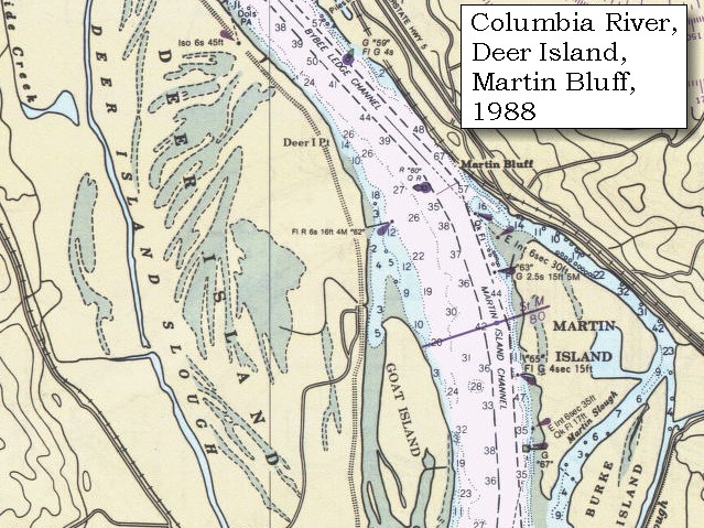
|
| on the other side is an extensive low island [Deer Island], separated from the left side by a narrow channel. |
|
|
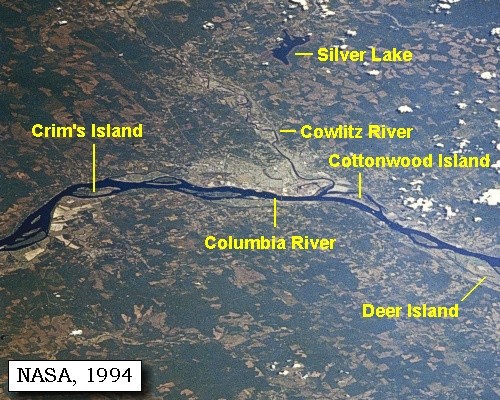
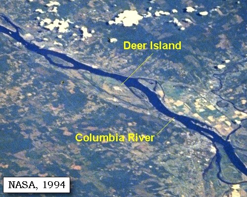
Deer Island: Deer Island is Holocene and Pleistocene alluvium, unconsolidated, poorly sorted to well-sorted, massive to laminated, commonly cross-stratified sand, silt, and minor gravel of the Columbia River floodplain. Locally includes fine-grained lacustrine, aeolian, and organic-rich marsh deposits. -- Evarts, 2002
|
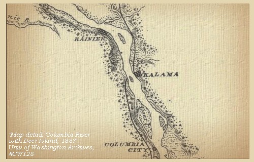
| Here we stopped to dine [Deer Island], and found the island open, with an abundant growth of grass, and a number of ponds well supplied with fowls; and at the lower extremity are the remains of an old village. We procured a swan, several ducks, and a brant, and saw some deer on the island. Besides this island, the lower extremity of which is seventeen miles from the channel just mentioned, we passed two or three smaller ones in the same distance. Here the hills on the right retire from the river, leaving a high plain [location of today's Woodland, Washington, on the flood plains of the Lewis River], between which, on the left bank, a range of high hills running southeast and covered with pine, forms a bold and rocky shore. At the distance of six miles, however, these hills again return and close the river on both sides [near Goble, Oregon and Kalama, Washington]. |
|
|
|
Goble Volcanics:
The thick sequence of basaltic flows and pyroclastic rocks (late Eocene-early Oligocene) that crop out on both sides of the Columbia River in southwestern Washington and northwestern Oregon are mapped as Goble Volcanics in Oregon, and informal or lithologic names are applied to the rocks on the Washington side. The type area is the vicinity of Goble, Oregon, where a thickness of more than 5,000 feet was mapped by Wilkingson and others (1946). The volcanics form cliffs along the Columbia River (and today's Interstate-5) for several miles. Subaerial lava flows, agglomerates, and oxidized soil horizons are typical features of the cliff exposures. The basalt is generally fresh, fine grained, and has masses of iddingsite scattered throughout along with microphenocrysts of plagioclase and pyroxene. Rock types include pillow, columnar or hackly jointed, massive or vesicular basalt flows and dikes. -- Armentrout, etc., 1980, and Evarts, 2002 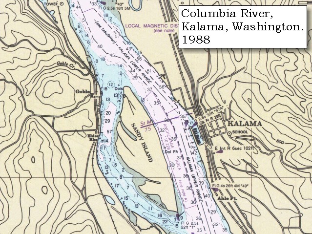
|
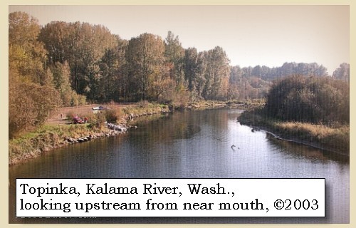
| We proceeded on, and at four miles reached a creek on the right [Kalama River], about twenty yards in width, immediately below which is an old village. |
|
|
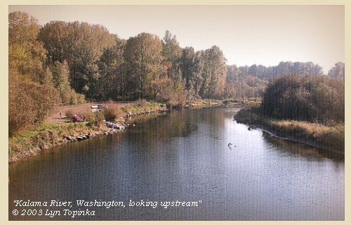
Kalama River: Lewis and Clark used "Cath la haws Creek" on their return trip to identify this drainage on the north bank of the Columbia. Their name was an attempt to identify the tribe that resided on the "creek." Early fur traders anglicized the Indian word to "Kalama" to identify the river. Today several versions of the name's origin exist, shrouding the meaning of the original origin. The Kalama River begins on the southwest slope of Mount St. Helens and flows 44.5 miles westsouthwest to enter the Columbia River at River Mile (RM) 73. It has a drainage are of 205 square miles. The topography is mountainous, averaging 1,880 feet, and climaxing near 8,000 feet on Mount St. Helens. Much of the landscape was formed over the last 20,000 years as a result of Mount St. Helens' volcanic activity. Lahars (mudflows) traveled down many of the Kalama basin?s drainages, leaving unconsolidated volcanic deposits that have a tendency to erode on steep slopes. -- Columbia Basin Fish and Wildlife Authority Website, 2004, and Washington State Historical Society Website, 2004, "Lasting Legacy".
|
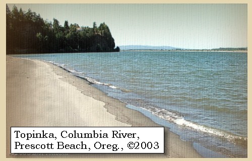
| Three miles further, and at the distance of thirty-two miles from our camp of last night, we halted under a point of highland, with thick pine trees on the left bank of the river. [Prescott Beach County Park] ...... |
|
|
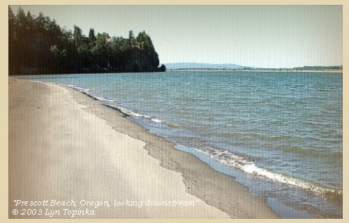
Prescott Beach: Prescott Beach hosts one of the Columbia River's finest fishing and windsurfing sites. The beach also features a covered picnic shelter, playground equipment, a beautiful gazebo, a horse shoe pit and sand volleyball courts. Prescott is day-use only, opening one hour before sunrise and closing one hour after sunset. Located 14 miles north of St. Helens, and five miles south of Rainier. Turn off U.S. 30 onto Graham Road. 1.75 miles to park entrance. -- Columbia County Forests, Parks, and Recreation Website, 2004
|
| The river is here deep, and about a mile and a half in width. Here too the ridge of low mountains [The Coast Range] running northwest and southeast, |
|
|
|
Coast Range:
The Coast Ranges, which border the entire west coast of the United States from the Olympic Peninsula south to Mexico, vary greatly in both rock type and climate. Upper Mesozoic and Tertiary sedimentary rocks predominate, although intrusive and metamorphic rocks are also present. Most rocks have been folded, faulted, and in places intensely sheared; many of the Tertiary rocks are poorly consolidated. Topography is mountainous, with steep slopes and intervening flat valleys. Precipitation in the Coast Ranges is seasonal, ranging from very wet in parts of the northern ranges to semiarid in the south, with periodic storms accompanied by intense rainfall. The combination of steep slopes, soft, sheared rocks, and periods of heavy precipitation makes this subdivision, particularly in California, one of the most landslide prone areas of the United States. Tectonic melange, especially that of the Franciscan assemblage, is especially slide prone; landslides on natural slopes are common in all three categories of slide, fall, and flow. Debris flows during rainstorms are a particular hazard in southern California, where much of the area is heavily developed, so that many landslides have been artificially activated. The Coast Ranges are seismically active, and earthquakes have triggered many landslides. -- Radbruch-Hall, et.al., 1982, USGS Professional Paper 1183 |
| cross the river, and form the western boundary of the plain through which we have just passed [The Willamette Valley/Puget Trough]. This great plain or valley begins above the mouth of Quicksand river [Sandy River], and is about sixty miles wide in a straight line, while on the right and left it extends to a great distance: it is a fertile and delightful country, shaded by thick groves of tall timber, watered by small ponds, and running on both sides of the river. The soil is rich, and capable of any species of culture; but in the present condition of the Indians, its chief production is the wappatoo root, which grows spontaneously and exclusively in this region. Sheltered as it is on both sides, the temperature is much milder than that of the surrounding country; for even at this season of the year we observe very little appearance of frost. During its whole extent it is inhabited by numerous tribes of Indians, who either reside in it permanently, or visit its waters in quest of fish and wappatoo roots: we gave it the name of the Columbia valley. |
|
|
|
Puget Trough and Willamette Valley:
The Puget-Willamette Lowlands extend from the United States-Canadian border south to Eugene, Oregon, between the Coast Ranges and the Cascade Mountains. The climate is subhumid to humid. The northern part is a flat glacial plain interrupted by the complex bays and inlets of Puget Sound. The southern part of the lowlands consists of alluvial valleys along the Cowlitz, Columbia, and Willamette Rivers. Most of Oregon's population, technology and agricultural centers, and important transportion, power, and communications lifelines are located in the Willamette Valley of western Oregon. The lowlands of the Willamette Valley extend about 75 miles along the Willamette River and contain the major cities of Portland, Salem, Corvallis, and Eugene. The valley is part of the Willamette River drainage basin, which covers 12,300 square miles between the crest of the Oregon Coast Range on the west and the Cascade Range to the east. The Willamette River is the largest river in the valley and is fed by several major tributaries, including the McKenzie, Calapooia, Santiam, Tualatin, Yamhill, and Clakamas Rivers. The valley is the major source of ground and surface water for the population centers. -- Radbruch-Hall, et.al., 1982, USGS Professional Paper 1183, and Givler and Wells, 2001


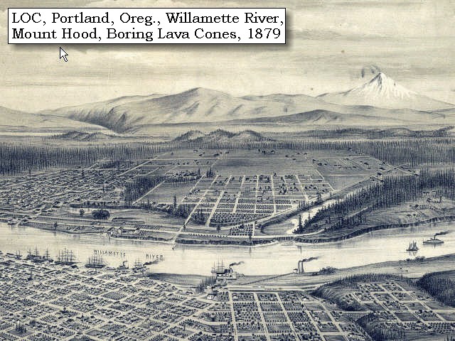
Geology of the Willamette Valley: The Willamette valley consists of four sub-basins: the southern and northern Willamette basins, the Tualatin basin, and the Portland basin. The Waldo Hills separate the southern Willamette basin from the northern basin, and the Chehalem Mountains separate the northern basin from the Tualatin Basin. Northeast of the Tualatin basin, the Tualatin Mountains form the divide with the Portland Basin. The Willamette Valley lies within a fore-arc basin between the Cascade Volcanic Arc and the Coast Ranges that may have originated in early Tertiary time. Some of the sub-basins have accumulated several hundred meters of sediment in late Cenozoic time. The northern basins also contain lavas of the Miocene Columbia River Basalt Group (CRBG). Flows of the CRBG entered the valley approximately 16 million years ago through a low in the Cascade Range and spread into the Portland and northern Willamette basins. The Tualatin Mountains, Chehalem Mountains, Waldo Hills, and Salem Hills are largely composed of CRBG flows that dip inward toward the basin centers. Approximately 3.0 million to 260,000 years ago, the Boring Lavas were erupted from several vents throughout the northern Willamette, Portland, and Tualatin basins. Boring Lavas capped the Oregon City plateau and created many of the prominent small cone-shaped hills and mountains southeast of downtown Portland. Between 15,000 and 12,700 years ago catastrophic floods from glacial Lake Missoula inundated the majority of the Willamette Valley. These floods reached up to 120 meters above sea level covering the valley with up to 35 meters of sediment and depositing ice-rafted boulders foreign to the Willamette Valley as far south as Eugene, Oregon. -- Gannett and Caldwell Boring Lava Field: Metropolitan Portland, Oregon, and an area east of Vancouver, Washington, includes most of a Plio-Pleistocene volcanic field. which erupted from several vents throughout the northern Willamette, Portland, and Tualatin basins. The field was identified by Trimble in 1963, who named it after the hills east of Portland. It consists of at least 50 small monogenetic centers, composed chiefly of mafic andesite. The eruptive features mostly are short stubby lava flows, who compositions are very similar to comparable units in the High Cascades. The field ranges in age from about 3 to 1 million years. -- Allen, 1990, IN: Wood and Kienle, and Hammond, 1989. 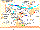
|
|
|
|
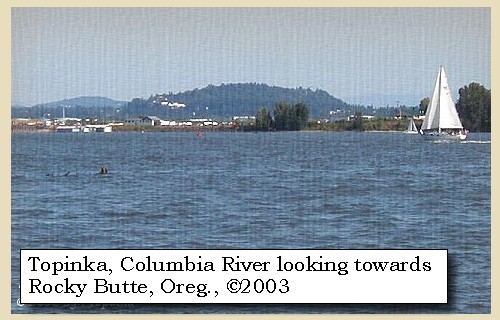
The Camp - November 5, 1805:
Lewis and Clark's camp of November 5, 1805, was "under a point of high ground, with thick pine trees", near the location of Prescott Beach County Park, Oregon. |
| Home | Previous | Continue |
If you have questions or comments please contact: GS-CVO-WEB@usgs.gov
June/July 2004, Lyn Topinka
The Volcanoes of Lewis and Clark Home Page | CVO Home Page