The Volcanoes of
Lewis and Clark
March 23 - 24, 1806
Heading Home - Fort Clatsop to Tenasillahe Island
 
Home
The Volcanoes of Lewis and Clark

Map of the Journey
Volcanoes, Basalt Plateaus, Major Rivers, etc.

The Volcanoes
Mount Adams, Mount Hood, Mount Jefferson, Mount Rainier, and Mount St. Helens

CALENDAR of the Journey
October 1805 to June 1806

Along the Journey
Pacific Northwest Maps - Columbia River, Volcanoes, Flood Basalts, Missoula Floods, Geology, etc.

The Corps of Discovery
The Journey of Lewis and Clark

About the Reference Materials
The Journals, Biddle/Allen, DeVoto, Gass, Moulton, Topo Maps, and others

USGS Lewis and Clark Links
Links to USGS Websites highlighting the Lewis and Clark Journey

Resources
Publications Referenced and Websites Visited


PREVIOUS

December 7-25, 1805
A Place to Winter, Tongue Point to Fort Clatsop
March 23-24

Heading Home,
Fort Clatsop to Tenasillahe Island

Fort Clatsop National Memorial, Mount St. Helens and Mount Adams, Rain and More Rain, Youngs Bay, Tongue Point, John Day River (Clatsop County), Cathlamet Bay and the Lewis and Clark NWR, Cathlamet Point - Aldrich Point, Tenasillahe Island
CONTINUE

March 25-28
Heading Home, Puget Island to Deer Island
 

On October 7, 1805, Lewis and Clark and the "Corps of Discovery" began their journey down the Clearwater River and into the volcanics of the Pacific Northwest. The Corps travelled from the Clearwater to the Snake and down the "Great Columbia", finally reaching the Pacific Ocean on November 15, 1805. Along the journey they encountered the lava flows of the Columbia Plateau, river channels carved by the great "Missoula Floods", and the awesome beauty of five Cascade Range volcanoes.

Map, Lewis and Clark in the Pacific Northwest, click for brief
                         summary
[Click map for brief summary about the area]


Heading for Home - March 1806
Back on the Columbia - Fort Clatsop to Tenasillahe Island
 

Lewis and Clark wintered at Fort Clatsop, near the mouth of the Columbia River. Today the Fort Clatsop National Memorial is a reconstruction of Lewis and Clarks winter quarters. On March 23, 1806, they began their journey home.

Sunday, March 23, 1806
The canoes were loaded, and at one o'clock in the afternoon we took a final leave of fort Clatsop.
"... at 1 P.M. we bid a final adieu to Fort Clatsop ..." [Lewis, March 23, 1806]


Along the Journey - March 23, 1806
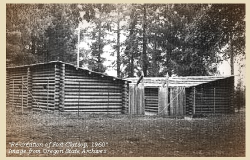
Fort Clatsop, 1960

Fort Clatsop National Memorial:
This site comemorates the 1805-06 winter encampment of the 33-member Lewis and Clark Expedition. A 1955 community-built replica of the explorers' 50'x50' Fort Clatsop is the focus of this 125-acre park. The fort, historic canoe landing, and spring are nestled in the coastal forests and wetlands of the Coast Range as it merges with the Columbia River Estuary. The Salt Works unit commemorates the expedition's salt-making activities. Salt obtained from seawater was essential to the explorers' winter at Fort Clatsop and their journey back to the United States in 1806. -- U.S. National Park Service Website, Fort Clatsop National Memorial, 2002


Map, 1814, Lewis and Clark on the Columbia, click to enlarge Map, 1833, Illman and Pilbrow, Columbia River, click to enlarge Map, 1987, Youngs Bay, Smith Point, Astoria, click to enlarge NASA Image, 2001, Mouth of the Columbia River, click to enlarge Image, 1940, Lewis and Clark Fort Clatsop location, click to enlarge Image, 1960, Lewis and Clark Fort Clatsop location, click to enlarge
  1. 1814 Map, Lewis and Clark's map of the Columbia River (section of original). (Click to enlarge.) Shows Fort Clatsop. Map includes three of the five volcanoes Lewis and Clark saw and commented on. While the journals mention the expedition seeing Mount Adams, it does not appear on their map. Mount Jefferson is to the south (bottom) and off the map. From the "Nicholas Biddle/Paul Allen" 1814 publication. Original Map: "A Map of Lewis and Clark's Track, Across the Western Portion of North America, From the Mississippi to the Pacific Ocean". From: History of the expedition under the command of Captains Lewis and Clark : to the sources of the Missouri, thence across the Rocky Mountains and down the river Columbia to the Pacific Ocean : performed during the years 1804-5-6 : by order of the government of the United States / prepared for the press by Paul Allen. Philadelphia : Bradford and Insskeep, 1814. Harold B. Lee Library, Brigham Young University #upbover maps37. -- Brigham Young University, Harold B. Lee Library Website, 2004.
  2. 1833 Map (section of original), Columbia River. (Click to enlarge). Includes Mount Hood and Mount Jefferson. Note: Mount Baker is depicted (upper middle) but Mounts Adams, Rainier and St. Helens are missing. The Columbia River is shown as "Oregon River" at its mouth and "Columbia or Oregon R." further inland. "Wappatoo Valley" is labeled. Also shows Fort Clatsop ("F. Clatsop or F. George"), the Willamette River ("Multnomah R."), Sandy River ("Quicksand R."), John Day River ("R.La Page"), Walla Walla River ("Wallwullah R."), Snake River ("Lewis R."), and the Yakima River ("Tapete R."). Original Map: Oregon Territory, 1833. Creator: Illman & Pilbrow, published by Illman & Pilbrow, New York. Comments: Illman & Pilbrow is the engraving firm which copyrighted and published this map, the actual artist is unknown. Washington State University Digital Maps Collection #WSU323. University of Washington Digital Maps Collection #UW104. -- Washington State University Early Washington Maps Digital Collection Website, 2004
  3. 1987 Map, Youngs Bay, Smith Point, Astoria (section of original). (Click to enlarge). Office of Coast Surveys, Historical Maps and Charts, Columbia River, Pacific Ocean to Harrington Point, 1987, Chart#18521, 1:40,000. -- NOAA Office of Coast Survey Website, 2004
  4. 2001, NASA Image, Mouth of the Columbia River, including the location of Fort Clatsop. (Click to enlarge). NASA Space Shuttle photograph of the mouth of the Columbia River, including the location of Fort Clatsop, the Lewis and Clark National Wildlife Refuge, Tenasillahe Island, Puget Island, and Crim's Island, June 20, 2001. NASA Astronaut Photography of Earth #SS002-724-30. -- NASA Astronaut Photography of Earth Website, 2002
  5. 1940, This is the site of Meriwether Lewis and William Clark's camp during the long wet winter of 1805-1806 in the Oregon Country. (Click to enlarge). It is now called Fort Clatsop and is a few miles south of Astoria and the Columbia River mouth. Photographer: Ben Maxwell. Photograph Date: 1940. Oregon State Archives Ben Maxwell Collection #5410A. -- Oregon State Archives Website, 2003
  6. 1960, Re-creation of Fort Clatsop. (Click to enlarge). Pictured is a re-creation of Fort Clatsop near Youngs River, south of Astoria, in September, 1960. The log buildings face each other with a wooden fence made out of spiked poles with an opening gate between them. The roof of each building slopes towards the center so the rainwater could be gathered. The fort was the first military establishment built in Oregon. Photographer: Ben Maxwell. Photograph Date: September 1960. Oregon State Archives Ben Maxwell Collection #8234. -- Oregon State Archives Website, 2003


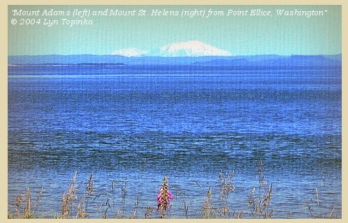
On a clear day, Mount St. Helens and Mount Adams are visible from the mouth of the Columbia River.


Along the Journey - March 23, 1806
Mount Adams (left) and Mount St. Helens from near mouth of the Columbia, 2004

Mount Adams and Mount St. Helens:
On November 25, 1805, Captain Clark wrote in his journal
"... Mt St. Hilians Can be Seen from the mouth of this river ..."
Astoria, Oregon, near the mouth of the Columbia River, is nearly 100 miles east of Mount St. Helens, Washington. In Lewis and Clark's time Mount St. Helens was 9,677 feet high. Since the eruption of May 18, 1980, the volcano is 8,364 feet high. Mount Adams, which Captain Clark did not mention, is east of Mount St. Helens, and, at 12,236 feet, can also be seen from near the mouth of the Columbia River.


Map, the Volcanoes of Lewis and Clark, click to enlarge Map, 1814, Lewis and Clark on the Columbia, click to enlarge Map, 1853, Washington and Oregon and the Columbia River, click to enlarge Map, 1855, Columbia River, Vancouver to the Pacific, click to enlarge Map, 1860, Columbia River, Washington, Oregon, click to enlarge Image, 1987, Mount Adams, Washington, from Troutlake, click to enlarge Image, ca.1853, Mount St. Helens and the mouth of the Columbia River, click to enlarge Image, 1889, Mount St. Helens and the mouth of the Columbia River, click to enlarge Image, 1978, Mount St. Helens, before the May 18, 1980 eruption, click to enlarge Image, 1982, Mount St. Helens from Spirit Lake, click to enlarge Image, 2004, Mount Adams and Mount St. Helens from Point Ellice
  1. Map, "Lewis and Clark Volcano Sitings"
  2. 1814 Map, Lewis and Clark's map of the Columbia River (section of original). (Click to enlarge.) Map includes three of the five volcanoes Lewis and Clark saw and commented on. While the journals mention the expedition seeing Mount Adams, it does not appear on their map. Mount Jefferson is to the south (bottom) and off the map. From the "Nicholas Biddle/Paul Allen" 1814 publication. Original Map: "A Map of Lewis and Clark's Track, Across the Western Portion of North America, From the Mississippi to the Pacific Ocean". From: History of the expedition under the command of Captains Lewis and Clark : to the sources of the Missouri, thence across the Rocky Mountains and down the river Columbia to the Pacific Ocean : performed during the years 1804-5-6 : by order of the government of the United States / prepared for the press by Paul Allen. Philadelphia : Bradford and Insskeep, 1814. Harold B. Lee Library, Brigham Young University #upbover maps37. -- Brigham Young University, Harold B. Lee Library Website, 2004.
  3. 1853 Map, Washington and Oregon and the Columbia River, from the Clearwater River to the Snake River and down the Columbia River to the Pacific Ocean (section of original). (Click to enlarge). Includes: Clearwater River (Kooskooski), Lapwai Creek (Lapwai R.), Snake River (Saptin or Lewis R.), Columbia River (Columbia R.), Yakima River (Yakima R.), Walla Walla River (Wallawalla R.), Umatilla River (Umatilla R.), Willow Creek (Quesnells R.), John Day River (John day's R.), Deschutes River (Fall R.), Willamette River (Willammette R.), and Cowlitz River (Cowlitz R.). Original Map: "Map of California, Oregon, Washington, Utah, and New Mexico (1853)", by Thomas Cowperthwait & Co. Washington State University Archives #WSU22. -- Washington State University Library Collections Website, 2003
  4. 1855 Map, Columbia River from Vancouver to the Pacific, including Mount St. Helens (section of original). (Click to enlarge). Original Map: "Map of Oregon and Washington Territories: showing the proposed Northern Railroad route to the Pacific Ocean, by John Disturnell, 1855. University of Washington Archives #UW155. -- University of Washington Library Collections Website, 2002
  5. 1860 Map, Columbia River, Washington State, and Oregon (section of original). (Click to enlarge). Original Map: Map of Oregon, Washington, and British Columbia, (1860). This map dates between March 2nd, 1861 (when the Dakota Territory was formed) and March 4th, 1863 (when the Idaho Territory was formed from eastern Washington and western Dakota) Nearing retirement from a thirty year long and rather successful career, S. Augustus Mitchell printed this map showcasing Oregon, the Territory of Washington, and British Columbia. Washington became a territory in 1853, arguing that distances to Willamette Valley kept them from obtaining a voice in the Oregon territorial government. As this map shows, when it split from Oregon proper the Washington territory included parts of Wyoming and Montana and all of Idaho. Territorial government for Idaho would not be approved until 1863. When Mitchell retired he left the business for his son to manage. Washington State University Archives #WSU7. -- Washington State University Archives, 2004
  6. 1987, USGS Photo showing Mount Adams, Washington, from Trout Lake (Click to enlarge). Photographer: Lyn Topinka, Date: November 1987. -- USGS Cascades Volcano Observatory Photo Archives, 2004
  7. ca.1853, Engraving. Mouth of the Columbia River (section of original). (Click to enlarge). Engraving depicts the Mouth of the Columbia River, Point Ellice, Mount St. Helens, and Tongue Point. Original also depicts Cape Disappointment and Point Adams. From: NOAA Photo Archives, America's Coastline Collection #line2075. -- NOAA Photo Archvies Website, 2002
  8. 1889, Engraving/Sketch. Mouth of the Columbia River (section of original). (Click to enlarge). Engraving depicts the Mouth of the Columbia River, Point Ellice, Mount St. Helens, and Tongue Point. Original also depicts Scarborough Hill. From: NOAA Library, Pacific Coast Coast Pilot of California, Oregon, and Washington, 1889 -- NOAA Photo Archives Website, 2004
  9. 1978, View of Mount St. Helens, before the eruption of May 18, 1980. (Click to enlarge). U.S. Army Corps of Engineers Photograph #Sce0234. Photograph Date: 1978. Photographer: unknown. From: U.S. Army Corps of Engineers Photo Archives. -- U.S. Army Corps of Engineers Website, 2002
  10. 1982, USGS Photo showing Mount St. Helens after the May 18, 1980 eruption. The volcano is reflected in Spirit Lake. (Click to enlarge). Photographer: Lyn Topinka, Date: May 19, 1982. -- USGS Cascades Volcano Observatory Photo Archives, 2004
  11. 2004, Mount Adams (left) and Mount St. Helens, Washington, as seen from Point Ellice, Washington, 14 miles upstream from the mouth of the Columbia River. (Click to enlarge). Copyright © 2004 Lyn Topinka, private archives, used with permission.


The wind was still high, but the alternative of remaining without provisions was so unpleasant, that we hoped to be able to double point William [Tongue Point, see below].
"... This morning proved so raney and uncertain that we were undetermined for some time whether we had best set out & risque the [tide] which appread to be riseing or not. the rained seased and it became fair about Meridian, at which time we loaded our canoes & at 1 P. M. left Fort Clatsop on our homeward bound journey. at this place we had wintered and remained from the 7th of Decr. 1805 to this day and have lived as well as we had any right to expect, and we can say that we were never one day without 3 meals of some kind a day either pore Elk meat or roots, notwithstanding the repeated fall of rain which has fallen almost constantly since we passed the long narrows ..." [Clark, March 23, 1806]


Along the Journey - March 23, 1806
Rain:
The dominate physiographic features of the Pacific Northwest are the Pacific Ocean, the Coast and Cascade Mountain Ranges, and the Columbia River Basin. The Pacific Ocean is the source of all moisture entering this region. The mountain ranges cross the region in a roughly north-south direction. As storms are driven by the prevailing westerly winds, the mountains force the removal of moisture from the airmass, as indicated by the higher rainfall west of the mountains than in east-side valleys. The Coast Range (excluding the Olympic Mountains), with a few peaks that extend above 3,000 feet, generally lies within 20 miles of the Pacific Ocean. -- U.S. Army Corps of Engineers Website, 2002


Rain at Fort Clatsop:
Fort Clatsop has a wet, mild climate. Annual precipitation in the vicinity of the Fort Clatsop National Memorial from 1953 through 1990 averaged 69.60 inches, most in the form of rainfall. Approximately 47 per cent of annual precipitation occurs during November, December, and January. Although actual precipitation is lower during the remainder of the year, clouds and fog are common in all months. -- U.S. National Park Service, Fort Clatsop National Memorial Website, 2002


Rain in the Coast Range:
The Coast Ranges, which border the entire west coast of the United States from the Olympic Peninsula south to Mexico, vary greatly in both rock type and climate. Upper Mesozoic and Tertiary sedimentary rocks predominate, although intrusive and metamorphic rocks are also present. Most rocks have been folded, faulted, and in places intensely sheared; many of the Tertiary rocks are poorly consolidated. Topography is mountainous, with steep slopes and intervening flat valleys. Precipitation in the Coast Ranges is seasonal, ranging from very wet in parts of the northern ranges to semiarid in the south, with periodic storms accompanied by intense rainfall. The combination of steep slopes, soft, sheared rocks, and periods of heavy precipitation makes this subdivision, particularly in California, one of the most landslide prone areas of the United States. Tectonic melange, especially that of the Franciscan assemblage, is especially slide prone; landslides on natural slopes are common in all three categories of slide, fall, and flow. Debris flows during rainstorms are a particular hazard in southern California, where much of the area is heavily developed, so that many landslides have been artificially activated. The Coast Ranges are seismically active, and earthquakes have triggered many landslides. -- Radbruch-Hall, et.al., 1982, USGS Professional Paper 1183


We had scarcely left the fort when we met Delashelwilt, and a party of twenty Chinnooks, who understanding that we had been trying to procure a canoe, had brought one for sale. Being, however, already supplied, we left them, and after getting out of Meriwether's bay [Youngs Bay], began to coast along the south side of the river:


Along the Journey - March 23, 1806
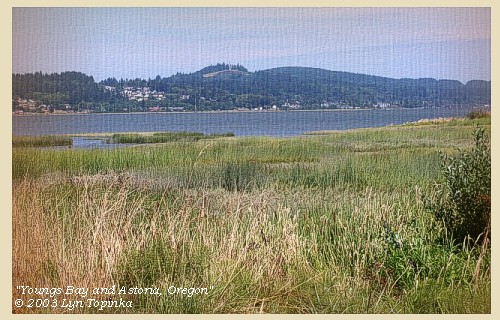
Youngs Bay, 2003

Youngs Bay:
Youngs Bay is a shallow body of water just west of Smith Point. The bay is crossed by U.S. Highway 26/101 vertical-lift highway bridge, approximately 0.3 mile above the junction of Youngs Bay with the Columbia River. Youngs Bay is a part of the Columbia River estuary. It receives water from four major streams - the Lewis and Clark River, Youngs River, Klatskanine River, and Wallooskee River. Captain Clark named the bay "Meriwether Bay" after Meriwether Lewis. Today the bay is named after the Youngs River, a river named in 1792 by Lieutenant William Broughton after Sir George Young of the Royal Navy. -- NOAA Office of Coast Survey Website, 2003, and Washington State Historical Society Website, 2004, "Lasting Legacy".


Map, 1798, Mouth of the Columbia River, click to enlarge Map, 1814, Lewis and Clark on the Columbia, click to enlarge Map, 1870, Youngs Bay, Lewis and Clark River, Youngs River, click to enlarge Map, 1887, Mouth of the Columbia River, click to enlarge Map, 1949, Youngs Bay, Smith Point, Astoria, click to enlarge Map, 1987, Youngs Bay, Smith Point, Astoria, click to enlarge NASA Image, 2001, Mouth of the Columbia River, click to enlarge Image, 2003, Youngs Bay, Oregon
  1. 1798 Map, Mouth of the Columbia River (section of original). (Click to enlarge). Inset map of original, showing the mouth of the Columbia River, including Cape Disappointment, Point Adams, Youngs River, Point George (today's Astoria), and Grays Bay. Original Map: George Vancouver's "A Chart Shewing Part of the Coast of N.W. America." In A Voyage of discovery to the North Pacific ocean, and Round the World. London, 1798. University of Virginia Special Collection "Lewis & Clark, The Maps of Exploration 1507-1814". -- University of Virginia Library Archives Website, 2004
  2. 1814 Map, Lewis and Clark's map of the Columbia River (section of original). (Click to enlarge.) Youngs Bay is depicted but not named. Also depicted but not named are the Lewis and Clark River and Youngs River, both of which empty into Youngs Bay. Map also includes three of the five volcanoes Lewis and Clark saw and commented on. While the journals mention the expedition seeing Mount Adams, it does not appear on their map. Mount Jefferson is to the south (bottom) and off the map. From the "Nicholas Biddle/Paul Allen" 1814 publication. Original Map: "A Map of Lewis and Clark's Track, Across the Western Portion of North America, From the Mississippi to the Pacific Ocean". From: History of the expedition under the command of Captains Lewis and Clark : to the sources of the Missouri, thence across the Rocky Mountains and down the river Columbia to the Pacific Ocean : performed during the years 1804-5-6 : by order of the government of the United States / prepared for the press by Paul Allen. Philadelphia : Bradford and Insskeep, 1814. Harold B. Lee Library, Brigham Young University #upbover maps37. -- Brigham Young University, Harold B. Lee Library Website, 2004.
  3. 1870 Map (section of original), Youngs Bay, Lewis and Clark River, and Youngs River. (Click to enlarge). Office of Coast Surveys, Historical Maps and Charts, Columbia River, Columbia River, Sheet No.1, 1870, Plate No.1130, 1:40,000. -- NOAA Office of Coast Survey Website, 2004
  4. 1887 Map (section of original), Mouth of the Columbia River. (Click to enlarge). Original Map: The Columbia River from Celilo to the mouth showing locations of the salmon fisheries, 1887. Scale ca. 1:375,000, Relief shown by hachures. U.S. Army Corps of Engineers, Engineer Office, G.P.O. 1888. University of Washington Archives #UW128. -- University of Washington Library Archives Website, 2002
  5. 1949 Map, Youngs Bay, Smith Point, Astoria (section of originial). (Click to enlarge). Office of Coast Surveys, Historical Maps and Charts, Columbia River, Pacific Ocean to Harrington Point, 1949, Chart#6151, 1:40,000. -- NOAA Office of Coast Survey Website, 2004
  6. 1987 Map, Youngs Bay, Smith Point, Astoria (section of original). (Click to enlarge). Office of Coast Surveys, Historical Maps and Charts, Columbia River, Pacific Ocean to Harrington Point, 1987, Chart#18521, 1:40,000. -- NOAA Office of Coast Survey Website, 2004
  7. 2001, NASA Image, Mouth of the Columbia River, including Youngs Bay. (Click to enlarge). NASA Space Shuttle photograph of the mouth of the Columbia River, including the location of Fort Clatsop, the Lewis and Clark National Wildlife Refuge, Tenasillahe Island, Puget Island, and Crim's Island, June 20, 2001. NASA Astronaut Photography of Earth #SS002-724-30. -- NASA Astronaut Photography of Earth Website, 2002
  8. 2003, Youngs Bay and part of Astoria, Oregon, as seen from the U.S. Highway 26/101 Bridge crossing the bay. (Click to enlarge). Copyright © 2003 Lyn Topinka, private archives, used with permission.


we doubled point William [Tongue Point] without any injury,


Along the Journey - March 23, 1806
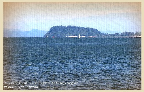
Tongue Point, 2003

Tongue Point:
Tongue Point, at Columbia River Mile 16 on the Oregon side of the Columbia, is a bold, rocky peninsula, 308 feet high, covered with trees and connected with the south bank by a low, narrow neck. It projects into the river for 0.8 mile. Lewis and Clark named the feature "Point William" after Captain Clark, however it did not stick. Tongue Point was named in 1792 by Lieutenant William Broughton, part of the Vancouver expedition. For ten days in 1805, Captain Clark and some of the men camped on the downstream side of Tongue Point while Captain Lewis, with five men, conducted a reconnaissance of the area and sought a secure location for winter quarters. -- NOAA Office of Coast Survey Website, 2003, and Washington State Historical Society Website, 2004, "Lasting Legacy".


Map, 1814, Lewis and Clark on the Columbia, click to enlarge Map, 1855, Northwest Oregon and mouth Columbia River, click to enlarge Map, 1887, Mouth of the Columbia River, click to enlarge Map, 1987, Youngs Bay, Smith Point, Astoria, click to enlarge Map, 1987, Tongue Point, western part of Cathlamet Bay, click to enlarge Map, 1987, Tongue Point, John Day River, western part of Cathlamet Bay, click to enlarge NASA Image, 2001, Mouth of the Columbia River, click to enlarge Engraving, 1848, Fort George (Astoria), click to enlarge Engraving, ca.1853, Mount St. Helens and the mouth of the Columbia River, click to enlarge Image, 1889, Mount St. Helens and the mouth of the Columbia River, click to enlarge Image, 2003, Tongue Point, Oregon
  1. 1814 Map, Lewis and Clark's map of the Columbia River (section of original). (Click to enlarge.) Astoria, Smith Point, and Tongue Point are depicted on the map but not named. Map also includes three of the five volcanoes Lewis and Clark saw and commented on. While the journals mention the expedition seeing Mount Adams, it does not appear on their map. Mount Jefferson is to the south (bottom) and off the map. From the "Nicholas Biddle/Paul Allen" 1814 publication. Original Map: "A Map of Lewis and Clark's Track, Across the Western Portion of North America, From the Mississippi to the Pacific Ocean". From: History of the expedition under the command of Captains Lewis and Clark : to the sources of the Missouri, thence across the Rocky Mountains and down the river Columbia to the Pacific Ocean : performed during the years 1804-5-6 : by order of the government of the United States / prepared for the press by Paul Allen. Philadelphia : Bradford and Insskeep, 1814. Harold B. Lee Library, Brigham Young University #upbover maps37. -- Brigham Young University, Harold B. Lee Library Website, 2004.
  2. 1855 Map, Northwest Oregon and mouth of the Columbia River (section of original). (Click to enlarge). Tongue Point is depicted but not named. Includes the Columbia River, Cape Disappointment, Point Adams, Saddle Mountain, Lewis and Clark River, Youngs River. Original Map: From the northern boundary of California to the Columbia River : from explorations and surveys / made under the direction of Hon. Jefferson Davis, Sec. of War by Lieut. R. S. Williamson, U.S. Topl. Engrs. and Lieut. H. L. Abbot, U.S. Topl. Engrs., H. C. Fillebrown, J. Young, and C. D. Anderson, Assts., 1855. Notes: Scale 1:760,320. Relief shown by hachures. At head of title: Routes in Oregon and California. Map no. 2. "Drawn by John Young." From U.S. War Department, Explorations and Surveys for a Railroad Route from the Mississippi River to the Pacific Ocean. Topographical Maps... to Illustrate the Various Reports... (Washington, 1859) Library of Congress American Memory Archives #G4290 1855 .W5 RR 170. -- U.S. Library of Congress Archives, 2004, "American Memory"
  3. 1887 Map (section of original), Mouth of the Columbia River. (Click to enlarge). Original Map: The Columbia River from Celilo to the mouth showing locations of the salmon fisheries, 1887. Scale ca. 1:375,000, Relief shown by hachures. U.S. Army Corps of Engineers, Engineer Office, G.P.O. 1888. University of Washington Archives #UW128. -- University of Washington Library Archives Website, 2002
  4. 1987 Map, Youngs Bay, Smith Point, Astoria (section of original). (Click to enlarge). Office of Coast Surveys, Historical Maps and Charts, Columbia River, Pacific Ocean to Harrington Point, 1987, Chart#18521, 1:40,000. -- NOAA Office of Coast Survey Website, 2004
  5. 1987 Map, Tongue Point and the western part of Cathlamet Bay (section of original). (Click to enlarge). Office of Coast Surveys, Historical Maps and Charts, Columbia River, Pacific Ocean to Harrington Point, 1987, Chart#18521, 1:40,000. -- NOAA Office of Coast Survey Website, 2004
  6. 1987 Map, Tongue Point, John Day River, and the western part of Cathlamet Bay (section of original). (Click to enlarge). Office of Coast Surveys, Historical Maps and Charts, Columbia River, Pacific Ocean to Harrington Point, 1987, Chart#18521, 1:40,000. -- NOAA Office of Coast Survey Website, 2004
  7. 2001, NASA Image, Mouth of the Columbia River, including Tongue Point. (Click to enlarge). NASA Space Shuttle photograph of the mouth of the Columbia River, including the location of Fort Clatsop, the Lewis and Clark National Wildlife Refuge, Tenasillahe Island, Puget Island, and Crim's Island, June 20, 2001. NASA Astronaut Photography of Earth #SS002-724-30. -- NASA Astronaut Photography of Earth Website, 2002
  8. 1848, Watercolor, Fort George formerly Astoria, 1848. (Click to enlarge). This watercolor view portrays Astoria, Oregon, during the year 1845, by Sir Henry James Warre. Tongue Point is in the middleground. Washington State University Photo Archvies #WSU553. -- Washington State University Library Archives Website, 2002
  9. ca.1853, Engraving, mouth of the Columbia River with Tongue Point and Mount St. Helens (section of original). (Click to enlarge). Engraving depicts the Mouth of the Columbia River, Point Ellice, Mount St. Helens, and Tongue Point (just barely discernable on the right). Original also depicts Cape Disappointment and Point Adams. NOAA Photo Archives, America's Coastline Collection #line2075. -- NOAA Photo Archvies Website, 2002
  10. 1889, Engraving/Sketch. Mouth of the Columbia River (section of original). (Click to enlarge). Engraving depicts the Mouth of the Columbia River, Point Ellice, Mount St. Helens, and Tongue Point. Original also depicts Scarborough Hill. From: NOAA Library, Pacific Coast Coast Pilot of California, Oregon, and Washington, 1889 -- NOAA Photo Archives Website, 2004
  11. 2003, Tongue Point, as seen from Astoria, Oregon. (Click to enlarge). Copyright © 2003 Lyn Topinka, private archives, used with permission.


and at six o'clock reached, at the distance of sixteen miles from fort Clatsop, the mouth of a small creek [John Day River, in Clatsop County], where we found our hunters.


Along the Journey - March 23, 1806
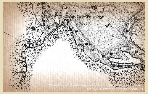
Map, John Day River (Clatsop County), 1890

John Day River, Clatsop County, Oregon:
Lewis and Clark refered to Clastsop County's John Day River as "Ke-ke mar que Creek", a word obtained from the local indians. They did not comprehend that Pacific Northwest Indians did not name geographical features such as rivers and creeks; instead, they identified sites on the drainages. This concept was also foreign to later cartographers. Their translations of native languages led to many misconceptions of actual Indian meanings and names. This western Oregon river, like the one in eastern Oregon, was named for John Day of Wilson Price Hunt's Astorian overland expedition, 1811-12. -- Washington State Historical Society Website, 2002


Map, 1814, Lewis and Clark on the Columbia, click to enlarge Map, 1887, Columbia River from mouth to Pillar Rock, click to enlarge Map, 1890, John Day River and John Day Point, click to enlarge Map, 1987, Tongue Point, John Day River, western part of Cathlamet Bay, click to enlarge
  1. 1814 Map, Lewis and Clark's map of the Columbia River (section of original). (Click to enlarge.) The John Day River is depicted but not named. It empties into Cathlamet Bay, also depicted but not named (full of islands). Map includes three of the five volcanoes Lewis and Clark saw and commented on. While the journals mention the expedition seeing Mount Adams, it does not appear on their map. Mount Jefferson is to the south (bottom) and off the map. From the "Nicholas Biddle/Paul Allen" 1814 publication. Original Map: "A Map of Lewis and Clark's Track, Across the Western Portion of North America, From the Mississippi to the Pacific Ocean". From: History of the expedition under the command of Captains Lewis and Clark : to the sources of the Missouri, thence across the Rocky Mountains and down the river Columbia to the Pacific Ocean : performed during the years 1804-5-6 : by order of the government of the United States / prepared for the press by Paul Allen. Philadelphia : Bradford and Insskeep, 1814. Harold B. Lee Library, Brigham Young University #upbover maps37. -- Brigham Young University, Harold B. Lee Library Website, 2004.
  2. 1887 Map, Columbia River from the Mouth to Pillar Rock (section of original). (Click to enlarge). The John Day River (right of Tongue Point) is depicted but not named. Original Map: The Columbia River from Celilo to the mouth showing locations of the salmon fisheries, 1887. Scale ca. 1:375,000, Relief shown by hachures. U.S. Army Corps of Engineers, Engineer Office, G.P.O. 1888. University of Washington Archives #UW128. -- University of Washington Library Archives Website, 2004
  3. 1890 Map (section of original), John Day River and John Day Point. (Click to enlarge). Office of Coast Surveys, Historical Maps and Charts, Columbia River, Columbia River, Sheet No.2, 1890, Chart #6141, Plate No.1454, 1:40,000. -- NOAA Office of Coast Survey Website, 2004
  4. 1987 Map, Tongue Point, John Day River, and the western part of Cathlamet Bay (section of original). (Click to enlarge). Office of Coast Surveys, Historical Maps and Charts, Columbia River, Pacific Ocean to Harrington Point, 1987, Chart#18521, 1:40,000. -- NOAA Office of Coast Survey Website, 2004


They had been fortunate enough to kill two elk, but at such a distance that we could not send for them before the next morning,


Along the Journey - March 23, 1806
The Camp - March 23, 1806:
On the Oregon side of the Columbia River, between Tongue Point and the John Day River (Clatsop County), across from today's Lewis and Clark National Wildlife Refuge.


Monday, March 24, 1806
The country is covered with a thick growth of timber: the water however is shallow to the distance of four miles from shore [they are in Cathlamet Bay]; and although there is a channel deep enough for canoes on the south side [South Channel], yet as the tide was low, we found some difficulty in passing along. [Cathlamet Bay in the vicinity of Knappa, Oregon, and is part of the Lewis and Clark National Wildlife Refuge.]
"... the tide being out this morning we found some difficulty in passing through the bay below the Cathlahmah village; this side of the river is very shallow to the distance of 4 miles from the shore tho' there is a channel sufficient for canoes near S. side. ..." [Lewis, March 24, 1806]


Along the Journey - March 24, 1806
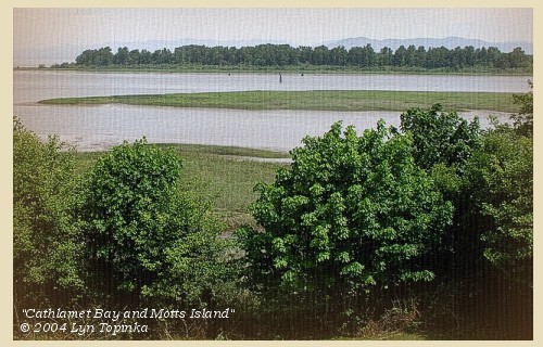
Cathlamet Bay, Lewis and Clark National Wildife Refuge, 2004

Cathlamet Bay and the Lewis and Clark National Wildlife Refuge:
Cathlamet Bay is east of Astoria, Oregon and Tongue Point, Oregon, and south of the main ship channel of the Columbia River, and is part of the broad Columbia River Estuary. There are many islands which are covered with tule in the summer, but in the winter they are almost indiscernible. Cathlamet Bay is part of the Lewis and Clark National Wildlife Refuge, established in 1972 to preserve the estuary land and water as vital fish and wildlife habitat. The refuge includes 35,000 acres of islands, bars, mud flats and tidal marshes. The refuge is the largest marsh in western Oregon and provides habitat for peak populations of 3,000 tundra swans, 2,000 Canada geese and 5,000 ducks in February and March each year as they gather here before the northward migration. Woody, Horseshoe, Karlson, and Marsh islands are the main islands in the wildlife refuge on Oregon's side of the Columbia. In 1805, on their trip to the Pacific Ocean, Lewis and Clark referred to these islands simply as "marshy islands". On their return in 1806, they called this area "Seal Islands". -- U.S. Fish and Wildlife Service Website, 2003, Lewis and Clark Bicentennial in Oregon Website, 2002, NOAA Office of Coast Survey Website, 2003 and Washington State Historical Society Website, 2002


Map, 1814, Lewis and Clark on the Columbia, click to enlarge Map, 1855, Northwest Oregon and mouth Columbia River, click to enlarge Map, 1887, Map, 1987, Tongue Point and western part of Cathlamet Bay, click to enlarge NASA Image, 2001, Mouth of the Columbia River, click to enlarge Image, 2004, Cathlamet Bay, part of the Lewis and Clark NWR
  1. 1814 Map, Lewis and Clark's map of the Columbia River (section of original). (Click to enlarge.) Cathlamet Bay is depicted but not named (full of islands). Map includes three of the five volcanoes Lewis and Clark saw and commented on. While the journals mention the expedition seeing Mount Adams, it does not appear on their map. Mount Jefferson is to the south (bottom) and off the map. From the "Nicholas Biddle/Paul Allen" 1814 publication. Original Map: "A Map of Lewis and Clark's Track, Across the Western Portion of North America, From the Mississippi to the Pacific Ocean". From: History of the expedition under the command of Captains Lewis and Clark : to the sources of the Missouri, thence across the Rocky Mountains and down the river Columbia to the Pacific Ocean : performed during the years 1804-5-6 : by order of the government of the United States / prepared for the press by Paul Allen. Philadelphia : Bradford and Insskeep, 1814. Harold B. Lee Library, Brigham Young University #upbover maps37. -- Brigham Young University, Harold B. Lee Library Website, 2004.
  2. 1855 Map, Northwest Oregon and mouth of the Columbia River (section of original). (Click to enlarge). The "Marshy" or "Seal Islands" are depicted but not named (many islands left of the tape). Includes the Columbia River, Cape Disappointment, Point Adams, Saddle Mountain, Lewis and Clark River, Youngs River. Original Map: From the northern boundary of California to the Columbia River : from explorations and surveys / made under the direction of Hon. Jefferson Davis, Sec. of War by Lieut. R. S. Williamson, U.S. Topl. Engrs. and Lieut. H. L. Abbot, U.S. Topl. Engrs., H. C. Fillebrown, J. Young, and C. D. Anderson, Assts., 1855. Notes: Scale 1:760,320. Relief shown by hachures. At head of title: Routes in Oregon and California. Map no. 2. "Drawn by John Young." From U.S. War Department, Explorations and Surveys for a Railroad Route from the Mississippi River to the Pacific Ocean. Topographical Maps... to Illustrate the Various Reports... (Washington, 1859) Library of Congress American Memory Archives #G4290 1855 .W5 RR 170. -- U.S. Library of Congress Archives, 2004, "American Memory"
  3. 1887 Map (section of original), Columbia River and the "Seal Islands" vicinity. (Click to enlarge). Cathlamet Bay, the bay east (right) of Tongue Point, is unnamed on the map. Original Map: The Columbia River from Celilo to the mouth showing locations of the salmon fisheries, 1887. Scale ca. 1:375,000, Relief shown by hachures. U.S. Army Corps of Engineers, Engineer Office, G.P.O. 1888. University of Washington Archives #UW128. -- University of Washington Library Archives Website, 2002
  4. 1987 Map, Tongue Point and western part of Cathlamet Bay (section of original). (Click to enlarge). Office of Coast Surveys, Historical Maps and Charts, Columbia River, Pacific Ocean to Harrington Point, 1987, Chart#18521, 1:40,000. -- NOAA Office of Coast Survey Website, 2004
  5. 2001, NASA Image, Mouth of the Columbia River, including the location of Fort Clatsop. (Click to enlarge). NASA Space Shuttle photograph of the mouth of the Columbia River, including the location of Fort Clatsop, the Lewis and Clark National Wildlife Refuge, Tenasillahe Island, Puget Island, and Crim's Island, June 20, 2001. NASA Astronaut Photography of Earth #SS002-724-30. -- NASA Astronaut Photography of Earth Website, 2002
  6. 2004, Cathlamet Bay, Oregon, part of the Lewis and Clark National Wildlife Refuge. (Click to enlarge). Copyright © 2004 Lyn Topinka, private archives, used with permission.


At one o'clock we reached the Cathlamah village, where we halted for about two hours, and purchased some wappatoo and a dog for the invalids. This village we have already described, [see November 26, 1805 entry] as situated opposite to the seal islands [Lewis and Clark National Wildlife Refuge]: ...... On resuming our route among the seal islands [Lewis and Clark National Wildlife Refuge], we mistook our way, which an Indian observing, he pursued us and put us into the right channel. ...... We continued our route along the shore, and after making fifteen miles encamped at an old village of nine houses [northeast of Brownsmead, Oregon, at Aldrich Point],


Along the Journey - March 24, 1806
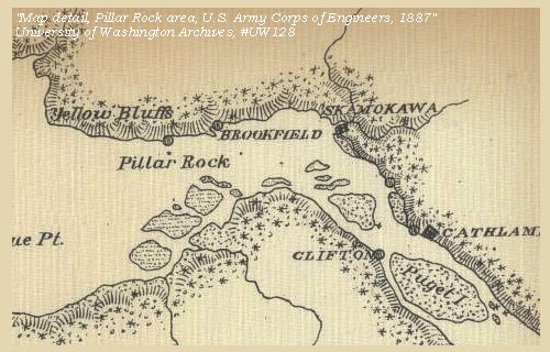
Map, Pillar Rock area, 1887

Cathlamet Point - Aldrich Point:
This area of land has had many names, from Lewis and Clark's "Point Samuel", to early settlers' "Cathlamet Point", and today's "Adrich Point".


Map, 1814, Lewis and Clark on the Columbia, click to enlarge Map, 1887, Pillar Rock vicinity, click to enlarge Map, 1989, Aldrich Point, click to enlarge
  1. 1814 Map, Lewis and Clark's map of the Columbia River (section of original). (Click to enlarge.) Cathlamet Point is depicted but not named. It is the point where the highlands along the south side of the river end. Map also includes three of the five volcanoes Lewis and Clark saw and commented on. While the journals mention the expedition seeing Mount Adams, it does not appear on their map. Mount Jefferson is to the south (bottom) and off the map. From the "Nicholas Biddle/Paul Allen" 1814 publication. Original Map: "A Map of Lewis and Clark's Track, Across the Western Portion of North America, From the Mississippi to the Pacific Ocean". From: History of the expedition under the command of Captains Lewis and Clark : to the sources of the Missouri, thence across the Rocky Mountains and down the river Columbia to the Pacific Ocean : performed during the years 1804-5-6 : by order of the government of the United States / prepared for the press by Paul Allen. Philadelphia : Bradford and Insskeep, 1814. Harold B. Lee Library, Brigham Young University #upbover maps37. -- Brigham Young University, Harold B. Lee Library Website, 2004.
  2. 1887 Map (section of original), Columbia River and the Pillar Rock vicinity. (Click to enlarge). Cathlamet Point (Aldrich Point) is unnamed on the map, but is the point opposite and upstream of Pillar Rock. Original Map: The Columbia River from Celilo to the mouth showing locations of the salmon fisheries, 1887. Scale ca. 1:375,000, Relief shown by hachures. U.S. Army Corps of Engineers, Engineer Office, G.P.O. 1888. University of Washington Archives #UW128. -- University of Washington Library Archives Website, 2002
  3. 1989 Map, Aldrich Point (section of original). (Click to enlarge). Office of Coast Surveys, Historical Maps and Charts, Columbia River, Harrington Point to Crims Island, 1989, Chart#18523, 1:40,000. -- NOAA Office of Coast Survey Website, 2004


opposite to the lower village of the Wahkiacums [lower end of Tenasillahe Island].


Along the Journey - March 24, 1806
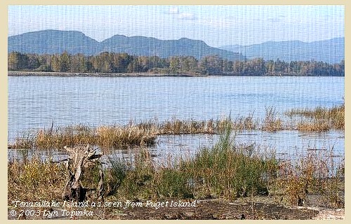
Tenasillahe Island, 2003

Tenasillahe Island:
Lewis and Clark used a descriptive term rather than an applied place name to identify this large island and nearby smaller island as "Marshy Islands." The island's present name is composed of two Chinook-jargon words, "tenas," meaning small, and "illahe," meaning land. The upstream Tenasillahe Island is part of the Julia Butler Hansen Refuge for Columbia White-Tailed Deer, while the downstream Welsh Island is part of the Lewis and Clark National Wildlife Refuge. -- "Recreation.gov" Webiste, 2004, and Washington State Historical Society Website, 2004, "Lasting Legacy"


Map, 1887, Pillar Rock vicinity, click to enlarge Map, 1989, Welsh Island and Tenasillahe Island, click to enlarge NASA Image, 2001, Mouth of the Columbia River, click to enlarge Image, 2003, Tenasillahe Island
  1. 1887 Map (section of original), Columbia River and the Pillar Rock vicinity. (Click to enlarge). Tenasillahe Island is unnamed on the map, but is part of the islands just downstream (left) of Puget Island, before the Columbia rounds Aldrich Point (also unnamed). Original Map: The Columbia River from Celilo to the mouth showing locations of the salmon fisheries, 1887. Scale ca. 1:375,000, Relief shown by hachures. U.S. Army Corps of Engineers, Engineer Office, G.P.O. 1888. University of Washington Archives #UW128. -- University of Washington Library Archives Website, 2002
  2. 1989 Map, Welsh Island and Tenasillahe Island (section of original). (Click to enlarge). Also includes the Hunting Islands, Steamboat Slough, and Skamokawa, Washington. Office of Coast Surveys, Historical Maps and Charts, Columbia River, Harrington Point to Crims Island, 1989, Chart#18523, 1:40,000. -- NOAA Office of Coast Survey Website, 2004
  3. 2001, NASA Image, Mouth of the Columbia River, including Tenasillahe Island. (Click to enlarge). NASA Space Shuttle photograph of the mouth of the Columbia River, including the location of Fort Clatsop, the Lewis and Clark National Wildlife Refuge, Tenasillahe Island, Puget Island, and Crim's Island, June 20, 2001. NASA Astronaut Photography of Earth #SS002-724-30. -- NASA Astronaut Photography of Earth Website, 2002
  4. 2003, Tenasillahe Island, as seen from Puget Island. (Click to enlarge). Copyright © 2003 Lyn Topinka, private archives, used with permission.


Here we were overtaken by two Chinnooks, who came to us after dark, and spent the night at our camp. We found plenty of wood for fires, which were quite necessary, as the weather had become cold.


Along the Journey - March 24, 1806
The Camp - March 24, 1806:
Having spent the day travelling through what is today's Lewis and Clark National Wildlife Refuge, the Corps camped on the Oregon side of the Columbia, northeast of Brownsmead, at Aldrich Point, across from Tenasillahe Island.


Home Previous Continue


If you have questions or comments please contact: GS-CVO-WEB@usgs.gov
June/July 2004, Lyn Topinka
The Volcanoes of Lewis and Clark Home Page | CVO Home Page