The Volcanoes of
Lewis and Clark
April 29, 1806
Up the Columbia - Walla Walla
 
Home
The Volcanoes of Lewis and Clark

Map of the Journey
Volcanoes, Basalt Plateaus, Major Rivers, etc.

The Volcanoes
Mount Adams, Mount Hood, Mount Jefferson, Mount Rainier, and Mount St. Helens

CALENDAR of the Journey
October 1805 to June 1806

Along the Journey
Pacific Northwest Maps - Columbia River, Volcanoes, Flood Basalts, Missoula Floods, Geology, etc.

The Corps of Discovery
The Journey of Lewis and Clark

About the Reference Materials
The Journals, Biddle/Allen, DeVoto, Gass, Moulton, Topo Maps, and others

USGS Lewis and Clark Links
Links to USGS Websites highlighting the Lewis and Clark Journey

Resources
Publications Referenced and Websites Visited


PREVIOUS

April 23-28
Up the Columbia, Rock Creek to Walla Walla
April 29

Up the Columbia River,
Walla Walla

Walla Walla River, Blue Mountains
CONTINUE

April 30
Walla Walla Shortcut, Overland, Walla Walla to the Touchet
 

On October 7, 1805, Lewis and Clark and the "Corps of Discovery" began their journey down the Clearwater River and into the volcanics of the Pacific Northwest. The Corps travelled from the Clearwater to the Snake and down the "Great Columbia", finally reaching the Pacific Ocean on November 15, 1805. Along the journey they encountered the lava flows of the Columbia Plateau, river channels carved by the great "Missoula Floods", and the awesome beauty of five Cascade Range volcanoes.

Map, Lewis and Clark in the Pacific Northwest, click for brief
                         summary
[Click map for brief summary about the area]


Heading for Home - April 1806
Up the Columbia - Walla Walla
 

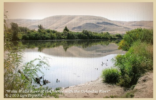
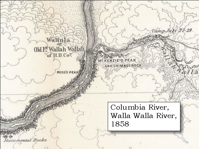
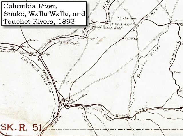
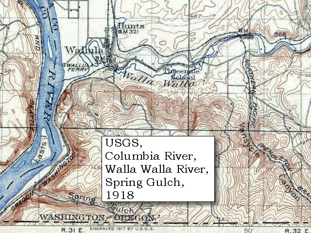
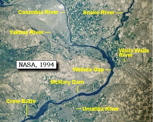
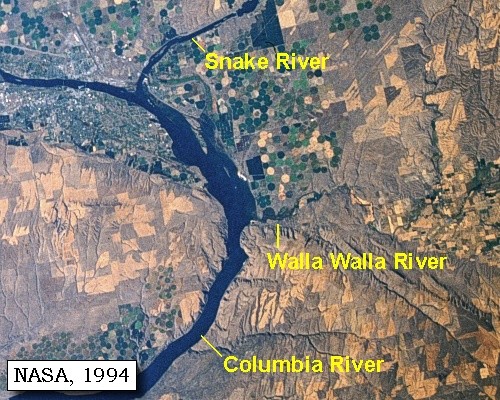
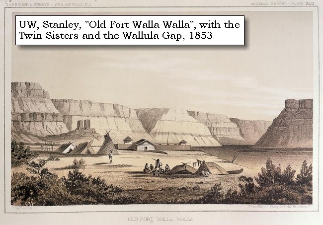
Lewis and Clark's camp of April 27 and 28, 1806, was on the left bank of the Columbia River just downstream of the confluence of the Walla Walla River and the Columbia River. This area today is under the waters of Lake Wallula.

Tuesday, April 29, 1806
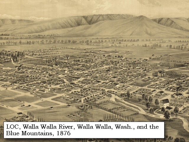
Yellept supplied us with two canoes in which we crossed with all our baggage by eleven o'clock, but the horses having strayed to some distance, we could not collect them in time to reach any fit place to encamp if we began our journey, as night would overtake us before we came to water. We therefore thought it adviseable to encamp about a mile from the Columbia, on the mouth of the Wollawollah river. [Walla Walla River] This is a handsome stream, about fifty yards wide, and four and a half feet in depth: its waters, which are clear, roll over a bed composed principally of gravel, intermixed with some sand and mud, and though the banks are low they do not seem to be overflowed.
"... The Wallahwallah River discharges it's self into the Columbia on it's South Side 15 miles below the enterance of Lewis's River, or the S. E. branch. this is a handsom Stream about 4 1/2 feet deep and 50 yards wide. the Indians inform us that it has it's source in the range of Mountains in view of us to the E. and S. E. ..." [Clark, April 29, 1806]


Along the Journey - April 29, 1806
Walla Walla River, 2003

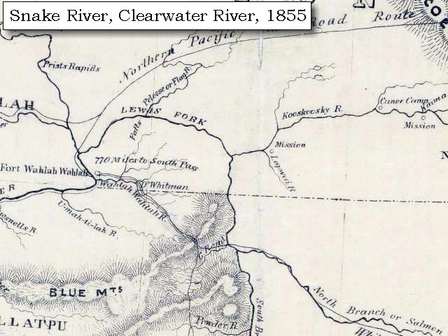
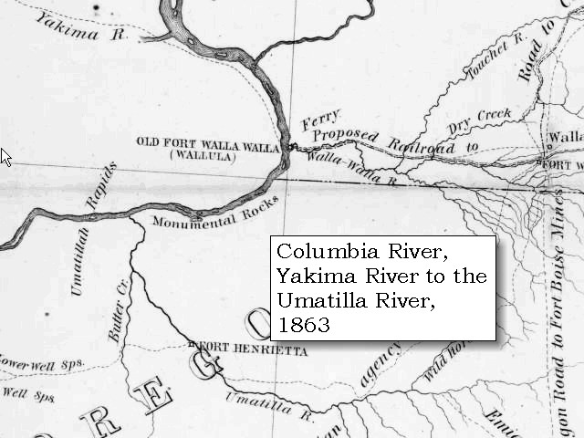
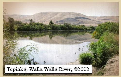
Walla Walla River:
The Walla Walla River basin lies between the Snake River basin on the north, the Blue Mountains to the east and south, and the Umatilla River basin on the south and west. The basin includes parts of Walla Walla and Columbia counties in Washington and part of Umatilla County in Oregon, and covers 1,720 square miles. The basin is approximately 55 miles long by 52 miles wide, with elevations ranging from a high of 6,250 feet to a low of 340 feet. It is located near the boundary between the Blue Mountains (south and southeast) and Columbia River Plateau (north and northwest) physiographic regions. Regional folding around the basin boundary and faulting formed the Walla Walla basin. The major rock underlying the basin is the Miocene Age (15 to 20 million years ago) Columbia River Basalt Group, which consists of a thick sequence of lava flows known to be in excess of 6,000 feet thick near Pasco. Individual flows generally range from approximately 50 to over 150 feet. Unconsolidated gravels and clays overlie the basalt. An extensive deposit of windblown silt (loess soil) called the Palouse Formation covers most of the Walla Walla River basin. This formation eroded and resulted in the gently rolling hills that are typical of the region. The Walla Walla River itself originates in the northeast corner of Umatilla County in Oregon. It dips south from there and then flows north through Milton-Freewater, crossing the Oregon/Washington border 6 miles north of Milton-Freewater. The principle tributaries of the Walla Walla include the Touchet River, Mill Creek, and the North and South Forks of the Walla Walla River. -- U.S. Army Corps of Engineers Website, Walla Walla District, 2004, Washington State Department of Ecology Website, 2004, and Columbia Basin Fish and Wildlife Authority Website, 2004


Map, 1814, Lewis and Clark on the Columbia, click to enlarge Map, 1833, Illman and Pilbrow, Columbia River, click to enlarge Map, 1853, Washington and Oregon and the Columbia River, click to enlarge Map, 1854, Columbia River, Willow Creek to Walla Walla, click to enlarge Map, 1855, Clearwater and Snake from Canoe Camp to the Columbia, click to enlarge Map, 1858 Military recon map, mouth of the Walla Walla River, click to enlarge Map, 1863, Umatilla, Walla Walla, Touchet Rivers, etc., click to enlarge Map, 1893, Columbia, Snake, and Walla Walla Rivers, click to enlarge Map, 1918 USGS topo map of Walla Walla River area, click to enlarge NASA Image, 1994, Columbia River from Crow Butte to the Snake River, click to enlarge NASA Image, 1994, Columbia River and the junction of the Walla Walla River, click to enlarge Engraving, 1853, Old Fort Walla Walla, click to enlarge Image, 2003, Walla Walla River
  1. 1814 Map, Lewis and Clark's map of the Columbia River (section of original). (Click to enlarge.) Shows the Walla Walla River ("Wollawwollah R."). Map also includes three of the five volcanoes Lewis and Clark saw and commented on. While the journals mention the expedition seeing Mount Adams, it does not appear on their map. Mount Jefferson is just visible to the south (bottom) and Mount Rainier is to the north but off the map. From the "Nicholas Biddle/Paul Allen" 1814 publication. Original Map: "A Map of Lewis and Clark's Track, Across the Western Portion of North America, From the Mississippi to the Pacific Ocean". From: History of the expedition under the command of Captains Lewis and Clark : to the sources of the Missouri, thence across the Rocky Mountains and down the river Columbia to the Pacific Ocean : performed during the years 1804-5-6 : by order of the government of the United States / prepared for the press by Paul Allen. Philadelphia : Bradford and Insskeep, 1814. Harold B. Lee Library, Brigham Young University #upbover maps37. -- Brigham Young University, Harold B. Lee Library Website, 2004.
  2. 1833 Map (section of original), Columbia River. (Click to enlarge). Includes Mount Hood and Mount Jefferson. Note: Mount Baker is depicted (upper middle) but Mounts Adams, Rainier and St. Helens are missing. The Columbia River is shown as "Oregon River" at its mouth and "Columbia or Oregon R." further inland. "Wappatoo Valley" is labeled. Also shows Fort Clatsop ("F. Clatsop or F. George"), the Willamette River ("Multnomah R."), Sandy River ("Quicksand R."), John Day River ("R.La Page"), Walla Walla River ("Wallwullah R."), Snake River ("Lewis R."), and the Yakima River ("Tapete R."). Original Map: Oregon Territory, 1833. Creator: Illman & Pilbrow, published by Illman & Pilbrow, New York. Comments: Illman & Pilbrow is the engraving firm which copyrighted and published this map, the actual artist is unknown. Washington State University Digital Maps Collection #WSU323. University of Washington Digital Maps Collection #UW104. -- Washington State University Early Washington Maps Digital Collection Website, 2004
  3. 1853 Map, Washington and Oregon and the Columbia River, from the Clearwater River to the Snake River and down the Columbia River to the Pacific Ocean (section of original). (Click to enlarge). Includes: Clearwater River (Kooskooski), Lapwai Creek (Lapwai R.), Snake River (Saptin or Lewis R.), Columbia River (Columbia R.), Yakima River (Yakima R.), Walla Walla River (Wallawalla R.), Umatilla River (Umatilla R.), Willow Creek (Quesnells R.), John Day River (John day's R.), Deschutes River (Fall R.), Willamette River (Willammette R.), and Cowlitz River (Cowlitz R.). Original Map: "Map of California, Oregon, Washington, Utah, and New Mexico (1853)", by Thomas Cowperthwait & Co. Washington State University Archives #WSU22. -- Washington State University Library Collections Website, 2003
  4. 1853-54 Map, Columbia River, including the Wallula Gap area (section of original). (Click to enlarge). Includes Horse Heaven Hills ("lands destitute of timber"), Willow Creek, Umatilla River, Walla Walla River, Touchet River, Twin Sisters ("Chimney Rock"), Yakima River, and the junction of the Snake River (only the "S" shows) with the Columbia. Original Map: "Rocky Mountains to Puget Sound : from explorations and surveys / made under the direction of the Hon. Jefferson Davis, Secretary of War by Isaac I. Stevens Governor of Washington Territory, 1853-4." Inset: (Supplementary sketch) Reconnaissance of the railroad route from Wallawalla to Seattle via Yak-e-mah River & Snoqualmie Pass. By A. W. Tinkham in January 1854. Drawn by J. R. P. Mechlin. 20 x 28 cm. Topographer, John Lambert, Published in Washington D.C., 1859, 1:1,200,000, Notes: From the U.S. War Department, Explorations and Surveys for a Railroad Route from the Mississippi River to the Pacific Ocean, Topographical Maps, to Illustrate the Various Reports, U.S. Library of Congress American Memories Reference "LC Railroad Maps #156". -- U.S. Library of Congress, American Memories Website, 2004
  5. 1855 Map, Clearwater and Snake Rivers, including the Walla Walla River (Wahlah Wahlah R.) (section of original). (Click to enlarge). Original Map: "Map of Oregon and Washington Territories: showing the proposed Northern Railroad route to the Pacific Ocean, by John Disturnell, 1855. University of Washington Archives #UW155. -- University of Washington Library Collections Website, 2002
  6. 1858 Military Recon Map (section of original), Mouth of the Walla Walla River. (Click to enlarge). Map of military reconnaissance from Fort Dalles, Oregon, via Fort Wallah-Wallah, to Fort Taylor, Washington Territory, 1858. Shows approximate location of military road constructed 1859 to 1862. From the report and maps of Captain John Mullan, United States Army, G.P.O., 1863. University of Washington Archives #UW85. -- University of Washington Library Archives Website, 2002
  7. 1863 Map (section of original), Columbia River, Umatilla Rapids, Monumental Rocks, Umatilla River, Walla Walla River, Touchet River, etc. (Click to enlarge). Original map by John Mullan, Julius Bien, and Edward Freyhold, United State Office of Explorations and Surveys. Prepared from field notes from 1858-1863. Scale 1:1,000,000. Original map from: report and maps of Captain John Mullan, United States Army, of his operations while engaged in the construction of a military road from Fort Walla-Walla, on the Columbia River, to Fort Benton, on the Missouri River, 1863. -- University of Washington Library Archives Website, 2002
  8. 1893 Map part of the Columbia River showing junctions with the Snake and Walla Walla Rivers (section of original). (Click to enlarge). Original Map: "Part of the Snake River from its mouth to the Grande Ronde, showing location of principal rapids". U.S. Engineers Office, 1893. Washington State University Historical Maps Collection #WSU586. -- Washington State University Library Archives Website, 2002
  9. 1918 Map (section of original), from Wallula 1:125,000 topographic quadrangle. (Click to enlarge). Original map surveyed in 1915, contour interval of 50 feet. -- University of Washington Library Collections Website, 2002
  10. 1994, NASA Image, Columbia River from Crow Butte to the Snake River (section of original) (Click to enlarge). View from space - Columbia River, Snake River, Yakima River, Walla Walla River, Umatilla River, Crow Butte and Wallula Gap, north-looking, low-oblique photograph, September 1994. NASA Earth from Space #STS064-112-093. -- NASA Earth from Space Website, 2002
  11. 1994, NASA Image, Columbia River and the junction of the Walla Walla River (section of original) (Click to enlarge). View from space - Columbia River and the Walla Walla River, north-looking, low-oblique photograph, September 1994. NASA Earth from Space #STS064-112-093. -- NASA Earth from Space Website, 2002
  12. 1853 Engraving, Nez Perce camp outside walls of Old Fort Walla Walla on the Columbia River, Washington. (Click to enlarge). Engraving by John M. Stanley, 1853. From: University of Washington Library Collection #NA4169. Original from U.S. War Department's Reports of explorations and surveys to ascertain the most practicable and economical route for a railroad from the Mississippi River to the Pacific Ocean, 1860, v.12, pt.1, pl.42. -- University of Washington Library Collection Website, 2002
  13. 2003, Walla Walla River near confluence with the Columbia River. (Click to enlarge). Copyright © 2003 Lyn Topinka, private archives, used with permission.


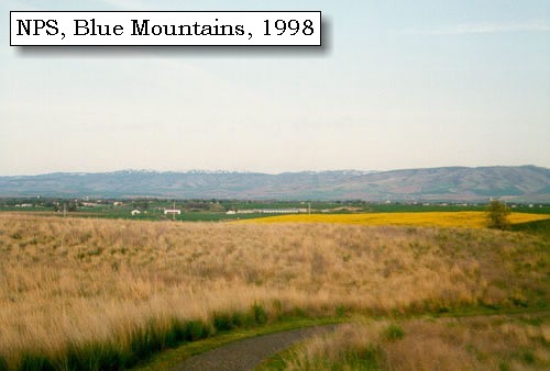
It [Walla Walla River] empties into the Columbia, about twelve or fifteen miles from the entrance of Lewis's river, [Snake River] and just above a range of high hills crossing the Columbia [Blue Mountains]. Its sources, like those of the Towahnahiooks [Deschutes River], Lapage [John Day River], Youmalolam [Umatilla River], and Wollawollah [Walla Walla River], come, as the Indians inform us, from the north side of a range of mountains [Blue Mountains] which we see to the east and southeast, and which, commencing to the south of mount Hood, stretch in a northeastern direction to the neighbourhood of a southern branch of Lewis's river [Snake River], at some distance from the Rocky mountains. Two principal branches however of the Towahnahiooks [Deschutes River] take their rise in mount Jefferson and mount Hood, which in fact appear to separate the waters of the Multnomah [Willamette River] and Columbia. They [Blue Mountains] are now about sixty-five or seventy miles from this place, and although covered with snow, do not seem high.


Along the Journey - April 29, 1806
Blue Mountains, 1998

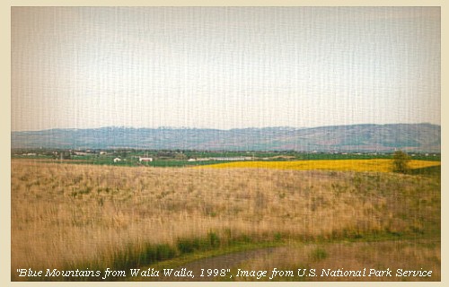
Blue Mountains:
The topography of the Blue Mountains consists of flat-topped ridges and steep stair-stepped valley walls formed by thousands of feet of Miocene basalt flows that engulfed the folded, faulted, and uplifted granitic core of the mountains. As mountains were uplifted, streams and glaciers carved canyons through the basalt layers. -- Columbia Basin Fish and Wildlife Authority Website, 2004


Map, 1814, Lewis and Clark on the Columbia, click to enlarge Map, 1855, Clearwater and Snake from Canoe Camp to the Columbia, click to enlarge Map, 1881, Snake, Clearwater, Grande Ronde, Salmon, click to enlarge Engraving, 1876, 'Birds eye view' of Walla Walla and the Blue Mountains, click to enlarge Image, 1998, Blue Mountains, click to enlarge
  1. 1814 Map, Lewis and Clark's map of the Columbia River (section of original). (Click to enlarge.) Shows the Blue Mountains (right side of map, horizontal chain of mountains). Map also includes three of the five volcanoes Lewis and Clark saw and commented on. While the journals mention the expedition seeing Mount Adams, it does not appear on their map. Mount Jefferson is just visible to the south (bottom) and Mount Rainier is to the north but off the map. From the "Nicholas Biddle/Paul Allen" 1814 publication. Original Map: "A Map of Lewis and Clark's Track, Across the Western Portion of North America, From the Mississippi to the Pacific Ocean". From: History of the expedition under the command of Captains Lewis and Clark : to the sources of the Missouri, thence across the Rocky Mountains and down the river Columbia to the Pacific Ocean : performed during the years 1804-5-6 : by order of the government of the United States / prepared for the press by Paul Allen. Philadelphia : Bradford and Insskeep, 1814. Harold B. Lee Library, Brigham Young University #upbover maps37. -- Brigham Young University, Harold B. Lee Library Website, 2004.
  2. 1855 Map, Clearwater and Snake Rivers, including the Blue Mountains (section of original). (Click to enlarge). Original Map: "Map of Oregon and Washington Territories: showing the proposed Northern Railroad route to the Pacific Ocean, by John Disturnell, 1855. University of Washington Archives #UW155. -- University of Washington Library Collections Website, 2002
  3. 1881 Map, Snake, Clearwater, Grande Ronde, and Salmon Rivers (section of original). (Click to enlarge). Original Map: "Map of the Grande Ronde Wallowa and Imnaha Country, 1881". Map section shows the Snake River (name doesn't show), "Clear Water" River (central right, tributary to the Snake), Grande Ronde River (lower left, only "de River" shows, tributary to the Snake), Salmon River (lower right, tributary to the Snake) Lewiston, Central Ferry, Alpowai, Dayton, Pataha, and the Blue Mountains. By H. Chandler, Eng., Buffalo, 1881., Washington State University Historical Maps Collection #WSU468. -- Washington State University Library Archives Website, 2002
  4. 1876 Engraving, "Birds eye view" of Walla Walla, Washington Territory, with the Blue Mountains 9 miles distant. (Click to enlarge). Drawn by E.S. Glover. A.L. Bancroft & Co., lithographers. Perspective map not drawn to scale. "From the west, looking east." Includes index to points of interest and text. -- U.S. Library of Congress, American Memories Website, 2002
  5. 1998, Blue Mountains from the Whitman Mission (Click to enlarge). National Park Service, Whitman Mission National Historic Site Negative #cmb-1998-12. -- U.S. National Park Service Website, 2002, Whitman Mission National Historic Site


To the south of these mountains [Blue Mountains] the Indian prisoner says there is a river, running towards the northwest, as large as the Columbia at this place, which is nearly a mile. This account may be exaggerated, but it serves to show that the Multnomah [Willamette River] must be a very large river, and that with the assistance of a southeastern branch of Lewis's river [Snake River], passing round the eastern extremity of that chain of mountains in which mounts Hood and Jefferson are so conspicuous, waters the vast tract of country to the south, till its remote sources approach those of the Missouri and Rio del Norde. [actually the Snake River and not the "Multnomah"] ......
"... The Snake indian prisoner informed us that at some distance in the large plains to the South of those Mountains there was a large river running to the N. W. which was as wide as the Columbia at this place, which is nearly 1 miles. this account is no doubt somewhat exagurated but it serves to evince the certainty of the Multnomah being a very large river and that it's waters are seperated from the Columbia by those mountains, and that with the aid of a Southwardly branch of Lewis's river which pass around the Easter extremity of those mountains, it must water that vast tract of country extending from those mountains to the Waters of the Gulf of California and no doubt it heads with the Roche jhone and Del Nord ..." [Clark, April 29, 1806]


Along the Journey - April 29, 1806
The Camp - April 29, 1806:
North side of the Walla Walla River, at the junction of the Walla Walla River with the Columbia River. Today this spot is under Lake Wallula behind McNary Dam.


Home Previous Continue


If you have questions or comments please contact: GS-CVO-WEB@usgs.gov
June/July 2004, Lyn Topinka
The Volcanoes of Lewis and Clark Home Page | CVO Home Page