The Volcanoes of
Lewis and Clark
April 15, 1806
Columbia River Gorge - Major Creek to The Dalles
 
Home
The Volcanoes of Lewis and Clark

Map of the Journey
Volcanoes, Basalt Plateaus, Major Rivers, etc.

The Volcanoes
Mount Adams, Mount Hood, Mount Jefferson, Mount Rainier, and Mount St. Helens

CALENDAR of the Journey
October 1805 to June 1806

Along the Journey
Pacific Northwest Maps - Columbia River, Volcanoes, Flood Basalts, Missoula Floods, Geology, etc.

The Corps of Discovery
The Journey of Lewis and Clark

About the Reference Materials
The Journals, Biddle/Allen, DeVoto, Gass, Moulton, Topo Maps, and others

USGS Lewis and Clark Links
Links to USGS Websites highlighting the Lewis and Clark Journey

Resources
Publications Referenced and Websites Visited


PREVIOUS

April 14
Columbia River Gorge, Dog Mountain to Major Creek
April 15

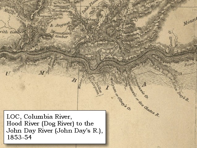
Columbia River Gorge,
Major Creek to The Dalles

Memaloose Island, Klickitat River and Lyle (Washington), Mill Creek, Rock Fort
CONTINUE

April 16-17
Leaving the Gorge, Rock Fort and The Dalles
 

On October 7, 1805, Lewis and Clark and the "Corps of Discovery" began their journey down the Clearwater River and into the volcanics of the Pacific Northwest. The Corps travelled from the Clearwater to the Snake and down the "Great Columbia", finally reaching the Pacific Ocean on November 15, 1805. Along the journey they encountered the lava flows of the Columbia Plateau, river channels carved by the great "Missoula Floods", and the awesome beauty of five Cascade Range volcanoes.

Map, Lewis and Clark in the Pacific Northwest, click for brief
                         summary
[Click map for brief summary about the area]


Heading for Home - April 1806
Columbia River Gorge - Major Creek to The Dalles
 

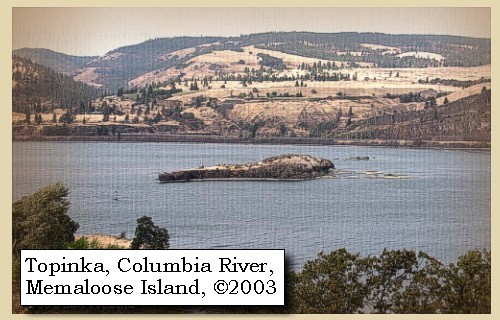
Lewis and Clark's camp of April 14, 1806, was on the east bank of Major Creek, Washingon, just across from Memaloose Island.

Tuesday, April 15, 1806
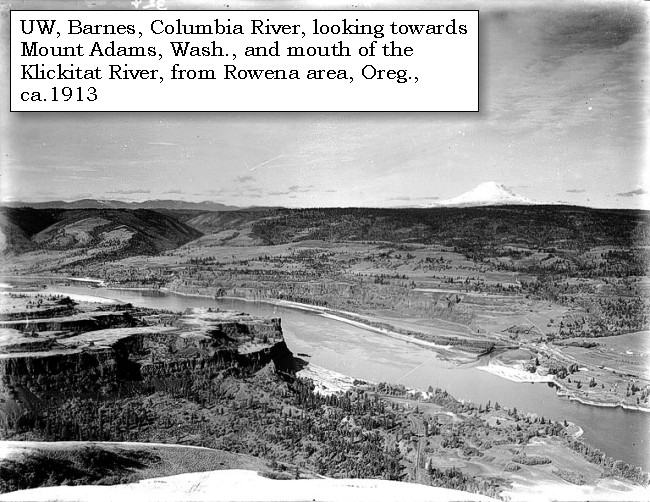
In hopes of purchasing horses we did not set out ...... till after breakfast, and in the meantime exposed our merchandise, and made them various offers; but as they declined bartering, we left them and soon reached the Sepulchre rock [Memaloose Island], where we halted a few minutes. The rock itself stands near the middle of the river, and contains about two acres of ground above high water. On this surface are scattered thirteen vaults, constructed like those below the Rapids, and some of them more than half filled with dead bodies.
"... at 8 A.M. we set out, we halted a few minutes at the sepulchre rock, and examined the deposits of the ded at that place. there were thirteen sepulchres on this rock which stands near the center of the river and has a surface of about 2 acres above high water mark ..." [Lewis, April 15, 1806]


Along the Journey - April 15, 1806
Memaloose Island, 2003

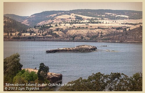
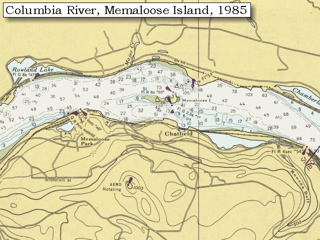
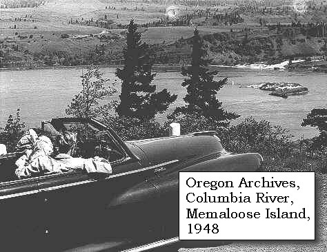
Memaloose Island:
Lewis and Clark called this island "Sepulchar Island". The Chinook Indian tribes of the Columbia Gorge used to lay the bones of their dead on open pyres on Memaloose Island in the middle of the Columbia River near The Dalles. A granite monument visible from Memaloose State Park campground marks the resting place where a local pioneer named Victor Trevitt wished to chart his eternal course buried among honorable men. Memaloose State Park, Oregon, was named for the island. -- Oregon State Parks and Recreation Website, 2002, and Lewis & Clark Bicentennial of Oregon Website, 2002


Map, 1934 USGS topo map of Memaloose area, click to enlarge Map, 1985, Major Creek, Washington, and Memaloose Island, click to enlarge Image, 1948, Memaloose Island, click to enlarge Image, 2003, Memaloose Island in the Columbia River
  1. 1934 Map (section of original), from The Dalles 1:125,000 topographic quadrangle. (Click to enlarge). Original map surveyed in 1929-30, contour interval of 50 feet. The Washington side of the river is not depicted on the map. -- University of Washington Library Collections Website, 2002
  2. 1985 Map (section of original), Major Creek, Washington, and Memaloose Island. (Click to enlarge). Office of Coast Surveys, Historical Maps and Charts, Columbia River, Bonneville to The Dalles, 1985, Chart#18531, 1:40,000. -- NOAA Office of Coast Survey Website, 2004
  3. 1948, Memaloose Island is in the background of this photograph. (Click to enlarge). Three people in a late 1940's model Chrysler convertable car at Memaloose State Park, overlooking the Columbia River. Photograph Date: 1948. Oregon State Archives, Oregon Highway Division #OHD3453, -- Oregon State Archives Website, 2002
  4. 2003, Memaloose Island as seen from Interstate 84, Oregon. (Click to enlarge). Copyright © 2003 Lyn Topinka, private archives, used with permission.


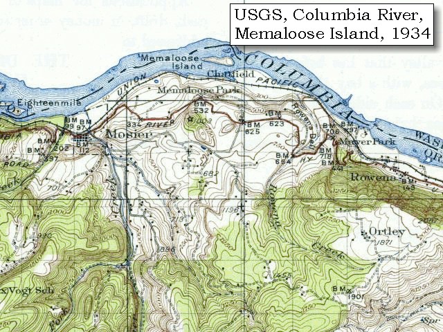
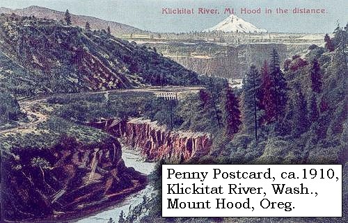
After satisfying our curiosity with these venerable remains, we returned to the northern shore, and proceeded to a village at the distance of four miles: on landing, we found that the inhabitants belonged to the same nation we had just left, and as they also had horses, we made a second attempt to purchase a few of them: but with all our dexterity in exhibiting our wares, we could not induce them to sell, as we had none of the only articles which they seemed desirous of procuring, a sort of war hatchet, called by the northwest traders an eye-dog. We therefore purchased two dogs, and taking leave of these Weocksockwillacums, proceeded to another of their villages, [on October 29, 1805, Lewis and Clark referred to this village as a village of Chilluckittequaws, location of today's Lyle, Washington] just below the entrance of Cataract river [Klickitat River]. Here too, we tried in vain to purchase some horses, nor did we meet with more success at the two villages of Chilluckittequaws, a few miles farther up the river.


Along the Journey - April 15, 1806
Mouth of the Klickitat River, Washington, 2004

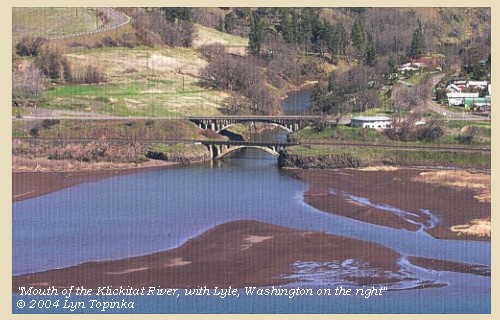
Klickitat River:
The Klickitat River is located on the east slope of the Cascade Range in south-central Washington and drains 1,350 square miles in Klickitat and Yakima counties. The Klickitat is one of the longest undammed rivers in the northwest. It flows 95 miles south from its source in the Cascades and enters the Columbia at River Mile 180, thirty-four miles upstream of Bonneville Dam. The geology of the Klickitat watershed is dominated by extensive basalt strata having a total thickness of several thousand feet. The crest of the Cascade Mountains, dominated by 12,000-foot Mount Adams ("Pahto") forms the western boundary of the basin. At the northwest corner of the basin lie the Goat Rocks, the deeply eroded remnants of an extinct volcano, that reach to about 8,000 feet. Basalt ridges and plateaus separate the Klickitat from other river basins on the north and east. About 75 percent of the subbasin is forested. The Klickitat River is located within the Columbia Gorge National Scenic Area. The spectacular geological formation of the "Narrows" supports one of the only two active Native American dip-net fisheries in the Columbia River Basin. Upstream on the Klickitat, anglers drift the river in pursuit of salmon and steelhead trout while marveling at the views of the wide rolling hills and basalt gorge landscape. -- Columbia Basin Fish and Wildlife Authority Website, 2002, and U.S. National Park Service Website, 2002, "Wild and Scenic Rivers".


Map, 1999, Mount Adams and Vicinity, click to enlarge Map, 1814, Lewis and Clark on the Columbia, click to enlarge Map, 1854, Columbia River, Hood River to the John Day, click to enlarge Map, 1855, Columbia River, Walla Walla to Vancouver, click to enlarge Map, 1859, Columbia River, Klickitat River and Fort Dalles, click to enlarge Map, 1887, White Salmon vicinity, click to enlarge Map, 1887, The Dalles vicinity, click to enlarge Map, 1985, Klickitat River and Lyle, Washington, click to enlarge Image, ca.1913, Rowena area, Mount Adams, and the mouth of the Klickitat, click to enlarge Penny Postcard, ca.1910, Aerial view Klickitat River with Mount Hood, click to enlarge Image, 2004, Mouth of the Klickitat River
  1. 1999 Map, Mount Adams and Vicinity, showing drainages into the Columbia River. (Click to enlarge). Includes the Wind River, Little White Salmon River, White Salmon River, and Klickitat River in Washington State, and the Hood River in Oregon. Map modified from Vallance, 1999, USGS Bulletin 2161.
  2. 1814 Map, Lewis and Clark's map of the Columbia River (section of original). (Click to enlarge.) Shows the Klickitat River ("Cataract R."). Map also includes three of the five volcanoes Lewis and Clark saw and commented on. While the journals mention the expedition seeing Mount Adams, it does not appear on their map. Mount Jefferson is to the south (bottom) and off the map. From the "Nicholas Biddle/Paul Allen" 1814 publication. Original Map: "A Map of Lewis and Clark's Track, Across the Western Portion of North America, From the Mississippi to the Pacific Ocean". From: History of the expedition under the command of Captains Lewis and Clark : to the sources of the Missouri, thence across the Rocky Mountains and down the river Columbia to the Pacific Ocean : performed during the years 1804-5-6 : by order of the government of the United States / prepared for the press by Paul Allen. Philadelphia : Bradford and Insskeep, 1814. Harold B. Lee Library, Brigham Young University #upbover maps37. -- Brigham Young University, Harold B. Lee Library Website, 2004.
  3. 1853-54 Map, Columbia River, including the Hood River to John Day area (section of original). (Click to enlarge). Includes Hood River (Dog River), Klickitat River (Klikatat R.), Mill Creek (?) (Wasco Ck.), The Dalles, The Deschutes (Wanwauwie or des Chutes R.), the John Day River (Mah hah or John Day's R.), and Rock Creek (Camill Cr.). Original Map: "Rocky Mountains to Puget Sound : from explorations and surveys / made under the direction of the Hon. Jefferson Davis, Secretary of War by Isaac I. Stevens Governor of Washington Territory, 1853-4." Inset: (Supplementary sketch) Reconnaissance of the railroad route from Wallawalla to Seattle via Yak-e-mah River & Snoqualmie Pass. By A. W. Tinkham in January 1854. Drawn by J. R. P. Mechlin. 20 x 28 cm. Topographer, John Lambert, Published in Washington D.C., 1859, 1:1,200,000, Notes: From the U.S. War Department, Explorations and Surveys for a Railroad Route from the Mississippi River to the Pacific Ocean, Topographical Maps, to Illustrate the Various Reports, U.S. Library of Congress American Memories Reference "LC Railroad Maps #156". -- U.S. Library of Congress, American Memories Website, 2004
  4. 1855 Map, Columbia River, including the Klickitat River (Cathlatates R.) (section of original). (Click to enlarge). Original Map: "Map of Oregon and Washington Territories: showing the proposed Northern Railroad route to the Pacific Ocean, by John Disturnell, 1855. University of Washington Archives #UW155. -- University of Washington Library Collections Website, 2002
  5. 1859 Map, Columbia River, including the Klickitat River (Klikatat Riv.), Fort Dalles, and the Deschutes River (Fall River) (section of original). (Click to enlarge). Original Map: "Map Exhibiting the Routes between Fort Dalles and the Great Salt Lake", By Bvt.2d Lieut. Joseph Dixon, Topl. Engrs. From Explorations made by him while attached to the Wagon Road Expedition to the Valley of the Great Salt Lake, under the command of Capt. H.D. Wallen, 4th Inft., Compiled under the direction of Capt. Geo. Thom, Topl. Engr., from the orders of Brig. Gen. W.S. Harney commanding the Department of Oregon, 1859. Publisher: Bureau of Topog. Engineers, 1860, UU Library ID: #G4240_1859_D5., Scale: 1:1,300,000. -- University of Utah Library, J.Willard Marriott Digitized Collections Website, 2004
  6. 1887 Map (section of original), Columbia River and the White Salmon River, including the Klickitat River. (Click to enlarge). Original Map: The Columbia River from Celilo to the mouth showing locations of the salmon fisheries, 1887. Scale ca. 1:375,000, Relief shown by hachures. U.S. Army Corps of Engineers, Engineer Office, G.P.O. 1888. University of Washington Archives #UW128. -- University of Washington Library Archives Website, 2002
  7. 1887 Map (section of original), Columbia River at The Dalles, including the Klickitat River. (Click to enlarge). Original Map: The Columbia River from Celilo to the mouth showing locations of the salmon fisheries, 1887. Scale ca. 1:375,000, Relief shown by hachures. U.S. Army Corps of Engineers, Engineer Office, G.P.O. 1888. University of Washington Archives #UW128. -- University of Washington Library Archives Website, 2002
  8. 1985 Map (section of original), Klickitat River and Lyle, Washington. (Click to enlarge). Office of Coast Surveys, Historical Maps and Charts, Columbia River, Bonneville to The Dalles, 1985, Chart#18531, 1:40,000. -- NOAA Office of Coast Survey Website, 2004
  9. ca.1913, Columbia River, Rowena area (Oregon), Mount Adams (Washington), and the mouth of the Klickitat River. (Click to enlarge). Photo by Albert Henry Barnes, ca.1913. University of Washington A.H. Barnes Collection #BAR015. -- University of Washington Library Archives, 2003
  10. ca.1910, Penny Postcard, Aerial view Klickitat River with Mount Hood in the distance. (Click to enlarge). #6094, The Portland Post Card Co., Portland, Oregon. -- L.Topinka private collection, 2003, used with permission.
  11. 2004, Mouth of the Klickitat River, Washington, as seen from Rowena Crest, Oregon. (Click to enlarge). Lyle, Washington is located on the upstream side (right). Copyright © 2004 Lyn Topinka, private archives, used with permission.


Klickitat Landing, 1899

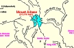
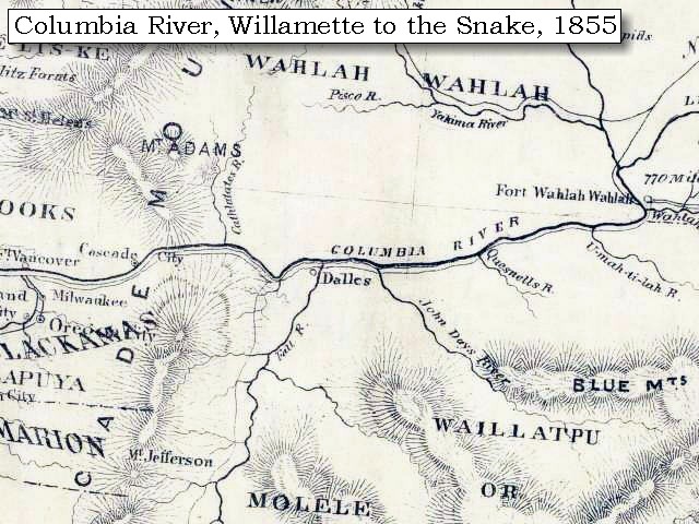
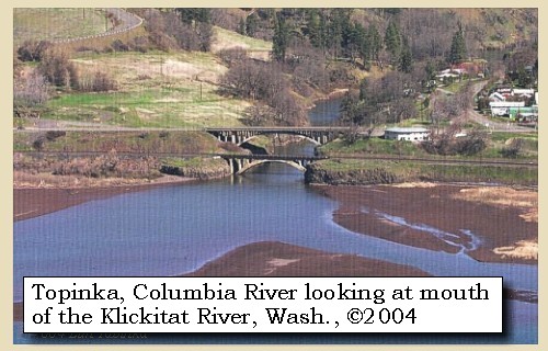
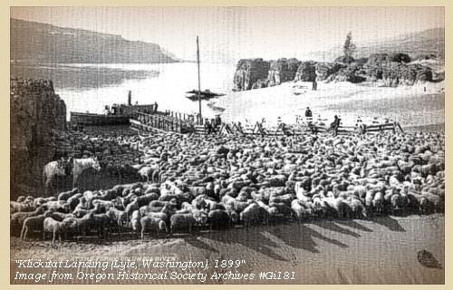
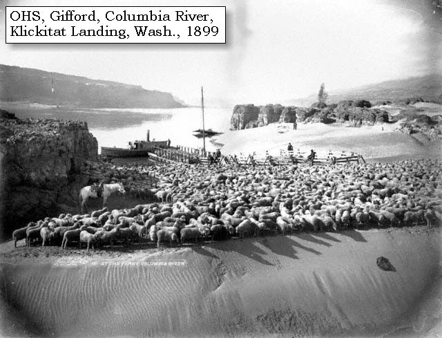
Lyle, Washington:
Lyle has a rich heritage that extends from the Indians who chose the location for their villages to the pioneers who arrived by ox-drawn carts from states far to the east. The first known white men to visit the site were members of the Lewis and Clark expedition who recorded their visit to the Indian village on the knoll west of the Klickitat on October 29, 1805. In 1876, the first Post Office east of the Cascades and north of the Columbia River was established at Klickitat Landing to service most of Eastern Washington. The mail arrived by steamship and was distributed by horseback. In 1876, James O. Lyle became the Postmaster and changed the name to Lyle. Early settlers recognized the strategic importance of Lyle and platted a town site. A ferry boat run was developed to accommodated trade between Oregon and Washington. In 1909, the present town of Lyle was platted. Two sheep sheds with a capacity of 30,000 sheet were constructed on the Point. With those in place, Lyle became an important sheep and wool shipping center. -- Lyle, Washington, Community Website, 2003


Map, 1985, Klickitat River and Lyle, Washington, click to enlarge Image, 1899, Klickitat Landing, click to enlarge
  1. 1985 Map (section of original), Klickitat River and Lyle, Washington. (Click to enlarge). Office of Coast Surveys, Historical Maps and Charts, Columbia River, Bonneville to The Dalles, 1985, Chart#18531, 1:40,000. -- NOAA Office of Coast Survey Website, 2004
  2. 1899, Klickitat Landing (Lyle, Washington). (Click to enlarge). Sheep at the Ferry, by Benjamin Gifford, 1899. Oregon Historical Society Photograph #Gi181. -- Oregon Historical Society Website, 2002


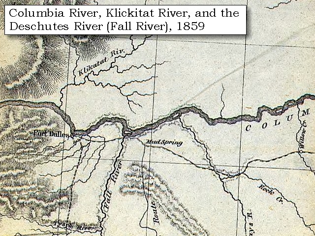
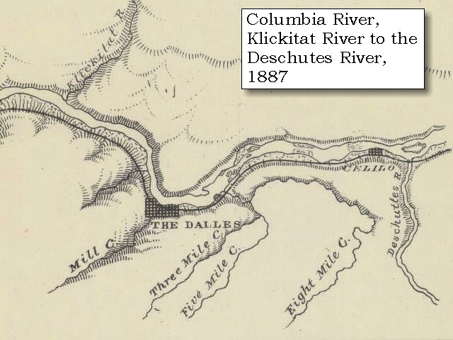
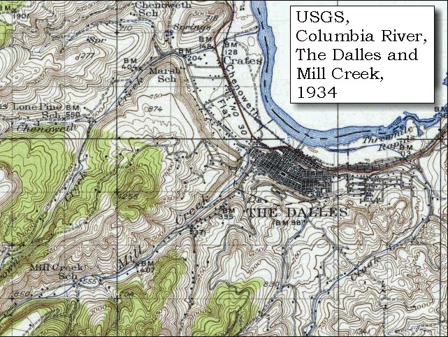
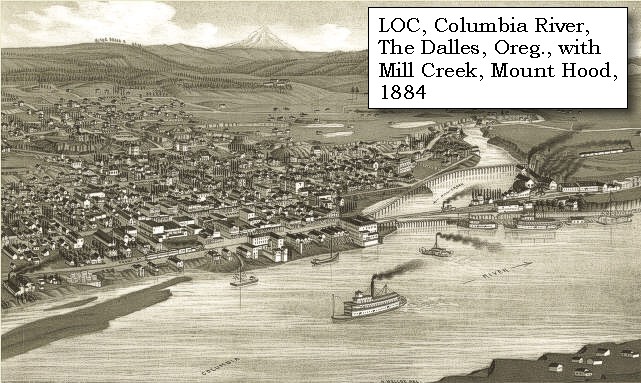
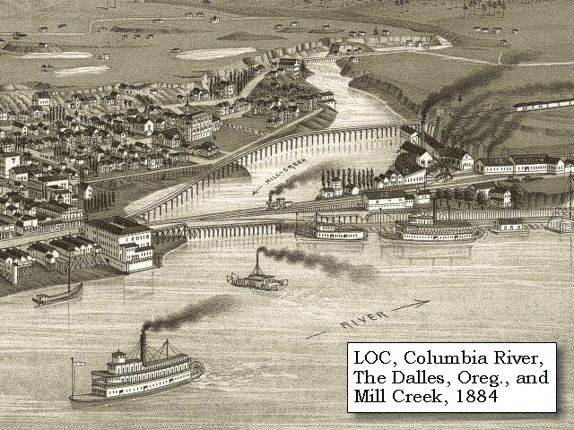
At three in the afternoon, we came to the mouth of Quinett creek [Mill Creek],


Along the Journey - April 15, 1806
Mill Creek, 1884

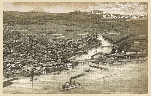
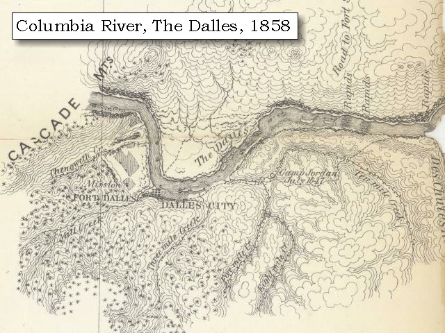
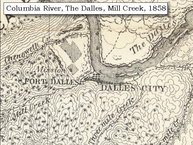
Mill Creek:
Lewis and Clark acquired the name "Que-neet Creek", also spelled "Que-nett", meaning "salmon trout", from the local Indians and applied it to a small stream on the southern shore of the Columbia. Seeking a defensive position for an encampment, they ascended the stream and found a natural rock formation for their security. Mill Creek, the present place name, derived from the establishment of a sawmill on the stream during the military occupation at Fort Dalles, Oregon Territory. The fort was an important military post during the Indian wars era. -- Washington State Historical Society Website, 2002, "Lasting Legacy"


Map, 1814, Lewis and Clark on the Columbia, click to enlarge Map, 1854, Columbia River, Hood River to the John Day, click to enlarge Map, 1858 Military recon map, The Dalles vicinity, click to enlarge Map, 1858 Military recon map, The Dalles and Mill Creek, click to enlarge Map, 1887, The Dalles vicinity, click to enlarge Map, 1934 USGS topo map of The Dalles Mill Creek area, click to enlarge Map, 1985, Mill Creek, The Dalles, click to enlarge Engraving detail, 1884, The Dalles and Mount Hood, with Mill Creek, click to enlarge Engraving detail, 1884, The Dalles and Mill Creek, click to enlarge Image, 1900, Trestle over Mill Creek, The Dalles, Oregon, click to enlarge
  1. 1814 Map, Lewis and Clark's map of the Columbia River (section of original). (Click to enlarge.) Mill Creek is depicted but not named (south side of the Columbia, center of map). Map includes three of the five volcanoes Lewis and Clark saw and commented on. While the journals mention the expedition seeing Mount Adams, it does not appear on their map. Mount Jefferson is just visible to the south (bottom) and Mount Rainier is to the north but off the map. From the "Nicholas Biddle/Paul Allen" 1814 publication. Original Map: "A Map of Lewis and Clark's Track, Across the Western Portion of North America, From the Mississippi to the Pacific Ocean". From: History of the expedition under the command of Captains Lewis and Clark : to the sources of the Missouri, thence across the Rocky Mountains and down the river Columbia to the Pacific Ocean : performed during the years 1804-5-6 : by order of the government of the United States / prepared for the press by Paul Allen. Philadelphia : Bradford and Insskeep, 1814. Harold B. Lee Library, Brigham Young University #upbover maps37. -- Brigham Young University, Harold B. Lee Library Website, 2004.
  2. 1853-54 Map, Columbia River, including the Hood River to John Day area (section of original). (Click to enlarge). Includes Hood River (Dog River), Klickitat River (Klikatat R.), Mill Creek (?) (Wasco Ck.), The Dalles, The Deschutes (Wanwauwie or des Chutes R.), the John Day River (Mah hah or John Day's R.), and Rock Creek (Camill Cr.). Original Map: "Rocky Mountains to Puget Sound : from explorations and surveys / made under the direction of the Hon. Jefferson Davis, Secretary of War by Isaac I. Stevens Governor of Washington Territory, 1853-4." Inset: (Supplementary sketch) Reconnaissance of the railroad route from Wallawalla to Seattle via Yak-e-mah River & Snoqualmie Pass. By A. W. Tinkham in January 1854. Drawn by J. R. P. Mechlin. 20 x 28 cm. Topographer, John Lambert, Published in Washington D.C., 1859, 1:1,200,000, Notes: From the U.S. War Department, Explorations and Surveys for a Railroad Route from the Mississippi River to the Pacific Ocean, Topographical Maps, to Illustrate the Various Reports, U.S. Library of Congress American Memories Reference "LC Railroad Maps #156". -- U.S. Library of Congress, American Memories Website, 2004
  3. 1858 Military Recon Map (section of original), Columbia River and The Dalles Vicinity. (Click to enlarge). Map of military reconnaissance from Fort Dalles, Oregon, via Fort Wallah-Wallah, to Fort Taylor, Washington Territory, 1858. Shows approximate location of military road constructed 1859 to 1862. From the report and maps of Captain John Mullan, United States Army, G.P.O., 1863. University of Washington Archives #UW85. -- University of Washington Library Archives Website, 2002
  4. 1858 Military Recon Map (section of original), Columbia River and The Dalles Vicinity. (Click to enlarge). Map of military reconnaissance from Fort Dalles, Oregon, via Fort Wallah-Wallah, to Fort Taylor, Washington Territory, 1858. Shows approximate location of military road constructed 1859 to 1862. From the report and maps of Captain John Mullan, United States Army, G.P.O., 1863. University of Washington Archives #UW85. -- University of Washington Library Archives Website, 2004
  5. 1887 Map (section of original), Columbia River at The Dalles, including Mill Creek. (Click to enlarge). Original Map: The Columbia River from Celilo to the mouth showing locations of the salmon fisheries, 1887. Scale ca. 1:375,000, Relief shown by hachures. U.S. Army Corps of Engineers, Engineer Office, G.P.O. 1888. University of Washington Archives #UW128. -- University of Washington Library Archives Website, 2002
  6. 1934 Map (section of original), from The Dalles 1:125,000 topographic quadrangle. (Click to enlarge). Original map surveyed in 1929-30, contour interval of 50 feet. The Washington side of the river is not depicted on the map. -- University of Washington Library Collections Website, 2002
  7. 1985 Map, Mill Creek and The Dalles. (Click to enlarge). Office of Coast Surveys, Historical Maps and Charts, Columbia River, Bonneville to The Dalles, 1985, Chart#18531, 1:40,000. -- NOAA Office of Coast Survey Website, 2004
  8. 1884, Detail from engraving of The Dalles, Oregon with Mount Hood on the skyline and the Columbia River and the mouth of Mill Creek in the foreground. (Click to enlarge). Created by H. Wellge. Published 1884, J.J. Stoner, Madison, Wisconsin. Panoramic view of the city of The Dalles, Oregon, county seat of Wasco County, 1884. Original lithograph shows The Dalles, Mount Hood, the Columbia River, and the mouth of Mill Creek. Reference #LC Panoramic Maps #727. -- Library of Congress American Memories Website, 2002
  9. 1884, Closer-in detail from engraving of The Dalles, Oregon, and the mouth of Mill Creek. (Click to enlarge). Created by H. Wellge. Published 1884, J.J. Stoner, Madison, Wisconsin. Panoramic view of the city of The Dalles, Oregon, county seat of Wasco County, 1884. Original lithograph shows The Dalles, Mount Hood, the Columbia River, and the mouth of Mill Creek. Reference #LC Panoramic Maps #727. -- Library of Congress American Memories Website, 2002
  10. 1900, Trestle over Mill Creek, The Dalles, Oregon. (Click to enlarge). Includes Umatilla House and Baldwin Opera House. Photograher: Seufert. Oregon Historical Society #38472, File #1036-A, Columbia Gorge Discovery Center Catalogue #2002.13.52. -- Columbia Gorge Discovery Center Website, 2004


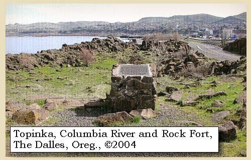
which we ascended a short distance and encamped for the night, at the spot we had called Rock fort [Rock Fort, The Dalles, Oregon].


Along the Journey - April 15, 1806
Rock Fort, 2004

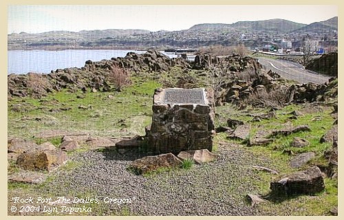
Rock Fort:
The fort-like basalt outcropping lies just downstream from the mouth of Mill Creek at present-day The Dalles, Oregon, on a wedge-shaped parcel bordered by the Columbia River, Bargeway Road, and Bridge and Garrison Streets. A riverfront trail leads to Rock Fort where interpretive signage marks the campsite. -- U.S. National Park Service Website, Lewis and Clark Expedition, 2003


Map, 1858 Military recon map, The Dalles and Mill Creek, click to enlarge Map, 1985, Mill Creek, The Dalles, click to enlarge Image, 2004, Rock Fort
  1. 1858 Military Recon Map (section of original), Columbia River and The Dalles Vicinity. (Click to enlarge). Map of military reconnaissance from Fort Dalles, Oregon, via Fort Wallah-Wallah, to Fort Taylor, Washington Territory, 1858. Shows approximate location of military road constructed 1859 to 1862. From the report and maps of Captain John Mullan, United States Army, G.P.O., 1863. University of Washington Archives #UW85. -- University of Washington Library Archives Website, 2004
  2. 1985 Map, Mill Creek and The Dalles. (Click to enlarge). Office of Coast Surveys, Historical Maps and Charts, Columbia River, Bonneville to The Dalles, 1985, Chart#18531, 1:40,000. -- NOAA Office of Coast Survey Website, 2004
  3. 2004, Rock Fort, The Dalles, Oregon. (Click to enlarge). Copyright © 2004 Lyn Topinka, private archives, used with permission.


Here we were soon visited by some of the people from the great narrows and falls: and on our expressing a wish to purchase horses, they agreed to meet us to-morrow on the north side of the river, where we would open a traffic. They then returned to their villages to collect the horses.


Along the Journey - April 15, 1806
The Main Camp - April 15 through April 17, 1806:
Lewis and Clark set up camp at "Rock Fort" during both their journey to the Pacific (October 25 through October 27, 1805) and their journey home (April 15 through April 17, 1806).


Home Previous Continue


If you have questions or comments please contact: GS-CVO-WEB@usgs.gov
June/July 2004, Lyn Topinka
The Volcanoes of Lewis and Clark Home Page | CVO Home Page