Lewis and Clark
|
November 3, 1805 Heading West - Rooster Rock to Columbia River Slough |
|
Home
The Volcanoes of Lewis and Clark Map of the Journey Volcanoes, Basalt Plateaus, Major Rivers, etc. The Volcanoes Mount Adams, Mount Hood, Mount Jefferson, Mount Rainier, and Mount St. Helens CALENDAR of the Journey October 1805 to June 1806 Along the Journey Pacific Northwest Maps - Columbia River, Volcanoes, Flood Basalts, Missoula Floods, Geology, etc. The Corps of Discovery The Journey of Lewis and Clark About the Reference Materials The Journals, Biddle/Allen, DeVoto, Gass, Moulton, Topo Maps, and others USGS Lewis and Clark Links Links to USGS Websites highlighting the Lewis and Clark Journey Resources Publications Referenced and Websites Visited |
PREVIOUS
November 2 Columbia River Gorge, Beacon Rock to Rooster Rock |
November 3
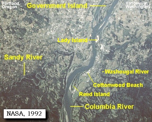
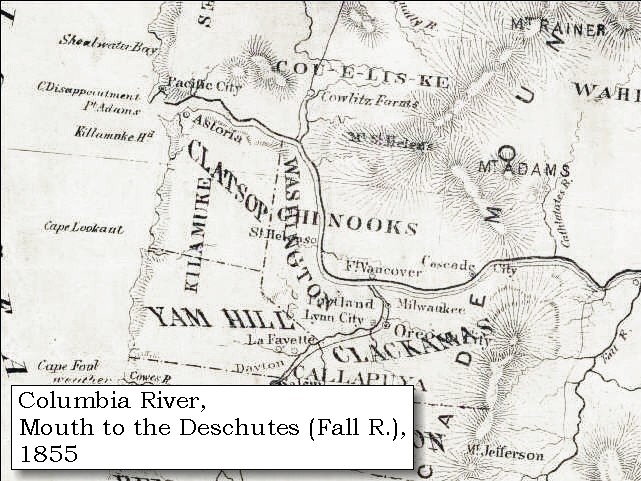
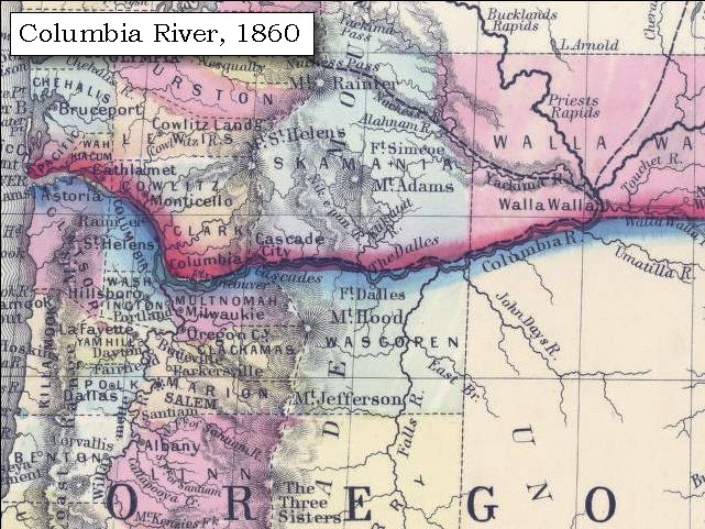
Columbia River Heading West, Rooster Rock to Columbia River Slough Crown Point and Vista House, Point Vancouver, Steigerwald Lake NWR, Mount Hood, Sandy River, Sandy River in 1805, Lewis and Clark State Recreation Area, Washougal River, Mount Hood, Lady Island, Government Island and Government Island State Recreation Area, Interstate-205 Bridge, Columbia River Slough |
CONTINUE
November 4 Vancouver, Washington, Columbia River Slough to Ridgefield NWR |
On October 7, 1805, Lewis and Clark and the
"Corps of Discovery" began their journey
down the Clearwater River and into the volcanics
of the Pacific Northwest. The Corps travelled from the
Clearwater to the Snake and down the
"Great Columbia", finally reaching the
Pacific Ocean on November 15, 1805.
Along the journey they encountered the
lava flows of the Columbia Plateau,
river channels carved by the great "Missoula Floods",
and the awesome beauty of five Cascade Range volcanoes.

[Click map for brief summary about the area] |
|
To the Pacific - November 1805
Heading West - Rooster Rock to Columbia River Slough |
| Lewis and Clark's camp of November 2, 1805, was on the Oregon side of the Columbia River near Rooster Rock. |
| Sunday, November 3, 1805 |
| We were detained until ten o'clock by a fog so thick that a man could not be discerned at the distance of fifty steps As soon as it cleared off we set out ...... The low grounds along the river are covered so thickly with rushes, vines, and other small growth, that they are almost impassable |
| "... The Countrey has a handsom appearance in advance no mountains extensive bottoms -- the water Shallow for a great distance from Shore --, The fog continued thick until 12 oClock ..." [Clark, November 3, 1805, first draft] |
| "... The Fog So thick this morning that we could not See a man 50 Steps off, this fog detained us untill 10 oClock at which time we Set out ..." [Clark, November 3, 1805] |
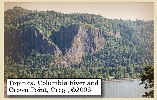
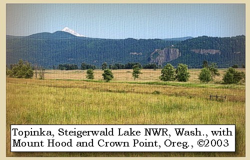
| High on the left above Lewis and Clark's camp of November 2, 1805 is Crown Point, while on the Washington side of the Columbia is Point Vancouver and Steigerwald Lake Wildlife Refuge. Mount Hood can be seen along this reach. |
|
|
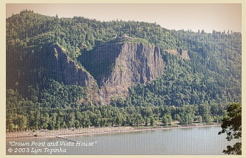
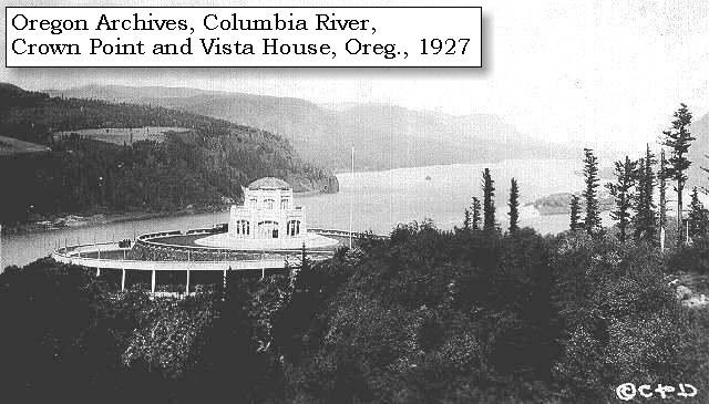
Crown Point and Vista House: Crown Point and Vista House are located in the Columbia Gorge National Scenic Area, 11 miles east of Troutdale, Oregon. Crown Point is the massive valley-fill of a Priest Rapids flow of Columbia River basalt, about 14 million years old, which filled the canyon. The lower part of the cliff is made up of a thick section of volcanic sediments which partly filled the canyon before it was covered by the lava flow. The single Priest Rapids flow consists of 508 feet of hackly jointed basalt which in turn overlies more than 198 feet of bedded Priest Rapids hyaloclastite. The Vista House was built in 1916 at the same time as Highway 30 (what is now the Historic Columbia River Gorge Highway, and the only way to reach Crown Point). The building was designed to be a place of refreshment and enjoyment of the Columbia Gorge. The octagonal building with its copper dome now houses a museum, gift shop and interpretive display of historic and geologic points of interest in the Gorge. -- Allen, 1985, Time Travel in Oregon, Beeson and Tolan, 1987, and Oregon State Parks and Recreation Website, 2002 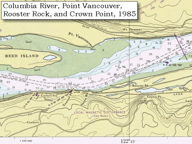
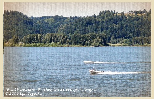
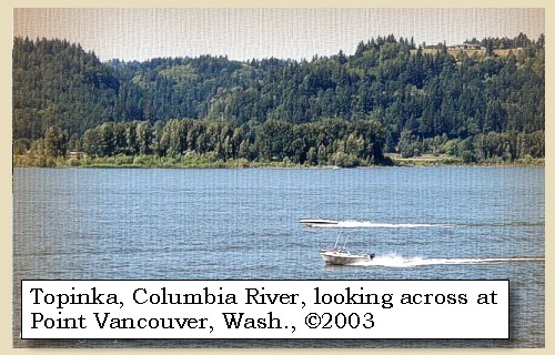
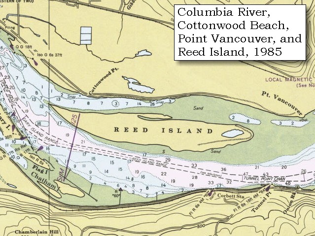
Point Vancouver: Point Vancouver was named by Lieutenant William Broughton in 1792, and marks the furthest upstream on the Columbia River he explored. He named the point of land after his commander Captain George Vancouver. -- City of Washougal Website, 2003 

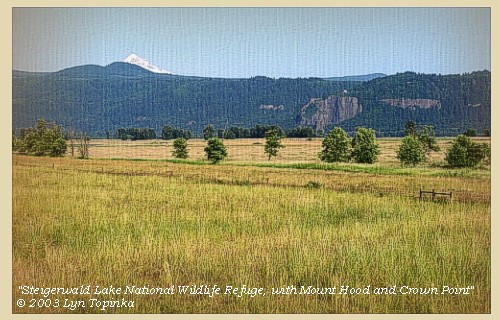
Steigerwald Lake National Wildlife Refuge: Steigerwald Lake National Wildlife Refuge consists of more than 950 acres of historic lakebed and river bottomland habitat with wetlands, riparian areas, grasslands, and hardwood forest. The refuge, which provides habitat for wintering waterfowl and year-round habitat fro a variety of wildlife species, can be viewed from Washington State Highway 14. -- U.S. Fish and Wildlife Service Website, 2003 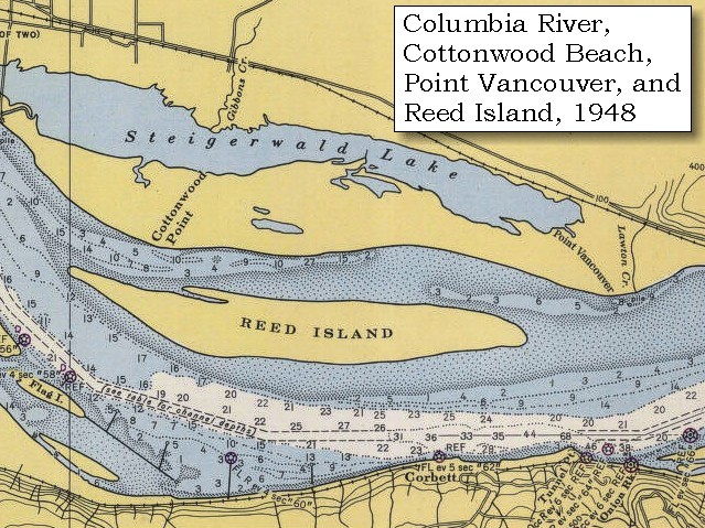
|
| At the distance of three miles we reached the mouth of a river on the left [Sandy River], which seemed to lose its waters in a sandbar opposite; the stream itself being only a few inches in depth. But on attempting to wade across, we discovered that the bed was a very bad quicksand, too deep to be passed on foot. We went up a mile and a half to examine this river, and found it to be at this distance a very considerable stream one hundred and twenty yards wide at its narrowest part, with several small islands. Its character resembles very much that of the river Platte. It drives its quicksand over the low grounds with great impetuosity, and such is the quantity of coarse sand which it discharges, that the accumulation has formed a large sandbar or island, three miles long, and a mile and a half wide, which divides the waters of the Quicksand river [Sandy River] into two channels. This sand island [Sandy River Delta] compresses the Columbia within a space of half a mile, and throws its whole current against the right shore. |
| "... halted at the mouth of a large river on the Lard Side, This river throws out emence quanty of (quick) Sand and is verry Shallow, th narrowest part 200 yards wide bold Current, much resembling the river Plat, Several Islands about 1 mile up and has a Sand bar of 3 miles in extent imedeately in its mouth, discharging it waters by 2 mouths, and Crowding its Corse Sands So as to throw the Columbian waters on its Nothern banks, & confdg it to 1/2 ms. in width ..." [Clark, November 3, 1805, first draft] |
| "... The Fog So thick this morning that we could not See a man 50 Steps off, this fog detained us untill 10 oClock at which time we Set out ...... I walked on the Sand beech Lard. Side, opposit the canoes as they passed allong. The under groth rushes, vines &c. in the bottoms too thick to pass through, at 3 miles I arrived at the enterance of a river which appeared to Scatter over a Sand bar, the bottom of which I could See quite across and did not appeart to be 4 Inches deep in any part; I attempted to wade this Stream and to my astonishment found the bottom a quick Sand, and impassable -- I called to the Canoes to put to Shore, I got into the Canoe and landed below the mouth, & Capt Lewis and my Self walked up this river about 1 1/2 miles to examine this river which we found to be a verry Considerable Stream Dischargeing its waters through 2 Chanels which forms an Island of about 3 miles in length on the river and 1 1/2 miles wide, composed of Corse Sand which is thrown out of this quick Sand river Compressing the waters of the Columbia and throwing the whole Current of its waters against its Northern banks, within a Chanel of 1/2 a mile wide, Several Small Islands 1 mile up this river, This Stream has much the appearance of the 'River Platt': roleing its quick Sands into the bottoms with great velocity after which it is divided into 2 Chanels by a large Sand bar before mentioned, the narrowest part of this River is 120 yards -- on the Opposit Side of the Columbia a (large Creek) falls in above this Creek on the Same Side is a Small prarie. extensive low country on each Side thickly timbered. ..." [Clark, November 3, 1805] |
| "... abt. noon we halted to dine at the mo. of a River which came in on the Lard. Side, the mouth of which was filled with quick Sand So that we could run a pole 6 or 8 feet in it, and it emptyd. in at Several places thro a verry large Sand bar which lay at the mo we then proceeded on passd. the mo. of a Small River on Stard. ..." [Whitehouse, November 3, 1805] |
| "... We saw about 12 o'Clock A.M. several Islands & halted to dine at the Mouth of a River, which came into the Columbia River on the South side. The mouths or entrance of this River is filled with a quick sand, which we run a pole 8 feet down, & had no solid bottom and it emptied itself by several Mouths. At 2 o'Clock P.M. we passed also the Mouth of a small river, lying on the North side of the Columbia River. The weather now got clear & pleasant. ..." [Whitehouse, November 3, 1805] |
|
|
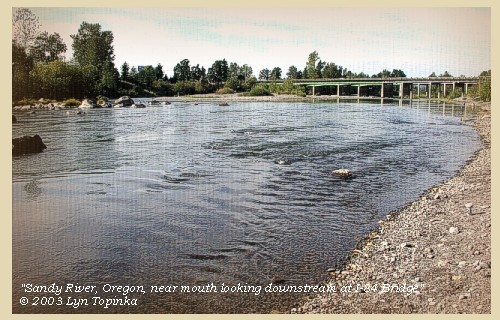
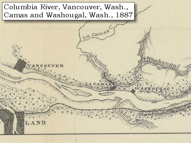
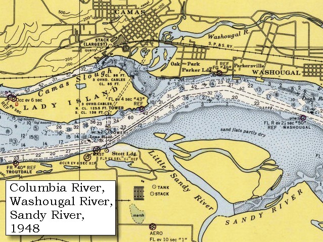
Sandy River: The Sandy River Basin is located within Multnomah and Clackamas Counties in Oregon, and drains an area of about 508 square miles. The Sandy and many of its tributaries originate high on the slopes of Mount Hood, and then flows approximately 56 miles in a northwesterly direction to join the Columbia River near Troutdale, Oregon, at Columbia River Mile (RM) 120.5. The Sandy River Basin is comprised of several watersheds, many of which are uniquely distinct in terms of hydrology and geomorphology. Principal tributaries include the ZigZag River, Still Creek and Salmon River in the Upper Basin, and the Bull Run River, Little Sandy River, Gordon Creek, Cedar Creek and Beaver Creek in the Lower Basin. Many other smaller tributaries located throughout the basin contribute significantly to stream flows, and provide habitat for a wide array of fish and wildlife. Where the Sandy and Columbia Rivers merge, sediments have deposited over the years to form a large delta, called the Sandy River Delta, which covers approximately 1,400 acres. This area was designated a Special Management Area in 1986 and was purchased by the U.S. Forest Service (USFS) in 1991. It is now part of the Columbia River Gorge Scenic Area. The Sandy River Delta was acquired to protect and enhance the natural resource values of the site, particularly the floodplain character and associated wetlands and to provide for compatible recreation uses. The mouth of the Sandy River is typically shallow and underlain almost entirely with sand and other fine sediments, and is influenced by tidal effects. -- Columbia Basin Fish and Wildlife Authority Website, 2003 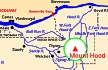


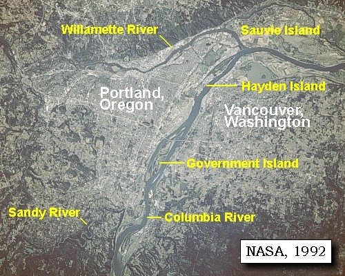
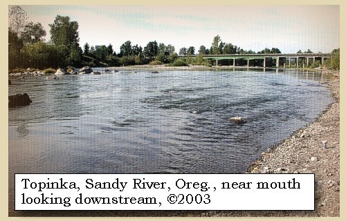
The Sandy River in 1805: In 1805, Meriwether Lewis and William Clark named a river on the south side of the Columbia River gorge the "Quicksand River." Their description of a wide, shallow river with a bed "formed entirely of quicksand," bears little resemblance to the narrow, moderately deep river we call today the Sandy River. What happened? The answer lay 50 miles away at Mount Hood. An eruption in the 1790's caused a tremendous amount of volcanic rock and sand to enter the Sandy River drainage. That sediment was still being flushed downstream when Lewis and Clark saw and named the river. Since 1806, the river has removed the excess sediment from its channel. The Toutle River in southwest Washington was similarly affected by the 1980 eruptions of Mount St. Helens. -- Gardner, et.al., 2000 Lewis and Clark State Recreation Area: Located at the western gateway of the Columbia River Gorge, the Lewis and Clark State Recreation Area honors its legendary namesakes who camped and explored here in November, 1805 and March/April 1806. The park is situated near the mouth of the Sandy River where it spills into the mighty Columbia River and at one of the entrances to the Historic Columbia River Highway. One of the most popular swimming spots on the Sandy River is adjacent to the park, as well as a public boat launch. A trail climbs the cliffs to Broughton's Bluff, which serves as a geologic boundary between the foothills of the Cascade Mountain Range and the neighboring Willamette Valley to the west. The park has interpretive signs and botanical trail. -- Lewis and Clark Bicentennial in Oregon Website, 2002, and Oregon State Parks and Recreation Website, 2002 |
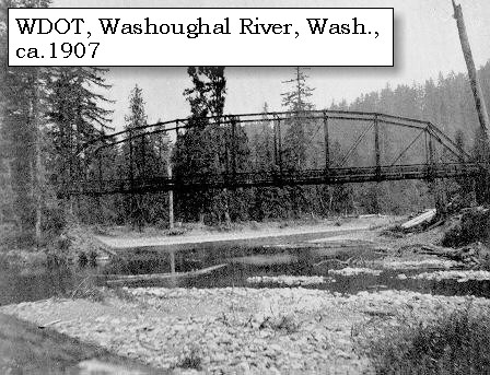
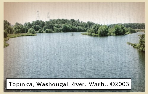
| Opposite to this river, which we call Quicksand river [Sandy River], is a large creek to which we gave the name of Seal river [Washougal River]. |
|
|
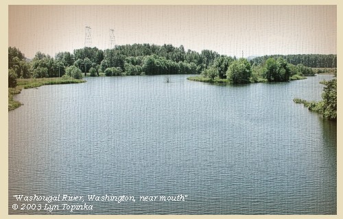
Washougal River: The Washougal River is located in southwest Washington, originating in Skamania County and flowing southwesterly into Clark County, joining the Columbia River at River Mile (RM) 121 at the town of Camas. The Washougal and Salmon Creek watersheds to the west encompasses approximately 240 square miles. This region lies in a geographical area known as the Willamette-Puget Trough, formed by the Cascade and Pacific Coast Mountain ranges. The towns of Camas and Washougal are located on the short confined floodplain at the mouth of the Washougal River. To the north and east of Washougal, the older rocks belong to several geologic formations, including the Skamania Volcanics and the Columbia River basalt group. West of Washougal, a thick sequence of sediments, deposited during the Miocene through the Pleistocene epochs, fills a structural basin formed during faulting and downwarping of the older rocks. These sediments belong to several geologic formations, including the Sandy River mudstone and the Troutdale Formation, both of Eocene age. During the late Pleistocene time, large quantities of sediments were deposited over the Troutdale Formation. -- Columbia Basin Fish and Wildlife Authority Website, 2003
|
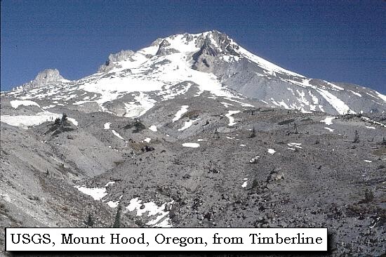
| The first [Sandy River] appears to pass through the low country, at the foot of the high range of mountains towards the southeast, [Cascade Range in Oregon] while the second [Washougal River] as well as all the large creeks on the right side of the Columbia, rise in the same ridge of mountains N. N. E. from this place [Cascade Range in Washington]. The mountain, which we have supposed to be the mount Hood of Vancouver, bears S. 85o E. about forty-seven miles from the mouth of the Quicksand river [Sandy River]. |
| "... Passed a Small Prarie on the Stard. Side above, a large Creek oppost 'qk Sand' River on the Stard. Side, extensive bottoms and low hilley Countrey on each Side ('good wintering Place') a high peaked mountain Suppose to be Mt. Hood is on the Lard Side S.85o E. 40 miles distant from the mouth of quick Sand river. -- ..." [Clark, November 3, 1805, first draft] |
| "... The Quick Sand river appears to pass through the low countrey at the foot of those high range of mountains in a Southerly direction, -- The large Creeks which fall into the Columbia on the Stard. Side rise in the Same range of mountains to the N. N. E. and pass through Some ridgey land -- A Mountain which we Suppose to be Mt. Hood, is S. 85o E about 47 miles distant from the mouth of quick sand river This mtn. is Covered with Snow and in the range of mountains which we have passed through and is of a Conical form but rugid -- ..." [Clark, November 3, 1805] |
| "... note the mountain we Saw from near the forks proves to be Mount 'Hood' ..." [Clark, November 3, 1805] |
| "... We at that time came to the mouth of a river on the south side, a quarter of a mile broad, but not more than 6 or 8 inches deep, running over a bar of quicksand. At this place we dined on venison and goose; and from which we can see the high point of a mountain covered with snow, in about a southeast direction from us. Our Commanding Officers are of opinion that it is Mount Hood, discovered by a Lieutenant of Vancoover, who was up this river 75 miles. ..." [Gass, November 3, 1805] |
| Mount Hood was named in 1792 by Lieutenant William Broughton, a member of the expedition under command of Captain George Vancouver. He named it after the British Admiral Samuel Hood, who backed their voyage. |
| "... we Saw the round mountain some distance a head which we expect is the Same which was discovred by Lieut. Hood and is called Hoods Mountain. ..." [Ordway, November 3, 1805] |
| "... the after part of the day clear and pleas we Saw a high round mountain on the Lard Side which we expect is the Same we Saw abo. the great falls and the Same that Lieut. Hood gave an account off. ..." [Whitehouse, November 3, 1805] |
| "... saw a high round Mountain, lying on the South side of the River, which we supposed to be the same Mountain, that we saw above the great falls of this River, and believe it to be the same Mountain; that Lieutenant Hood gave an account of when on a Voyage round the World with Captain Cook, This Mountain appeared nearly covered with Snow. We proceeded on, the River begin nearly One Mile & a quarter wide in general, & a number of large Islands in it, laying on both sides of it ..." [Whitehouse, November 3, 1805] |
|
|
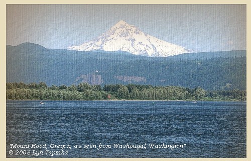
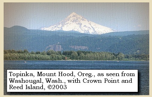
Mount Hood: Mount Hood, at 11,245 feet high, is the fourth highest peak in the Cascade Range and the highest in the state of Oregon. The peak dominates the skyline from the Portland, Oregon, metropolitan area to the wheat fields of Wasco and Sherman Counties of eastern Oregon. 

|
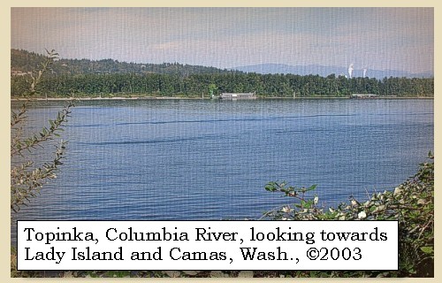
| After dinner we proceeded, and at the distance of three miles reached the lower mouth of Quicksand river [Sandy River]. On the opposite side a large creek falls [Washougal River] in near the head of an island [Lady Island], which extends for three miles and a half down the river; it is a mile and a half in width, rocky at the upper end, has some timber round its borders, but in the middle is open and has several ponds. |
|
|
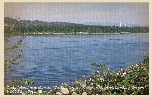
Lady Island: Lady Island was given two names by Lewis and Clark. On the draft map the island was labeled "Fowls I", but on the route map the island was labeled "White Brant Isld", after the lesser snow goose. Previously in 1792, Lieutentant William Broughton had named the island "Johnstone Island". The present name is for Joseph Lady, who in 1853 had a land claim on the island. Today Lady Island is part of the Camas Mill, a pulp and paper manufacturing complex that is bound on three sides by the City of Camas, Washington. A little over a quarter of the mill site lies north of the Camas Slough (an arm of the Columbia River that connects to the Washougal River). The rest of the mill resides on Lady Island which is situated directly south of the slough and fronts the Columbia River. The wastewater treament system and a solid waste landfill are located on Lady Island. -- Washington State Historical Society Website, 2002, and Washington State Department of Ecology Website, 2003
|
| Half a mile lower is another island in the middle of the river, to which from its appearance we gave the name of Diamond island [Government Island]. |
|
|
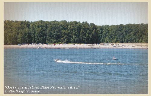
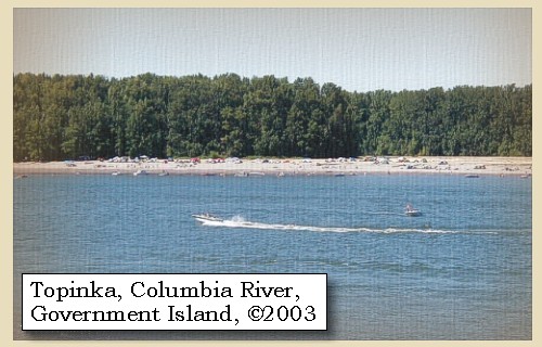
Government Island and Government Island State Recreation Area: In 1805 Lewis and Clark reached a cluster of Islands - the easternmost one they called "Diamond Island" because of it's shape. Their camp of November 3, 1805 was on this island. Today, the largest island in this cluster is known as Government Island, a name acquired when the military grazed cattle on the island. Government, Lemon, and McGuire Islands are located in the Columbia River northeast of Portland International Airport between Columbia River River Mile 111.5 and River Mile 119. The island complex, consists of approximately 2,200 acres. Access to Government Island is by boat only. There are two docks and a floating tie-up on the north side of the island. With 15 miles of shoreline and a free primitive campground, the park is popular with anglers. The interior of the island is still used as a cattle ranch and also contains protected natural areas. Entry to the interior is prohibited. -- Port of Portland Website, 2002, and Oregon State Parks and Recreation Website, 2003
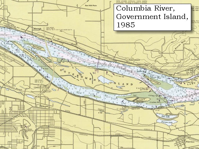
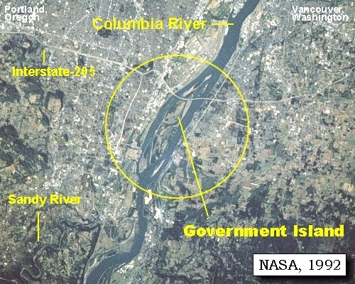
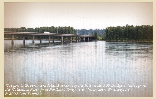
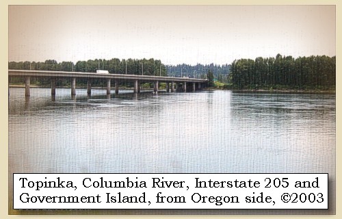
Interstate-205 Bridge: In 1982, the Interstate-205 Bridge (Glenn Jackson Bridge) was completed, spanning the Columbia River from Portland, Oregon, to Vancouver, Washington. Part of the bridge crosses Government Island.
|
| Here we met fifteen Indians ascending the river in two canoes, but the only information we could procure from them was, that they had seen three vessels, which we presume to be European, at the mouth of the Columbia. We went along its right side for three miles, and encamped opposite to it, after making today thirteen miles. |
| "... proceeded on to the center of a large Island in the middle of the river which we call Dimond Island from its appearence, here we met 15 Indn. men in 2 canoes from below, they informed us they Saw 3 vestles below &c. &c. we landed on the North side of this Dimond Island and Encamped ... Capt. Lewis borrowed a Small canoe of those Indians & 4 men took her across to a Small lake in the Isld. he killed a Swan and Several Ducks ... " [Clark, November 3, 1805] |
|
|
|
The Camp - November 3, 1805:
The Corps camped on the north shore of Government Island (Diamond Island). Government Island is located 3 miles downstream from Camas, Washington. |
|
A canoe soon after arrived from the
village at the foot of the last rapid,
with an Indian and his
family, consisting of a wife, three children,
and a woman
who had been taken prisoner from Snake Indians,
living on a
river from the south, which we afterwards
found to be the Multnomah
[Willamette River].
......
Below Quicksand river [Sandy River] the country is low, rich and thickly wooded on each side of the river: the islands have less timber, but are furnished with a number of ponds near which are vast quantities of fowls, such as swan, geese, brants, cranes, storks, white gulls, cormorants and plover. [Lewis and Clark are describing the area known as the Columbia Slough] The river is wide, and contains a great number of sea otters [seals]. |
|
|
|
Columbia River Slough:
The Columbia Slough is 18 miles long. Its watershed covers a 61 square mile area from urban North Portland to Gresham. Prior to human manipulation, the slough's channels, lakes, and wetlands absorbed the waters of the Columbia during natural periodic spring freshets and floods. The teeming plant and animal life, and rich soils of the floodplain drew human settlement to the area. -- Center for Columbia River History Website, 2002 |
| Home | Previous | Continue |
If you have questions or comments please contact: GS-CVO-WEB@usgs.gov
June/July 2004, Lyn Topinka
The Volcanoes of Lewis and Clark Home Page | CVO Home Page