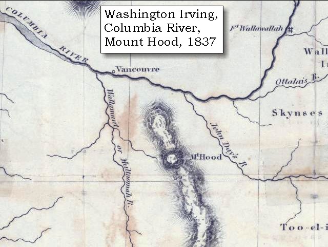
|
April 3, 1806 Five Volcanoes and the Willamette River |
|
Home
The Volcanoes of Lewis and Clark Map of the Journey Volcanoes, Basalt Plateaus, Major Rivers, etc. The Volcanoes Mount Adams, Mount Hood, Mount Jefferson, Mount Rainier, and Mount St. Helens CALENDAR of the Journey October 1805 to June 1806 Along the Journey Pacific Northwest Maps - Columbia River, Volcanoes, Flood Basalts, Missoula Floods, Geology, etc. The Corps of Discovery The Journey of Lewis and Clark About the Reference Materials The Journals, Biddle/Allen, DeVoto, Gass, Moulton, Topo Maps, and others USGS Lewis and Clark Links Links to USGS Websites highlighting the Lewis and Clark Journey Resources Publications Referenced and Websites Visited |
PREVIOUS
April 2 Gathering Provisions, Cottonwood Beach Camp and the Willamette River |
April 3
Five Volcanoes and a Side-Trip Up the Willamette River Cottonwood Beach, Mount Hood, Portland International Airport, Willamette River, Portland (Oregon), Five Volcanoes - Mount Rainier, Mount St. Helens, Mount Adams, Mount Hood, and Mount Jefferson, Clark's side-trip up the Willamette, Multnomah Channel, Sauvie Island, Willamette Falls and Oregon City, St. Johns Bridge and Cathedral Park |
CONTINUE
April 4-5 Back on the Columbia, The Willamette Valley |
On October 7, 1805, Lewis and Clark and the
"Corps of Discovery" began their journey
down the Clearwater River and into the volcanics
of the Pacific Northwest. The Corps travelled from the
Clearwater to the Snake and down the
"Great Columbia", finally reaching the
Pacific Ocean on November 15, 1805.
Along the journey they encountered the
lava flows of the Columbia Plateau,
river channels carved by the great "Missoula Floods",
and the awesome beauty of five Cascade Range volcanoes.

[Click map for brief summary about the area] |
|
Heading for Home - April 1806
Five Volcanoes and the Willamette River |
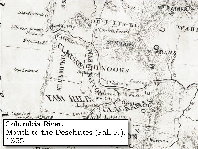
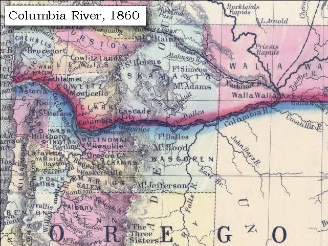
| Between March 31 and April 5, 1806 Lewis and Clark camped near present day Cottonwood Beach, just upstream of Washougal, Washington. From this campsite, William Clark led a group of men back down the Columbia to discover the Willamette River, which they had missed on both their outward and return voyages. |
| Thursday, April 3, 1806 |
| Since the Chronology of this web presentation is following the Biddle/Allen publication, the report of Clarke's April 2-3 journey up the Willamette River is presented here, April 3, 1806, as told on his return to camp. |
| A considerable number of Indians crowded us to-day, [Cottonwood Beach Camp] many of whom came from the upper part of the river. These poor wretches confirm the reports of scarcity among the nations above; which, indeed, their appearance sufficiently prove, for they seem almost starved, and greedily picked the bones and refuse meat thrown away by us. |
|
|
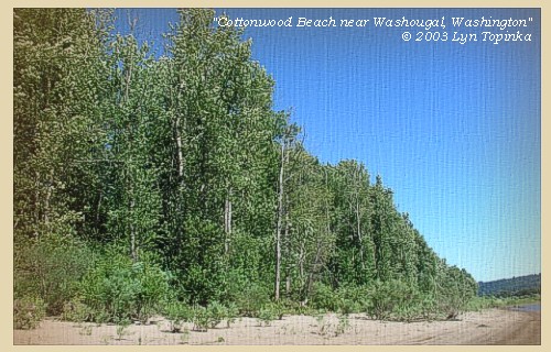
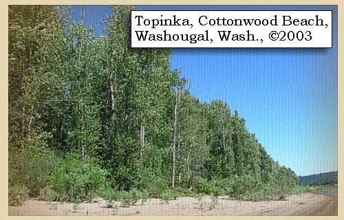
Cottonwood Beach: Between March 31 and April 5, 1806 the Corps of Discovery camped near present day Cottonwood Beach in Washougal. From this campsite, William Clark also led a group of men back down the Columbia to discover the Willamette River, which they had missed on both their outward and return voyages. Presently, the cities of Washougal and Camas, Port of Camas/Washougal, and the Clark County Parks Department, are collaborating on creating a regional park at this location and it has been named Capt. William Clark Park at Cottonwood Beach. -- City of Washougal, Washington, Website, 2002 
|
| "... From this place Mount Hood bears S. 85o E. distant 40 miles ..." [Lewis, April 3, 1806] |
|
|
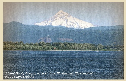
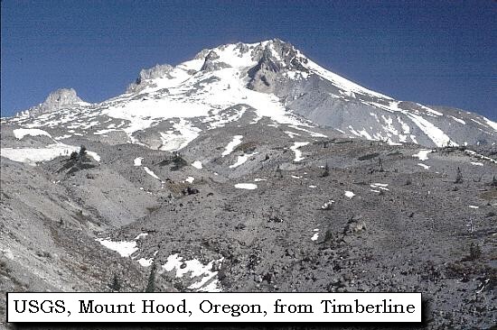
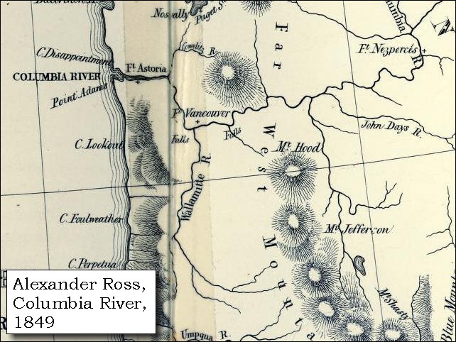
Mount Hood: Mount Hood, at 11,245 feet high, is the fourth highest peak in the Cascade Range and the highest in the state of Oregon. The peak dominates the skyline from the Portland, Oregon, metropolitan area to the wheat fields of Wasco and Sherman Counties of eastern Oregon. 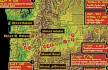


|
| Captain Clark's Side Trip Up the Willamette |
| Wednesday and Thursday, April 2-3, 1806 - Continued |
| "... While I was out hunting, Capt. Clarke got information that a large river came in on the south side of the Columbia, about 40 miles below this place, opposite a large island, which had concealed it from our view: and went down with six men to view it. He found it to be a very large river, 500 yards wide, with several nations of Indians living on it; and its source supposed to be near the head waters of some of the rivers, which fall into the gulph of California. On their return they bought some dogs at an Indian village; and last night arroved at camp. ..." [Gass, April 4, 1806] |
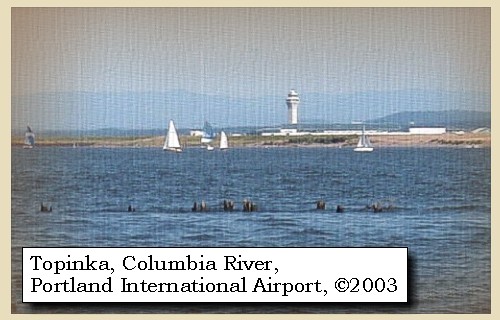
| In the evening captain Clarke returned from his excursion. On setting out yesterday at half past eleven o'clock [Wednesday, April 2], he directed his course along the south side of the river, where, at the distance of eight miles, he passed a village of the Nechacohee tribe, belonging to the Eloot nation [today's Portland Internationl Airport]. ...... |
|
|
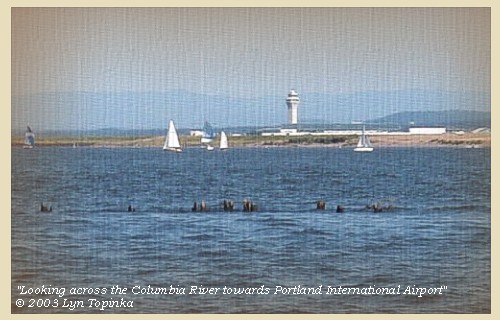
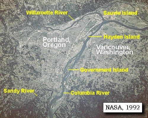
Portland International Airport: Today's Portland International Airport (PDX) was the former site of a Neerchokioo village, used by the Shahala Indians as a temporary residence for gathering wapato, a potato-like water root. Visited twice by Lewis and Clark, the site is now under the airport parking structure. PDX is located 10 miles east of downtown Portland, Oregon. -- Lewis and Clark Bicentennial in Oregon Website, 2002 
|
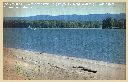
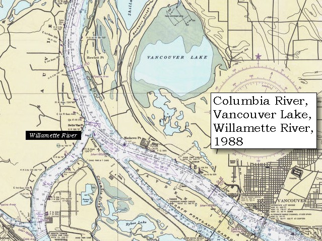
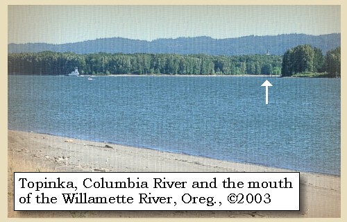
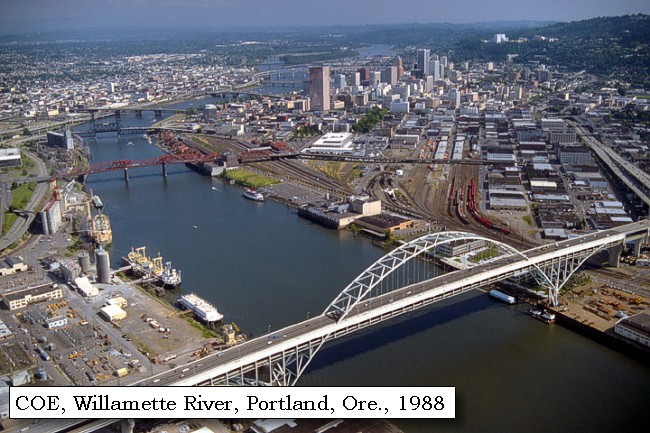
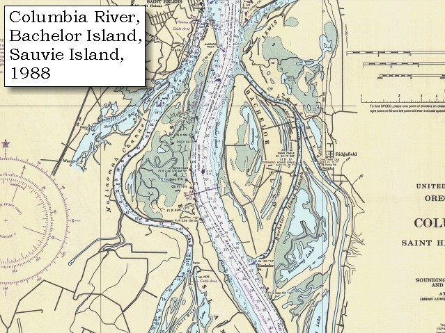
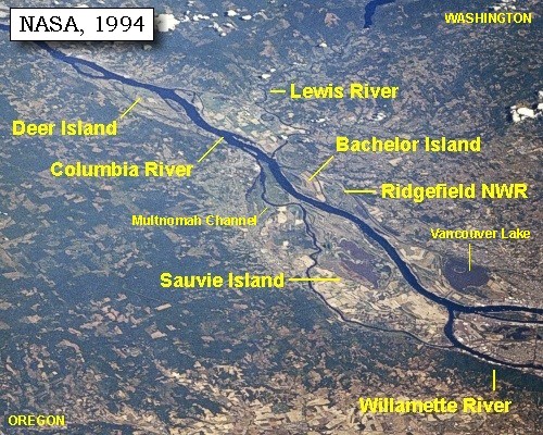
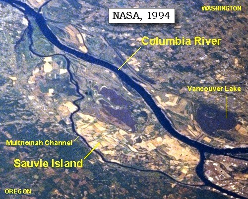
| and after lighting his pipe, and smoking with them, he continued down the river. He now found what we had called Image-canoe island [Hayden Island], to consist of three islands, the one in the middle concealing the opening between the other two in such a way, as to present to us on the opposite side of the river, the appearance of a single island. At the lower point of the third, and thirteen miles below the last village, he entered the mouth of a large river [Willamette River], which was concealed by three small islands in its mouth, from those who descend or go up the Columbia. [37 years after Lewis and Clark, Portland, Oregon was established along the banks of the Willamette River]. This river, which the Indians call Multnomah [Willamette River], from a nation of the same name, residing near it on Wappatoo island [Sauvie Island], enters the Columbia, one hundred and forty miles from the mouth of the latter river, of which it may justly be considered as forming one fourth, though it had now fallen eighteen inches below its greatest annual height. |
| "... at the distance of 13 miles below the last village and at the place I had supposed was the lower point of the image canoe island, I entered this river which the nativs had informed us of, called 'Multonomah' River so called by the nativs from a nation who reside on Wappato Island a little below the enterance of this river. Multnomah discharges itself in the Columbia on the S.E. and may be justly said to be 1/4 the size of that noble river. Multnomah had fallen 18 inches from its greatest annual height. three small Islands are situated in it's mouth which hides the river from view from the Columbia. ..." [Clark, April 2, 1806] |
|
|
Willamette River: Most of Oregon's population, technology and agricultural centers, and important transportion, power, and communications lifelines are located in the Willamette Valley of western Oregon. The lowlands of the Willamette Valley extend approximately 75 miles along the Willamette River and contain the major cities of Portland, Salem, Corvallis, and Eugene. The valley is part of the Willamette River drainage basin, which covers 12,300 square miles between the crest of the Oregon Coast Range on the west and the Cascade Range to the east. The Willamette River is the largest river in the valley and is fed by several major tributaries, including the McKenzie, Calapooia, Santiam, Tualatin, Yamhill, and Clakamas Rivers. The valley is the major source of ground and surface water for the population centers. -- Givler and Wells, 2001

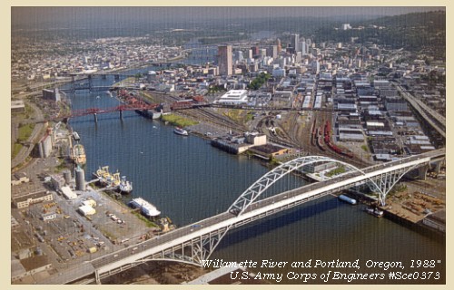
Portland, Oregon: In 1843, Tennessee drifter William Overton and Massachusetts lawyer Asa Lovejoy beached their canoe on the banks of the Willamette River. Overcome by the beauty of the area, Overton saw great potential for this mountain-ringed, timber-rich land. His only problem was that he lacked the 25 cents needed to file a land claim. So, he struck a bargain with Lovejoy -- In return for a quarter, Overton would share his claim to the 640-acre site known as "The Clearing." Soon bored with clearing trees and building roads, Overton drifted on, selling his half of the claim to Francis W. Pettygrove. The new partners, Lovejoy and Pettygrove, couldn't decide on a name for their new township. Lovejoy was determined to name the site after his hometown of Boston, Massachusetts, while Pettygrove was equally adamant about his native Portland, Maine. They decided to flip a coin, now known as the "Portland Penny", to settle the argument. Pettygrove won on two tosses out of three. Lovejoy and Pettygrove were confident that Portland, with its deep water and abundant natural resources, would one day become a popular and prosperous port. Portland was officially incorporated on February 8, 1851, and today covers 130 square miles. -- Portland, Oregon Visitor's Association Website, 2003
|
| FIVE VOLCANOES |
| From its entrance mount Regnier [Mount Rainier] bears nearly north, mount St. Helen's north, with a very high humped mountain a little to the east of it [Mount Adams], which seems to lie in the same chain with the conic-pointed mountains before mentioned. Mount Hood bore due east, and captain Clarke now discovered to the southeast, a mountain which we had not yet seen, and to which he gave the name of mount Jefferson. Like mount St. Helen's its figure is a regular cone covered with snow, and is probably of equal height with that mountain, though being more distant, so large a portion of it does not appear above the range of mountains which lie between these and this point. |
| "... from the enterance of this river, I can plainly See Mt. Jefferson which is high and Covered with snow S. E. Mt. Hood East, Mt St. Helians a high humped Mountain to the East of Mt St. Helians. I also Saw the Mt. Raneer Nearly North ..." [Clark, April 2, 1806] |
| "... from the Columbia at the entrance of the Multonomah river Mount Jefferson bears S. E. this is a noble mountain. I think equally as high as Mount St. Helines but it's distance being much greater than that of the latter, so great a portion of it dose not appear above the range of mountains which lie betwen boath those stupendious mountains and this point of view. like M. St. Heleans from the same point boar N , Mount Hood due East, and Mount Ranier nearly North. there is also a very high humped mountain a little to the East of Mount St. Heleans which appears to lie in the same chain with those conic pointed mountains before mentioned. ..." [Lewis, April 6, 1806] |
| " ... I provaled on an old indian to mark the Multnomah R down on the Sand which hid and perfectly Corisponded with the Sketch given me by sundary others, with the addition of a circular mountain which passes this river at the falls and connects with the mountains of the Seacoast. he also lais down the Clark a mos passing a high Conical Mountain near it's mouth on the lower Side and heads in Mount Jefferson which he lais down by raising the Sand as a very high mountain and Covered with eternal Snow. the high mountain which this Indian lais down near the enterance of Clark a mos river, we have not Seen as the hills in it's direction from this vally is high and obscures the Sight of it from us. Mt. Jefferson we Can plainly See from the enterance of Multnomah from which place it bears S. E. this is a noble Mountain and I think equally as high or Something higher than Mt. St. Heleans but its distance being much greater than that of the latter, So great a portion of it does not appear above the range of mountains which lie between both those Stupendious Mountains and the Mount of Multnomah. like Mt. St. Heleans its figure is a regular Cone and is covered with eturnial Snow. ..." [Clark, April 7, 1806] |
|
|
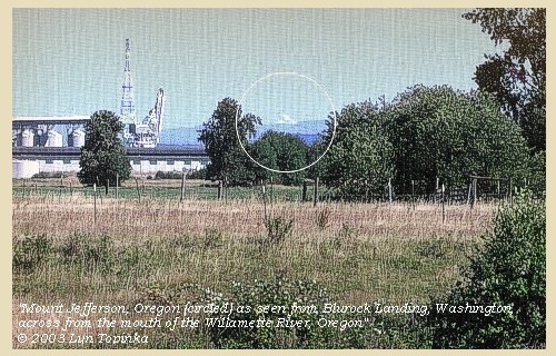
Mount Jefferson, Oregon, (circled): as seen from Blurock Landing, Washington. Blurock Landing is across the Columbia River from the mouth of the Willamette River, Oregon. Copyright © 2003 Lyn Topinka, private archives, used with permission. 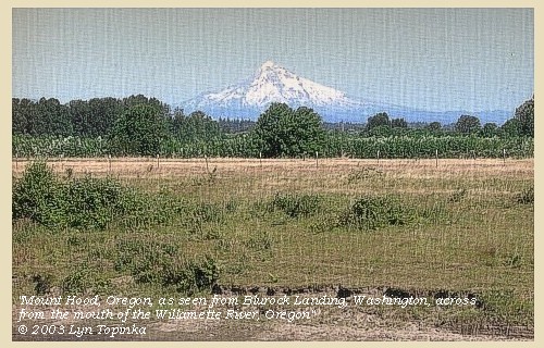
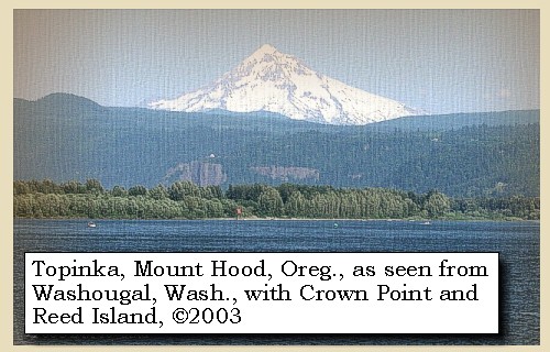
Mount Hood, Oregon: as seen from Blurock Landing, Washington. Blurock Landing is across the Columbia River from the mouth of the Willamette River, Oregon. Copyright © 2003 Lyn Topinka, private archives, used with permission. 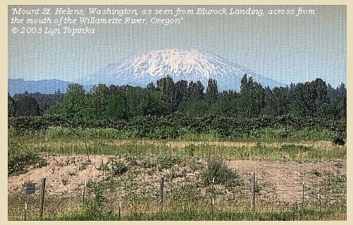
Mount St. Helens, Washington: as seen from Blurock Landing, Washington. Blurock Landing is across the Columbia River from the mouth of the Willamette River, Oregon. Copyright © 2003 Lyn Topinka, private archives, used with permission. 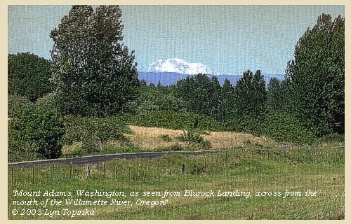
Mount Adams, Washington: as seen from Blurock Landing, Washington. Blurock Landing is across the Columbia River from the mouth of the Willamette River, Oregon. Copyright © 2003 Lyn Topinka, private archives, used with permission. 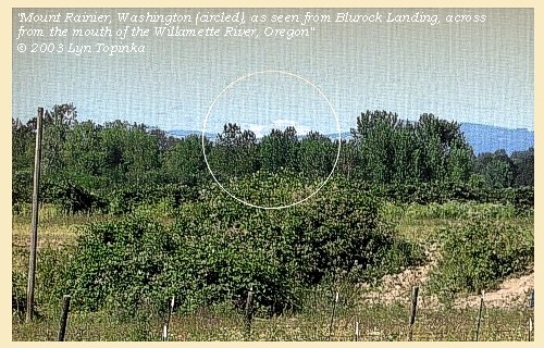
Mount Rainier, Washington: as seen from Blurock Landing, Washington. Blurock Landing is across the Columbia River from the mouth of the Willamette River, Oregon. Copyright © 2003 Lyn Topinka, private archives, used with permission. |
| Captain Clark's Side Trip Up the Willamette ... Continued |
| Soon after entering the Multnomah [Willamette River] he was met by an old Indian descending the river alone in a canoe. After some conversation with him, the pilot informed captain Clarke, that this old man belonged to the Clackamos nation, who reside on a river forty miles up the Multnomah. The current of this latter river [Clackamas River], is as gentle as that of the Columbia, its surface is smooth and even, and it appears to possess water enough for the largest ship, since, on sounding with a line of five fathoms, he could find no bottom for at least one third of the width of the stream. At the distance of seven miles, he passed a sluice or opening, on the right [Multnomah Channel], eighty yards wide, |
|
|
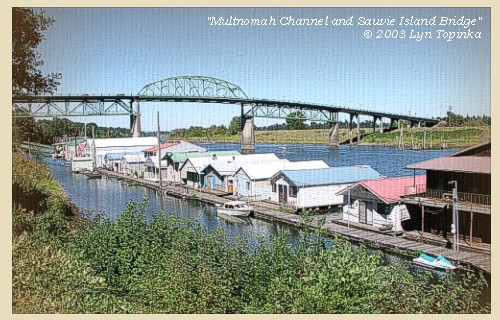
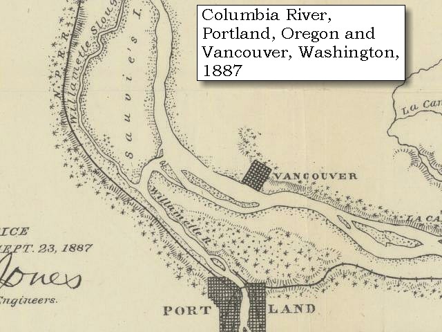
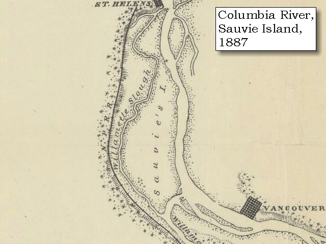
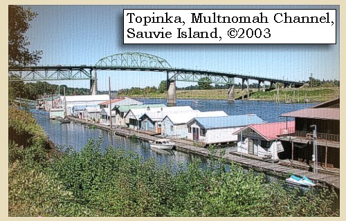
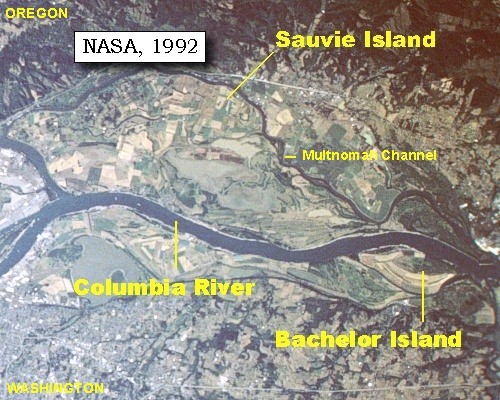
Multnomah Channel: Multnomah Channel has also been known as the Willamette Slough (1887 map). The channel separates Sauvie Island from mainland Oregon, and is a favorite recreation spot of boaters.
|
| and which separates Wappatoo island [Sauvie Island] from the continent, by emptying itself into the inlet below. |
|
|
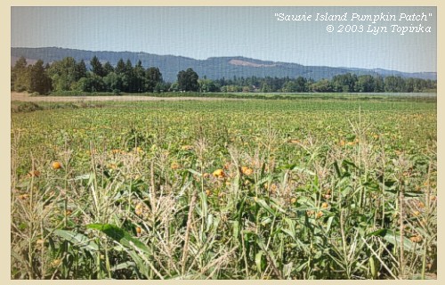
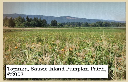
Sauvie Island: Sauvie Island contains approximately 24,000 acres of land and lakes, and had its origin in alluvial deposits from the Columbia and Willamette rivers as their velocities decreased by changes in direction and by lava extrusions located on the north end. The island is 16 miles long and 4.5 miles at the widest point. The Sauvie Island wildlife area includes 8,053 acres of deeded land and 3,490 acres of land leased from the Division of State Lands for wildlife management purposes. The island is bounded on the east by the Columbia River; on the south by the Willamette River and on the west by the Multnomah Channel. Across the river on the Washington side, Scappoose Bay provides fish and wildlife habitat. -- Columbia Basin Fish and Wildlife Authority Website, 2002, Oregon State Archives Website, 2002, and Washington State Historical Society Website, 2002
|
| Three miles further up, he reached a large wooden house, on the east side, where he intended to sleep, but on entering the rooms he found such swarms of fleas that he preferred lying on the ground in the neighbourhood [Night of April 2, 1806, Clark camped on the east side of the Willamette River near Portland's modern Municipal Terminal Four] |
|
|
|
Captain Clark's Camp - April 2, 1806
Captain Clark camped on the east side of the Willamette River near Portland's modern Municipal Terminal Four. |
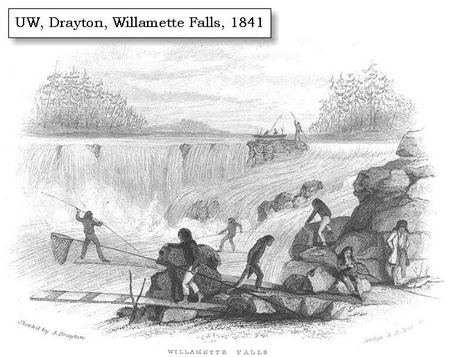
| The guide informed him that this house is the temporary residence of the Nemalquinner tribe of the Cushook nation, who reside just below the falls of the Multnomah [Willamette Falls, Oregon City], but come down here occasionally to collect wappatoo: it was thirty feet long, and forty deep; built of broad boards, covered with the bark of white cedar; the floor on a level with the surface of the earth, and the arrangement of the interior like those near the seacoast. ...... The guide informed him further, that a small distance above were two bayous, on which were a number of small houses belonging to the Cushooks, but that the inhabitants had all gone up to the falls of the Multnomah [Willamette Falls, Oregon City], for the purpose of fishing. |
|
|
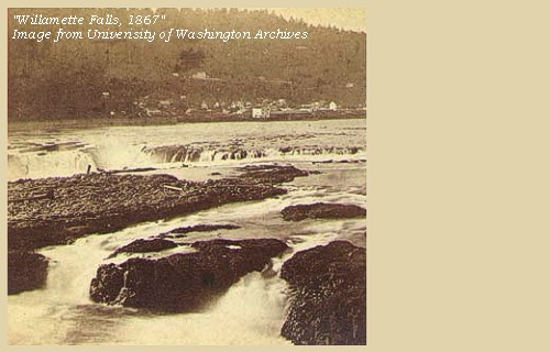
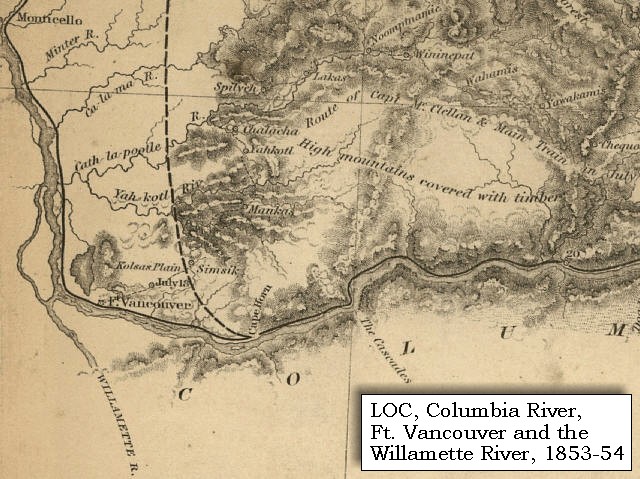
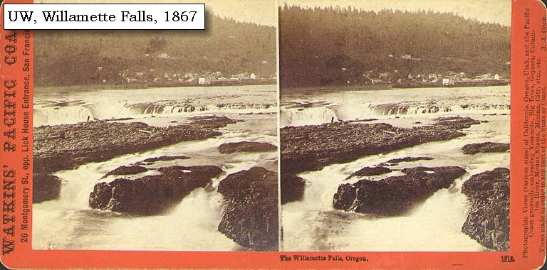
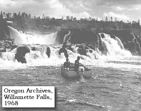
Willamette Falls and Oregon City: The Willamette Falls area, now known as Oregon City, was the center of commerce and culture to native American tribes long before pioneers crossed the continent in their covered wagons. The falls were one of the biggest salmon fishing holes in the American West. Willamette Falls Locks opened its gates on January 1, 1873, allowing river traffic along the Willamette River safe portage around the 40-foot high Willamette Falls. The locks were the first water resource project in Oregon, and has been designated a National Historic Site and an Historic Engineering Site. The original lockmaster's office has been converted into a museum, and displays photographs of the historic locks that have been in operation since 1873. -- Library of Congress Website, 2002, "End of the Oregon Trail", and U.S. Army Corps of Engineers Website, 2002.
|
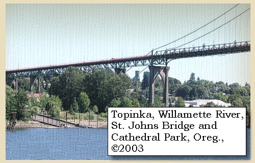
| Early the next morning [April 3, 1806] captain Clarke proceeded up the river, which, during the night, had fallen about five inches. At the distance of two miles he came to the centre of a bend under the highlands on the right side [today's Cathedral Park, St. John's Bridge, Portland, Oregon], from which its course, as could be discerned, was to the east of southeast. |
| "... The water had fallen in the course of last night five inches. I set out and proceeded up a short distance and attempted a second time to fathom the river with my cord of 5 fathom but could find no bottom. the mist was so thick that I could see but a short distance up this river. When I left it, it was bending to the East of S.E. being perfectly satisfyed of the size and magnitude of this great river which must water that vast tract of Country between the western range of mountains and those on the sea coast and as far S. as the Waters of California about Latd. 37. North. I deturmined to return. at 7 oClock A. M. set out on my return ... the enterance of Multnomah river is 142 miles up the Columbia river from its enterance into the Pacific Ocean ..." [Clark, April 3, 1806] |
|
|
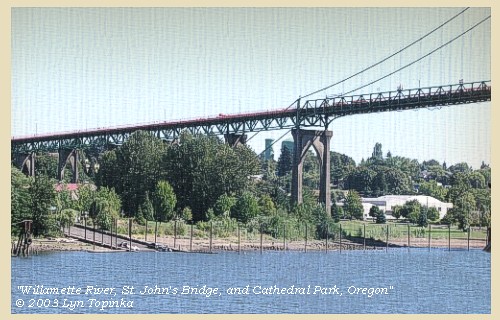
St. Johns Bridge and Cathedral Park: The site which now bears the name Cathedral Park is steeped in history. It is believed to be one of the 14 Lewis and Clark landing sites in the Vancouver-Portland area: William Clark and eight men camped there on April 2, 1806. This spot had been a fishing and camping site for many area Indian tribes. In 1847, the founder of St. Johns, James Johns, settled on the site and operated a ferry to Linnton across the Willamette River. In 1931, the St. Johns Bridge was built on the site with 400-foot towers and a main span of 1,207 feet. It is the only steel suspension bridge in Portland and is designated as an official historical landmark. In the early 1970s, Howard Galbraith, the "honorary mayor" of unincorporated St. Johns, got tired of the junkyard state of the area under the eastern end of the bridge. He organized a drive that eventually raised $7.5 million to build a park. After eight years of community fund raising, combined with state, county and city funding, the park was dedicated at a community celebration on May 3, 1980. It got its name from a photo of the St. Johns Bridge by Al Monner that appeared on the front page of the Oregon Journal in 1968. Reference was made to its beautiful cathedral-like arches and the park found its name. -- City of Portland Parks and Recreation Website, 2002 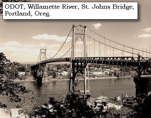
|
|
At this place the
Multnomah
[Willamette River]
is five hundred yards wide, and for half that distance across,
the cord of five fathoms would not reach the
bottom. It appears to be washing away its banks,
and has more sandbars and willow points than the Columbia. Its
regular gentle current, the depth and smoothness,
and uniformity with which it rolls its vast body of water, prove that
its supplies are at once distant and regular;
nor, judging from its appearance and courses, is it rash to believe that
the
Multnomah
[Willamette River]
and its tributary streams water
the vast extent of country between the
western mountains
[Cascade Mountain Range]
and those of
the seacoast
[Coast Range],
as far perhaps as the
waters of the gulf of California.
......
At three o'clock he [Captain Clark] halted for an hour at the Nechecolee house, where his guide resided [location near today's Portland International Airport] ...... He then entered into a long conversation with regard to all the adjacent country and its inhabitants, which the old man [the father of the guide] explained with great intelligence, and then drew with his finger in the dust a sketch of the Multnomah, [Willamette River], and Wappatoo island [Sauvie Island]. This captain Clarke copied and preserved. |
| "... I provailed on an old man to draw me a sketch of the Multnomar River and give me the names of the nations resideing on it which he readily done, and gave me the names of 4 nations who reside on this river two of them very noumerous. The enterance of Multnomah river is 142 miles up the Columbia river from its enterance into the Pacific Ocean ..." [Clark, April 3, 1806] |
| He now purchased five dogs, and taking leave of the Nechecolee village, returned to camp [Cottonwood Beach, near Washougal, Washington] . |
|
|
|
The Main Camp - March 31 through April 5, 1806:
Cottonwood Beach, Washougal, Washington. |
| Home | Previous | Continue |
If you have questions or comments please contact: GS-CVO-WEB@usgs.gov
June/July 2004, Lyn Topinka
The Volcanoes of Lewis and Clark Home Page | CVO Home Page