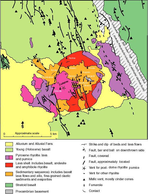
3. Generalized geologic map of Alid volcanic center. Because map was traced from lines on air photograph,the scale is approximate and varies somewhat across the illustration. Fumarole sites are labeled but may be unreadable in this figure. They can be found within the geochemistry PDF.