
For more information on how electronic tiltmeters and GPS receivers help monitor the deformation of Kīlauea volcano, see the HVO Deformation page.

Click image at right for larger map. Data plots from additional stations are available from our interactive map, which allows you to view different types of data (using the right-side menu on the map).
Electronic Tilt at Kīlauea Summit - Past 2 Days

Electronic Tilt at Kīlauea Summit and East Rift Zone - Past Week
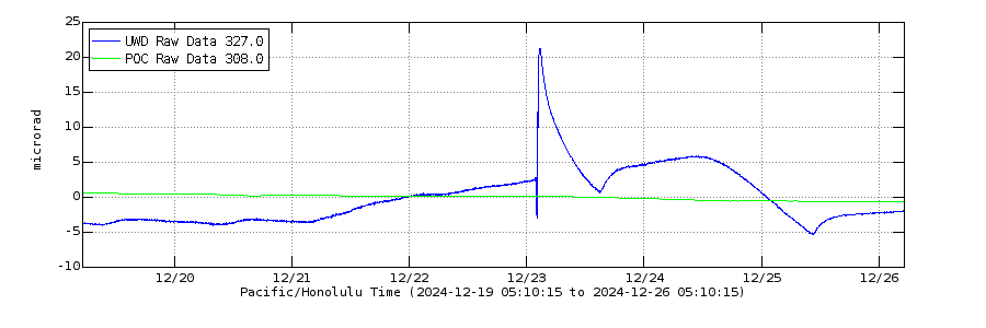
Electronic Tilt at Kīlauea Summit and East Rift Zone - Past Month
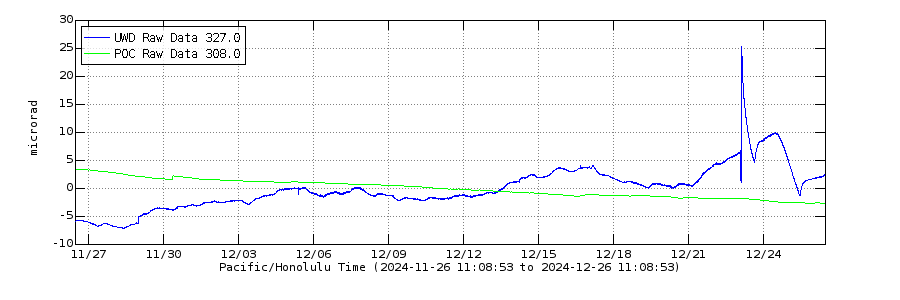
Above: The different colored lines show tilt in a specific direction at a specific station (see the legend in upper left corner of each plot). Station UWD is located near Uēkahuna, on the western rim of Kīlauea's summit caldera. Station POC is located on the north rim of Pu‘u‘ō‘ō cone on the middle East Rift Zone of Kīlauea. These data are recorded by continuously operating electronic tiltmeters. Positive changes often indicate inflation of the magma storage areas beneath the caldera or on the middle East Rift Zone of Kīlauea, but may also result from heavy rainfall or, occasionally, instrumental malfunctions.
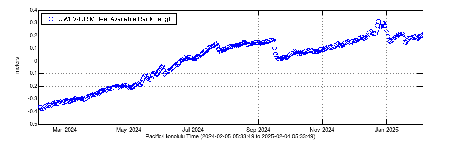
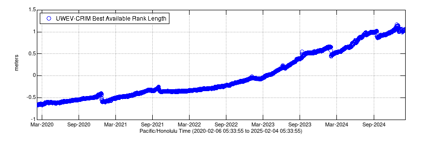
Global Positioning System - Kīlauea Summit
Change in distance between two Global Positioning System (GPS) stations located on opposite sides of Kīlauea's summit caldera. A rapid increase in distance can be interpreted as inflation of the summit magma reservoir.
Past Year
Past Five Years
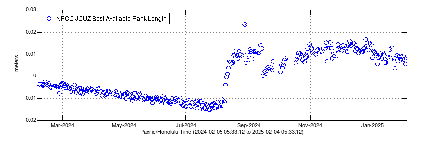
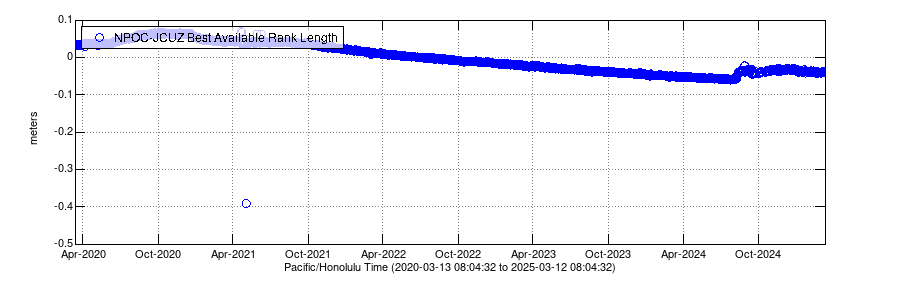
Global Positioning System - Kīlauea middle East Rift Zone
Change in distance between two station near Pu‘u‘ō‘ō cone on the middle East Rift Zone of Kīlauea. A rapid increase in distance can be interpreted as inflation of the magma storage chambers in this area.
Past Year
Past Five Years

Past Week Monitoring Data for Kīlauea
Past Month Monitoring Data for Kīlauea
Past Year Monitoring Data for Kīlauea
Past 5 Years Monitoring Data for Kīlauea
For more information on how electronic tiltmeters and GPS receivers help monitor the deformation of Kīlauea volcano, see the HVO Deformation page.
Click image at right for larger map. Data plots from additional stations are available from our interactive map, which allows you to view different types of data (using the right-side menu on the map).
Electronic Tilt at Kīlauea Summit - Past 2 Days
Electronic Tilt at Kīlauea Summit and East Rift Zone - Past Week
Electronic Tilt at Kīlauea Summit and East Rift Zone - Past Month
Above: The different colored lines show tilt in a specific direction at a specific station (see the legend in upper left corner of each plot). Station UWD is located near Uēkahuna, on the western rim of Kīlauea's summit caldera. Station POC is located on the north rim of Pu‘u‘ō‘ō cone on the middle East Rift Zone of Kīlauea. These data are recorded by continuously operating electronic tiltmeters. Positive changes often indicate inflation of the magma storage areas beneath the caldera or on the middle East Rift Zone of Kīlauea, but may also result from heavy rainfall or, occasionally, instrumental malfunctions.
Global Positioning System - Kīlauea Summit
Change in distance between two Global Positioning System (GPS) stations located on opposite sides of Kīlauea's summit caldera. A rapid increase in distance can be interpreted as inflation of the summit magma reservoir.
Past Year
Past Five Years
Global Positioning System - Kīlauea middle East Rift Zone
Change in distance between two station near Pu‘u‘ō‘ō cone on the middle East Rift Zone of Kīlauea. A rapid increase in distance can be interpreted as inflation of the magma storage chambers in this area.
Past Year
Past Five Years