The Volcanoes of
Lewis and Clark
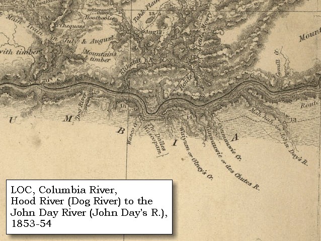
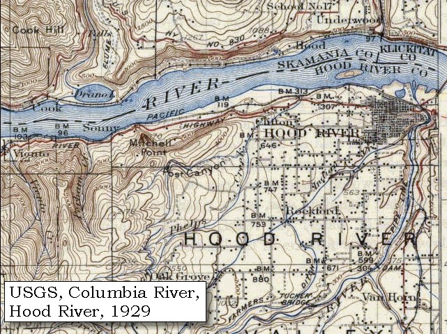
April 14, 1806
Columbia River Gorge - Dog Mountain to Major Creek
 
Home
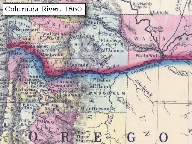
The Volcanoes of Lewis and Clark

Map of the Journey
Volcanoes, Basalt Plateaus, Major Rivers, etc.

The Volcanoes
Mount Adams, Mount Hood, Mount Jefferson, Mount Rainier, and Mount St. Helens

CALENDAR of the Journey
October 1805 to June 1806

Along the Journey
Pacific Northwest Maps - Columbia River, Volcanoes, Flood Basalts, Missoula Floods, Geology, etc.

The Corps of Discovery
The Journey of Lewis and Clark

About the Reference Materials
The Journals, Biddle/Allen, DeVoto, Gass, Moulton, Topo Maps, and others

USGS Lewis and Clark Links
Links to USGS Websites highlighting the Lewis and Clark Journey

Resources
Publications Referenced and Websites Visited


PREVIOUS

April 13
Columbia River Gorge, Cascade Locks to Dog Mountain
April 14

Columbia River Gorge,
Dog Mountain to Major Creek

Underwood Mountain, White Salmon River, Columbia River west of White Salmon, Hood River and Hood River Valley, Mount Hood, Mount Adams, Bingen Gap Basalts, Major Creek
CONTINUE

April 15
Columbia River Gorge, Major Creek to The Dalles
 

On October 7, 1805, Lewis and Clark and the "Corps of Discovery" began their journey down the Clearwater River and into the volcanics of the Pacific Northwest. The Corps travelled from the Clearwater to the Snake and down the "Great Columbia", finally reaching the Pacific Ocean on November 15, 1805. Along the journey they encountered the lava flows of the Columbia Plateau, river channels carved by the great "Missoula Floods", and the awesome beauty of five Cascade Range volcanoes.

Map, Lewis and Clark in the Pacific Northwest, click for brief
                         summary
[Click map for brief summary about the area]


Heading for Home - April 1806
Columbia River Gorge - Dog Mountain to Major Creek
 

Lewis and Clark's camp of April 13, 1806, was on the Washington side of the Columbia near Dog Mountain, between Collins Creek and Dog Creek.

Monday, April 14, 1806
In the morning, they all joined us with four more deer. After breakfast we resumed our journey, and though the wind was high during the day, yet by keeping along the northern shore, we were able to proceed without danger. ......

A few miles upstream of Dog Mountain and just below the White Salmon River is Underhill Mountain. Underhill Mountain is a Pleistocene volcano.


Along the Journey - April 14, 1806
Underwood Mountain, Washington, 2003

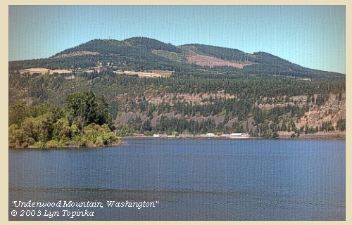
Underwood Mountain:
The right bank of the White Salmon River skirts the base of a Pleistocene volcano Underwood Mountain (2,755 feet). At this location, the Hood River valley extends north a few miles into Washington, and the early Pleistocene volcano, Underwood Mountain, fills much of it there. A lava from Underwood Mountain has a K-Ar (whole rock, Hammond and Korosec, 1983) age of 0.85+/-0.02 million years. The geology of this area is characterized by basalt flows of Pleistocene and Miocene age, commonly separated by interbeds of other rock types and (or) soil horizons. These basalt flows lie approximately in a horizontal plane, but have been subjected to considerable faulting. -- Scott, et. al., 1997, and Hinkle, 1996, USGS WRI95-4272.


Map, 1929 USGS topo map of Underwood Mountain area, click to enlarge Image, 2003, Underwood Mountain
  1. 1929 Map (section of original), from Hood River 1:125,000 topographic quadrangle. (Click to enlarge). Original map surveyed in 1925-26, contour interval of 100 feet. Little White Salmon River is on the left and White Salmon River is on the right. Mitchell Point is on the Oregon side. -- University of Washington Library Collections Website, 2002
  2. 2003, Underwood Mountain, Washington, as seen from Hood River, Oregon. (Click to enlarge). Copyright © 2003 Lyn Topinka, private archives, used with permission.


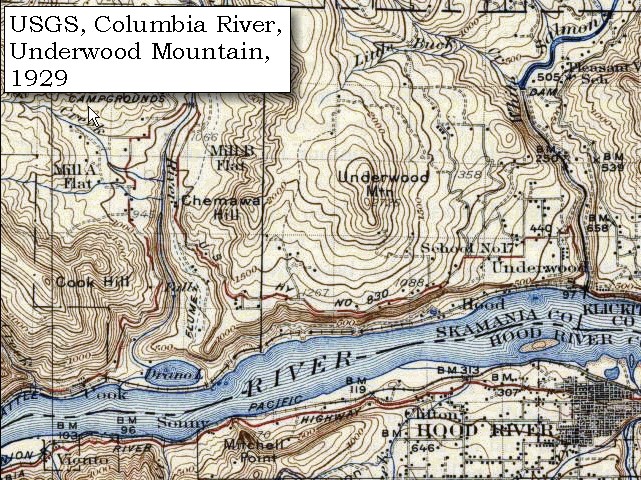
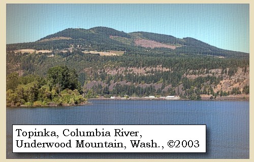
Geology of the Underwood Mountain Area:
Geologic mapping in the region, compiled by Korosec (1987), identifies three principal geologic units in the area: Grande Ronde Basalt, Frenchman Springs Member of the Wanapum Basalt, and Basalt of Underwood Mountain. The Grande Ronde Basalt is composed of Miocene flows of the Columbia River Basalt Group. The Grande Ronde Basalt is the thickest formation in the Columbia River Basalt Group, and it commonly exceeds 1,000 feet in thickness. The Frenchman Springs Member of the Wanapum Basalt overlies the Grande Ronde Basalt. In this area, the Frenchman Springs Member crops out in the cliffs above the Spring Creek Fish Hatchery, and the hatchery springs discharge from the member of the Wanapum Basalt. The Frenchman Springs Member is a series of Miocene flows of the Columbia River Basalt Group. The thickness of these flows in this area is unknown, but in its type locality, the Frenchman Springs Member is 250 feet thick. The Basalt of Underwood Mountain overlies the Frenchman Springs Member and is widely exposed on Underwood Mountain and Underwood Heights. Basalt of Underwood Mountain is a Pleistocene unit composed of numerous blocky, jointed flows, each about 10 to 30 feet thick. The total thickness of the Basalt of Underwood Mountain reaches at least 590 feet. -- Hinkle, 1996, USGS WRI95-4272


At one o'clock we halted for dinner at a large village situated in a narrow bottom, just above the entrance of Canoe creek [White Salmon River]. ......


Along the Journey - April 14, 1806
White Salmon River, 2003

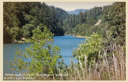
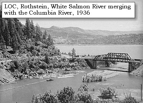
White Salmon River:
The White Salmon River originates in south central Washington along the south slope of Mount Adams. It flows south for 45 miles before entering the Columbia River and Bonneville Reservoir near Underwood, Washington, at Columbia River Mile 167. The White Salmon River drains approximately 386 square miles. Principal tributaries include Trout Lake, Buck, Mill, Dry, Gilmer, and Rattlesnake Creeks. The White Salmon basin is oriented north to south with elevations ranging from 80 feet to 7,500 feet. Topography varies within the watershed from rugged mountains to rolling hills to river valleys. Consolidated sediments are overlain with basaltic lava flows. Subsequent erosion, mud flows, and glaciation have resulted in precipitous cliffs, deeply incised canyons, and relatively flat valley floors. The mainstem of the White Salmon River drops 7,420 feet in 45 miles for an average gradient of 3.2 percent. Churning rapids and unique beauty draw visitors to the White Salmon River. Glacial waters and cold clear springs support a lush plant life, while continuous rapids, waterfalls, and abrupt drops challenge boaters of advanced skills. The best fishing is below BZ Corners, however difficult access because the river is in a steep canyon. Most of the river corridor is private land. Lewis and Clark called this river "Canoe Creek", because several native fishing canoes were observed at the mouth of the stream. -- Columbia Basin Fish and Wildlife Authority Website, 2002, U.S. National Park Service Website, 2002, "Wild and Scenic Rivers", U.S. Forest Service Website, 2002, "Gifford Pinchot National Forest", and Washington State Historical Society Website, 2004, "Lasting Legacy".


Map, 1999, Mount Adams and Vicinity, click to enlarge Map, 1814, Lewis and Clark on the Columbia, click to enlarge Map, 1887, White Salmon vicinity, click to enlarge Map, 1929 USGS topo map of Underwood Mountain area, click to enlarge Image, 1936, White Salmon River, click to enlarge Image, 2003, White Salmon River
  1. 1999 Map, Mount Adams and Vicinity, showing drainages into the Columbia River. (Click to enlarge). Includes the Wind River, Little White Salmon River, White Salmon River, and Klickitat River in Washington State, and the Hood River in Oregon. Map modified from Vallance, 1999, USGS Bulletin 2161.
  2. 1814 Map, Lewis and Clark's map of the Columbia River (section of original). (Click to enlarge.) Shows the White Salmon River ("Canoe Creek"). Map also includes three of the five volcanoes Lewis and Clark saw and commented on. While the journals mention the expedition seeing Mount Adams, it does not appear on their map. Mount Jefferson is to the south (bottom) and off the map. From the "Nicholas Biddle/Paul Allen" 1814 publication. Original Map: "A Map of Lewis and Clark's Track, Across the Western Portion of North America, From the Mississippi to the Pacific Ocean". From: History of the expedition under the command of Captains Lewis and Clark : to the sources of the Missouri, thence across the Rocky Mountains and down the river Columbia to the Pacific Ocean : performed during the years 1804-5-6 : by order of the government of the United States / prepared for the press by Paul Allen. Philadelphia : Bradford and Insskeep, 1814. Harold B. Lee Library, Brigham Young University #upbover maps37. -- Brigham Young University, Harold B. Lee Library Website, 2004.
  3. 1887 Map (section of original), Columbia River and the White Salmon River and vicinity. (Click to enlarge). Original Map: The Columbia River from Celilo to the mouth showing locations of the salmon fisheries, 1887. Scale ca. 1:375,000, Relief shown by hachures. U.S. Army Corps of Engineers, Engineer Office, G.P.O. 1888. University of Washington Archives #UW128. -- University of Washington Library Archives Website, 2002
  4. 1929 Map (section of original), from Hood River 1:125,000 topographic quadrangle. (Click to enlarge). Original map surveyed in 1925-26, contour interval of 100 feet. Little White Salmon River is on the left and White Salmon River is on the right. -- University of Washington Library Collections Website, 2002
  5. 1936, Logs on the White Salmon River with the Columbia River in the background. (Click to enlarge). Photograph by Arthur Rothstein, July 1936. U.S. Library of Congress Archives, Farm Security Administration - Office of War Information Photograph Collection. -- U.S. Library of Congress Archives, American Memories Website 2002.
  6. 2003, White Salmon River, Washington, looking upstream from mouth. (Click to enlarge). Copyright © 2003 Lyn Topinka, private archives, used with permission.


Columbia River west of White Salmon, ca.1902

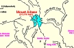
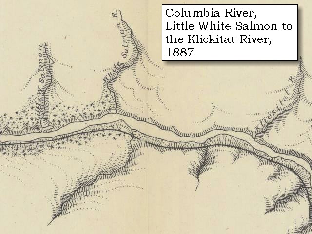
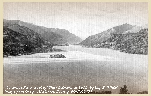
Columbia River west of White Salmon:
The Washington town of White Salmon is located on the bluff, just upstream of the White Salmon River.


Map, 1929 USGS topo map of Underwood Mountain area, click to enlarge Image, ca.1902, Columbia River west from White Salmon, Washington, click to enlarge
  1. 1929 Map (section of original), from Hood River 1:125,000 topographic quadrangle. (Click to enlarge). Original map surveyed in 1925-26, contour interval of 100 feet. Little White Salmon River is on the left and White Salmon River is on the right. -- University of Washington Library Collections Website, 2002
  2. ca.1902, Columbia River west from White Salmon. (Click to enlarge). Photograph date: ca.1902. Photographer: Lily E. White. Oregon Historical Society #OrHi65457. -- Oregon Historical Society Website 2002.


Across from the White Salmon River, on the Oregon side, is Hood River. Hood River is one of the main tributaries of Mount Hood. Lewis and Clark mention seeing Hood River "the mouth of a Small river 40 yards wide on the Lard. Side" on their journey downstream (October 29, 1805), but make no mention of it here.


Along the Journey - April 14, 1806
Hood River, Oregon, 2003

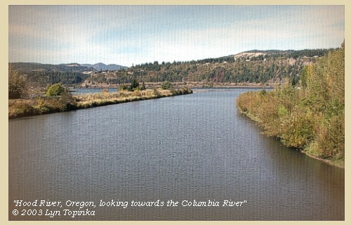
Hood River:
The Hood River watershed is located in north central Oregon and covers 339 square miles. The river flows north from Mount Hood into the Columbia River 22 miles upstream of the Bonneville Dam. The Hood River has three major forks - the West Fork enters the mainstem 12 miles from the Columbia, while the Middle and East Forks converge near River Mile 15. The watershed has an estimated 695 stream miles with 108 miles accessible to anadromous fish. About 100,000 years ago, a large portion of Mount Hood's north flank and summit collapsed. The resulting debris avalanche transformed into a lahar (mudflow) that swept down the Hood River valley. At the river's mouth (where the city of Hood River now stands) the lahar was 400 feet deep. The lahar crossed the Columbia River and surged up the White Salmon River valley on the Washington side. Since that time lava has filled in the scar left by the debris avalanche. Today the Hood River Bridge connects the cities of Hood River, Oregon, with Bingen and White Salmon in Washington State. The Hood River Bridge is one of only three river crossings in the Columbia River Gorge National Scenic Area. The bridge was recently designated by the Washington State Legislature as State Route 35. It was built in 1924 and is the second oldest Columbia River crossing. Lewis and Clark called this river "Labieche", after Private Francois Labiche, a member of the expedition. Another early name was "Dog River". Today's name "Hood River" is taken from Mount Hood, the source of the river. -- Columbia Basin Fish and Wildlife Authority Website, 2002, Gardner, et.al., 2000, USGS Fact Sheet 060-00, Oregon State Archives Website, 2002, Washington State Department of Transportation Website, 2003, and Washington State Historical Society Website, 2004, "Lasting Legacy".


Map, 1993, Mount Hood and Vicinity, click to enlarge Map, 1814, Lewis and Clark on the Columbia, click to enlarge Map, 1854, Columbia River, Hood River to the John Day, click to enlarge Map, 1887, White Salmon vicinity, click to enlarge Map, 1929 USGS topo map of Hood River area, click to enlarge Image, 1920, Hood River Bridge over Hood River, click to enlarge
  1. 1993 Map, Mount Hood and Vicinity, showing river drainages which flow into the Columbia river. (Click to enlarge). Includes Hood River and the Sandy River. Map modified from: Brantley and Scott, 1993.
  2. 1814 Map, Lewis and Clark's map of the Columbia River (section of original). (Click to enlarge.) Shows Hood River ("Labieche R."). Map also includes three of the five volcanoes Lewis and Clark saw and commented on. While the journals mention the expedition seeing Mount Adams, it does not appear on their map. Mount Jefferson is to the south (bottom) and off the map. From the "Nicholas Biddle/Paul Allen" 1814 publication. Original Map: "A Map of Lewis and Clark's Track, Across the Western Portion of North America, From the Mississippi to the Pacific Ocean". From: History of the expedition under the command of Captains Lewis and Clark : to the sources of the Missouri, thence across the Rocky Mountains and down the river Columbia to the Pacific Ocean : performed during the years 1804-5-6 : by order of the government of the United States / prepared for the press by Paul Allen. Philadelphia : Bradford and Insskeep, 1814. Harold B. Lee Library, Brigham Young University #upbover maps37. -- Brigham Young University, Harold B. Lee Library Website, 2004.
  3. 1853-54 Map, Columbia River, including the Hood River to John Day area (section of original). (Click to enlarge). Includes Hood River (Dog River), Klickitat River (Klikatat R.), Mill Creek (?) (Wasco Ck.), The Dalles, The Deschutes (Wanwauwie or des Chutes R.), the John Day River (Mah hah or John Day's R.), and Rock Creek (Camill Cr.). Original Map: "Rocky Mountains to Puget Sound : from explorations and surveys / made under the direction of the Hon. Jefferson Davis, Secretary of War by Isaac I. Stevens Governor of Washington Territory, 1853-4." Inset: (Supplementary sketch) Reconnaissance of the railroad route from Wallawalla to Seattle via Yak-e-mah River & Snoqualmie Pass. By A. W. Tinkham in January 1854. Drawn by J. R. P. Mechlin. 20 x 28 cm. Topographer, John Lambert, Published in Washington D.C., 1859, 1:1,200,000, Notes: From the U.S. War Department, Explorations and Surveys for a Railroad Route from the Mississippi River to the Pacific Ocean, Topographical Maps, to Illustrate the Various Reports, U.S. Library of Congress American Memories Reference "LC Railroad Maps #156". -- U.S. Library of Congress, American Memories Website, 2004
  4. 1887 Map (section of original), Columbia River including the Hood River. (Click to enlarge). The Hood River is not named, entering the Columbia from the south, almost directly across from the White Salmon River. Original Map: The Columbia River from Celilo to the mouth showing locations of the salmon fisheries, 1887. Scale ca. 1:375,000, Relief shown by hachures. U.S. Army Corps of Engineers, Engineer Office, G.P.O. 1888. University of Washington Archives #UW128. -- University of Washington Library Archives Website, 2002
  5. 1929 Map (section of original), from Hood River 1:125,000 topographic quadrangle. (Click to enlarge). Original map surveyed in 1925-26, contour interval of 100 feet. Hood River is the drainiage lower right which enters the Columbia River at the city of Hood River, Oregon. -- University of Washington Library Collections Website, 2002
  6. 1920, Hood River Bridge, Columbia River Highway, Hood River, Oregon. (Click to enlarge). -- Oregon Department of Transportation Website, 2002


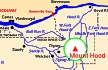
Geology of Hood River Valley:
The Hood River Valley is an incompletely understood structural depression extending north into Washington and southward toward Mount Hood. The valley's east margin is a series of anastomosing normal-slip faults that displace the Columbia River Basalt Group by about 1,800 feet in the area of Panorama Point, Oregon. Panorama Point itself is a promontory of the Wanapum Basalt Formation, but the hills to the east in the Hood River escarpment are underlain by the Grande Ronde Basalt, a stratigraphically lower formation (also in the Columbia River Basalt Group) displaced upward by the faults. The Hood River valley extends north a few miles into Washington, although an early Pleistocene volcano, Underwood Mountain, fills much of it there. A lava from Underwood Mountain has a K-Ar (whole rock, Hammond and Korosec, 1983) age of 0.85+/-0.02 million years. -- Scott, et. al., 1997


"... Sergt. Pryor & men returned with Drewyer & the two Fields they had killed 4 deer. we then departed and proceed on verry well passed Labuche River on N. Side about noon the wind rose so high form the N. W. that we came too at a village on the N. Side ... Mount Hood appears near the River on the South Side which is covd. thick with Snow & very white the wind high we delayed about 2 hours and proceed. on ..." [Ordway, April 14, 1806]


Along the Journey - April 14, 1806
Mount Hood, Oregon, from city of Hood River, 2004

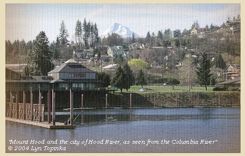
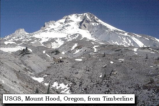
Mount Hood:
Mount Hood, at 11,245 feet high, is the fourth highest peak in the Cascade Range and the highest in the state of Oregon. The peak dominates the skyline from the Portland, Oregon, metropolitan area to the wheat fields of Wasco and Sherman Counties of eastern Oregon.


Map, the Volcanoes of Lewis and Clark, click to enlarge Map, 1993, Mount Hood and Vicinity, click to enlarge Map, 1814, Lewis and Clark on the Columbia, click to enlarge Map, 1853, Washington and Oregon and the Columbia River, click to enlarge Map, 1855, Columbia River, Vancouver to the Pacific, click to enlarge Map, 1860, Columbia River, Washington, Oregon, click to enlarge Image, Mount Hood, Oregon, as seen from Timberline, click to enlarge Image, 2004, Mount Hood from Hood River
  1. Map, "Lewis and Clark Volcano Sitings"
  2. 1993 Map, Mount Hood and Vicinity, showing river drainages which flow into the Columbia river. (Click to enlarge). Includes Hood River and the Sandy River. Map modified from: Brantley and Scott, 1993.
  3. 1814 Map, Lewis and Clark's map of the Columbia River (section of original). (Click to enlarge.) Map includes three of the five volcanoes Lewis and Clark saw and commented on. While the journals mention the expedition seeing Mount Adams, it does not appear on their map. Mount Jefferson is to the south (bottom) and off the map. From the "Nicholas Biddle/Paul Allen" 1814 publication. Original Map: "A Map of Lewis and Clark's Track, Across the Western Portion of North America, From the Mississippi to the Pacific Ocean". From: History of the expedition under the command of Captains Lewis and Clark : to the sources of the Missouri, thence across the Rocky Mountains and down the river Columbia to the Pacific Ocean : performed during the years 1804-5-6 : by order of the government of the United States / prepared for the press by Paul Allen. Philadelphia : Bradford and Insskeep, 1814. Harold B. Lee Library, Brigham Young University #upbover maps37. -- Brigham Young University, Harold B. Lee Library Website, 2004.
  4. 1853 Map, Washington and Oregon and the Columbia River, from the Clearwater River to the Snake River and down the Columbia River to the Pacific Ocean (section of original). (Click to enlarge). Includes: Clearwater River (Kooskooski), Lapwai Creek (Lapwai R.), Snake River (Saptin or Lewis R.), Columbia River (Columbia R.), Yakima River (Yakima R.), Walla Walla River (Wallawalla R.), Umatilla River (Umatilla R.), Willow Creek (Quesnells R.), John Day River (John day's R.), Deschutes River (Fall R.), Willamette River (Willammette R.), and Cowlitz River (Cowlitz R.). Original Map: "Map of California, Oregon, Washington, Utah, and New Mexico (1853)", by Thomas Cowperthwait & Co. Washington State University Archives #WSU22. -- Washington State University Library Collections Website, 2003
  5. 1855 Map, Columbia River from Vancouver to the Pacific, including Mount St. Helens (section of original). (Click to enlarge). Original Map: "Map of Oregon and Washington Territories: showing the proposed Northern Railroad route to the Pacific Ocean, by John Disturnell, 1855. University of Washington Archives #UW155. -- University of Washington Library Collections Website, 2002
  6. 1860 Map, Columbia River, Washington State, and Oregon (section of original). (Click to enlarge). Original Map: Map of Oregon, Washington, and British Columbia, (1860). This map dates between March 2nd, 1861 (when the Dakota Territory was formed) and March 4th, 1863 (when the Idaho Territory was formed from eastern Washington and western Dakota) Nearing retirement from a thirty year long and rather successful career, S. Augustus Mitchell printed this map showcasing Oregon, the Territory of Washington, and British Columbia. Washington became a territory in 1853, arguing that distances to Willamette Valley kept them from obtaining a voice in the Oregon territorial government. As this map shows, when it split from Oregon proper the Washington territory included parts of Wyoming and Montana and all of Idaho. Territorial government for Idaho would not be approved until 1863. When Mitchell retired he left the business for his son to manage. Washington State University Archives #WSU7. -- Washington State University Archives, 2004
  7. Image, Mount Hood, Oregon, as seen from Timberline parking lot. (Click to enlarge). Photographer: Lyn Topinka. -- USGS Cascades Volcano Observatory Photo Archives, 2004
  8. 2004, Mount Hood, Oregon, as seen from the City of Hood River. (Click to enlarge). Image taken from levee along the Columbia River. Copyright © 2004 Lyn Topinka, private archives, used with permission.


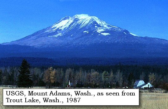
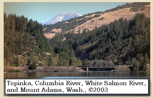
While Lewis and Clark did not mention spotting Mount Adams, it is visible from this section of the Columbia River.


Along the Journey - April 14, 1806
Mount Adams and the mouth of the White Salmon River, 2003

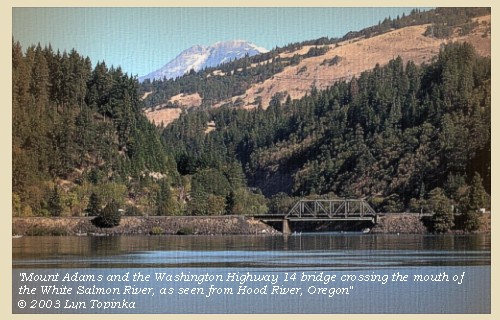
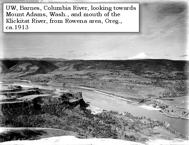
Mount Adams:
Mount Adams, Washington, is visible from Hood River, Oregon. Mount Adams, at 12,276 feet, is one of the largest volcanoes in the Cascade Range. The towering stratovolcano is marked by a dozen glaciers, most of which are fed radially from its summit icecap.


Map, the Volcanoes of Lewis and Clark, click to enlarge Map, 1999, Mount Adams and Vicinity, click to enlarge Map, 1814, Lewis and Clark on the Columbia, click to enlarge Map, 1853, Washington and Oregon and the Columbia River, click to enlarge Map, 1855, Columbia River, Vancouver to the Pacific, click to enlarge Map, 1860, Columbia River, Washington, Oregon, click to enlarge Image, ca.1913, Rowena area, Mount Adams, and the mouth of the Klickitat, click to enlarge Image, 1987, Mount Adams, Washington, from Troutlake, click to enlarge Image, 2003, Mount Adams and the mouth of the White Salmon River
  1. Map, "Lewis and Clark Volcano Sitings"
  2. 1999 Map, Mount Adams and Vicinity, showing drainages into the Columbia River. (Click to enlarge). Includes the Wind River, Little White Salmon River, White Salmon River, and Klickitat River in Washington State, and the Hood River in Oregon. Map modified from Vallance, 1999, USGS Bulletin 2161.
  3. 1814 Map, Lewis and Clark's map of the Columbia River (section of original). (Click to enlarge.) Map includes three of the five volcanoes Lewis and Clark saw and commented on. While the journals mention the expedition seeing Mount Adams, it does not appear on their map. Mount Jefferson is to the south (bottom) and off the map. From the "Nicholas Biddle/Paul Allen" 1814 publication. Original Map: "A Map of Lewis and Clark's Track, Across the Western Portion of North America, From the Mississippi to the Pacific Ocean". From: History of the expedition under the command of Captains Lewis and Clark : to the sources of the Missouri, thence across the Rocky Mountains and down the river Columbia to the Pacific Ocean : performed during the years 1804-5-6 : by order of the government of the United States / prepared for the press by Paul Allen. Philadelphia : Bradford and Insskeep, 1814. Harold B. Lee Library, Brigham Young University #upbover maps37. -- Brigham Young University, Harold B. Lee Library Website, 2004.
  4. 1853 Map, Washington and Oregon and the Columbia River, from the Clearwater River to the Snake River and down the Columbia River to the Pacific Ocean (section of original). (Click to enlarge). Includes: Clearwater River (Kooskooski), Lapwai Creek (Lapwai R.), Snake River (Saptin or Lewis R.), Columbia River (Columbia R.), Yakima River (Yakima R.), Walla Walla River (Wallawalla R.), Umatilla River (Umatilla R.), Willow Creek (Quesnells R.), John Day River (John day's R.), Deschutes River (Fall R.), Willamette River (Willammette R.), and Cowlitz River (Cowlitz R.). Original Map: "Map of California, Oregon, Washington, Utah, and New Mexico (1853)", by Thomas Cowperthwait & Co. Washington State University Archives #WSU22. -- Washington State University Library Collections Website, 2003
  5. 1855 Map, Columbia River from Vancouver to the Pacific, including Mount St. Helens (section of original). (Click to enlarge). Original Map: "Map of Oregon and Washington Territories: showing the proposed Northern Railroad route to the Pacific Ocean, by John Disturnell, 1855. University of Washington Archives #UW155. -- University of Washington Library Collections Website, 2002
  6. 1860 Map, Columbia River, Washington State, and Oregon (section of original). (Click to enlarge). Original Map: Map of Oregon, Washington, and British Columbia, (1860). This map dates between March 2nd, 1861 (when the Dakota Territory was formed) and March 4th, 1863 (when the Idaho Territory was formed from eastern Washington and western Dakota) Nearing retirement from a thirty year long and rather successful career, S. Augustus Mitchell printed this map showcasing Oregon, the Territory of Washington, and British Columbia. Washington became a territory in 1853, arguing that distances to Willamette Valley kept them from obtaining a voice in the Oregon territorial government. As this map shows, when it split from Oregon proper the Washington territory included parts of Wyoming and Montana and all of Idaho. Territorial government for Idaho would not be approved until 1863. When Mitchell retired he left the business for his son to manage. Washington State University Archives #WSU7. -- Washington State University Archives, 2004
  7. ca.1913, Columbia River, Rowena area (Oregon), Mount Adams (Washington), and the mouth of the Klickitat River. (Click to enlarge). Photo by Albert Henry Barnes, ca.1913. University of Washington A.H. Barnes Collection #BAR015. -- University of Washington Library Archives, 2003
  8. 1987, USGS Photo showing Mount Adams, Washington, from Trout Lake (Click to enlarge). Photographer: Lyn Topinka, Date: November 1987. -- USGS Cascades Volcano Observatory Photo Archives, 2004
  9. 2003, Mount Adams, Washington, and the mouth of the White Salmon River, as seen from Hood River, Oregon. (Click to enlarge). Copyright © 2003 Lyn Topinka, private archives, used with permission.


After dinner we proceeded, and passing at the distance of six miles, the high cliffs on the left [Bingen Gap],


Along the Journey - April 14, 1806
Basalts of Bingen Gap, 2003

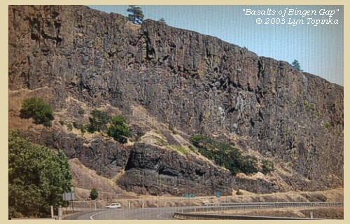
Basalts of Bingen Gap:


Image, 2003, Basalts of Bingen Gap, Washington
  1. 2003, Basalts of Bingen Gap, as seen from Washington State Highway 14. (Click to enlarge). Copyright © 2003 Lyn Topinka, private archives, used with permission.


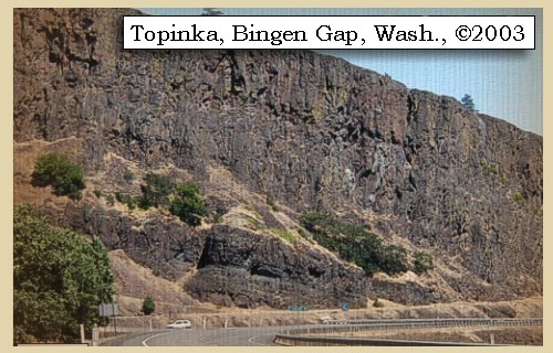
encamped at the mouth of a small run on the same side [Major Creek]. ......
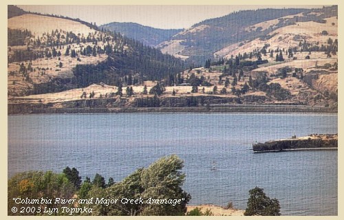
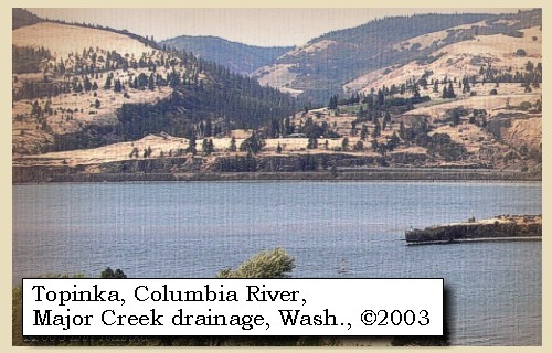

Along the Journey - April 14, 1806
Major Creek drainage, 2003

Major Creek:


Map, 1985, Major Creek, Washington, and Memaloose Island, click to enlarge Image, 2003, Major Creek, Washington
  1. 1985 Map (section of original), Major Creek, Washington, and Memaloose Island. (Click to enlarge). Office of Coast Surveys, Historical Maps and Charts, Columbia River, Bonneville to The Dalles, 1985, Chart#18531, 1:40,000. -- NOAA Office of Coast Survey Website, 2004
  2. 2003, Major Creek drainiage in Washington State, as seen from Memaloose Overlook off of Interstate 84, Oregon. (Click to enlarge). The tip of Memaloose Island is on the right. Copyright © 2003 Lyn Topinka, private archives, used with permission.


Along the Journey - April 14, 1806
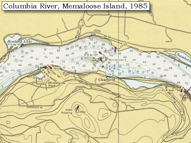
The Camp - April 14, 1806:
Lewis and Clark's camp of April 14, 1806, was on the Washington side, on the east bank of Major Creek, across from Memaloose Island.


Home Previous Continue


If you have questions or comments please contact: GS-CVO-WEB@usgs.gov
June/July 2004, Lyn Topinka
The Volcanoes of Lewis and Clark Home Page | CVO Home Page