Mount St. Helens, Washington:
Mount St. Helens (8,364 feet, 9,677 feet before May 18, 1980) is located in southwestern Washington about 50 miles northeast of Portland, Oregon, and is one of several lofty volcanic peaks that dominate the Cascade Range of the Pacific Northwest. Geologists call Mount St. Helens a composite volcano (or stratovolcano), a term for steep-sided, often symmetrical cones constructed of alternating layers of lava flows, ash, and other volcanic debris. Composite volcanoes tend to erupt explosively and pose considerable danger to nearby life and property. In contrast, the gently sloping shield volcanoes, such as those in Hawaii, typically erupt nonexplosively, producing fluid lavas that can flow great distances from the active vents. Although Hawaiian-type eruptions may destroy property, they rarely cause death or injury.
"Fujiyama of America":
Before 1980, snow-capped, gracefully symmetrical Mount St. Helens was known as the "Fujiyama of America." Mount St. Helens, other active Cascade volcanoes, and those of Alaska comprise the North American segment of the circum-Pacific "Ring of Fire," a notorious zone that produces frequent, often destructive, earthquake volcanic activity.
Ancestral Mount St. Helens:
Ancestral Mount St. Helens began to grow before the last major glaciation of the Ice Age had ended about 10,000 years ago. The oldest ash deposits were erupted at least 40,000 years ago onto an eroded surface of still older volcanic and sedimentary rocks. Intermittent volcanism continued after the glaciers disappeared, and nine main pulses of pre-1980 volcanic activity have been recognized. These pulses lasted from about 5,000 years to less than 100 years each and were separated by dormant intervals of about 15,000 years to only 200 years. A forerunner of Spirit Lake was born about 3,500 years ago, or possibly earlier, when eruption debris formed a natural dam across the valley of the North Fork of the Toutle River.
Recent History:
Mount St. Helens is the youngest of the major Cascade volcanoes, in the sense that its visible cone was entirely formed during the past 2,200 years, well after the melting of the last of the Ice Age glaciers about 10,000 years ago. Mount St. Helens' smooth, symmetrical slopes are little affected by erosion as compared with its older, more glacially scarred neighbors - Mount Rainier and Mount Adams in Washington, and Mount Hood in Oregon. The local Indians and early settlers in the then sparsely populated region witnessed the occasional violent outbursts of Mount St. Helens.
The most recent of the pre-1980 eruptive activity began in A.D. 1800 with an explosive eruption, followed by several additional minor explosions and extrusions of lava, and ended with the formation of the Goat Rocks lava dome by 1857.
May 18, 1980:
On May 18, 1980, the volcano was transformed.
The catastrophic eruption, was preceded by 2 months of intense activity that included more than 10,000 earthquakes, hundreds of small phreatic (steam-blast) explosions, and the outward growth of the volcano's entire north flank by more than 260 feet. A magnitude 5.1 earthquake struck beneath the volcano at 8:32 a.m. on May 18, setting in motion the devastating eruption.
Within seconds of the earthquake, the volcano's bulging north flank slid away in the largest landslide in recorded history, triggering a destructive, lethal lateral blast of hot gas, steam, and rock debris that swept across the landscape as fast as 680 miles per hour. Temperatures within the blast reached as high as 570 degrees Fahrenheit (300 degrees Celsius). Snow and ice on the volcano melted, forming torrents of water and rock debris that swept down river valleys leading from the volcano. Within minutes, a massive plume of ash thrust 15 miles into the sky, where the prevailing wind carried about 520 million tons of ash across 22,000 square miles of the Western United States.
1980 Devastation:
On May 18, 1980, the bulge on Mount St. Helens north flank slide away in a huge landslide which covered 23 square miles north and west of the volcano, and buried 14 miles of the North Fork Toutle River Valley to an average depth of 150 feet, with a maximum depth of 600 feet.
The landslide depressurized the volcano's magma system, and triggered powerful explosions. Rocks, ash, volcanic gas, and steam were blasted upward and outward to the north, reached 17 miles northward from the volcano, and covered an area of 230 square miles, felling and singing trees. Over 4 billion board feet of timber - enough to build about 300,000 two-bedroom homes - was destroyed.
The lateral blast produced an eruption column of ash and gas which rose more than 15 miles into the atmosphere in only 15 minutes. Over the course of the day, prevailing winds blew 520 million tons of ash eastward across the United States and caused complete darkness in Spokane, Washington, 250 miles from the volcano. The plume spread across the United States in 3 days and circled the earth in 15.
Beginning just after noon, pyroclastic flows - swift avalanches of hot ash, pumice, and gas - poured out of the crater at 50 to 80 miles per hour and spread as far as 5 miles to the north. Based on the eruption rate of these pyroclastic flows, scientists estimate that the eruption reached its peak between 3:00 and 5:00 p.m.
Melting snow and ice which had covered the volcano melted sending
surges of water that eroded and mixed with loose rock debris to form volcanic mudflows (lahars). Several lahars poured down the volcano into river valleys, ripping trees from their roots and destroying 27 bridges and over 200 homes.
The lahars with the blast destroyed more than 185 miles of highways and roads, and 15 miles of railway. Fifty-seven people were killed.
Following 1980:
Following the 1980 explosive eruption, more than a dozen extrusions of thick, pasty lava built a mound-shaped lava dome in the new crater. The dome is about 3,600 feet in diameter and 820 feet tall.
In 2004:
After 18 years of relative quiescence, Mount St. Helens volcano once again captured the world?s attention when it showed signs of reawakening in September 2004. On September 23 a swarm of small, shallow earthquakes began in and beneath the 1980-1986 lava dome. Initially this swarm resembled previous swarms that had not led to eruption. By September 24 many hundreds of earthquakes had occurred. Earthquake rates peaked that day at about 2 to 3 per minute then gradually declined, and it appeared that the swarm was ending. But on September 25 shallow earthquakes increased again in both size and rate. This reinvigorated level of seismicity prompted scientists to issue a notice of volcanic unrest for the first time since 1986. The release of energy by earthquakes increased dramatically during the next several days, and by October 1 earthquakes occurred nearly continuously. Peak sizes reached M3.5, and earthquakes larger than M2.5 occurred about once per minute. Concurrently, parts of the glacier south of the lava dome rose and cracked noticeably, creating a broad welt. The accelerated size and frequency of earthquakes and noticeable deformation of the glacier indicated that molten rock (magma) was rising toward the surface. On October 1, 2004, an explosion lofted steam and ash several thousand feet above a vent blasted through the fractured glacier, and hurled rock fragments at least ? mile across the western half of the glacier and 1980-1986 lava dome. Four more steam and ash explosions occurred through October 5. Following this brief series of steam-and-ash explosions, the volcano settled into a quieter phase during which the welt continued to grow and a new lava dome appeared. This process continued into 2005 and currently (October 2005) shows no signs of stopping.
Recorded History:
Mount St. Helens was recognized as a volcano at least as early as 1835; the first geologist apparently viewed the volcano 6 years later. James Dwight Dana of Yale University, while sailing with the Charles Wilkes U.S. Exploring Expedition, saw the peak (then quiescent) from off the mouth of the Columbia River in 1841. Another member of the expedition later described "cellular basaltic lavas" at the mountain's base.
Baron St. Helens:
Mount St. Helens was named for British diplomat Alleyne Fitzherbert, whose title was Baron St. Helens. The mountain was named by Commander George Vancouver while surveying the northern Pacific coast from 1792 to 1794.
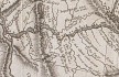
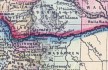

- Map, "Lewis and Clark Volcano Sitings"
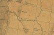
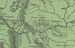
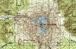
- 1978 Map, Mount St. Helens and Vicinity, and its major river drainages. (Click to enlarge).
Swift Creek, Pine Creek, and the Muddy River drain the southern flanks of Mount St. Helens and drain into the Lewis
River. The Kalama River drains west into the Columbia River. The North and South Fork Toutle Rivers drain to the north
west and enter the Cowlitz (a tributary from Mount Rainier), which drains into the Columbia River south of Longview,
Washington.
Map modified from Crandell and Mullineaux, 1978, USGS Bulletin 1383-C.
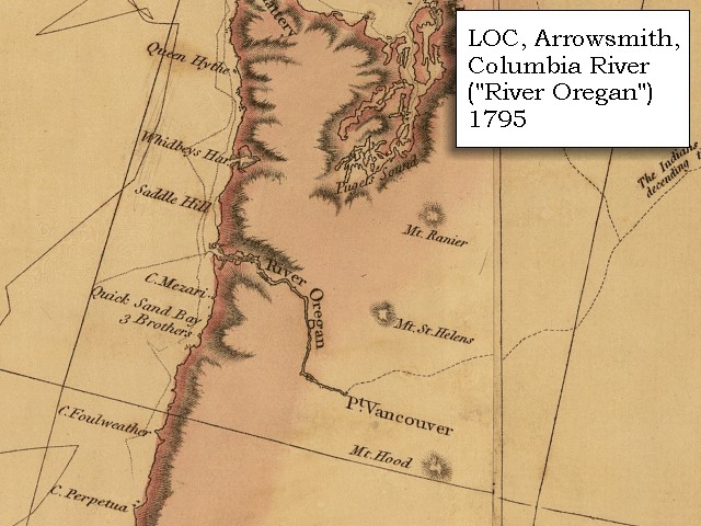
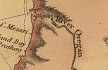
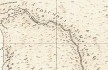
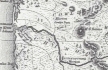
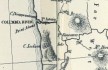
- 1795 Map, Pacific Northwest and the Columbia River (section of original). (Click to enlarge).
Includes the Columbia River ("River Oregan"), Mount Rainier, Mount St. Helens, and Mount Hood, and Point Vancouver.
Original Map: A map exhibiting all the new discoveries in the interior parts of North America / inscribed by permission to the honorable
governor and company of adventurers of England trading into Hudsons Bay in testimony of their liberal communications to
their most obedient and very humble servant A. Arrowsmith, January 1st 1795.
Published: London, 1802. Notes: Relief shown by hachures. Shows "Rivers added east of the Rocky Mountains, 900 L. 450 Lat.," from Tooley's Printed maps of America. In lower margin: London: Published Jan. 1, 1795 by A. Arrowsmith, No. 24 Rathbone Place. Includes notes.
Reference: Tooley. Printed maps of America 137. Scale [ca. 1:3,800,000] (W 1600--W 400/N 700--N 250).
Library of Congress American Memory Archives #G3300 1802 A7 Vault Casetop.
-- U.S. Library of Congress Archives, 2004, "American Memory"
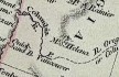
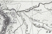
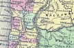
- 1798 Map, Columbia River of George Vancouver (section of original). (Click to enlarge).
Includes Columbia River, Cape Disappointment, Point Adams, Point Vancouver, and Mount St. Helens.
Original Map: George Vancouver's "A Chart Shewing Part of the
Coast of N.W. America." In A Voyage of discovery to the North Pacific ocean, and Round the World. London, 1798.
University of Virginia Special Collection "Lewis & Clark, The Maps of Exploration 1507-1814".
-- University of Virginia Library Archives Website, 2004
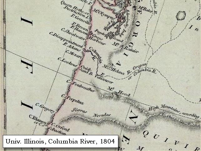
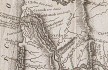
- 1804 Map, Pacific Northwest and the Columbia River (section of original). (Click to enlarge).
Includes the Columbia River, Mount Baker, Mount Rainier, Mount St. Helens, and Mount Hood.
Original Map: "North America".
Year: 1804.
Author: Robert Wilkinson and E. Bourne.
Notes:
Scale, ca. 1:9,000,000; London, R. Wilkinson, 12th of Aug. 1804; 1 map, hand col.; 51 x 61 cm.; Relief shown by hachures; Prime meridians: Greenwich, Ferro. -- Henry Stevens and Roland Tree, Comparative cartography, exemplified in an analytical & bibliographical description of nearly one hundred maps and charts of the American continent published in Great Britain during the years 1600 to 1850, no. 62a. In the Collection of Map & Geography Library, University of Illinois at Urbana-Champaign, Champaign, Illinois,
Call Number: G3300 1804 .W5.
-- Univerisity of Illinois at Urbana-Champaign Website, 2004.
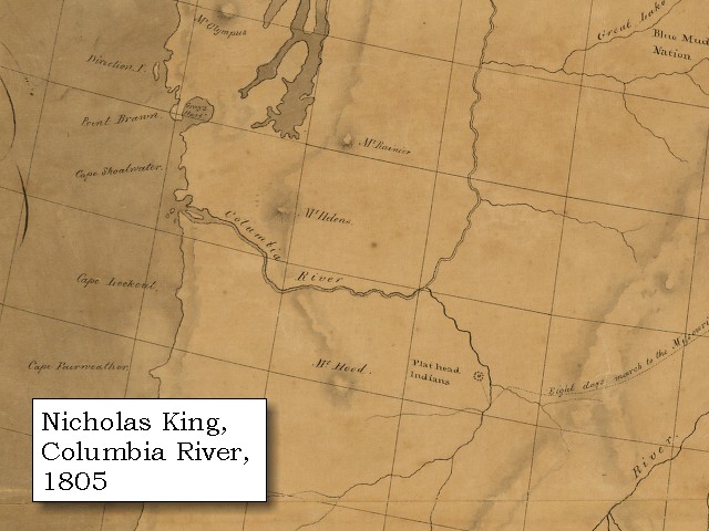
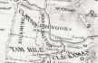
- 1805 Map, Pacific Northwest and the Columbia River (section of original). (Click to enlarge).
Includes the Columbia River, Mount Rainier, Mount St. Helens, and Mount Hood.
Original Map: A map of part of the continent of North America : between the 35th and 51st degrees of north latitude, and extending from 89o degrees of west longitude to the Pacific Ocean / compiled from the authorities of the best informed travellers by M. Lewis ; copied by Nicholas King, 1805.
Notes: Map covers western North America, from Lake Michigan and Lake Superior to the Pacific Ocean, including southern Canada and northern
Mexico. Pen-and-ink and watercolor.
Note from map folder: Map was copied from a sketch by William Clark, not one by Meriwether Lewis as indicated in the title. Copy sectioned and mounted on cloth.
Library of Congress American Memory Archives #G3300 1805 .C5 Vault Oversize.
-- U.S. Library of Congress Archives, 2004, "American Memory"
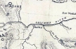
- 1814 Map, Lewis and Clark's map of the Columbia River (section of original). (Click to enlarge.)
Includes three of the five volcanoes Lewis and Clark saw and commented on. While the journals mention the expedition seeing Mount Adams, it does not appear on their map. Mount Jefferson is to the south (bottom) and off the map.
From the "Nicholas Biddle/Paul Allen" 1814 publication.
Original Map: "A Map of Lewis and Clark's Track, Across the Western Portion of North America, From the Mississippi to the Pacific Ocean".
From: History of the expedition under the command of Captains Lewis and Clark : to the sources of the Missouri, thence across the Rocky Mountains and down the river Columbia to the Pacific Ocean : performed during the years 1804-5-6 : by order of the government of the United States / prepared for the press by Paul Allen. Philadelphia : Bradford and Insskeep, 1814.
Harold B. Lee Library, Brigham Young University #upbover maps37.
-- Brigham Young University, Harold B. Lee Library Website, 2004.
- 1814 Map, Lewis and Clark's map of the Columbia River (section of original). (Click to enlarge.)
Map includes three of the five volcanoes Lewis and Clark saw and commented on. While the journals mention the expedition seeing Mount Adams, it does not appear on their map. Mount Jefferson is just visible to the south (bottom) and Mount Rainier is to the north but off the map.
From the "Nicholas Biddle/Paul Allen" 1814 publication.
Original Map: "A Map of Lewis and Clark's Track, Across the Western Portion of North America, From the Mississippi to the Pacific Ocean".
From: History of the expedition under the command of Captains Lewis and Clark : to the sources of the Missouri, thence across the Rocky Mountains and down the river Columbia to the Pacific Ocean : performed during the years 1804-5-6 : by order of the government of the United States / prepared for the press by Paul Allen. Philadelphia : Bradford and Insskeep, 1814.
Harold B. Lee Library, Brigham Young University #upbover maps37.
-- Brigham Young University, Harold B. Lee Library Website, 2004.
- 1833 Map (section of original), Columbia River. (Click to enlarge).
Includes Mount Hood and Mount Jefferson. Note: Mount Baker is depicted (upper middle) but Mounts Adams, Rainier and St. Helens are missing. The Columbia River is shown as "Oregon River" at its mouth and "Columbia or Oregon R." further inland. "Wappatoo Valley" is labeled. Also shows Fort Clatsop ("F. Clatsop or F. George"), the Willamette River ("Multnomah R."), Sandy River ("Quicksand R."), John Day River ("R.La Page"), Walla Walla River ("Wallwullah R."), Snake River ("Lewis R."), and the Yakima River ("Tapete R.").
Original Map: Oregon Territory, 1833.
Creator: Illman & Pilbrow, published by Illman & Pilbrow, New York.
Comments: Illman & Pilbrow is the engraving firm which copyrighted and published this map, the actual artist is unknown.
Washington State University Digital Maps Collection #WSU323.
University of Washington Digital Maps Collection #UW104.
-- Washington State University Early Washington Maps Digital Collection Website, 2004
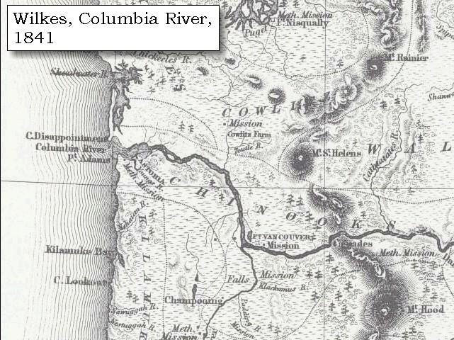
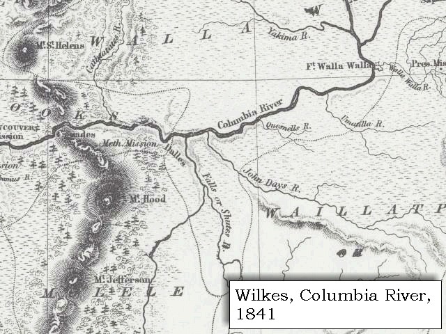
- 1841 Map (section of original), Columbia River, west. (Click to enlarge).
Includes Mount Rainier, Mount St. Helens, and Mount Hood. Mount Adams is depicted but not named.
From Wilkes, 1841, the U.S. Exploring Expedition.
-- Washington State University Early Washington Maps Digital Collection Website, 2004
- 1841 Map (section of original), Columbia River, east. (Click to enlarge).
Includes Mount St. Helens, Mount Hood, and Mount Jefferson. Mount Adams is depicted but not named.
From Wilkes, 1841, the U.S. Exploring Expedition.
-- Washington State University Early Washington Maps Digital Collection Website, 2004
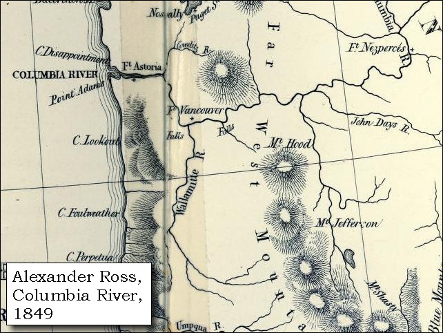
- 1849 Map (section of original), Alexander Ross's Columbia River. (Click to enlarge).
Original Map: Map of the Columbia to illustrate Ross's adventures.
Author: Alexander Ross; Publication Date: 1849; Publisher: London, Smith, Elder and Co., 1849.
Washington State University Archives #WSU478.
-- Washington State University Early Washington Maps Digital Collection Website, 2004
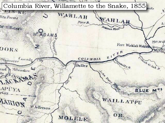
- 1853 Map, Washington and Oregon and the Columbia River,
from the Clearwater River to the Snake River and down the Columbia River to the Pacific Ocean (section of original). (Click to enlarge).
Includes: Clearwater River (Kooskooski), Lapwai Creek (Lapwai R.), Snake River (Saptin or Lewis R.), Columbia River (Columbia R.), Yakima River (Yakima R.), Walla Walla River (Wallawalla R.), Umatilla River (Umatilla R.), Willow Creek (Quesnells R.), John Day River (John Day's R.), Deschutes River (Fall R.), Willamette River (Willammette R.), and Cowlitz River (Cowlitz R.).
Original Map: "Map of California, Oregon, Washington, Utah, and New Mexico (1853)",
by Thomas Cowperthwait & Co.
Washington State University Archives #WSU22.
-- Washington State University Library Collections Website, 2003
- 1855 Map, Columbia River from
Vancouver to the Pacific (section of original). (Click to enlarge).
Includes Mount Rainier, Mount St. Helens, Mount Adams, Mount Hood (depicted but not named), and Mount Jefferson.
Original Map: "Map of Oregon and Washington Territories:
showing the proposed Northern Railroad route to the Pacific Ocean,
by John Disturnell, 1855.
University of Washington Archives #UW155.
-- University of Washington Library Collections Website, 2002
- 1855 Map, Columbia River from
Cascade Range to Walla Walla (section of original). (Click to enlarge).
Includes Mount Adams, Mount St. Helens, Mount Hood (depicted but not named), and Mount Jefferson.
Original Map: "Map of Oregon and Washington Territories:
showing the proposed Northern Railroad route to the Pacific Ocean,
by John Disturnell, 1855.
University of Washington Archives #UW155.
-- University of Washington Library Collections Website, 2002
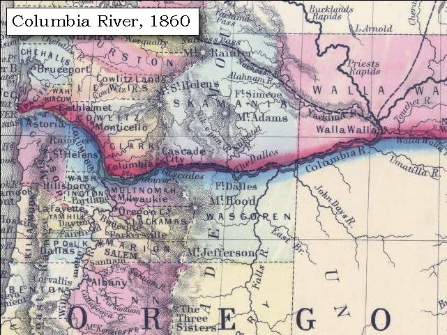
- 1860 Map, Columbia River, Washington State, and Oregon (section of original). (Click to enlarge).
Original Map: Map of Oregon, Washington, and British Columbia, (1860).
This map dates between March 2nd, 1861 (when the Dakota Territory was formed) and March 4th, 1863 (when the Idaho Territory was formed from eastern Washington and western Dakota)
Nearing retirement from a thirty year long and rather successful career, S. Augustus Mitchell printed this map showcasing Oregon, the Territory of Washington, and British Columbia. Washington became a territory in 1853, arguing that distances to Willamette Valley kept them from obtaining a voice in the Oregon territorial government. As this map shows, when it split from Oregon proper the Washington territory included parts of Wyoming and Montana and all of Idaho. Territorial government for Idaho would not be approved until 1863. When Mitchell retired he left the business for his son to manage.
Washington State University Archives #WSU7.
-- Washington State University Archives, 2004
- 1919 Map of Mount St. Helens (section of original), from Mount St. Helens 1:125,000
topographic quadrangle. (Click to enlarge).
Original map surveyed in 1913-1914 and 1916, contour interval of 100 feet.
Map published in 1919.
-- University of Washington Library Collections Website, 2002
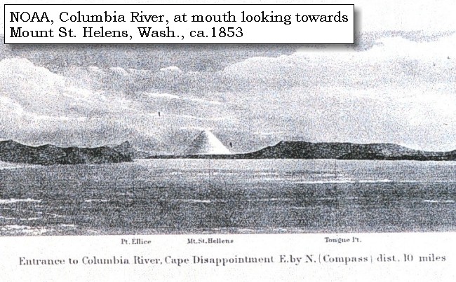
- ca.1853, Engraving. Mouth of the Columbia River (section of original).
(Click to enlarge). Engraving depicts the Mouth of the Columbia River, Point Ellice,
Mount St. Helens,
and Tongue Point. Original also depicts Cape Disappointment and Point Adams.
From: NOAA Photo Archives, America's Coastline Collection #line2075.
-- NOAA Photo Archvies Website, 2002
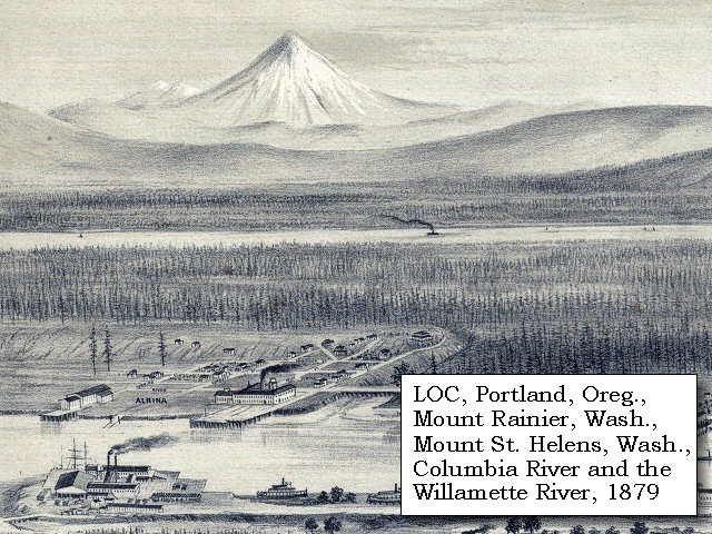
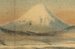
- 1879, Detail of engraving of Portland, Oregon and Mount Rainier and Mount St. Helens, Washington. (Click to enlarge).
The Columbia River is middleground and the Willamette River is in the foreground.
Created by E.S. Glover. Published 1879, San Francisco.
"Bird's-eye-view", looking east to the Cascade
Mountains.
Original lithograph shows Mount Rainier, Mount St.
Helens, Mount Adams, and Mount Hood, and also the
Columbia River and the Willamette River.
Reference #LC Panoramic Maps #722.
--
Library of Congress American Memories Website, 2002
- 1889, Engraving/Sketch. Mouth of the Columbia River (section of original).
(Click to enlarge). Engraving depicts the Mouth of the Columbia River, Point Ellice,
Mount St. Helens, and Tongue Point. Original also depicts Scarborough Hill.
From: NOAA Library, Pacific Coast Coast Pilot of California, Oregon, and Washington, 1889
-- NOAA Photo Archives Website, 2004
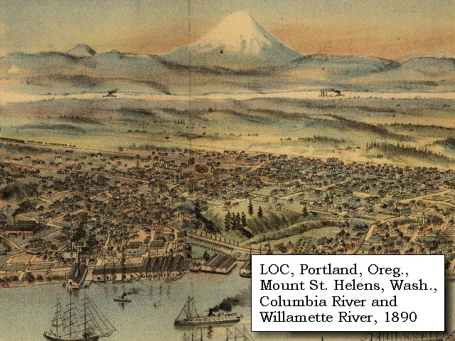
- 1890, Detail from engraving of Portland, Oregon,
with Mount St. Helens. (Click to enlarge).
Created by Clohessy & Strengele. Published 1890, San Francisco.
"Bird's-eye-view", Portland, Oregon, 1890.
Original lithograph shows Mount St.
Helens, Mount Adams, and Mount Hood, with the
Columbia River and the Willamette River.
Reference #75694939.
--
Library of Congress American Memories Website, 2002
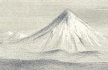
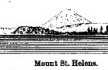
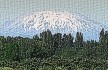
- 1978, View of Mount St. Helens, before the eruption of May 18, 1980. (Click to enlarge).
U.S. Army Corps of Engineers Photograph #Sce0234. Photograph Date: 1978. Photographer: unknown.
From: U.S. Army Corps of Engineers Photo Archives.
-- U.S. Army Corps of Engineers Website, 2002
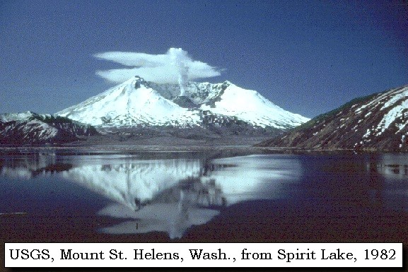
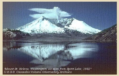
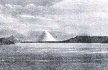
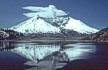
- 1982, USGS Photo showing Mount St. Helens after the May 18, 1980 eruption. The volcano is reflected in Spirit Lake. (Click to enlarge).
Photographer: Lyn Topinka, Date: May 19, 1982.
-- USGS Cascades Volcano Observatory Photo Archives, 2004
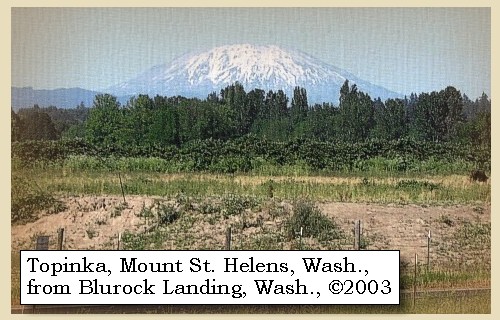
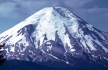
- 2003, Mount St. Helens, Washington, as seen from Blurock Landing, Washington. (Click to enlarge). Blurock Landing is across the Columbia River from the mouth of the Willamette River, Oregon. From this location Lewis and Clark spotted five volcanoes.
Copyright © 2003 Lyn Topinka, private archives, used with permission.
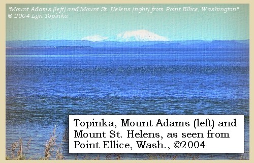
- 2004, Mount Adams (left) and Mount St. Helens, Washington, as seen from Point Ellice, Washington, 14 miles upstream from the mouth of the Columbia River. (Click to enlarge).
Copyright © 2004 Lyn Topinka, private archives, used with permission.
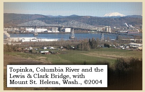
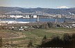
- 2004, Mount St. Helens, Washington, and the Lewis and Clark Bridge, as seen from near Rainier, Oregon. (Click to enlarge).
The Lewis and Clark Bridge connects Longview, Washington, with Rainier, Oregon.
Copyright © 2004 Lyn Topinka, private archives, used with permission.
Excerpts from:
Brantley, 1994,
Brantley and Myers, 2000,
Foxworthy and Hill, 1982,
Major, et.al., 2005,
and
Tilling, et.al., 1990.
|